![Cover image](https://images.tarmacs.app/cycling-routes/covers/switzerland/espace-mittelland/charmey-3.webp)
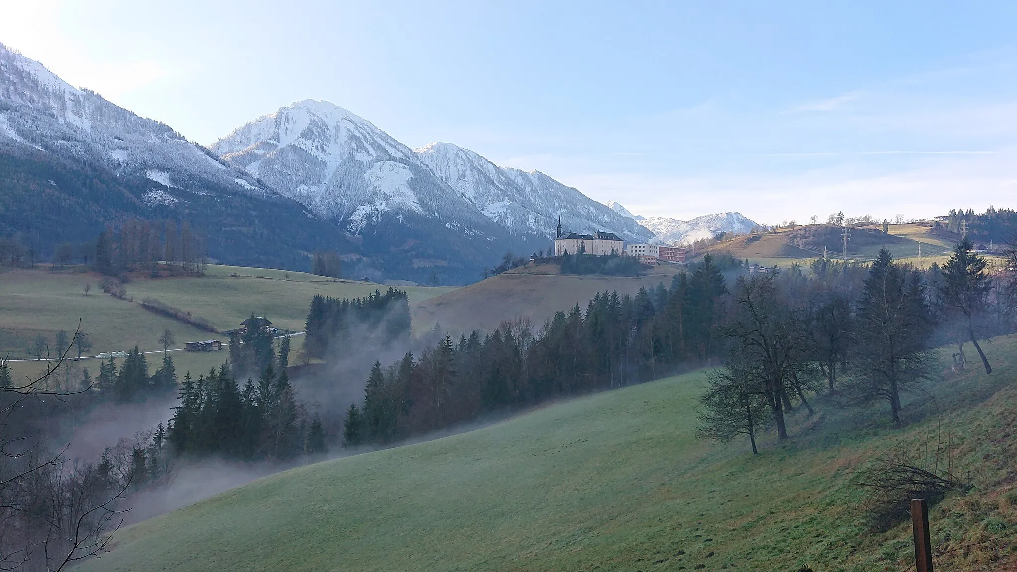
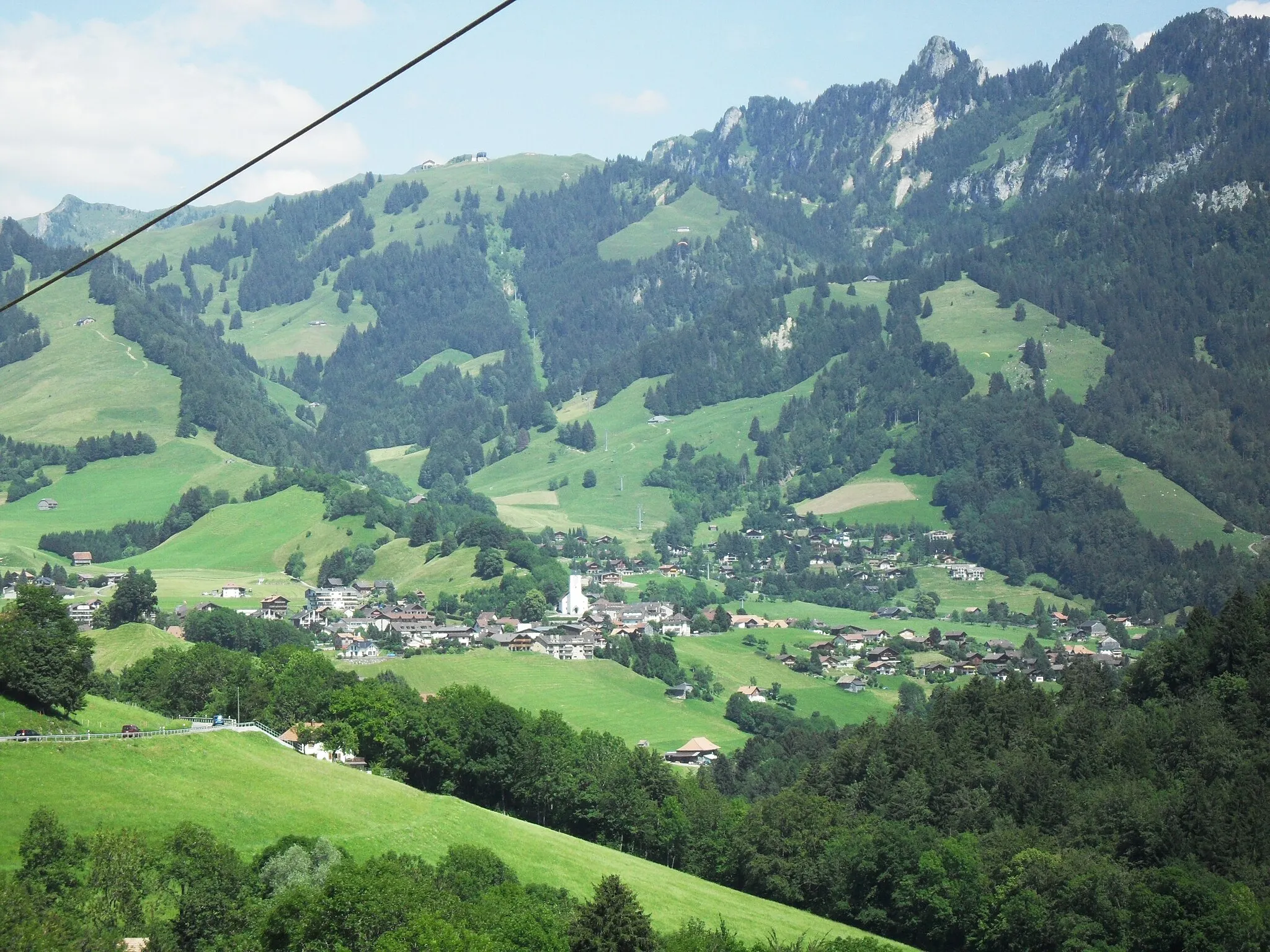
Klidná lokalita se vzrušujícími výhledy pro cyklisty.
Cyklistické trasy kolem Charmey
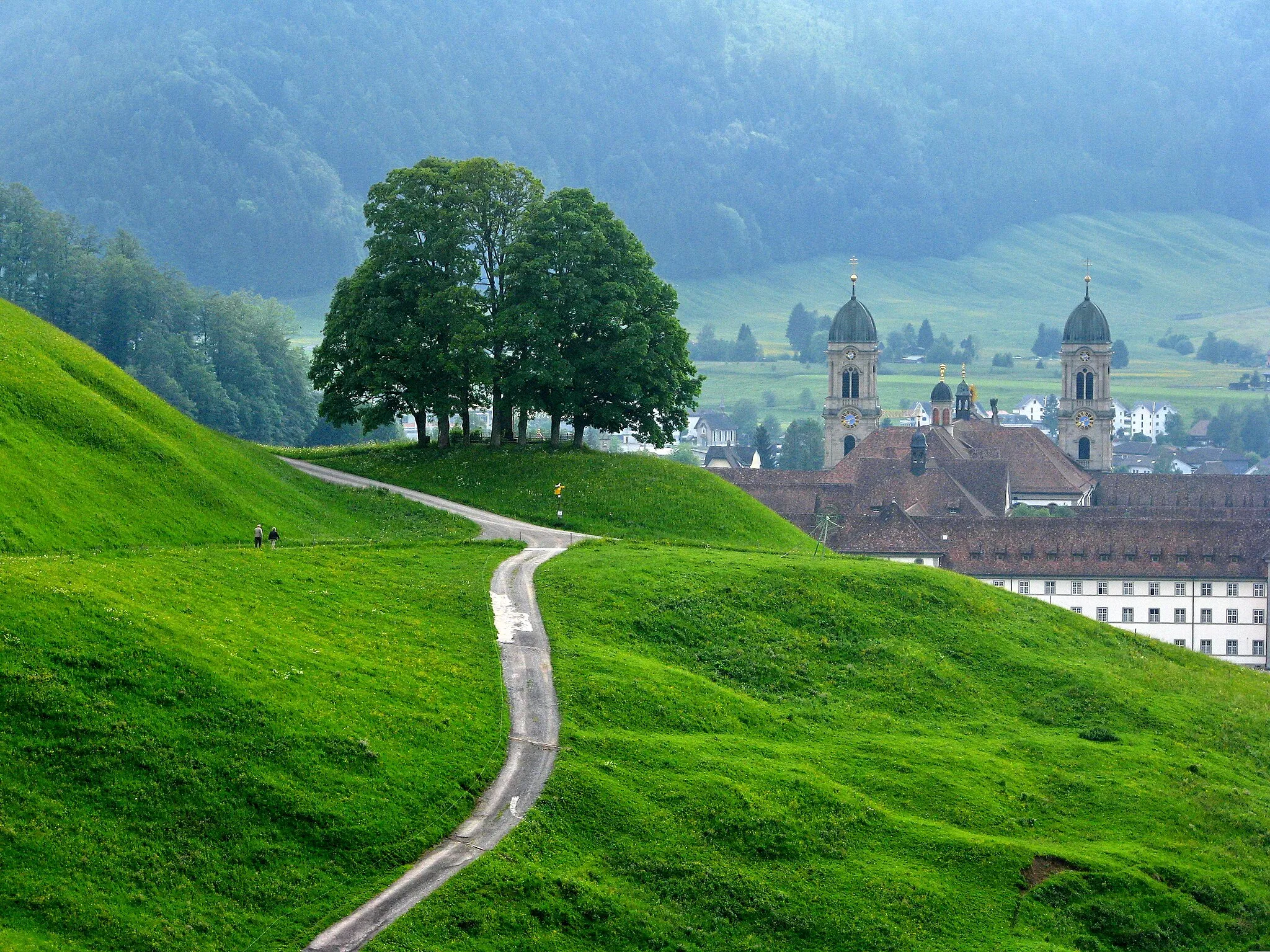
Charmey je malebná lokalita v regionu Espace Mittelland ve Švýcarsku. Pro cyklisty nabízí okolí s krásnými výhledy a možnost relaxace v přírodě. V blízkosti se nachází známé horské sedlo.
![Miniaturní mapa "Gravelová cesta Botterens - Cerniat" inspirace pro cyklisty v oblasti Espace Mittelland, Switzerland. Vytvořeno pomocí plánovače tras Tarmacs.app](https://images.tarmacs.app/cycling-routes/routemaps/600/switzerland/espace-mittelland/charmey/gravel/174824.webp)
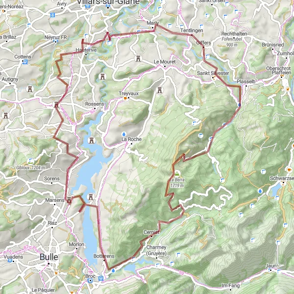
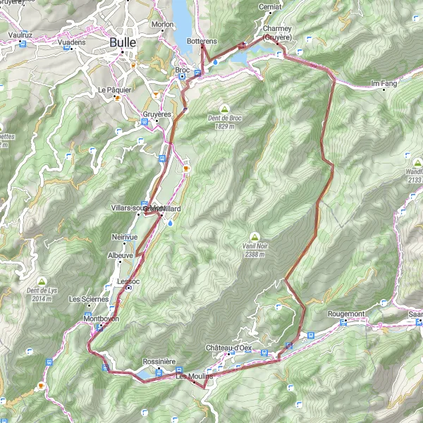
Malebná cesta po nezpevněných cestách s nádhernými výhledy
Tato 71km dlouhá cesta je ideální pro milovníky gravelových cest. Po cestě můžete navštívit vesnici Botterens nebo se vydat k jezeru Gruyère. S převýšením 1912m nabízí tato trasa malebné výhledy a klidnou atmosféru krajiny.
![Miniaturní mapa "Alpine Panorama Expedition" inspirace pro cyklisty v oblasti Espace Mittelland, Switzerland. Vytvořeno pomocí plánovače tras Tarmacs.app](https://images.tarmacs.app/cycling-routes/routemaps/600/switzerland/espace-mittelland/charmey/road/147248.webp)
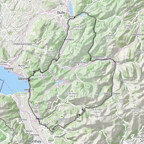
Scenic road cycling route offering panoramic vistas
Embark on a breathtaking journey through the Swiss Alps, conquering high mountain passes like Col du Pillon and Col de la Croix. Marvel at the postcard-perfect landscapes of Gstaad, Villars-sur-Ollon, and Aigle, before reaching the picturesque shores of Montreux. Enjoy a mix of natural beauty and cultural richness along the route.
![Miniaturní mapa "Okruh z Charmey do Gruyère" inspirace pro cyklisty v oblasti Espace Mittelland, Switzerland. Vytvořeno pomocí plánovače tras Tarmacs.app](https://images.tarmacs.app/cycling-routes/routemaps/600/switzerland/espace-mittelland/charmey/road/147183.webp)
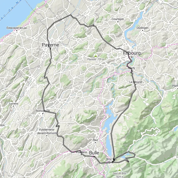
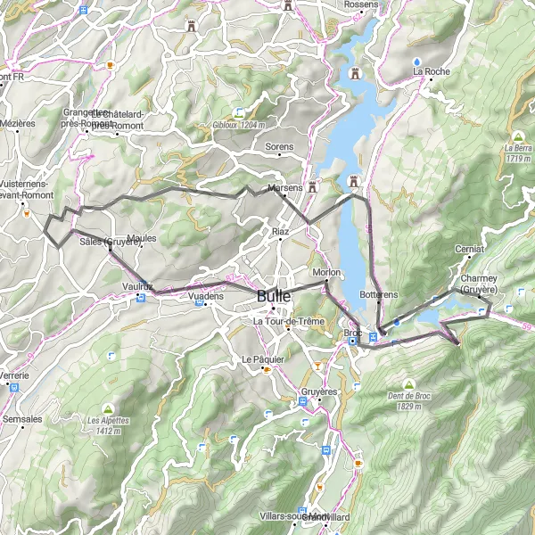
Procestujte malebné vesnice a přírodní scenérie cestou do Gruyère.
Tato cyklistická trasa vede přes malebné vesnice Bulle, Sâles (Gruyère) a Grangettes-près-Romont s celkovým převýšením 1717 m na vzdálenost 109 km. Na cestě můžete navštívit historické památky jako Payerne, přírodní krásy jako Lac de la Gruyère a nádherný Vanil de la Monse. Trasa nabízí rozmanitost terénu a zajímavé vyhlídky na Espace Mittelland.
![Miniaturní mapa "Cyklostezka kolem jezera Gruyère" inspirace pro cyklisty v oblasti Espace Mittelland, Switzerland. Vytvořeno pomocí plánovače tras Tarmacs.app](https://images.tarmacs.app/cycling-routes/routemaps/600/switzerland/espace-mittelland/charmey/road/174829.webp)
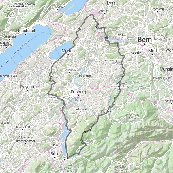
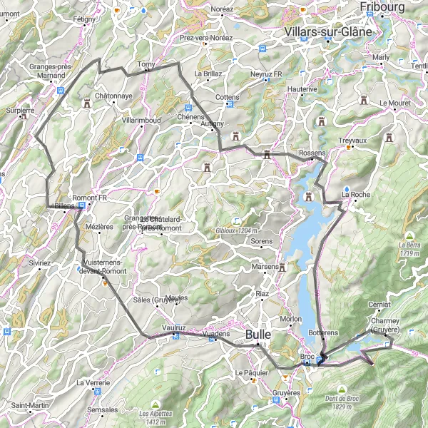
Malebná cesta kolem jezera s mnoha historickými památkami
Tato 157km dlouhá cesta nabízí malebné výhledy a mnoho historických památek, jako je La Berra nebo Murten. Po cestě můžete navštívit také Hauteville či Kallnach. S převýšením 2861m je to výzva pro zkušené cyklisty, kteří ocení krásy regionu.
![Miniaturní mapa "Expedice do pohoří Schwarzsee" inspirace pro cyklisty v oblasti Espace Mittelland, Switzerland. Vytvořeno pomocí plánovače tras Tarmacs.app](https://images.tarmacs.app/cycling-routes/routemaps/600/switzerland/espace-mittelland/charmey/gravel/147191.webp)
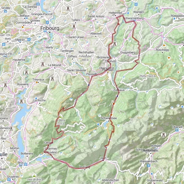
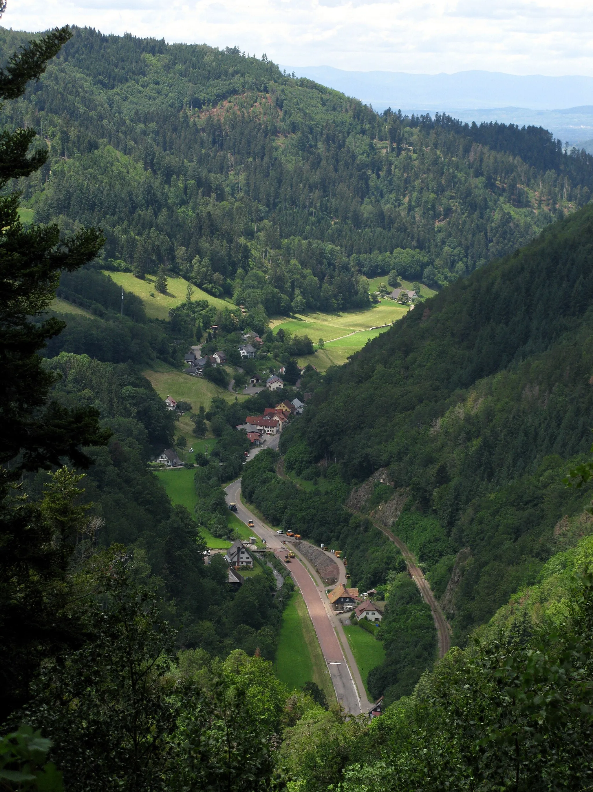
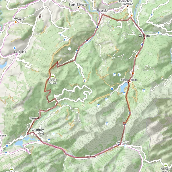
Náročná trasa za dobrodružstvím a krásami přírody
Trasa do pohoří Schwarzsee vás provede malebnými vesnicemi a nádhernými výhledy na okolní hory. Cestou můžete navštívit horský průsmyk Schwendelberg a relaxovat u jezera Schwarzsee.
![Miniaturní mapa "Jízda kolem jezera Gruyère" inspirace pro cyklisty v oblasti Espace Mittelland, Switzerland. Vytvořeno pomocí plánovače tras Tarmacs.app](https://images.tarmacs.app/cycling-routes/routemaps/600/switzerland/espace-mittelland/charmey/road/147178.webp)
Prozkoumejte krásy okolí jezera Gruyère na kole
Svěží jezerní vzduch, malebná městečka a panoramatické výhledy ze svahů - to vše nabízí tato cyklotrasa. Zajímavé je i historické město Broc ležící pod horou Vanil de la Monse.
![Miniaturní mapa "Okruh kolem hor Gruyère" inspirace pro cyklisty v oblasti Espace Mittelland, Switzerland. Vytvořeno pomocí plánovače tras Tarmacs.app](https://images.tarmacs.app/cycling-routes/routemaps/600/switzerland/espace-mittelland/charmey/road/147151.webp)
Výzva pro zkušené cyklisty nabízející panoramatické výhledy
Tato trasa vede přes malebná městečka a okolní kopce s možností obdivovat jezero Gruyère a horu Vanil de la Monse. V cíli trasy užijete relaxaci na náměstí Place du Perrex v historickém centru města.
Gravel Gruyère Circuit
![Miniaturní mapa "Gravel Gruyère Circuit" inspirace pro cyklisty v oblasti Espace Mittelland, Switzerland. Vytvořeno pomocí plánovače tras Tarmacs.app](https://images.tarmacs.app/cycling-routes/routemaps/600/switzerland/espace-mittelland/charmey/gravel/147141.webp)
Epic gravel ride through charming Gruyère region
Explore the picturesque villages like Charmey and Montbovon as you tackle the challenging climbs and enjoy breathtaking views of Ciernes Picat and Mont Chupiaô. This route offers a perfect blend of natural beauty and cultural heritage.
La Valsainte Loop
![Miniaturní mapa "La Valsainte Loop" inspirace pro cyklisty v oblasti Espace Mittelland, Switzerland. Vytvořeno pomocí plánovače tras Tarmacs.app](https://images.tarmacs.app/cycling-routes/routemaps/600/switzerland/espace-mittelland/charmey/gravel/147189.webp)
A thrilling gravel adventure through La Valsainte
Discover the rugged beauty of La Valsainte as you conquer steep ascents to landmarks like Chällihorn and La Berra. Take in the serene landscapes of Schwarzsee and Crésuz while enjoying the remote atmosphere of the Swiss countryside.
![Miniaturní mapa "Okružní cyklistická trasa z Charmey" inspirace pro cyklisty v oblasti Espace Mittelland, Switzerland. Vytvořeno pomocí plánovače tras Tarmacs.app](https://images.tarmacs.app/cycling-routes/routemaps/600/switzerland/espace-mittelland/charmey/road/147273.webp)
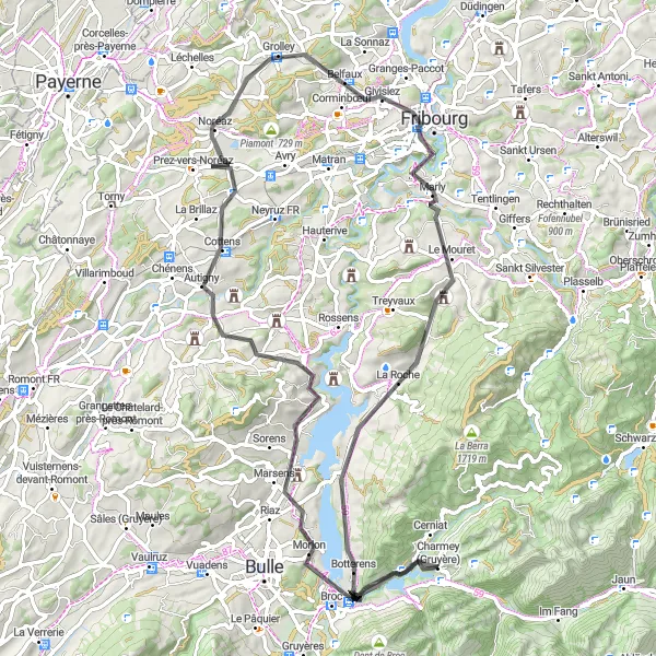
Jedinečná cesta plná úžasných výhledů a malebných vesnic
Tato 82km dlouhá trasa nabízí 1335m stoupání a prochází mnoha zajímavými místy. Začíná v Morlonu, kde si můžete užít krásné výhledy. Dále pokračuje přes Pont-en-Ogoz a Grolley až do Marly. Na cestě nesmíte vynechat krásnou vesnici La Combert a historické město Botterens.
Cyklotrasy v okolí:
Okolní oblasti:
![Obrázek Salzburg](https://images.tarmacs.app/cycling-routes/covers/austria/salzburg/schwarzach-im-pongau-4.webp)
![Obrázek Tirol](https://images.tarmacs.app/cycling-routes/covers/austria/tirol/fieberbrunn-4.webp)
![Obrázek Vorarlberg](https://images.tarmacs.app/cycling-routes/covers/austria/vorarlberg/sulz-5.webp)
![Obrázek Région lémanique](https://images.tarmacs.app/cycling-routes/covers/switzerland/region-lemanique/aubonne-4.webp)
![Obrázek Nordwestschweiz](https://images.tarmacs.app/cycling-routes/covers/switzerland/nordwestschweiz/graenichen-5.webp)
![Obrázek Zentralschweiz](https://images.tarmacs.app/cycling-routes/covers/switzerland/zentralschweiz/einsiedeln-4.webp)
![Obrázek Ticino](https://images.tarmacs.app/cycling-routes/covers/switzerland/ticino/morbio-inferiore-1.webp)
![Obrázek Freiburg](https://images.tarmacs.app/cycling-routes/covers/germany/freiburg/buchenbach-2.webp)
![Obrázek Franche-Comté](https://images.tarmacs.app/cycling-routes/covers/france/franche-comte/levier-4.webp)
![Obrázek Alsace](https://images.tarmacs.app/cycling-routes/covers/france/alsace/betschdorf-2.webp)
![Obrázek Rhône-Alpes](https://images.tarmacs.app/cycling-routes/covers/france/rhone-alpes/livron-sur-drome-2.webp)
![Obrázek Piemonte](https://images.tarmacs.app/cycling-routes/covers/italy/piemonte/revello-4.webp)