![Cover image](https://images.tarmacs.app/cycling-routes/covers/switzerland/nordwestschweiz/itingen-4.webp)
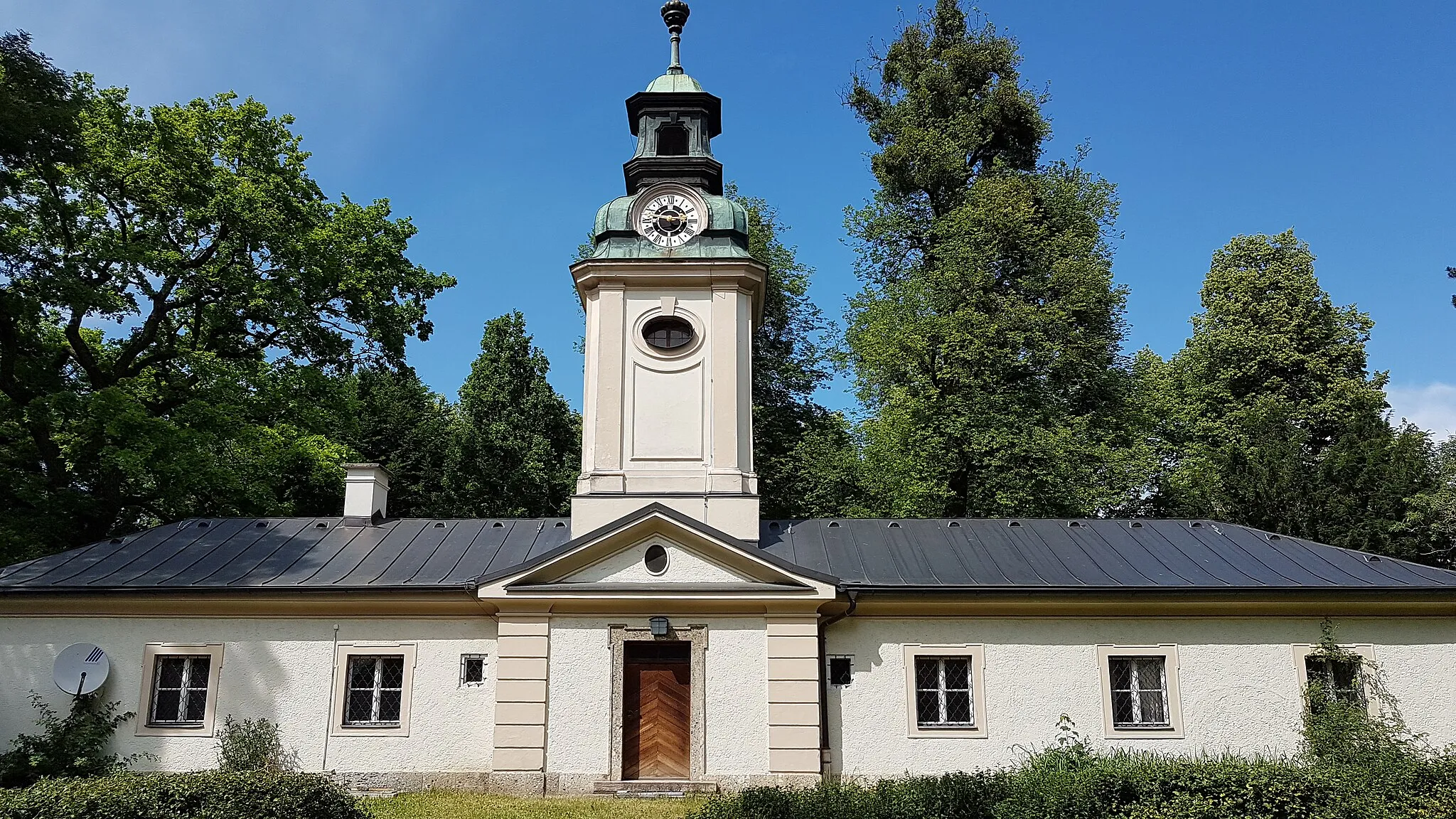
Vhodné místo pro cyklisty v Nordwestschweiz.
Cyklistické trasy kolem Itingen
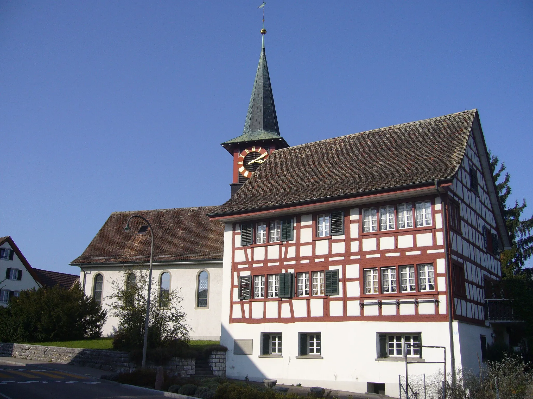
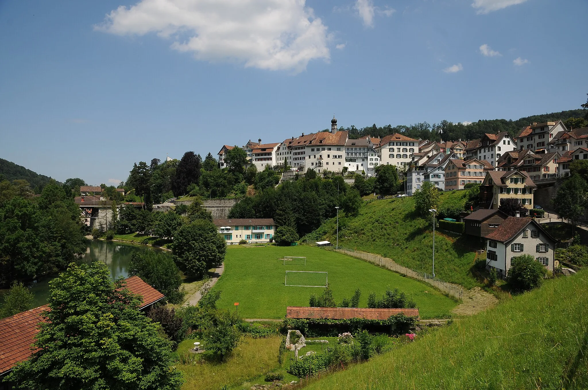
Itingen se nachází v regionu Nordwestschweiz ve Švýcarsku a je vhodným místem pro cyklisty. Kopcovitá krajina a cyklostezky v okolí lákají cyklisty k objevování nových tras.
![Miniaturní mapa "Gravel Trail to Balsthal" inspirace pro cyklisty v oblasti Nordwestschweiz, Switzerland. Vytvořeno pomocí plánovače tras Tarmacs.app](https://images.tarmacs.app/cycling-routes/routemaps/600/switzerland/nordwestschweiz/itingen/gravel/173107.webp)
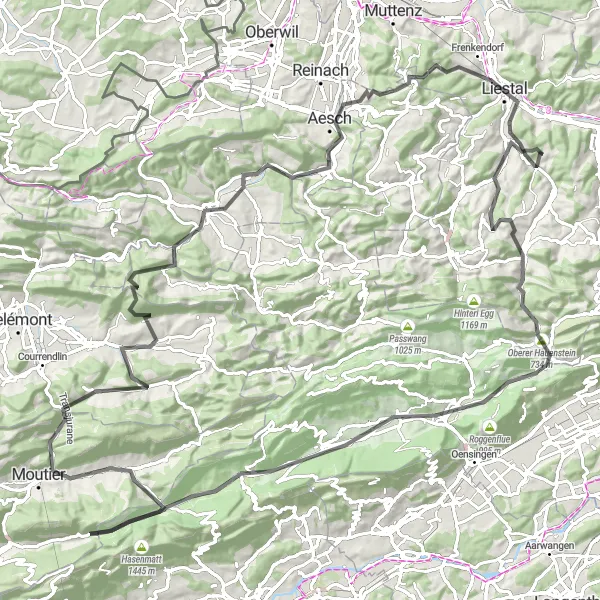
Explore the picturesque countryside and reach the charming town of Balsthal on this challenging gravel trail.
Embark on an 80km gravel adventure with 1736m of ascent, passing through quaint villages like Wolfwil and Lampenberg. Highlights include the historic Schanz and Oberer Hauenstein.
![Miniaturní mapa "Okružní cesta Itingen - Neuwiller" inspirace pro cyklisty v oblasti Nordwestschweiz, Switzerland. Vytvořeno pomocí plánovače tras Tarmacs.app](https://images.tarmacs.app/cycling-routes/routemaps/600/switzerland/nordwestschweiz/itingen/road/173066.webp)
Zajímavá okružní cesta s výhledem na Švýcarsko a Francii
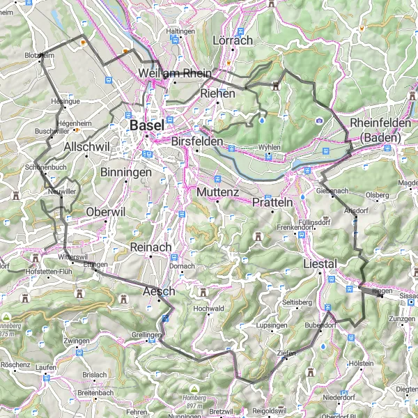
Tato okružní cesta vede převážně po silnici a nabízí pohled na zajímavá místa, jako je Huningue nebo Eichberg. S převýšením 1321 metrů a vzdáleností 93 kilometrů je vhodná pro cyklisty, kteří chtějí objevovat různorodé krajinu a kulturu.
![Miniaturní mapa "Gravelová cesta Hölstein - Liestal" inspirace pro cyklisty v oblasti Nordwestschweiz, Switzerland. Vytvořeno pomocí plánovače tras Tarmacs.app](https://images.tarmacs.app/cycling-routes/routemaps/600/switzerland/nordwestschweiz/itingen/gravel/173046.webp)
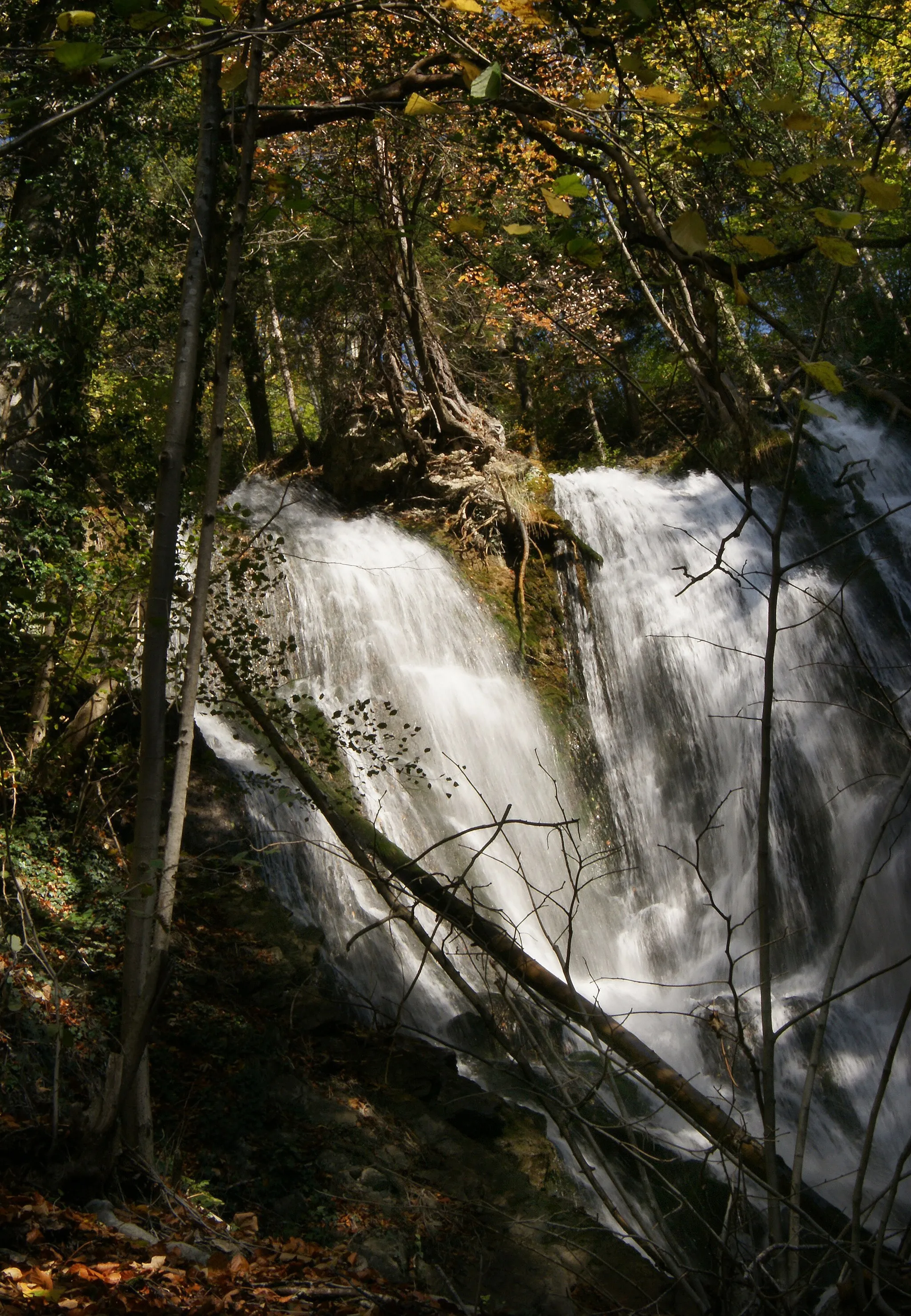
Krásná gravelová trasa s vodopádem
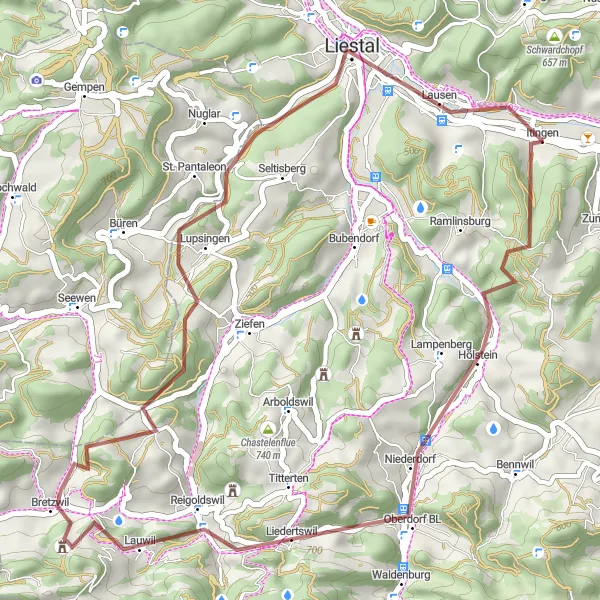
Tato kratší cesta nabízí malebné výhledy a zajímavé místa, jako je Lupsingen nebo Ergolz-Wasserfall. S převýšením 1054 metrů a vzdáleností 40 kilometrů je ideální pro toulky po krajině na horském kole.
![Miniaturní mapa "Gravelová cesta Grammet - Sissach" inspirace pro cyklisty v oblasti Nordwestschweiz, Switzerland. Vytvořeno pomocí plánovače tras Tarmacs.app](https://images.tarmacs.app/cycling-routes/routemaps/600/switzerland/nordwestschweiz/itingen/gravel/173034.webp)
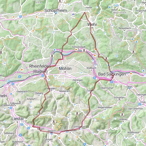
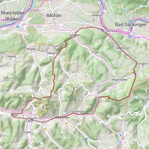
Příjemná gravelová trasa s malebnými výhledy
Tato cesta vede převážně po nezpevněných cestách a nabízí pohled na zajímavá místa, jako je Rheinfelden nebo Mumpferflue. S převýšením 1372 metrů a vzdáleností 66 kilometrů je skvělou volbou pro milovníky gravelové cyklistiky.
![Miniaturní mapa "Scenic Ride to Riehen" inspirace pro cyklisty v oblasti Nordwestschweiz, Switzerland. Vytvořeno pomocí plánovače tras Tarmacs.app](https://images.tarmacs.app/cycling-routes/routemaps/600/switzerland/nordwestschweiz/itingen/road/173051.webp)
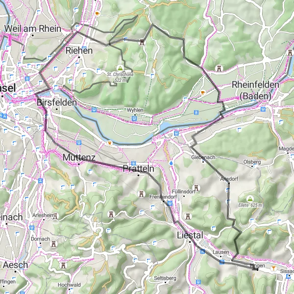
Enjoy a leisurely road cycling journey to the picturesque town of Riehen, covering 53km of beautiful landscapes.
With 592m of ascent, this road route offers a mix of charming villages and natural beauty. Highlights include Liestal and Buttenberg, as well as the scenic Grammet.
![Miniaturní mapa "Silniční cyklostezka Löffelberg" inspirace pro cyklisty v oblasti Nordwestschweiz, Switzerland. Vytvořeno pomocí plánovače tras Tarmacs.app](https://images.tarmacs.app/cycling-routes/routemaps/600/switzerland/nordwestschweiz/itingen/road/173151.webp)
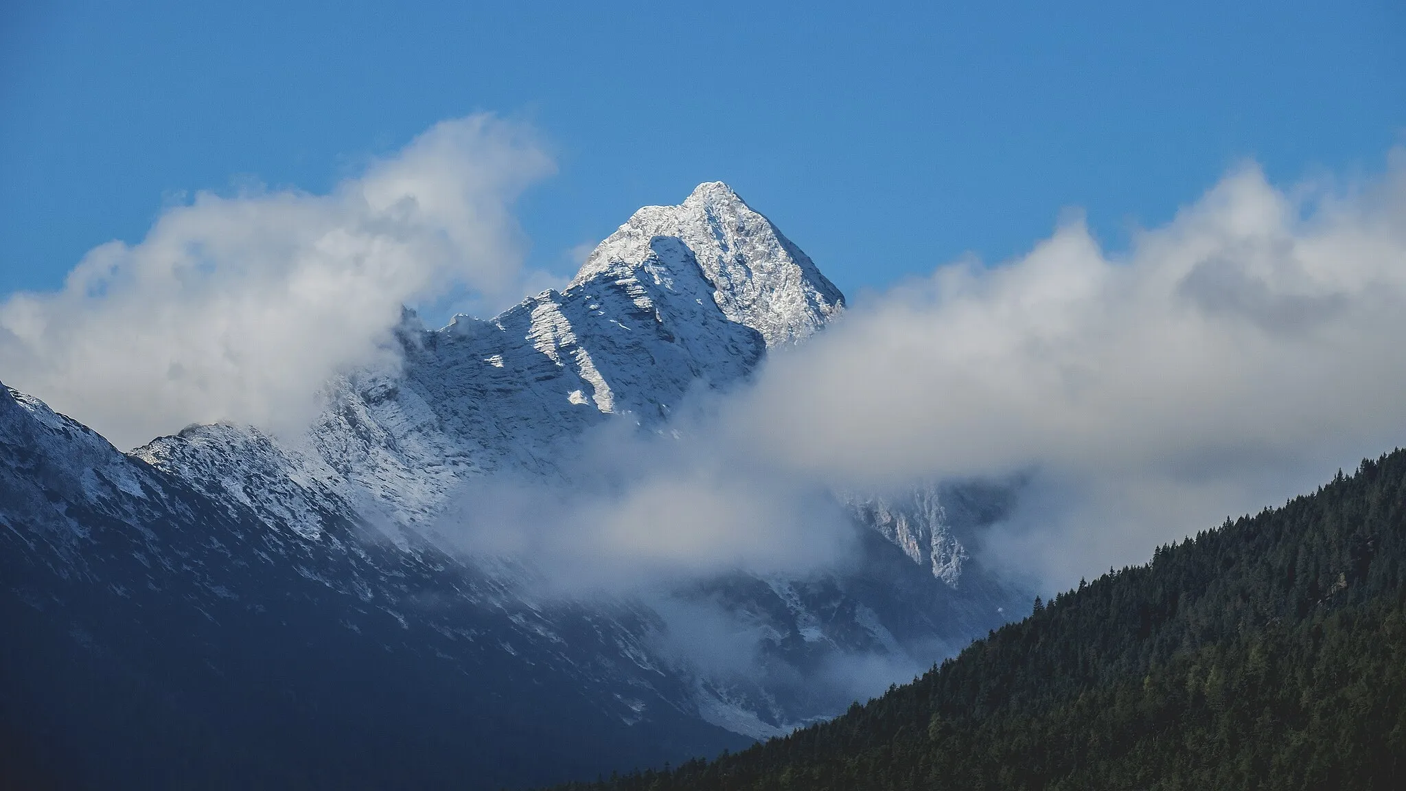
Dojeďte na vrchol s panoramatickým výhledem a zažijte vzrušující dobrodružství
Tato náročná trasa vás zavede přes horské vrcholy a malebné vesničky s historickými památkami. Projeďte se kolem nádherných panoramat a dostanete se až na vrchol s úchvatným výhledem. Cesta je vhodná pro zkušené cyklisty s silnou fyzickou kondicí a odvahou.
![Miniaturní mapa "Gravel Adventure to Wasserflue" inspirace pro cyklisty v oblasti Nordwestschweiz, Switzerland. Vytvořeno pomocí plánovače tras Tarmacs.app](https://images.tarmacs.app/cycling-routes/routemaps/600/switzerland/nordwestschweiz/itingen/gravel/173080.webp)
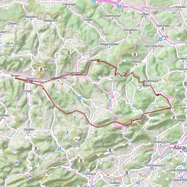
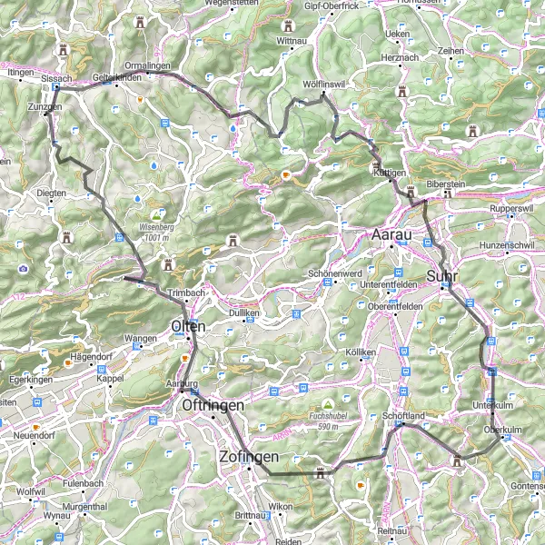
Embark on a thrilling gravel adventure to the scenic peak of Wasserflue, covering 52km of challenging terrain.
With 1230m of ascent, this gravel route offers a mix of natural beauty and cultural highlights. Explore Gelterkinden and Kilchberg, as well as the picturesque village of Berg.
![Miniaturní mapa "Okruh kolem Nordwestschweiz z Itingenu" inspirace pro cyklisty v oblasti Nordwestschweiz, Switzerland. Vytvořeno pomocí plánovače tras Tarmacs.app](https://images.tarmacs.app/cycling-routes/routemaps/600/switzerland/nordwestschweiz/itingen/gravel/199959.webp)
Slušný výškový rozdíl zaručuje adrenalinový zážitek
Když se vydáte na tento okruh, můžete se těšit na malebné výhledy, strmé stoupání i sjezdy a pohodovou jízdu okolím Nordwestschweiz. Trasa vás provede zajímavými místy a zážitky nebudete mít určitě dost.
![Miniaturní mapa "Road Adventure to Aarwangen" inspirace pro cyklisty v oblasti Nordwestschweiz, Switzerland. Vytvořeno pomocí plánovače tras Tarmacs.app](https://images.tarmacs.app/cycling-routes/routemaps/600/switzerland/nordwestschweiz/itingen/road/173081.webp)
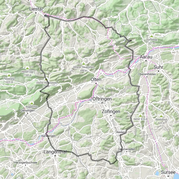
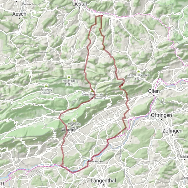
Embark on a thrilling road cycling journey to the historic town of Aarwangen, covering 114km of challenging terrain.
With 2010m of ascent, this road route offers a mix of scenic landscapes and cultural experiences. Highlights include Sissach and Salhöhe, as well as the impressive Ruine Spitzburg.
![Miniaturní mapa "Okružní cesta Gelterkinden - Geissflue" inspirace pro cyklisty v oblasti Nordwestschweiz, Switzerland. Vytvořeno pomocí plánovače tras Tarmacs.app](https://images.tarmacs.app/cycling-routes/routemaps/600/switzerland/nordwestschweiz/itingen/road/173091.webp)
Zajímavá okružní cesta s výstupem na Geissflue
Tato okružní cesta nabízí krásné výhledy a zajímavá místa, jako je Roti Flue nebo Wasserflue. S celkovým převýšením 1754 metrů a vzdáleností 92 kilometrů je skvělou volbou pro cyklisty, kteří hledají výzvu.
Cyklotrasy v okolí:
Okolní oblasti:
![Obrázek Salzburg](https://images.tarmacs.app/cycling-routes/covers/austria/salzburg/siezenheim-3.webp)
![Obrázek Tirol](https://images.tarmacs.app/cycling-routes/covers/austria/tirol/leutasch-3.webp)
![Obrázek Vorarlberg](https://images.tarmacs.app/cycling-routes/covers/austria/vorarlberg/thueringen-4.webp)
![Obrázek Région lémanique](https://images.tarmacs.app/cycling-routes/covers/switzerland/region-lemanique/caux-3.webp)
![Obrázek Espace Mittelland](https://images.tarmacs.app/cycling-routes/covers/switzerland/espace-mittelland/deitingen-3.webp)
![Obrázek Zürich](https://images.tarmacs.app/cycling-routes/covers/switzerland/zurich/dietlikon-dietlikon-dorf-1.webp)
![Obrázek Ostschweiz](https://images.tarmacs.app/cycling-routes/covers/switzerland/ostschweiz/lichtensteig-4.webp)
![Obrázek Zentralschweiz](https://images.tarmacs.app/cycling-routes/covers/switzerland/zentralschweiz/gunzwil-4.webp)
![Obrázek Freiburg](https://images.tarmacs.app/cycling-routes/covers/germany/freiburg/dornhan-5.webp)
![Obrázek Tübingen](https://images.tarmacs.app/cycling-routes/covers/germany/tubingen/maselheim-4.webp)
![Obrázek Franche-Comté](https://images.tarmacs.app/cycling-routes/covers/france/franche-comte/lons-le-saunier-1.webp)
![Obrázek Alsace](https://images.tarmacs.app/cycling-routes/covers/france/alsace/sierentz-5.webp)