![Cover image](https://images.tarmacs.app/cycling-routes/covers/switzerland/nordwestschweiz/oftringen-4.webp)
Projížďky krajinou a stoupání Benkerjoch v blízkosti.
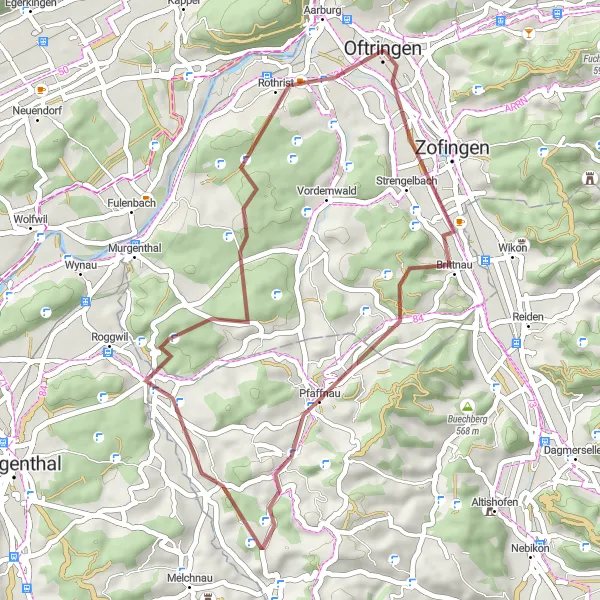
Cyklistické trasy kolem Oftringen
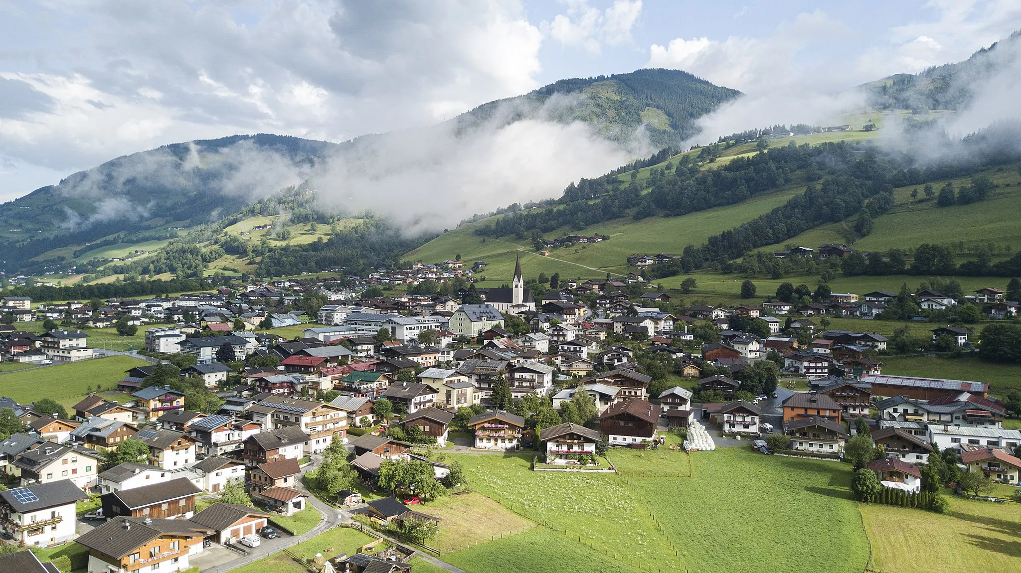
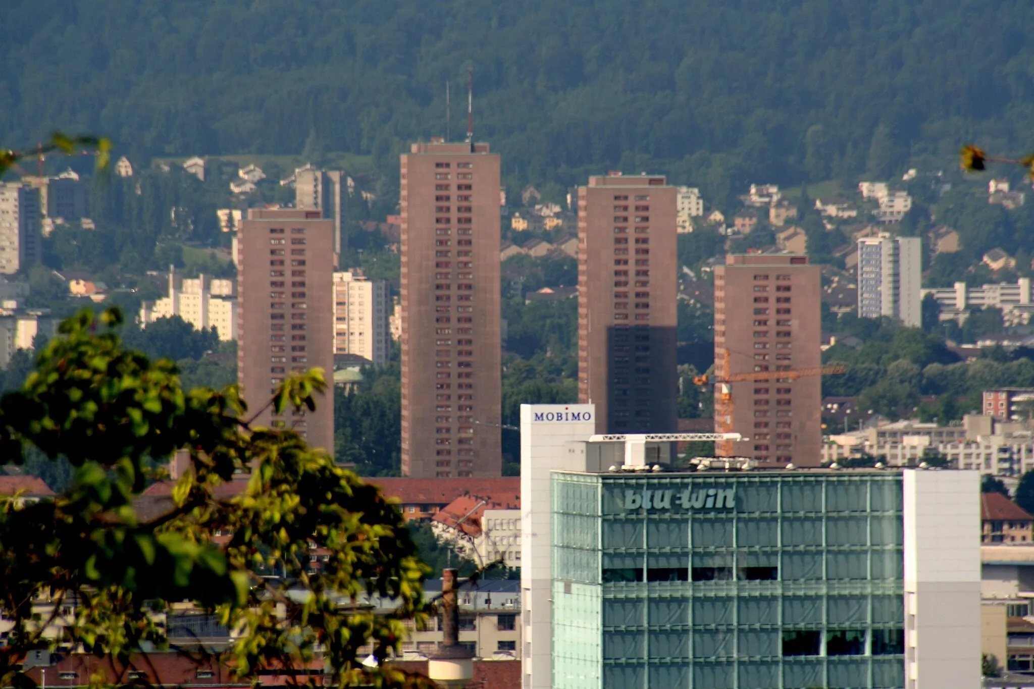
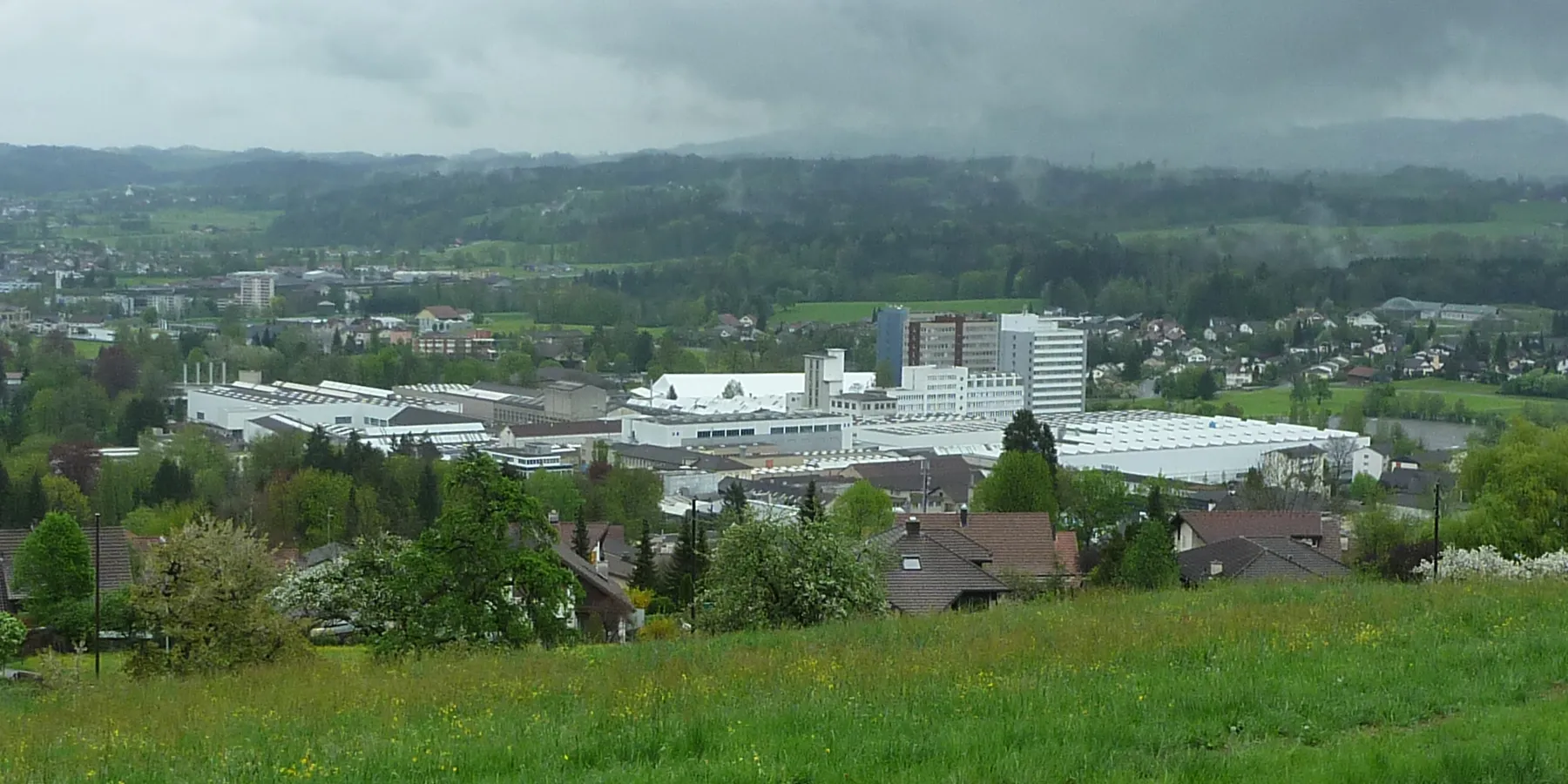
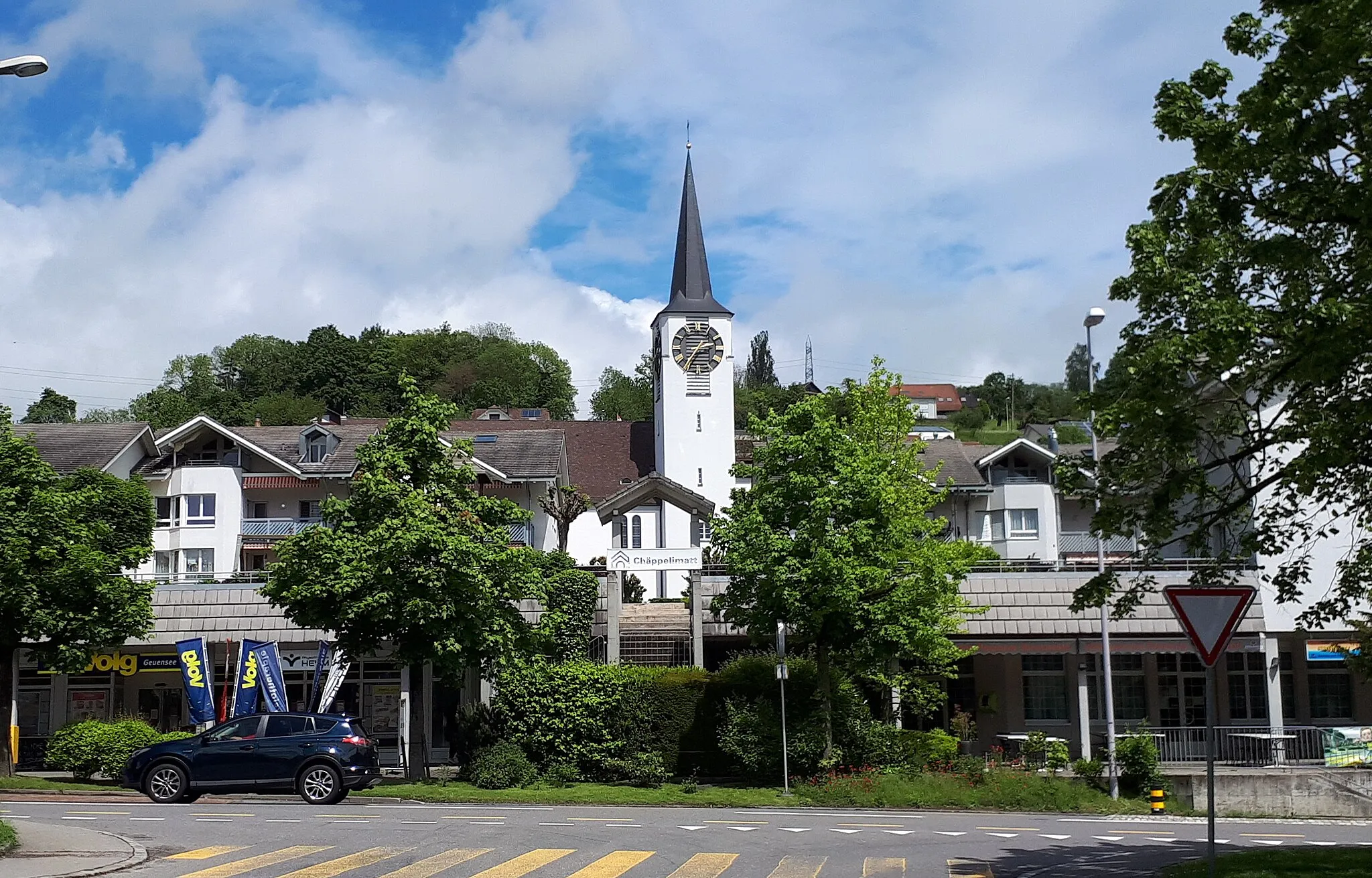
Oftringen je lokalita ve švýcarském regionu Nordwestschweiz. Pro cyklisty zde není tolik cyklostezek, ale mohou si užít projížďky krajinou a okolními vesnicemi. Nedaleko se nachází stoupání Benkerjoch, které je vhodné pro tréninkové jízdy.
![Miniaturní mapa "Gravel Adventure near Oftringen" inspirace pro cyklisty v oblasti Nordwestschweiz, Switzerland. Vytvořeno pomocí plánovače tras Tarmacs.app](https://images.tarmacs.app/cycling-routes/routemaps/600/switzerland/nordwestschweiz/oftringen/gravel/165829.webp)
Get off the beaten path and explore the Swiss countryside on this gravel adventure
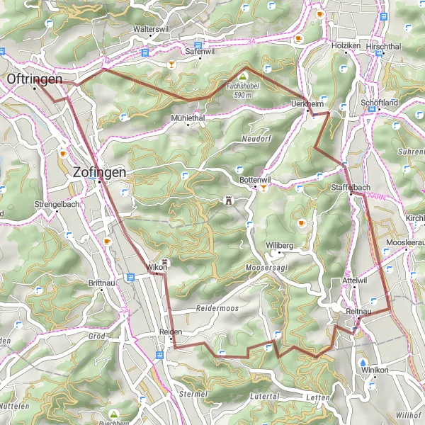
Covering a distance of 39 km with a total ascent of 595 meters, this gravel route offers a mix of challenging terrain and scenic views. Perfect for gravel enthusiasts looking for a fun and exciting ride through the beautiful Swiss countryside.
![Miniaturní mapa "Road Route near Oftringen" inspirace pro cyklisty v oblasti Nordwestschweiz, Switzerland. Vytvořeno pomocí plánovače tras Tarmacs.app](https://images.tarmacs.app/cycling-routes/routemaps/600/switzerland/nordwestschweiz/oftringen/road/165868.webp)
Experience the beauty of the Swiss countryside on this scenic road route
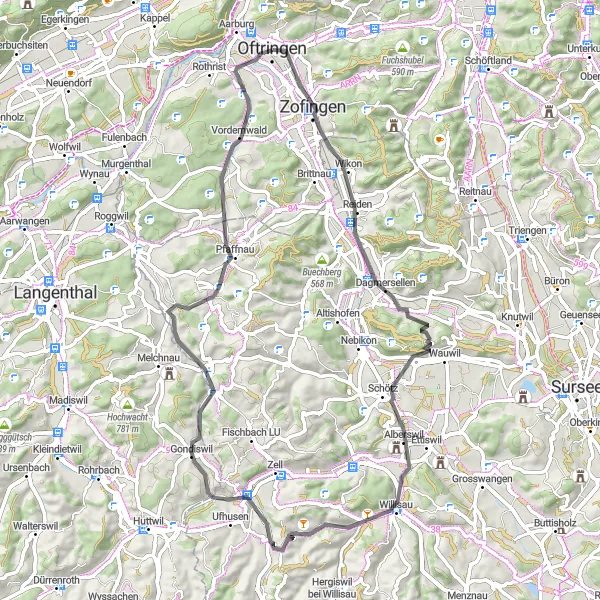
Covering a distance of 44 km with a total ascent of 382 meters, this road route offers stunning views of rolling hills and charming villages. Perfect for road cycling enthusiasts looking for a moderate challenge.
![Miniaturní mapa "Gravelová cesta kolem Safenwil a Reiden" inspirace pro cyklisty v oblasti Nordwestschweiz, Switzerland. Vytvořeno pomocí plánovače tras Tarmacs.app](https://images.tarmacs.app/cycling-routes/routemaps/600/switzerland/nordwestschweiz/oftringen/gravel/165798.webp)
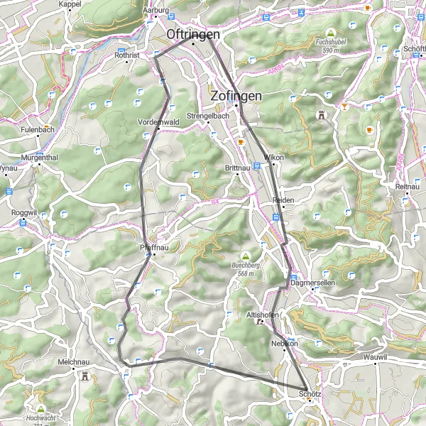
Výlet do přírody a klidných vesnic na 36 km dlouhé trase
Tato gravelová trasa vás zavede kolem malebné vesnice Safenwil a historického města Reiden. S převýšením 717 m a vzdáleností 36 km, nabízí ideální kombinaci dobrodružství a přírodní krásy.
![Miniaturní mapa "Scenic Road Cycling Tour from Oftringen" inspirace pro cyklisty v oblasti Nordwestschweiz, Switzerland. Vytvořeno pomocí plánovače tras Tarmacs.app](https://images.tarmacs.app/cycling-routes/routemaps/600/switzerland/nordwestschweiz/oftringen/road/165835.webp)
Embark on a breathtaking journey through the Swiss countryside
This 92 km road cycling tour is perfect for cyclists seeking a challenging yet rewarding experience. With a total ascent of 1169 meters, you'll ride through quaint villages, lush forests, and rolling hills, making for a truly unforgettable adventure.
![Miniaturní mapa "Gravel Route around Oftringen" inspirace pro cyklisty v oblasti Nordwestschweiz, Switzerland. Vytvořeno pomocí plánovače tras Tarmacs.app](https://images.tarmacs.app/cycling-routes/routemaps/600/switzerland/nordwestschweiz/oftringen/gravel/165795.webp)
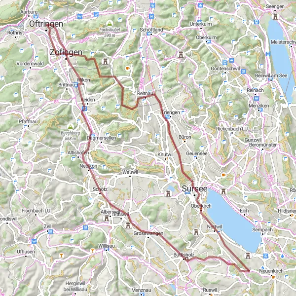
Explore the countryside on this challenging gravel route
This 78 km gravel route takes you through picturesque villages and lush green landscapes, with a total ascent of 850 meters. Enjoy the peaceful surroundings and the opportunity to connect with nature while cycling.
![Miniaturní mapa "Road Cycling Loop starting from Oftringen" inspirace pro cyklisty v oblasti Nordwestschweiz, Switzerland. Vytvořeno pomocí plánovače tras Tarmacs.app](https://images.tarmacs.app/cycling-routes/routemaps/600/switzerland/nordwestschweiz/oftringen/road/165832.webp)
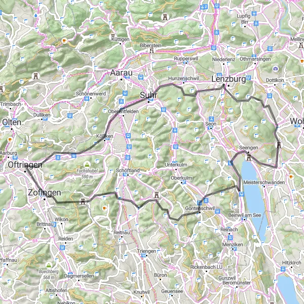
Discover the beauty of the Swiss landscape on this exciting road cycling loop
This 80 km road cycling loop offers a challenging yet rewarding experience for cyclists of all levels. With a total ascent of 937 meters, you'll ride through picturesque villages, rolling hills, and scenic landscapes, making for a memorable cycling adventure.
![Miniaturní mapa "Gravel Route Okolí Oftringen" inspirace pro cyklisty v oblasti Nordwestschweiz, Switzerland. Vytvořeno pomocí plánovače tras Tarmacs.app](https://images.tarmacs.app/cycling-routes/routemaps/600/switzerland/nordwestschweiz/oftringen/gravel/193937.webp)
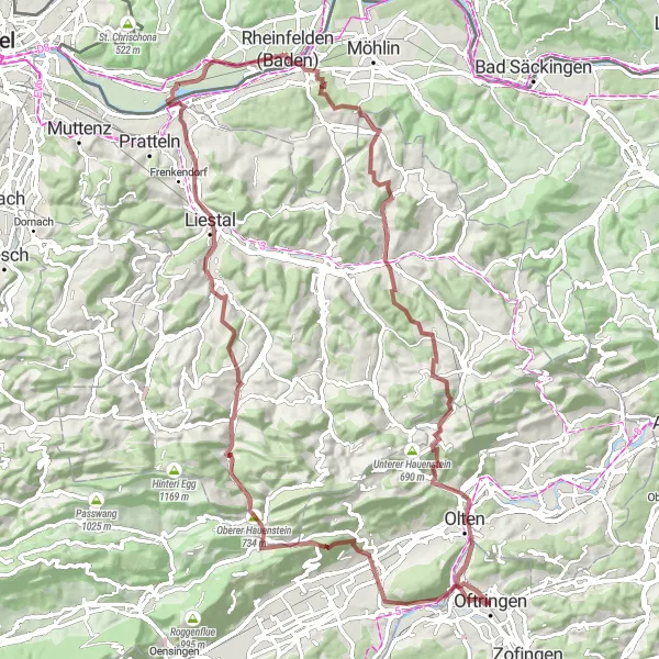
Zajímavá cesta plná dobrodružství a krásných výhledů
Tato 91km cyklistická trasa nabízí nádherné výhledy z Aussichtsturm Sonnenberg a mnoho dalších zajímavých míst jako Augst a Oberer Hauenstein. S výstupem 1841m je to výzva pro zkušené cyklisty, ale odměnou jsou úžasné scenérie a památky podél trasy.
![Miniaturní mapa "Okruh přes Grossdietwil a Aarwangen" inspirace pro cyklisty v oblasti Nordwestschweiz, Switzerland. Vytvořeno pomocí plánovače tras Tarmacs.app](https://images.tarmacs.app/cycling-routes/routemaps/600/switzerland/nordwestschweiz/oftringen/road/165830.webp)
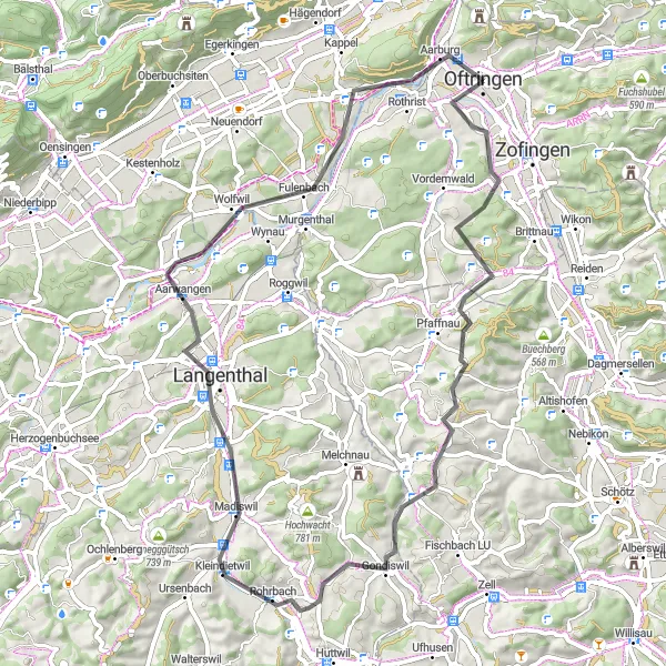
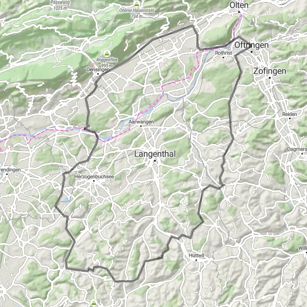
64 km dlouhý výlet plný malebných vesnic a krásné krajiny
Tato cyklotrasa vás zavede kolem malebné vesnice Grossdietwil a historického města Aarwangen. S převýšením 850 m a vzdáleností 64 km, nabízí ideální kombinaci památek a přírodní krásy.
![Miniaturní mapa "Cesta přes Kölliken, Lenzburg a Schloss Hallwyl" inspirace pro cyklisty v oblasti Nordwestschweiz, Switzerland. Vytvořeno pomocí plánovače tras Tarmacs.app](https://images.tarmacs.app/cycling-routes/routemaps/600/switzerland/nordwestschweiz/oftringen/road/165845.webp)
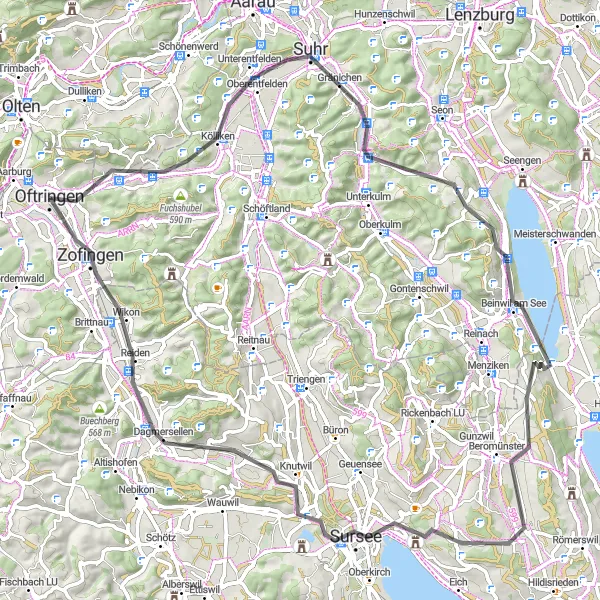
Vychutnejte si 76 km dlouhou jízdu plnou památek a krásné krajiny
Tato cyklotrasa vás zavede kolem malebného městečka Kölliken, historického hradu Lenzburg a úchvatného zámku Schloss Hallwyl. S převýšením 1300 m a vzdáleností 76 km, nabízí ideální kombinaci výzev a památek.
![Miniaturní mapa "Silniční Trasa Od Oftringen" inspirace pro cyklisty v oblasti Nordwestschweiz, Switzerland. Vytvořeno pomocí plánovače tras Tarmacs.app](https://images.tarmacs.app/cycling-routes/routemaps/600/switzerland/nordwestschweiz/oftringen/road/193963.webp)
Skvělá volba pro milovníky silniční cyklistiky s pár náročnými výstupy
Tato 64km cyklistická trasa nabízí výzvy jako Alpenzeiger a krásná místa jako Willisau a Salberig. S převýšením 796m je to ideální trasa pro středně zdatné cyklisty, kteří chtějí objevit okolí a užít si krásy švýcarské krajiny.
Cyklotrasy v okolí:
Okolní oblasti:
![Obrázek Salzburg](https://images.tarmacs.app/cycling-routes/covers/austria/salzburg/uttendorf-4.webp)
![Obrázek Tirol](https://images.tarmacs.app/cycling-routes/covers/austria/tirol/kitzbuehel-2.webp)
![Obrázek Vorarlberg](https://images.tarmacs.app/cycling-routes/covers/austria/vorarlberg/hohenems-3.webp)
![Obrázek Région lémanique](https://images.tarmacs.app/cycling-routes/covers/switzerland/region-lemanique/verbier-4.webp)
![Obrázek Espace Mittelland](https://images.tarmacs.app/cycling-routes/covers/switzerland/espace-mittelland/rueggisberg-1.webp)
![Obrázek Zürich](https://images.tarmacs.app/cycling-routes/covers/switzerland/zurich/zuerich-kreis-4-aussersihl-3.webp)
![Obrázek Ostschweiz](https://images.tarmacs.app/cycling-routes/covers/switzerland/ostschweiz/uzwil-4.webp)
![Obrázek Zentralschweiz](https://images.tarmacs.app/cycling-routes/covers/switzerland/zentralschweiz/geuensee-5.webp)
![Obrázek Freiburg](https://images.tarmacs.app/cycling-routes/covers/germany/freiburg/konstanz-3.webp)
![Obrázek Tübingen](https://images.tarmacs.app/cycling-routes/covers/germany/tubingen/kressbronn-am-bodensee-4.webp)
![Obrázek Franche-Comté](https://images.tarmacs.app/cycling-routes/covers/france/franche-comte/dole-1.webp)
![Obrázek Alsace](https://images.tarmacs.app/cycling-routes/covers/france/alsace/masevaux-5.webp)