![Cover image](https://images.tarmacs.app/cycling-routes/covers/switzerland/nordwestschweiz/roschenz-4.webp)
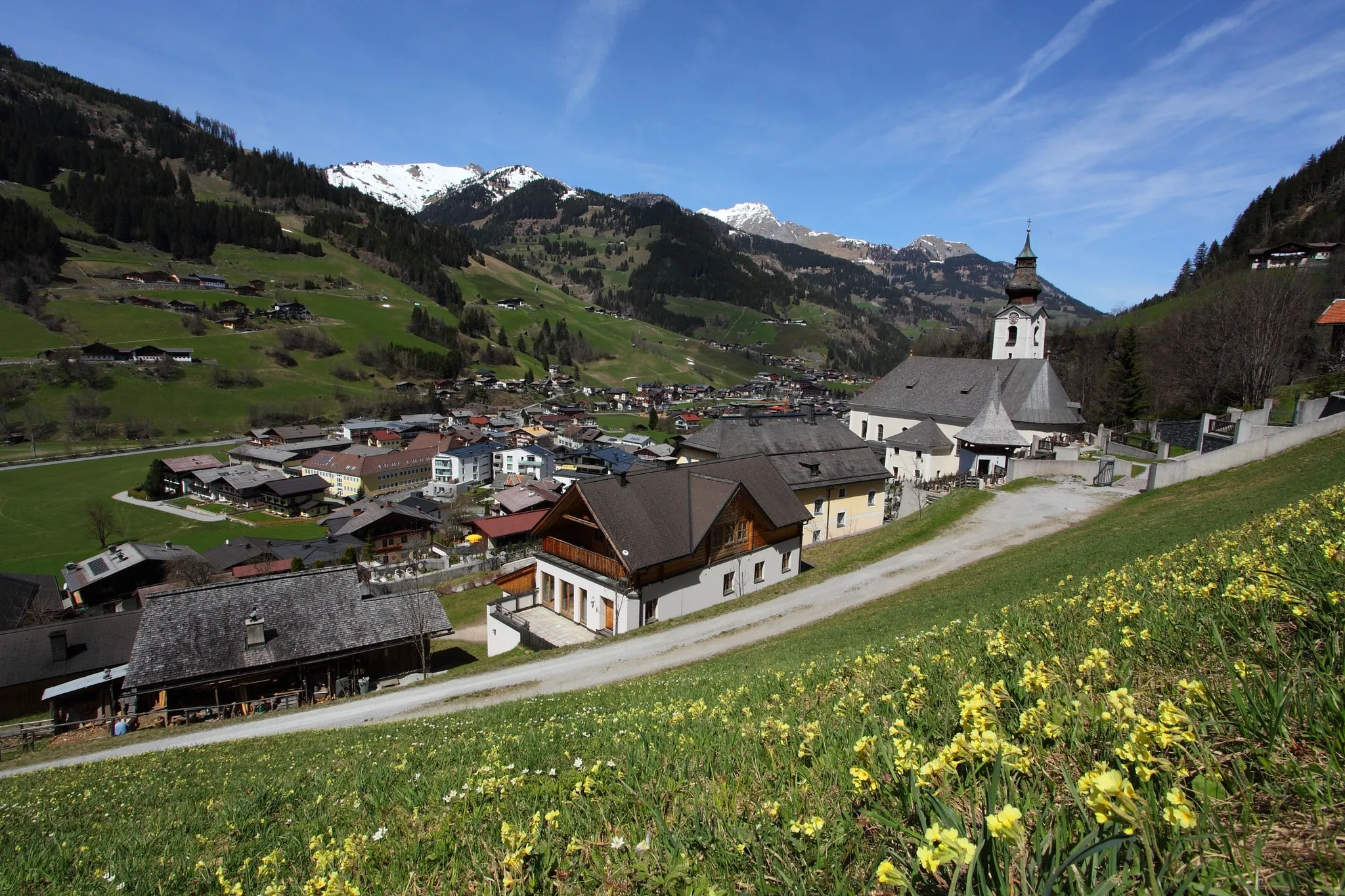
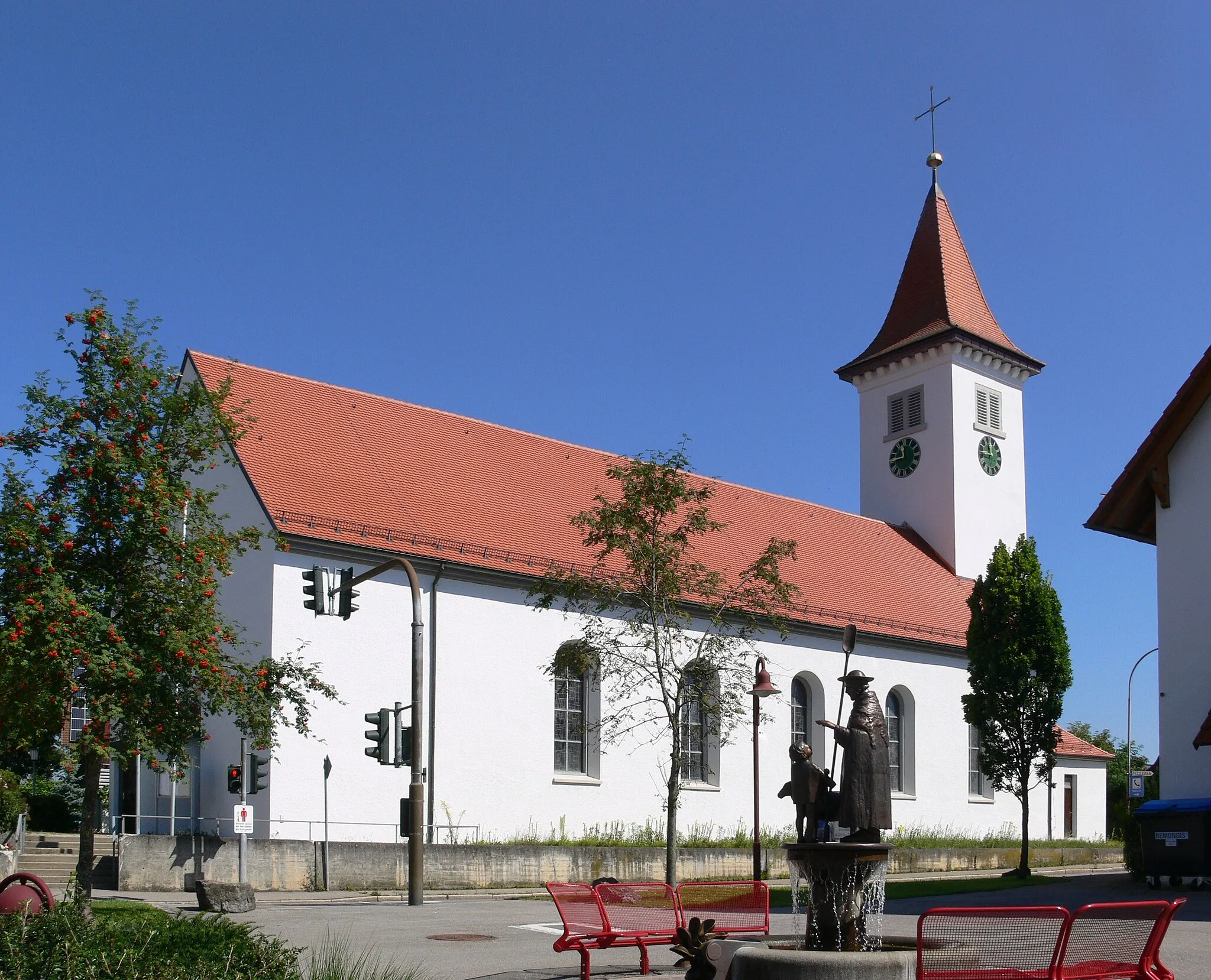
Malebná lokalita pro cyklisty
Cyklistické trasy kolem Roschenz
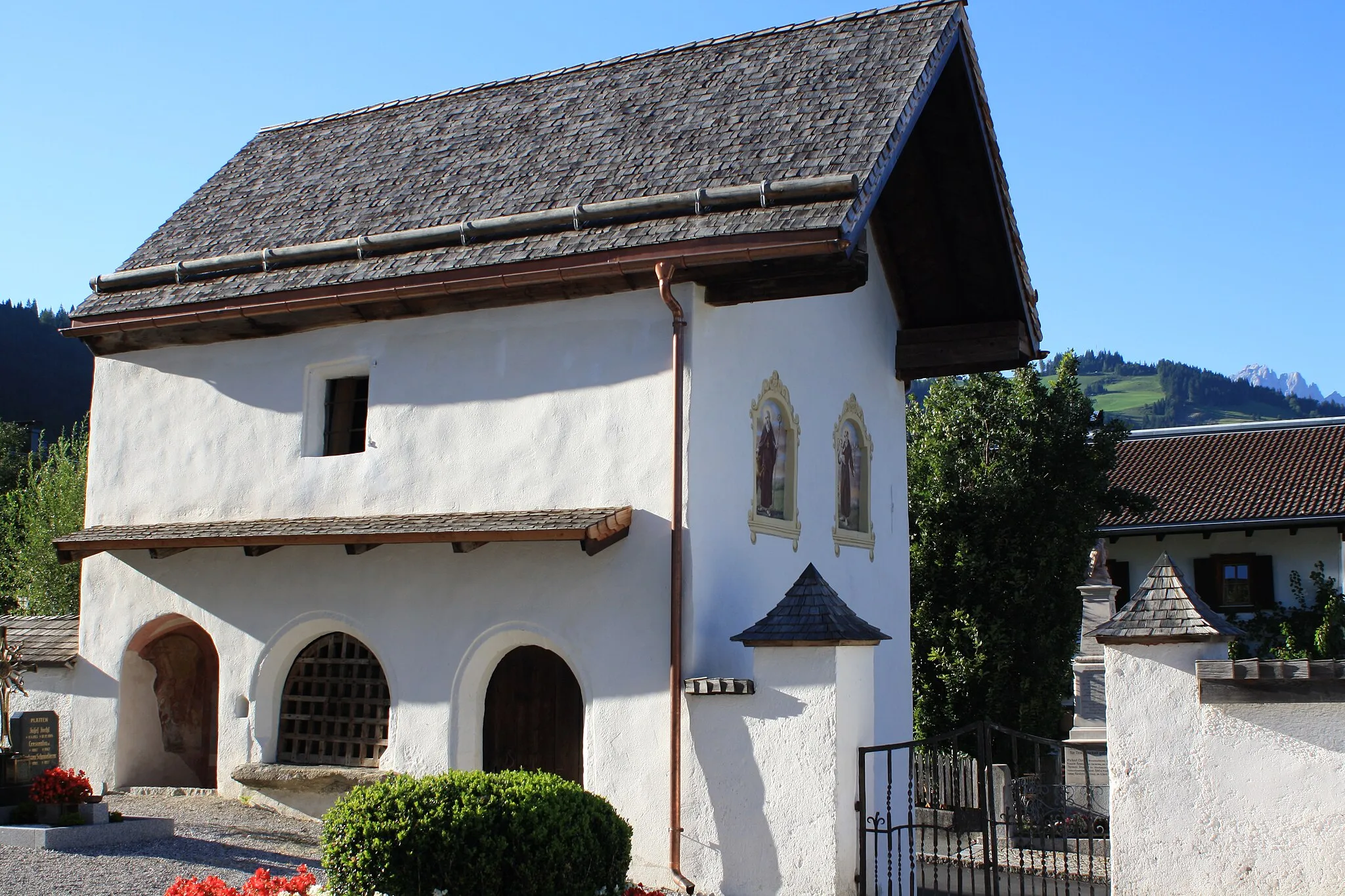
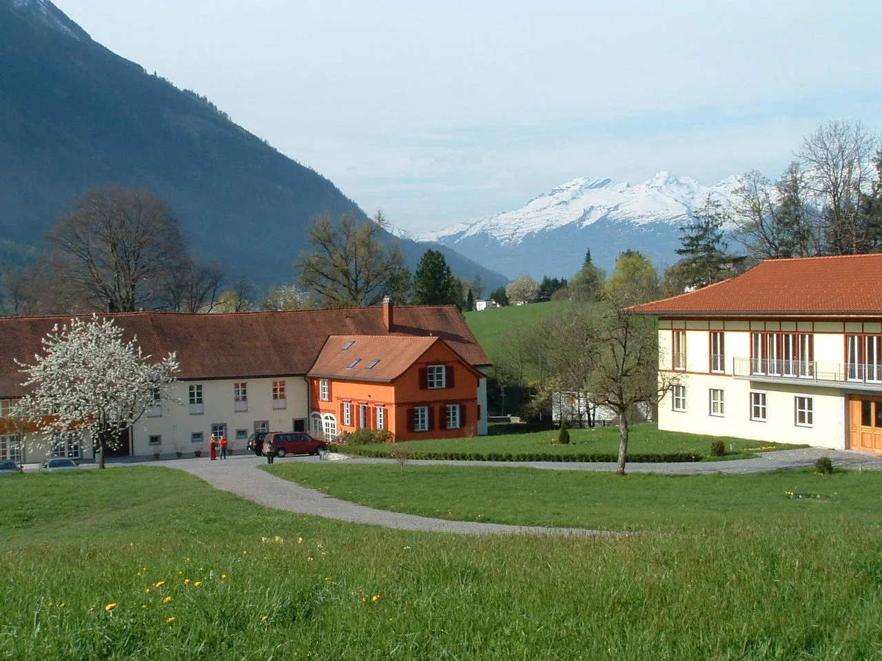
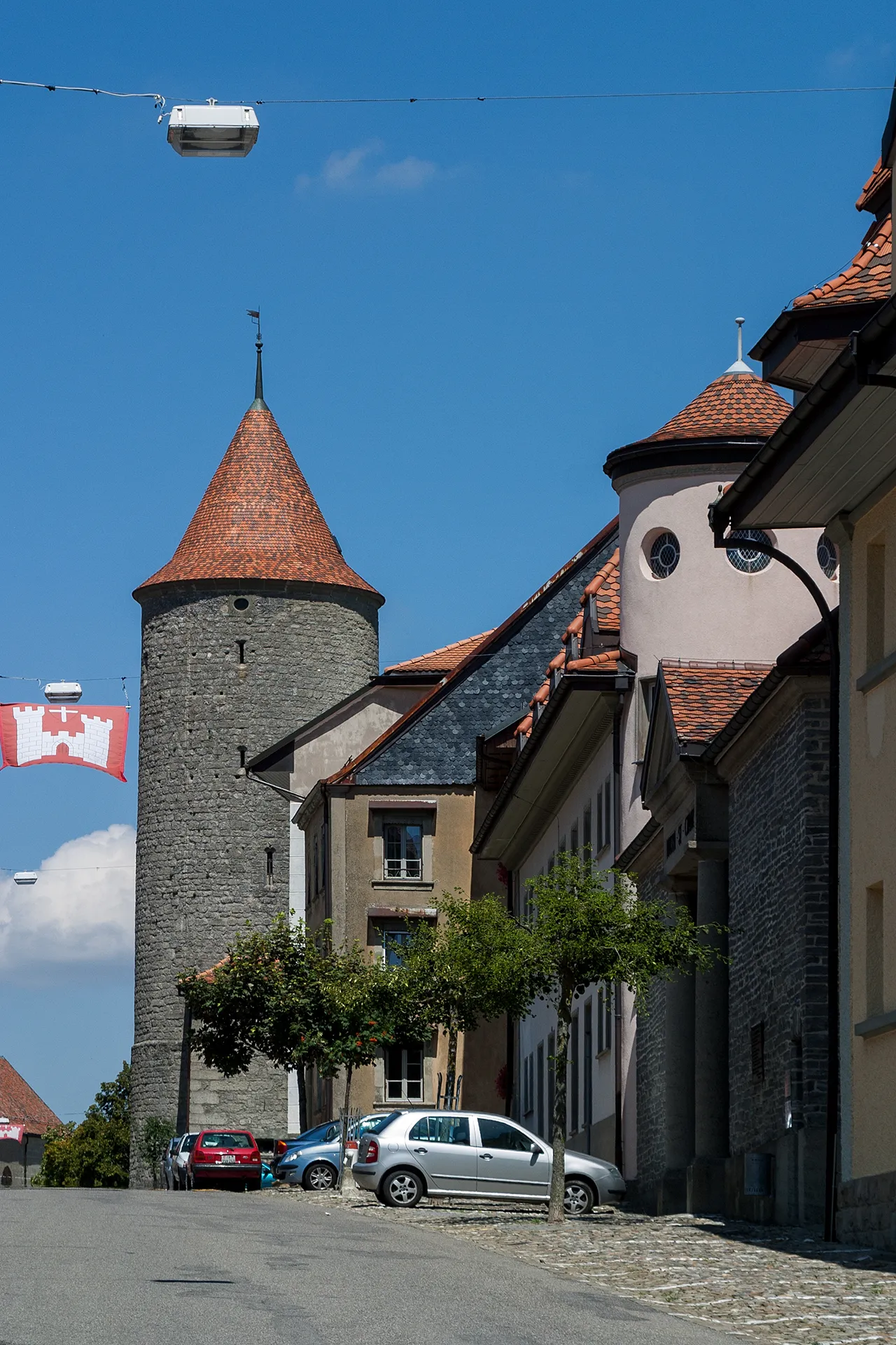
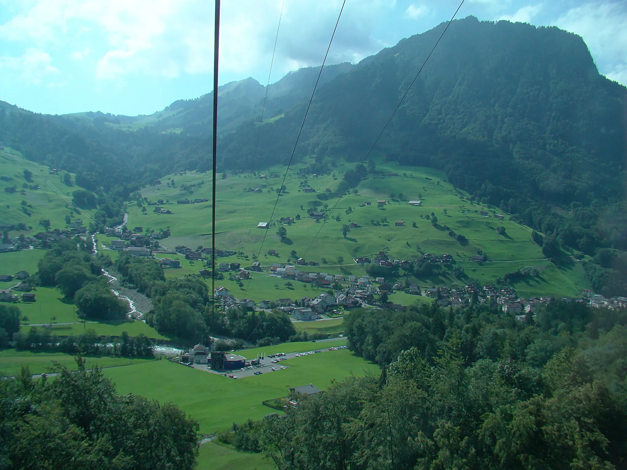
Röschenz je malebná lokalita v regionu Nordwestschweiz ve Švýcarsku. Cyklisté zde najdou malebné silnice obklopené krásnou přírodou. V blízkosti se nachází několik cyklistických tras vhodných pro road i gravel biking. Oblast nabízí skvělý mix rovinatých úseků a mírných stoupání.
![Miniaturní mapa "Road - Mont Girod Circuit" inspirace pro cyklisty v oblasti Nordwestschweiz, Switzerland. Vytvořeno pomocí plánovače tras Tarmacs.app](https://images.tarmacs.app/cycling-routes/routemaps/600/switzerland/nordwestschweiz/roschenz/road/198139.webp)
Explore the stunning Mont Girod Circuit in Nordwestschweiz
This 107km road route offers a challenging ascent of 2178m, with highlights such as Saulcy and Mont Girod, passing through picturesque villages and lush forests. Enjoy the breathtaking views and the sense of accomplishment as you conquer this demanding circuit.
![Miniaturní mapa "Road - Passwang Adventure" inspirace pro cyklisty v oblasti Nordwestschweiz, Switzerland. Vytvořeno pomocí plánovače tras Tarmacs.app](https://images.tarmacs.app/cycling-routes/routemaps/600/switzerland/nordwestschweiz/roschenz/road/170384.webp)
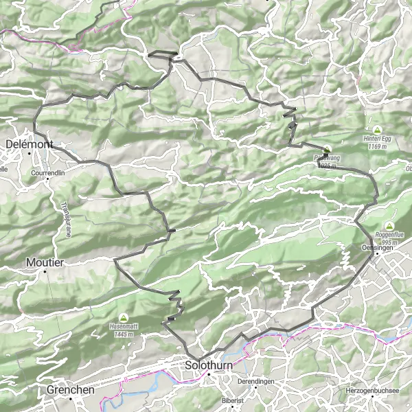
Embark on a scenic road adventure through Passwang in Nordwestschweiz
This 115km road route offers a challenging ascent of 2681m, with highlights such as Nunningen and Solothurn, passing through charming villages and beautiful landscapes. Enjoy the exhilarating climbs and thrilling descents on this epic journey through Passwang.
![Miniaturní mapa "Trasa Eggflue - Chilchberg" inspirace pro cyklisty v oblasti Nordwestschweiz, Switzerland. Vytvořeno pomocí plánovače tras Tarmacs.app](https://images.tarmacs.app/cycling-routes/routemaps/600/switzerland/nordwestschweiz/roschenz/road/170379.webp)
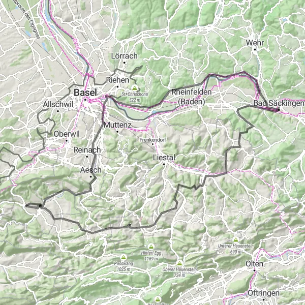
Bike kind: silnice, Výstup: 1731 m, Vzdálenost: 120 km
Trasa Eggflue - Chilchberg je výzvou pro zkušené cyklisty a nabízí panoramatické výhledy a malebná místa. Projedete atraktivní Eggflue a Aesch. Cesta vede přes několik historických obcí s bohatým kulturním dědictvím. Krakonosná trasa s mnoha náročnými pasážemi a malebnou krajinou.
![Miniaturní mapa "Gravel - Stürmechopf Challenge" inspirace pro cyklisty v oblasti Nordwestschweiz, Switzerland. Vytvořeno pomocí plánovače tras Tarmacs.app](https://images.tarmacs.app/cycling-routes/routemaps/600/switzerland/nordwestschweiz/roschenz/gravel/198144.webp)
Conquer the rugged terrain of Stürmechopf in Nordwestschweiz
This 76km gravel route offers a demanding ascent of 2573m, with highlights such as Laupersdorfer Stierenberg and Laufen, passing through remote landscapes and challenging terrain. Test your skills and endurance on this epic ride and enjoy the thrill of conquering the Stürmechopf Challenge.
![Miniaturní mapa "Trasa Räschberg - Col du Neuneich" inspirace pro cyklisty v oblasti Nordwestschweiz, Switzerland. Vytvořeno pomocí plánovače tras Tarmacs.app](https://images.tarmacs.app/cycling-routes/routemaps/600/switzerland/nordwestschweiz/roschenz/gravel/170406.webp)
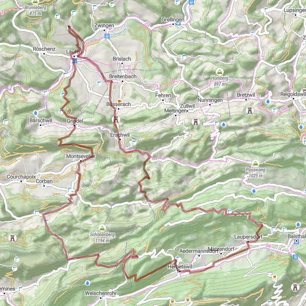
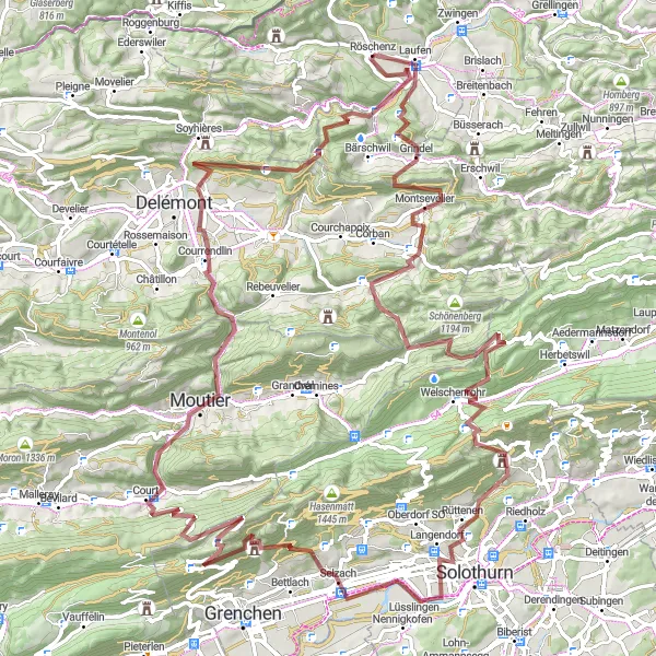
Bike kind: štěrk, Výstup: 1284 m, Vzdálenost: 47 km
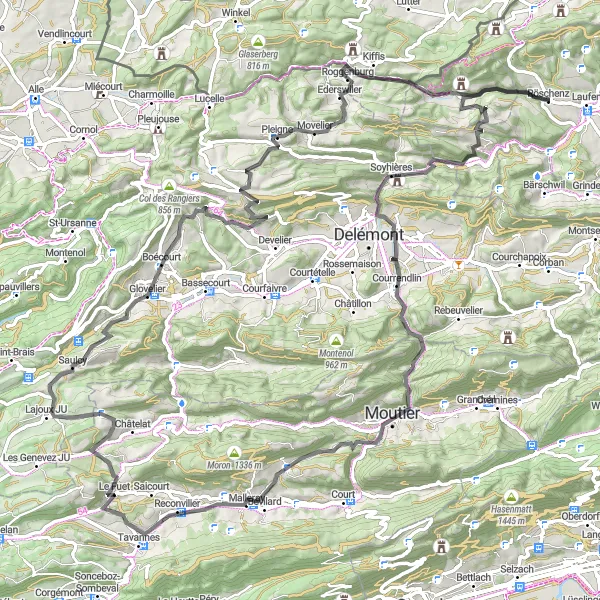
Trasa vede přes úchvatné Räschberg a zahrnuje mnoho malebných míst jako je La Joux a Movelier. Vrcholem cesty je náročný Col du Neuneich. Zajímavé a rozmanité prostředí poskytuje pestrý zážitek cyklistům a nabízí krásné výhledy.
![Miniaturní mapa "Gravel - Allschwil Loop" inspirace pro cyklisty v oblasti Nordwestschweiz, Switzerland. Vytvořeno pomocí plánovače tras Tarmacs.app](https://images.tarmacs.app/cycling-routes/routemaps/600/switzerland/nordwestschweiz/roschenz/gravel/170386.webp)
Embark on a gravel adventure through Allschwil in Nordwestschweiz
This 58km gravel route offers a moderate ascent of 889m, with highlights such as Leymen and Zwingen, passing through rustic countryside and charming villages. Immerse yourself in the peaceful surroundings and enjoy the thrill of off-road cycling on this scenic loop.
![Miniaturní mapa "Gravel - Mont Girod Epic" inspirace pro cyklisty v oblasti Nordwestschweiz, Switzerland. Vytvořeno pomocí plánovače tras Tarmacs.app](https://images.tarmacs.app/cycling-routes/routemaps/600/switzerland/nordwestschweiz/roschenz/gravel/170398.webp)
Embark on an epic gravel adventure to Mont Girod in Nordwestschweiz
This 118km gravel route offers a challenging ascent of 3828m, with highlights such as Egg and Moutier, passing through stunning landscapes and historic towns. Immerse yourself in the beauty of the region and enjoy the sense of accomplishment as you conquer the Mont Girod Epic.
![Miniaturní mapa "Trasa Hard - Challpass" inspirace pro cyklisty v oblasti Nordwestschweiz, Switzerland. Vytvořeno pomocí plánovače tras Tarmacs.app](https://images.tarmacs.app/cycling-routes/routemaps/600/switzerland/nordwestschweiz/roschenz/road/170405.webp)
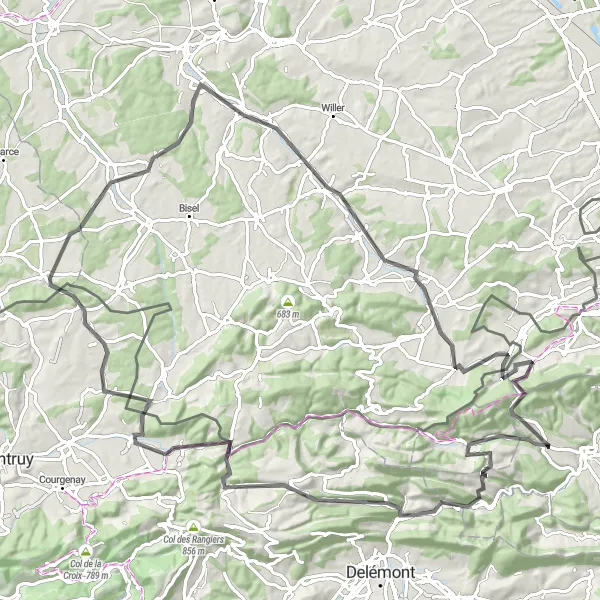
Bike kind: silnice, Výstup: 1588 m, Vzdálenost: 100 km
Trasa Hard - Challpass je náročnou trasou po silnicích s bohatými výhledy a malebnými místy. Projedete malebnými místy jako Hard a Liesberg. Trasa končí na vrcholu Challpass s panoramatickým výhledem na krajinu. Přestože cesta je náročná, nabízí krásné zážitky a pestré scenérie.
![Miniaturní mapa "Trasa Challpass - Forstberg" inspirace pro cyklisty v oblasti Nordwestschweiz, Switzerland. Vytvořeno pomocí plánovače tras Tarmacs.app](https://images.tarmacs.app/cycling-routes/routemaps/600/switzerland/nordwestschweiz/roschenz/gravel/170378.webp)
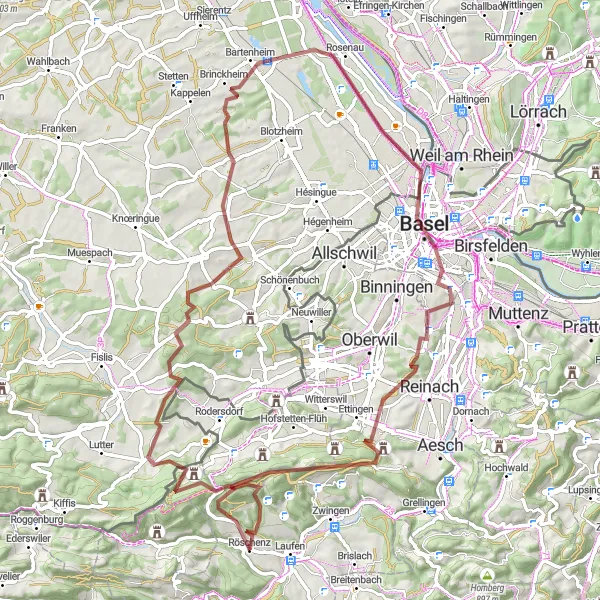
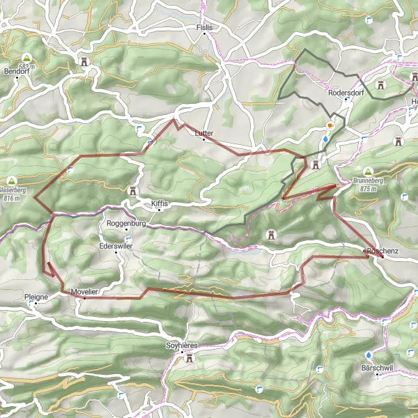
Bike kind: štěrk, Výstup: 1524 m, Vzdálenost: 81 km
Trasa Challpass - Forstberg je náročnou trasou po štěrkových cestách a nabízí působivé scenérie. Projedete malebné obce jako Burg im Leimental a Michelbach-le-Bas. Trasa končí v lesním prostředí Forstberg s klidnou atmosférou a malebnými výhledy. Zajímavý výlet pro zkušené cyklisty.
![Miniaturní mapa "Trasa Löffelberg - Challpass" inspirace pro cyklisty v oblasti Nordwestschweiz, Switzerland. Vytvořeno pomocí plánovače tras Tarmacs.app](https://images.tarmacs.app/cycling-routes/routemaps/600/switzerland/nordwestschweiz/roschenz/road/170397.webp)
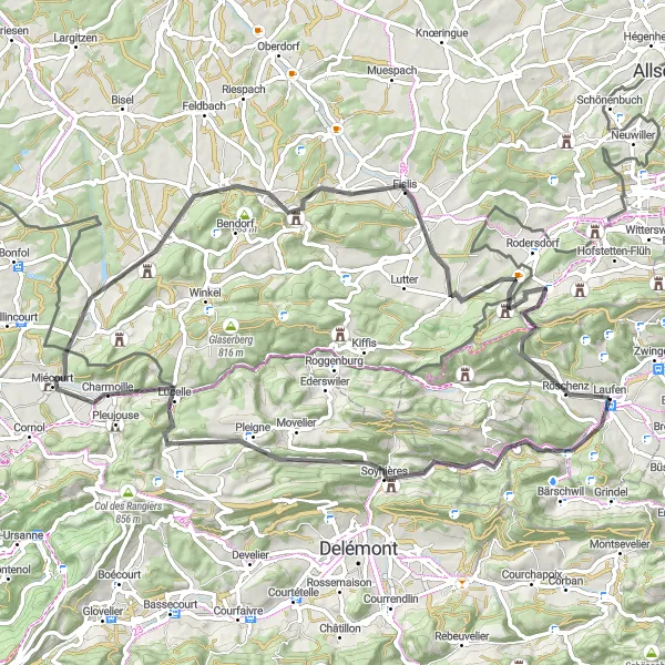
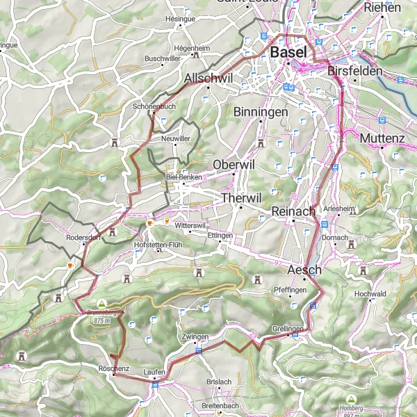
Bike kind: silnice, Výstup: 1309 m, Vzdálenost: 77 km
Trasa Löffelberg - Challpass vede po malebných silničkách a nabízí pestrý výlet pro cyklisty. Objevíte krásné místa jako Löffelberg a Mettembert. Konec trasy v Challpass je nádherným bodem pro relaxaci a obdivování výhledu. Celkově trasa nabízí skvělý mix krásné krajiny a zajímavých míst.
Cyklotrasy v okolí:
Okolní oblasti:
![Obrázek Salzburg](https://images.tarmacs.app/cycling-routes/covers/austria/salzburg/grossarl-5.webp)
![Obrázek Tirol](https://images.tarmacs.app/cycling-routes/covers/austria/tirol/reith-bei-kitzbuehel-2.webp)
![Obrázek Vorarlberg](https://images.tarmacs.app/cycling-routes/covers/austria/vorarlberg/frastanz-4.webp)
![Obrázek Région lémanique](https://images.tarmacs.app/cycling-routes/covers/switzerland/region-lemanique/orbe-3.webp)
![Obrázek Espace Mittelland](https://images.tarmacs.app/cycling-routes/covers/switzerland/espace-mittelland/romont-5.webp)
![Obrázek Zürich](https://images.tarmacs.app/cycling-routes/covers/switzerland/zurich/wallisellen-3.webp)
![Obrázek Ostschweiz](https://images.tarmacs.app/cycling-routes/covers/switzerland/ostschweiz/oberegg-4.webp)
![Obrázek Zentralschweiz](https://images.tarmacs.app/cycling-routes/covers/switzerland/zentralschweiz/dallenwil-4.webp)
![Obrázek Freiburg](https://images.tarmacs.app/cycling-routes/covers/germany/freiburg/hilzingen-3.webp)
![Obrázek Tübingen](https://images.tarmacs.app/cycling-routes/covers/germany/tubingen/schlier-2.webp)
![Obrázek Franche-Comté](https://images.tarmacs.app/cycling-routes/covers/france/franche-comte/ronchamp-3.webp)
![Obrázek Alsace](https://images.tarmacs.app/cycling-routes/covers/france/alsace/huningue-1.webp)