![Cover image](https://images.tarmacs.app/cycling-routes/covers/switzerland/ostschweiz/rehetobel-5.webp)
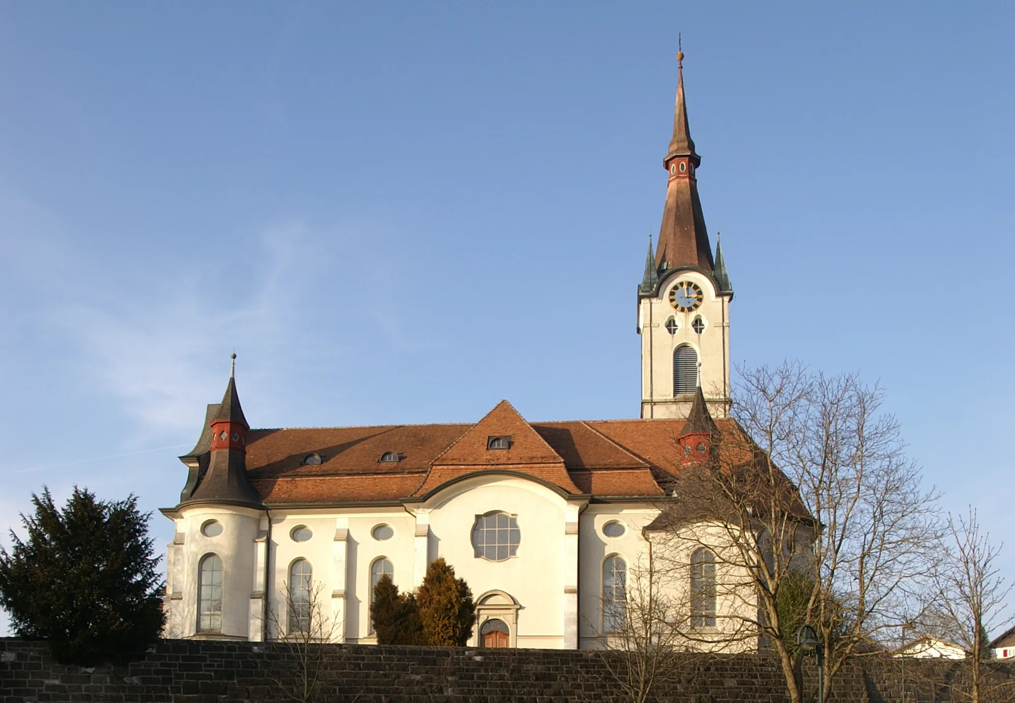
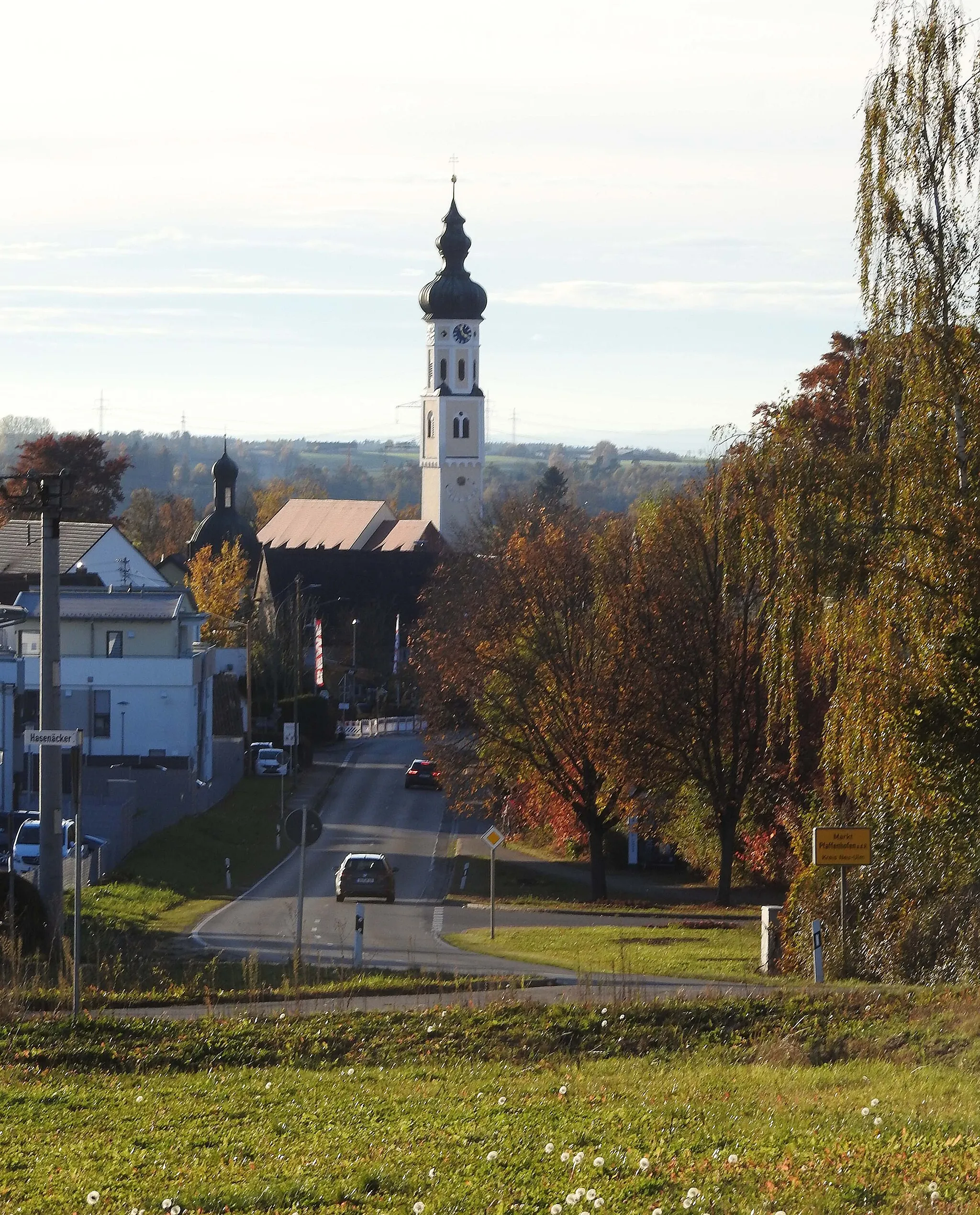
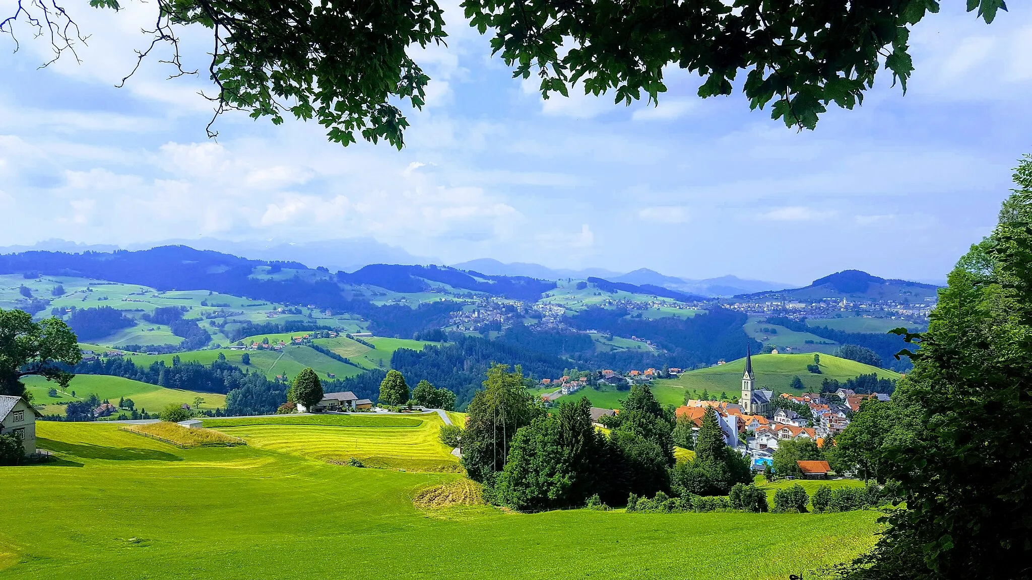
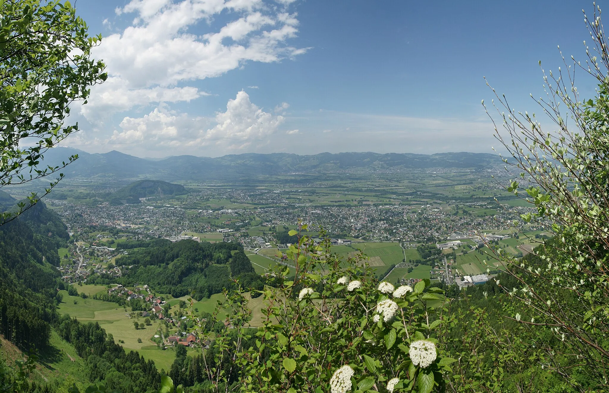
Malebná obec v kantonu Appenzell Ausserrhoden s možností výstupu na Hoher Kasten.
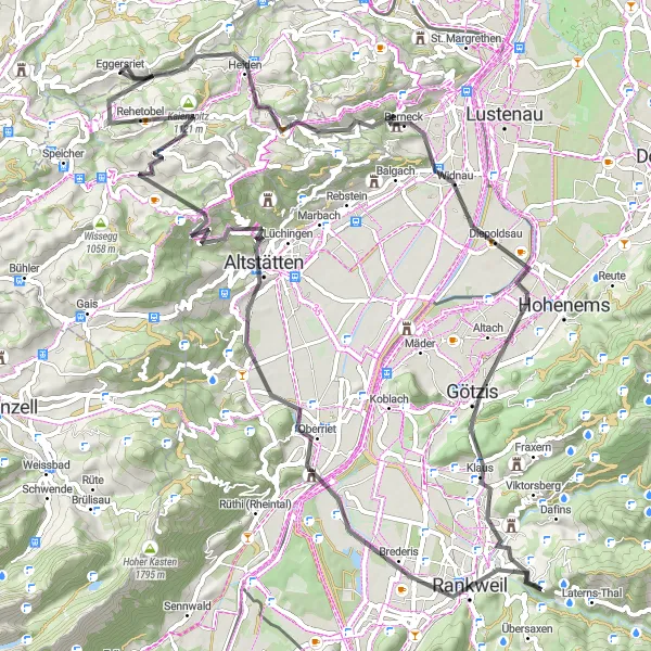
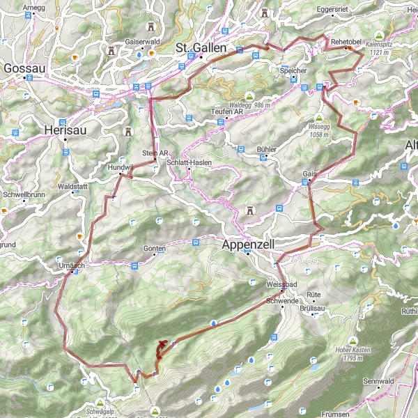
Cyklistické trasy kolem Rehetobel
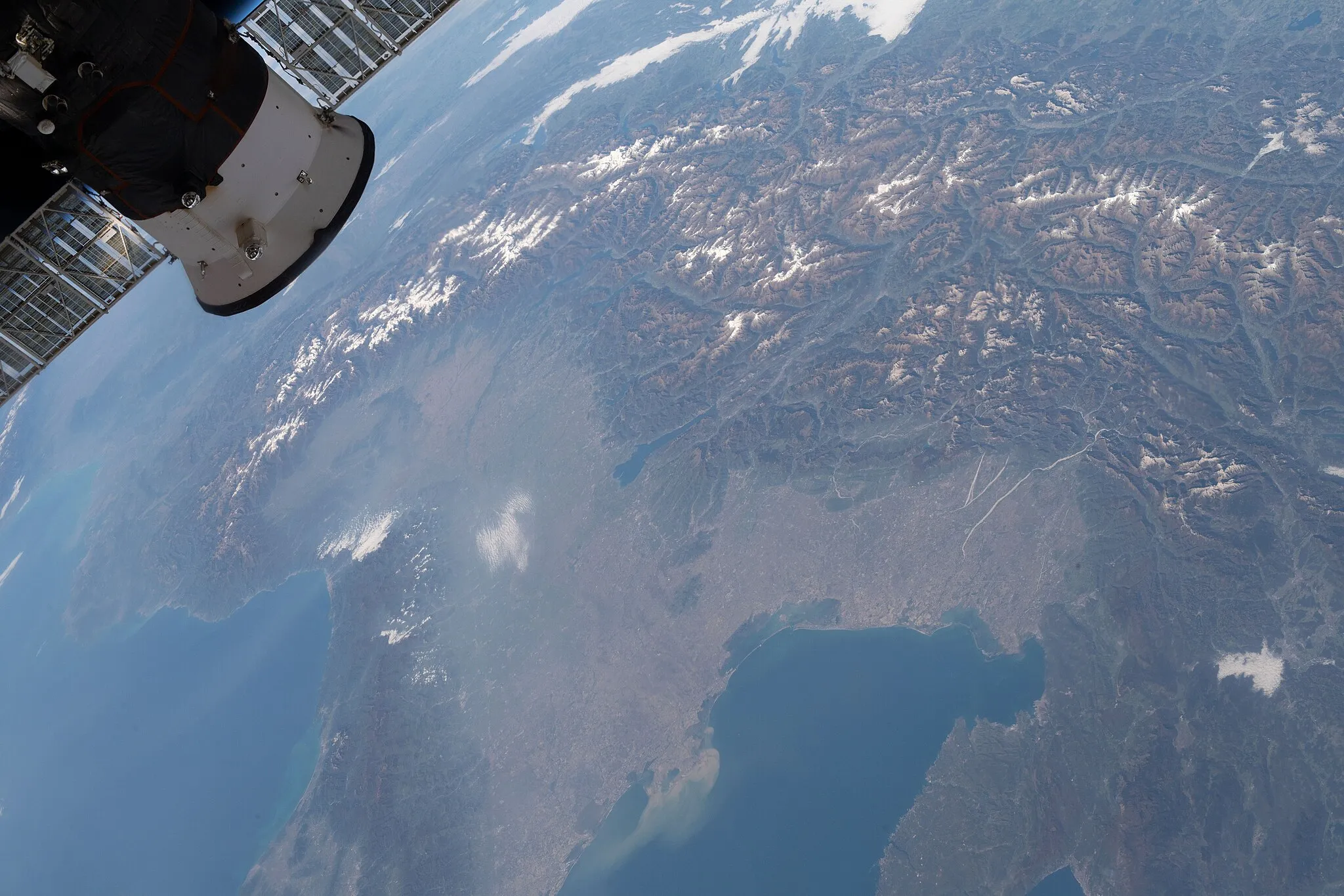
Rehetobel je malebná obec v kantonu Appenzell Ausserrhoden. Pro cyklisty nabízí trasy kolem údolí řeky Sitter a možnost výstupu na nedalekou horu Hoher Kasten. Okolní krajina je ideální pro horskou cyklistiku a gravel biking.
![Miniaturní mapa "Výzva pro silniční cyklisty kolem Rehetobel" inspirace pro cyklisty v oblasti Ostschweiz, Switzerland. Vytvořeno pomocí plánovače tras Tarmacs.app](https://images.tarmacs.app/cycling-routes/routemaps/600/switzerland/ostschweiz/rehetobel/road/185415.webp)
Soutěživá trasa s mnoha náročnými stoupáními
Kruhová trasa dlouhá 84km nabízí nekonečné stoupání a sjezdy, s nádhernými výhledy a malebnými vesničkami. Vrcholem je Fünfländerblick s panoramatickým výhledem.
![Miniaturní mapa "Road Cycling Adventure to Lake Constance" inspirace pro cyklisty v oblasti Ostschweiz, Switzerland. Vytvořeno pomocí plánovače tras Tarmacs.app](https://images.tarmacs.app/cycling-routes/routemaps/600/switzerland/ostschweiz/rehetobel/road/185479.webp)
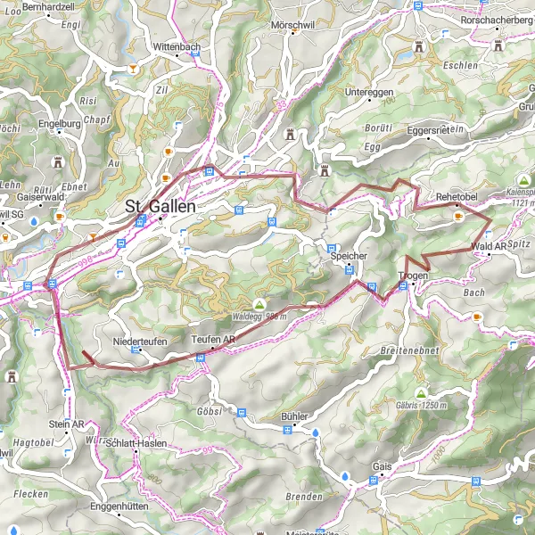
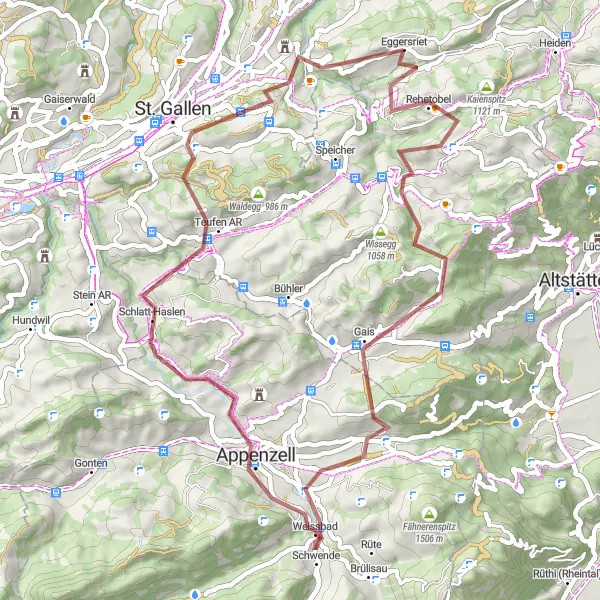
Exciting road route with moderate ascent and scenic viewpoints
Embark on a 58 km road cycling adventure near Rehetobel, featuring highlights like Lake Constance Viewpoint, Wittenbach, and Untereggen. With a total ascent of 1030 meters, this route offers a mix of challenging climbs and rewarding descents. Enjoy the stunning landscapes and cultural attractions along the way, including the charming village of Rehetobel.
![Miniaturní mapa "Road Route Gupf - Rehetobel" inspirace pro cyklisty v oblasti Ostschweiz, Switzerland. Vytvořeno pomocí plánovače tras Tarmacs.app](https://images.tarmacs.app/cycling-routes/routemaps/600/switzerland/ostschweiz/rehetobel/road/185430.webp)
Pitoreskni cesta přes Gupf a Losenpaß
Cesta nabízí nádherné výhledy na okolní hory a jezera. Projedete malebnými vesnicemi a zkuste místní kulinářské speciality. Překonáte několik náročných stoupání a spadání.
![Miniaturní mapa "Gravel Route Teufen AR - Rehetobel" inspirace pro cyklisty v oblasti Ostschweiz, Switzerland. Vytvořeno pomocí plánovače tras Tarmacs.app](https://images.tarmacs.app/cycling-routes/routemaps/600/switzerland/ostschweiz/rehetobel/gravel/185441.webp)
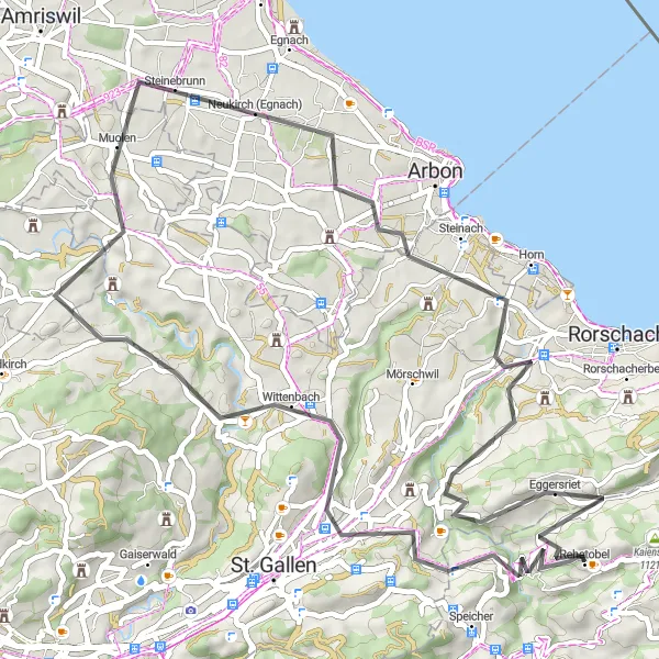
Poutavá trasa s výhledem na jezero Bodamské
Procestujete malebné vesnice a obklopeni krásnou přírodou. Výhledy na jezero Bodamské budou jedním z vrcholů vaší cesty. Odpočinete si u malebné krajiny a užijete si přírodu na maximum.
![Miniaturní mapa "Road Route Kaienspitz - Ruppenpass" inspirace pro cyklisty v oblasti Ostschweiz, Switzerland. Vytvořeno pomocí plánovače tras Tarmacs.app](https://images.tarmacs.app/cycling-routes/routemaps/600/switzerland/ostschweiz/rehetobel/road/185403.webp)
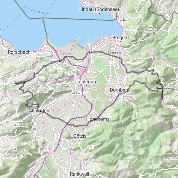
Cyklistický zážitek mezi Kaienspitz a Lustenau
Tato cesta nabízí kombinaci náročných stoupání a sjezdů. Projetím historicky významnými oblastmi získáte vhled do místní kultury a historie. Užijete si i malebné výhledy do okolní krajiny.
![Miniaturní mapa "Gravel Route Speicher - Rorschach" inspirace pro cyklisty v oblasti Ostschweiz, Switzerland. Vytvořeno pomocí plánovače tras Tarmacs.app](https://images.tarmacs.app/cycling-routes/routemaps/600/switzerland/ostschweiz/rehetobel/gravel/185420.webp)
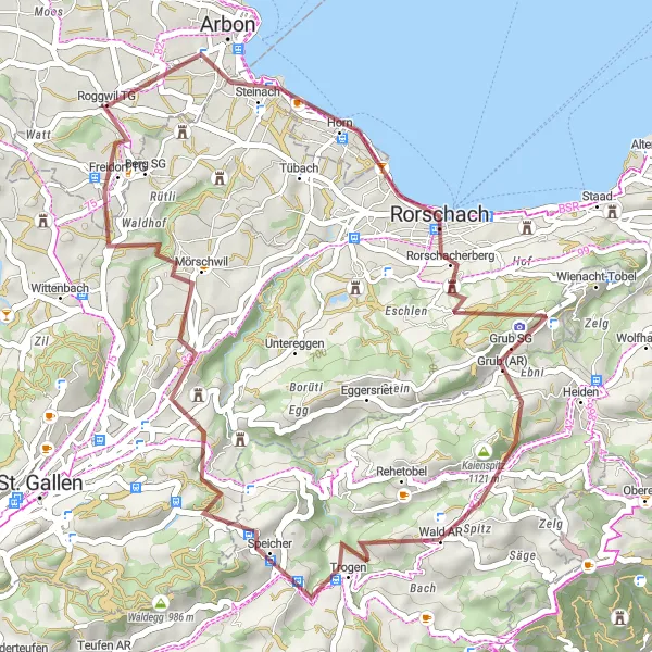
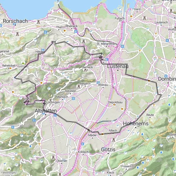
Poznejte okolí Skourhornu a Rorschachu na kole
Gravelová cesta vedoucí skrze malebné vesnice a přírodu vás provede nezapomenutelnými výhledy a turistickými atrakcemi. Objevte nové cesty daleko od civilizace.
![Miniaturní mapa "Gravel cyklostezka na východním Švýcarsku" inspirace pro cyklisty v oblasti Ostschweiz, Switzerland. Vytvořeno pomocí plánovače tras Tarmacs.app](https://images.tarmacs.app/cycling-routes/routemaps/600/switzerland/ostschweiz/rehetobel/gravel/185397.webp)
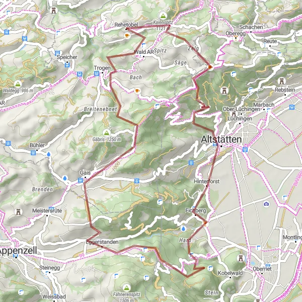
Zajímavá trasa vhodná pro horské kola
Tato trasa nabízí 46 km cyklistických dobrodružství s celkovým převýšením 1616 metrů. Projedete kolem vrcholu Gupf a můžete si užít krásné výhledy z hory Gäbris.
![Miniaturní mapa "Silniční cyklostezka kolem Bodamského jezera a Appenzellu" inspirace pro cyklisty v oblasti Ostschweiz, Switzerland. Vytvořeno pomocí plánovače tras Tarmacs.app](https://images.tarmacs.app/cycling-routes/routemaps/600/switzerland/ostschweiz/rehetobel/road/185417.webp)
Dlouhá trasa s mnoha zajímavými místy
Tento 108 km dlouhý okruh nabízí 1494 metrů převýšení a projíždí kolem Bodamského jezera a Appenzellu. Zastavte se na Niederbüren a ochutnejte místní speciality.
![Miniaturní mapa "Gravel Road to St. Gallen" inspirace pro cyklisty v oblasti Ostschweiz, Switzerland. Vytvořeno pomocí plánovače tras Tarmacs.app](https://images.tarmacs.app/cycling-routes/routemaps/600/switzerland/ostschweiz/rehetobel/gravel/185439.webp)
Picturesque gravel route with challenging ascent and stunning views
Explore the beauty of Ostschweiz on this 54 km gravel road, passing through highlights such as Rehetobel, Gäbris, and Appenzell. The route includes a total ascent of 1621 meters, offering a challenging but rewarding cycling experience. Don't miss the opportunity to enjoy the panoramic views from Hoher Hirschberg and the historical charm of St. Gallen.
![Miniaturní mapa "Gravel Route Trogen - St. Gallen" inspirace pro cyklisty v oblasti Ostschweiz, Switzerland. Vytvořeno pomocí plánovače tras Tarmacs.app](https://images.tarmacs.app/cycling-routes/routemaps/600/switzerland/ostschweiz/rehetobel/gravel/185522.webp)
Gravelová trasa s výhledy na jezero Bodamské
Trasa vás zavede po malebných vesnicích a přes kopce s úžasnými výhledy na okolní krajinu. Objevíte historické památky a projedete rozmanitou přírodou.
Cyklotrasy v okolí:
![Obrázek Gaißau](https://images.tarmacs.app/cycling-routes/covers/austria/vorarlberg/gaissau-5.webp)
![Obrázek Höchst](https://images.tarmacs.app/cycling-routes/covers/austria/vorarlberg/hoechst-4.webp)
![Obrázek Mäder](https://images.tarmacs.app/cycling-routes/covers/austria/vorarlberg/maeder-3.webp)
![Obrázek Lustenau](https://images.tarmacs.app/cycling-routes/covers/austria/vorarlberg/lustenau-4.webp)
![Obrázek Koblach](https://images.tarmacs.app/cycling-routes/covers/austria/vorarlberg/koblach-5.webp)
![Obrázek Fußach](https://images.tarmacs.app/cycling-routes/covers/austria/vorarlberg/fussach-5.webp)
![Obrázek Altach](https://images.tarmacs.app/cycling-routes/covers/austria/vorarlberg/altach-5.webp)
![Obrázek Götzis](https://images.tarmacs.app/cycling-routes/covers/austria/vorarlberg/goetzis-4.webp)
![Obrázek Meiningen](https://images.tarmacs.app/cycling-routes/covers/austria/vorarlberg/meiningen-5.webp)
Okolní oblasti:
![Obrázek Kärnten](https://images.tarmacs.app/cycling-routes/covers/austria/karnten/spittal-an-der-drau-1.webp)
![Obrázek Steiermark](https://images.tarmacs.app/cycling-routes/covers/austria/steiermark/lend-1.webp)
![Obrázek Oberösterreich](https://images.tarmacs.app/cycling-routes/covers/austria/oberosterreich/muenzkirchen-1.webp)
![Obrázek Tirol](https://images.tarmacs.app/cycling-routes/covers/austria/tirol/debant-1.webp)
![Obrázek Vorarlberg](https://images.tarmacs.app/cycling-routes/covers/austria/vorarlberg/koblach-4.webp)
![Obrázek Zürich](https://images.tarmacs.app/cycling-routes/covers/switzerland/zurich/bulach-3.webp)
![Obrázek Ticino](https://images.tarmacs.app/cycling-routes/covers/switzerland/ticino/muralto-4.webp)
![Obrázek Tübingen](https://images.tarmacs.app/cycling-routes/covers/germany/tubingen/mietingen-4.webp)
![Obrázek Schwaben](https://images.tarmacs.app/cycling-routes/covers/germany/schwaben/pfaffenhofen-an-der-roth-2.webp)
![Obrázek Lombardia](https://images.tarmacs.app/cycling-routes/covers/italy/lombardia/azzate-5.webp)
![Obrázek Provincia Autonoma di Bolzano/Bozen](https://images.tarmacs.app/cycling-routes/covers/italy/provincia-autonoma-di-bolzano-bozen/gais-2.webp)
![Obrázek Liechtenstein](https://images.tarmacs.app/cycling-routes/covers/liechtenstein/liechtenstein/balzers-5.webp)