![Cover image](https://images.tarmacs.app/cycling-routes/covers/switzerland/ostschweiz/stein-am-rhein-2.webp)
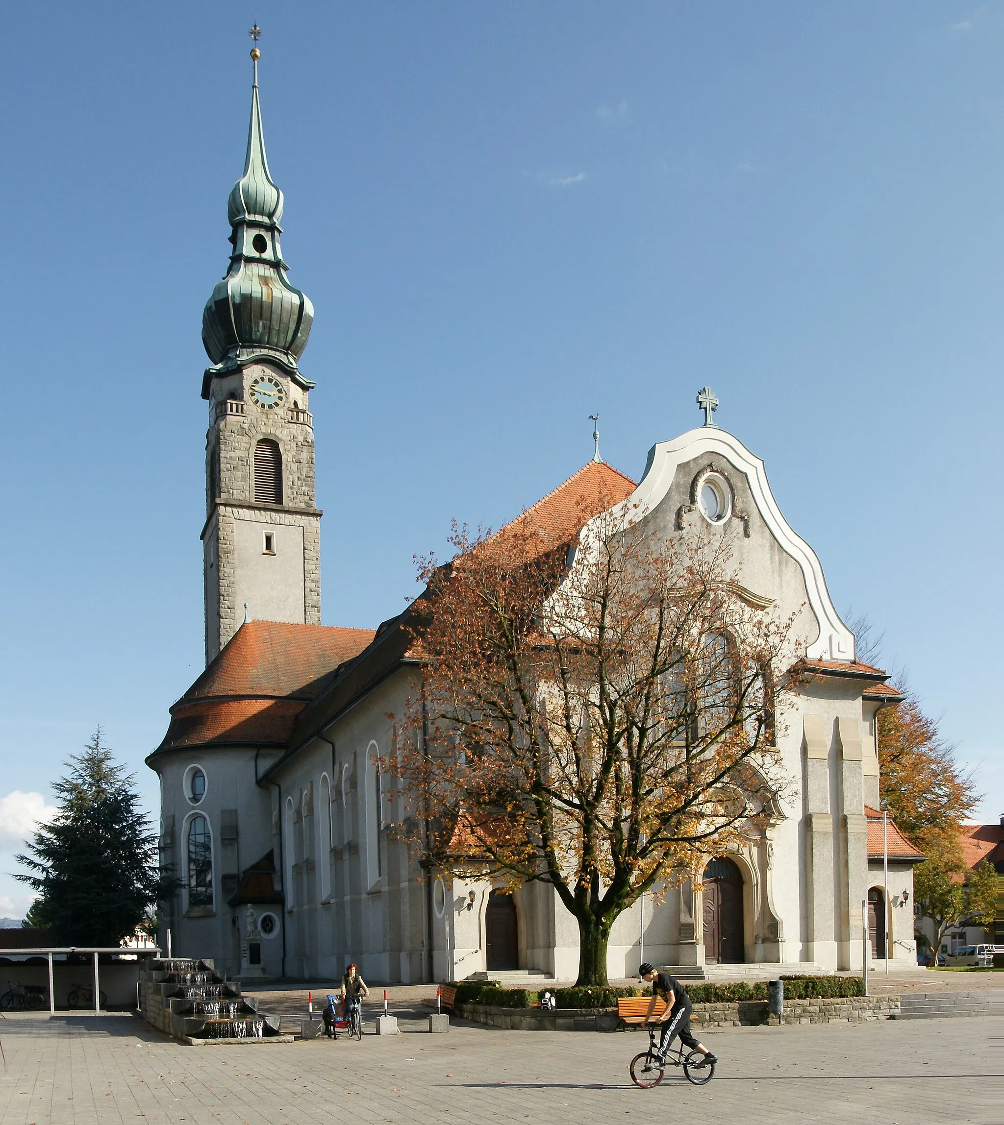
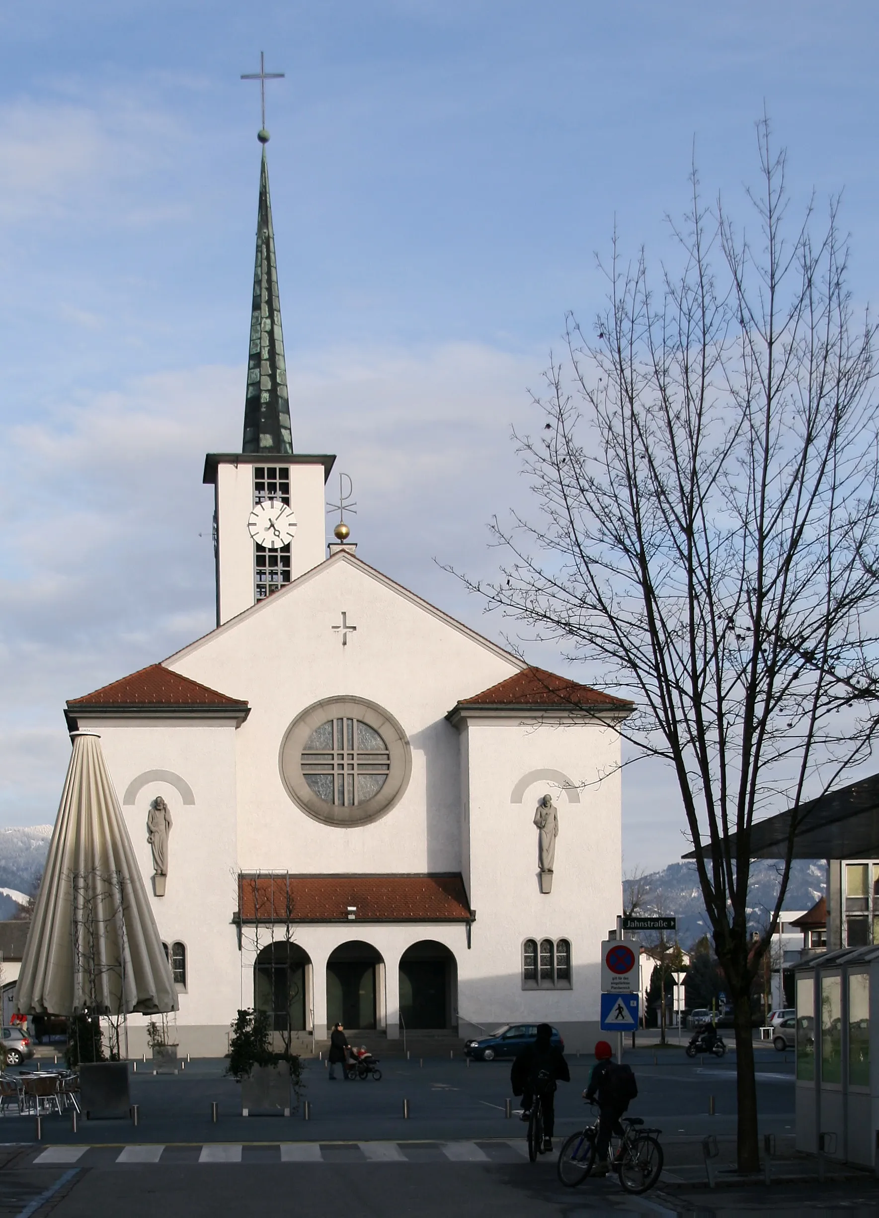
Historické město s pěknými cyklostezkami.
Cyklistické trasy kolem Stein am Rhein
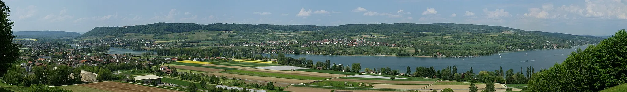
Stein am Rhein je malebné historické město v oblasti Ostschweiz. Okolí nabízí krásné cyklostezky podél řeky a kolem starobylých staveb. Nedaleko se nachází známá stoupání a cyklistické atrakce.
![Miniaturní mapa "Jízda kolem Stein am Rhein" inspirace pro cyklisty v oblasti Ostschweiz, Switzerland. Vytvořeno pomocí plánovače tras Tarmacs.app](https://images.tarmacs.app/cycling-routes/routemaps/600/switzerland/ostschweiz/stein-am-rhein/road/86328.webp)
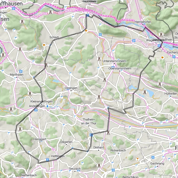
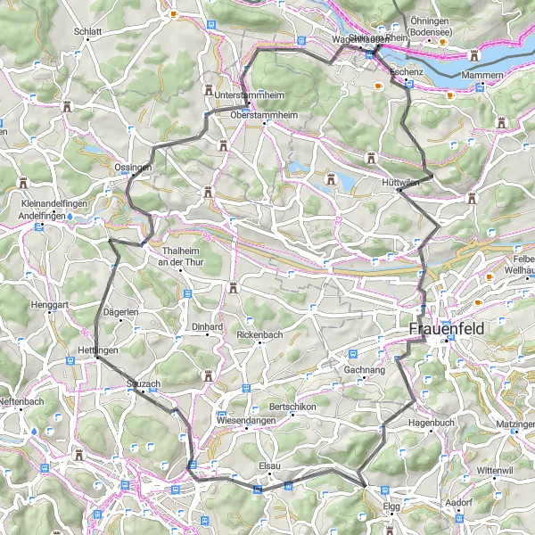
Pěkná cyklotrasa blízko Stein am Rhein
Tato 59 km dlouhá cesta nabízí významné stoupání 852 metrů. Zajímavé místa můžete vidět v Niederneunforn, Dägerlen, Forenbuck, Trullikon a Wagenhausen.
![Miniaturní mapa "Epic Road Cycling Tour of Lake Constance" inspirace pro cyklisty v oblasti Ostschweiz, Switzerland. Vytvořeno pomocí plánovače tras Tarmacs.app](https://images.tarmacs.app/cycling-routes/routemaps/600/switzerland/ostschweiz/stein-am-rhein/road/86223.webp)
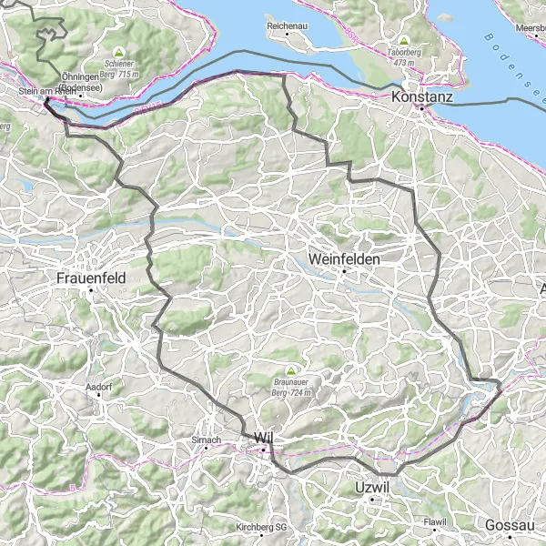
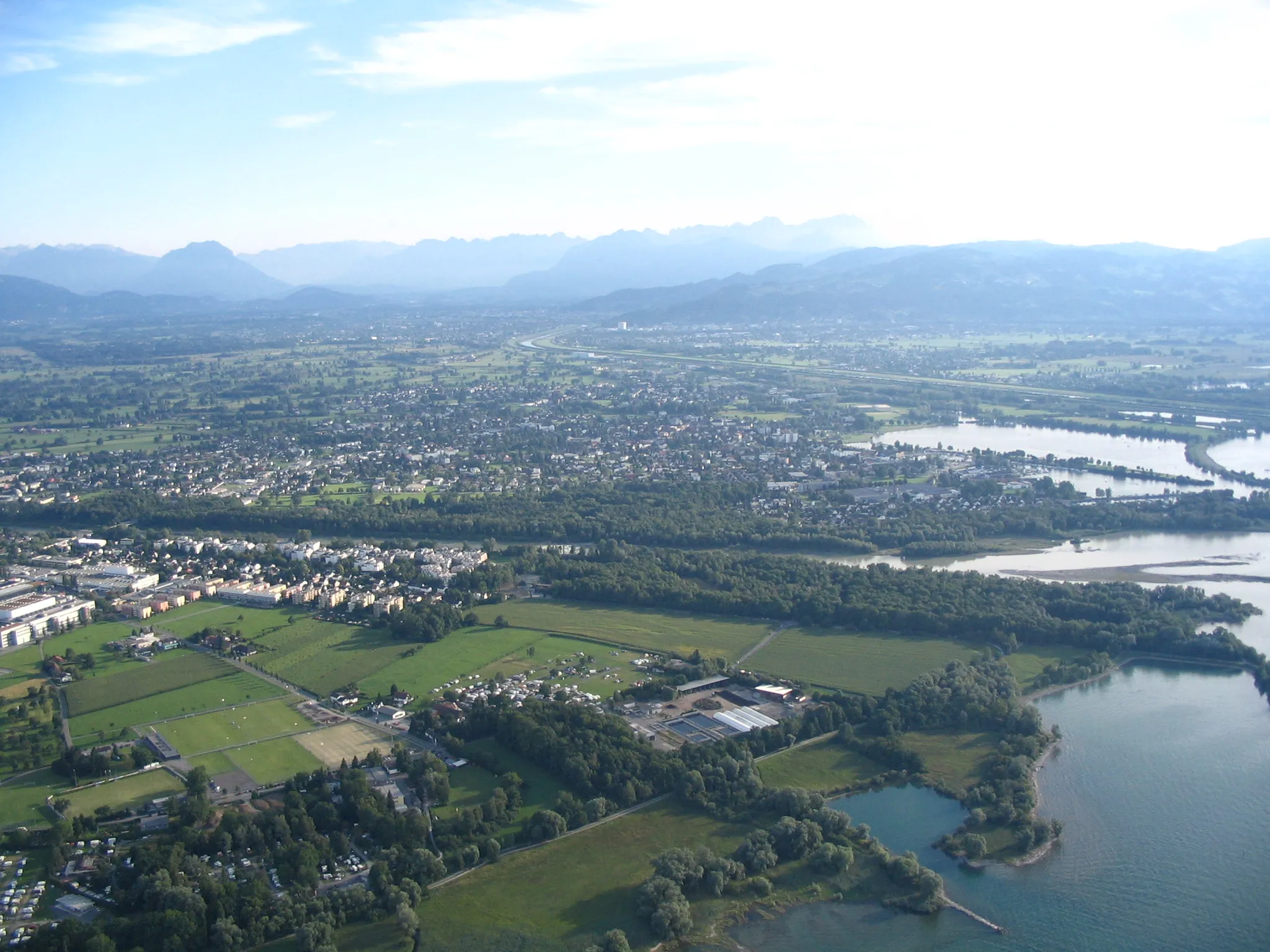
Embark on an epic road cycling journey around Lake Constance with stunning landscapes.
Embark on a challenging 103 km road cycling tour around Lake Constance with 1209 meters of ascent. Cycle through iconic sites like Eschenz, Steckborn, Napoleonturm, and Wil, and enjoy panoramic views from the Thur River and Sitter River confluence. Conclude your journey in the historic town of Stein am Rhein.
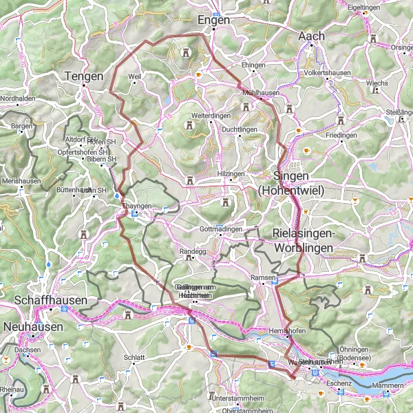
Kolem Schaffhausenu
![Miniaturní mapa "Kolem Schaffhausenu" inspirace pro cyklisty v oblasti Ostschweiz, Switzerland. Vytvořeno pomocí plánovače tras Tarmacs.app](https://images.tarmacs.app/cycling-routes/routemaps/600/switzerland/ostschweiz/stein-am-rhein/gravel/86347.webp)
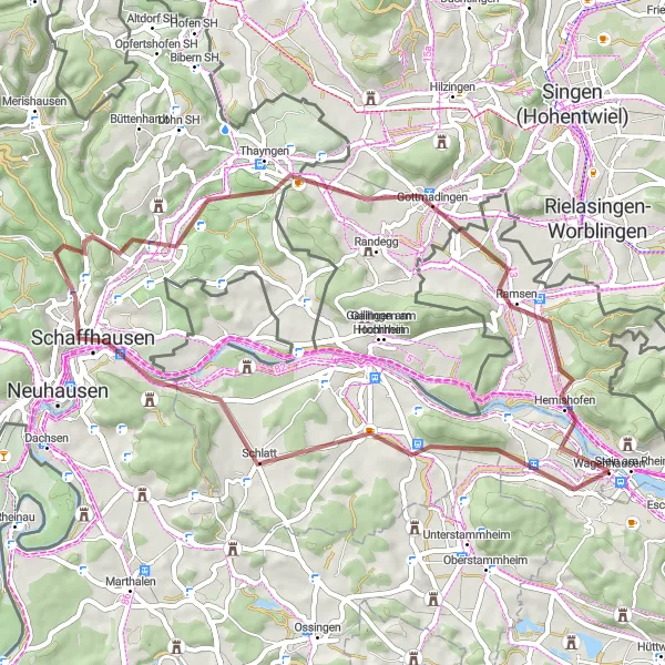
Vydejte se na 51 km dlouhou cestu kolem Schaffhausenu s převýšením 560 m.
Tato trasa vás zavede kolem Stein am Rhein, Cholfirstu, Schaffhausenu, Bergu, Gottmadingenu, Hemishofenu a Wolkensteinerbergu. Užijete si krásné výhledy a objevíte zajímavá místa podél cesty.
![Miniaturní mapa "Okružní cesta kolem Stein am Rhein" inspirace pro cyklisty v oblasti Ostschweiz, Switzerland. Vytvořeno pomocí plánovače tras Tarmacs.app](https://images.tarmacs.app/cycling-routes/routemaps/600/switzerland/ostschweiz/stein-am-rhein/road/86267.webp)
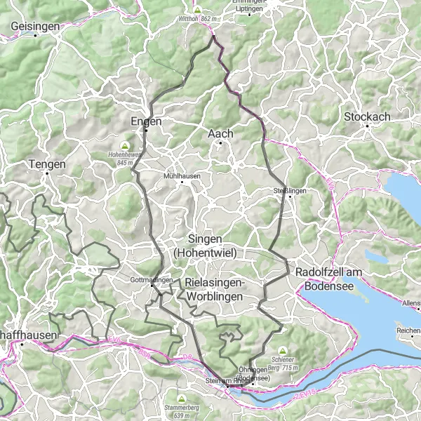
Náročná 77 km dlouhá cyklotrasa s významným převýšením 1068 metrů
Tato trasa poskytuje velkou výzvu pro zkušené cyklisty a nezapomínatelný zážitek pro ty, kteří si rádi užívají krásnou krajinu. Během cesty můžete navštívit Heilsberg, Hilzingen, Engen, Welschberg, Reschberg, Steißlingen, Blattform a Öhningen (Bodensee).
![Miniaturní mapa "Road Trasa kolem Stein am Rhein" inspirace pro cyklisty v oblasti Ostschweiz, Switzerland. Vytvořeno pomocí plánovače tras Tarmacs.app](https://images.tarmacs.app/cycling-routes/routemaps/600/switzerland/ostschweiz/stein-am-rhein/road/86255.webp)
Cyklistická výzva s úchvatnými výhledy
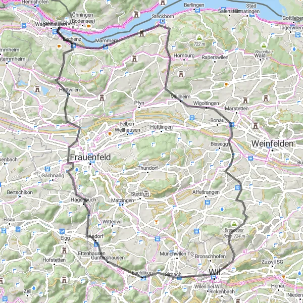
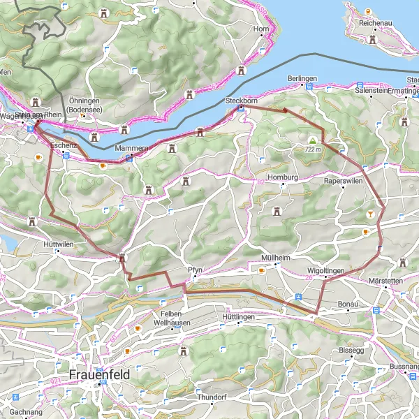
Tato 80 km trasa nabízí 1071 m převýšení a krásné výhledy na krajinu a okolní hory. Navštívíte místa jako Steckborn, Braunau a Hüttwilen, které stojí za návštěvu. Ideální pro cyklisty hledající výzvu a krásnou krajinu.
![Miniaturní mapa "Road Adventure in Thurgau" inspirace pro cyklisty v oblasti Ostschweiz, Switzerland. Vytvořeno pomocí plánovače tras Tarmacs.app](https://images.tarmacs.app/cycling-routes/routemaps/600/switzerland/ostschweiz/stein-am-rhein/road/86240.webp)
Travel through the rolling hills of Thurgau on this challenging road cycling route.
Embark on a 65 km road cycling adventure with 804 meters of ascent through the scenic landscapes of Thurgau. Pass by iconic sites like Eschenz, Hüttwilen, Heidenbüel, and Stammerberg, and enjoy the thrill of the Bahnhofbrücke bridge crossing the Amriswil-Bischofszell railway line.
![Miniaturní mapa "Trasa kolem Stein am Rhein" inspirace pro cyklisty v oblasti Ostschweiz, Switzerland. Vytvořeno pomocí plánovače tras Tarmacs.app](https://images.tarmacs.app/cycling-routes/routemaps/600/switzerland/ostschweiz/stein-am-rhein/gravel/86248.webp)
Prozkoumejte malebné okolí Stein am Rhein na horském kole
Tato cyklistická trasa nabízí 43 km dobrodružství po krásném venkovském prostředí. S převýšením 250 metrů si užijete výzvu pro vaše nohy a nezapomenutelné výhledy. Cestou narazíte na mnoho zajímavých míst a historických památek, které stojí za zastavení.
![Miniaturní mapa "Gravel Adventure in Schaffhausen" inspirace pro cyklisty v oblasti Ostschweiz, Switzerland. Vytvořeno pomocí plánovače tras Tarmacs.app](https://images.tarmacs.app/cycling-routes/routemaps/600/switzerland/ostschweiz/stein-am-rhein/gravel/86225.webp)
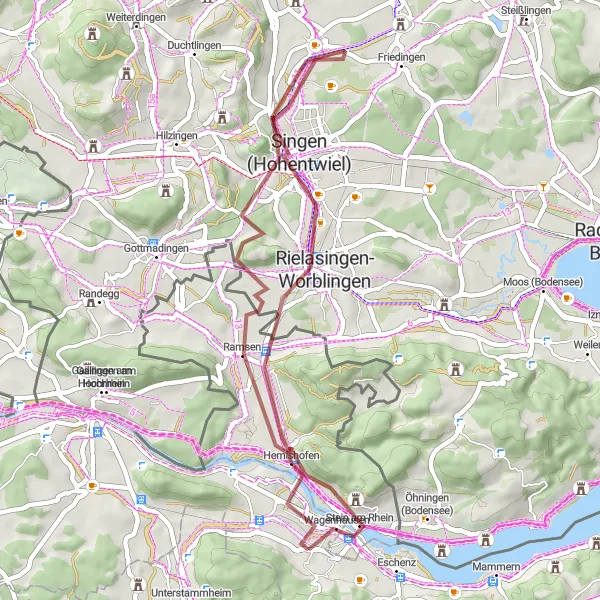
Experience the beauty of Schaffhausen's countryside on this gravel cycling expedition.
Embark on a 40 km gravel cycling expedition with 646 meters of ascent through the stunning landscapes of Schaffhausen. Discover hidden treasures like Wolkensteinerberg, Ramsen, and Singen (Hohentwiel), and immerse yourself in the tranquility of Worblingen village.
![Miniaturní mapa "Gravel Road to Lake Constance" inspirace pro cyklisty v oblasti Ostschweiz, Switzerland. Vytvořeno pomocí plánovače tras Tarmacs.app](https://images.tarmacs.app/cycling-routes/routemaps/600/switzerland/ostschweiz/stein-am-rhein/gravel/86237.webp)
Explore the picturesque Klingenstrasse and hidden gems like Fischbach on this gravel route.
Embark on a scenic 48 km gravel cycling journey with 736 meters of ascent through charming Swiss landscapes. Pass through quaint villages like Steckborn, Fischbach, and Wagenhausen, and enjoy the tranquility of Lake Constance in the background.
![Miniaturní mapa "Gravel Krásná krajina okolo Stein am Rhein" inspirace pro cyklisty v oblasti Ostschweiz, Switzerland. Vytvořeno pomocí plánovače tras Tarmacs.app](https://images.tarmacs.app/cycling-routes/routemaps/600/switzerland/ostschweiz/stein-am-rhein/gravel/86357.webp)
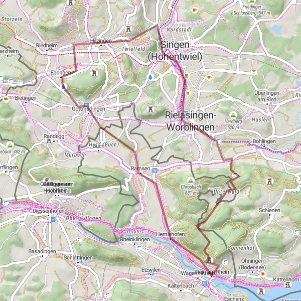
Prozkoumejte malebnou krajinu na kole s významnými zastávkami
Tato trasa nabízí 66 km krásné krajiny a zajímavých míst, která stojí za návštěvu. Během cesty navštívíte Gailingen am Hochrhein, Thayngen a další malebné lokality. S převýšením 753 m to bude výzva pro každého cyklistu.
Cyklotrasy v okolí:
![Obrázek Gaißau](https://images.tarmacs.app/cycling-routes/covers/austria/vorarlberg/gaissau-5.webp)
![Obrázek Höchst](https://images.tarmacs.app/cycling-routes/covers/austria/vorarlberg/hoechst-4.webp)
![Obrázek Fußach](https://images.tarmacs.app/cycling-routes/covers/austria/vorarlberg/fussach-5.webp)
![Obrázek Hard](https://images.tarmacs.app/cycling-routes/covers/austria/vorarlberg/hard-5.webp)
![Obrázek Lustenau](https://images.tarmacs.app/cycling-routes/covers/austria/vorarlberg/lustenau-4.webp)
![Obrázek Koblach](https://images.tarmacs.app/cycling-routes/covers/austria/vorarlberg/koblach-5.webp)
![Obrázek Mäder](https://images.tarmacs.app/cycling-routes/covers/austria/vorarlberg/maeder-3.webp)
![Obrázek Meiningen](https://images.tarmacs.app/cycling-routes/covers/austria/vorarlberg/meiningen-5.webp)
![Obrázek Hörbranz](https://images.tarmacs.app/cycling-routes/covers/austria/vorarlberg/hoerbranz-4.webp)
Okolní oblasti:
![Obrázek Kärnten](https://images.tarmacs.app/cycling-routes/covers/austria/karnten/landskron-2.webp)
![Obrázek Steiermark](https://images.tarmacs.app/cycling-routes/covers/austria/steiermark/mureck-3.webp)
![Obrázek Oberösterreich](https://images.tarmacs.app/cycling-routes/covers/austria/oberosterreich/frankenburg-5.webp)
![Obrázek Salzburg](https://images.tarmacs.app/cycling-routes/covers/austria/salzburg/strasswalchen-3.webp)
![Obrázek Tirol](https://images.tarmacs.app/cycling-routes/covers/austria/tirol/reutte-3.webp)
![Obrázek Vorarlberg](https://images.tarmacs.app/cycling-routes/covers/austria/vorarlberg/dornbirn-5.webp)
![Obrázek Zürich](https://images.tarmacs.app/cycling-routes/covers/switzerland/zurich/dietikon-3.webp)
![Obrázek Ticino](https://images.tarmacs.app/cycling-routes/covers/switzerland/ticino/claro-2.webp)
![Obrázek Schwaben](https://images.tarmacs.app/cycling-routes/covers/germany/schwaben/ruderatshofen-1.webp)
![Obrázek Provincia Autonoma di Bolzano/Bozen](https://images.tarmacs.app/cycling-routes/covers/italy/provincia-autonoma-di-bolzano-bozen/gais-5.webp)
![Obrázek Liechtenstein](https://images.tarmacs.app/cycling-routes/covers/liechtenstein/liechtenstein/ruggell-1.webp)