![Cover image](https://images.tarmacs.app/cycling-routes/covers/slovenia/vzhodna-slovenija/polzela-5.webp)
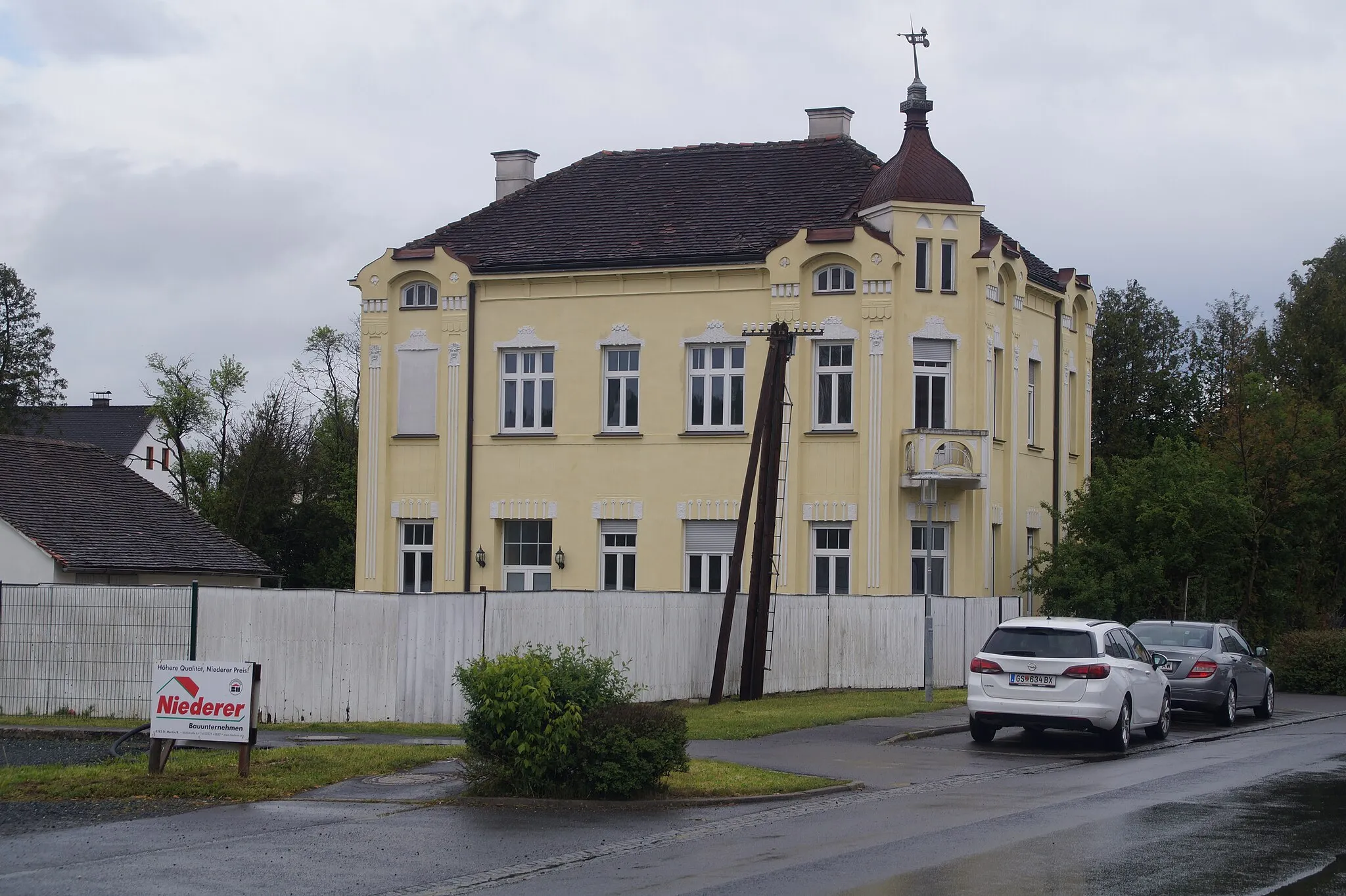
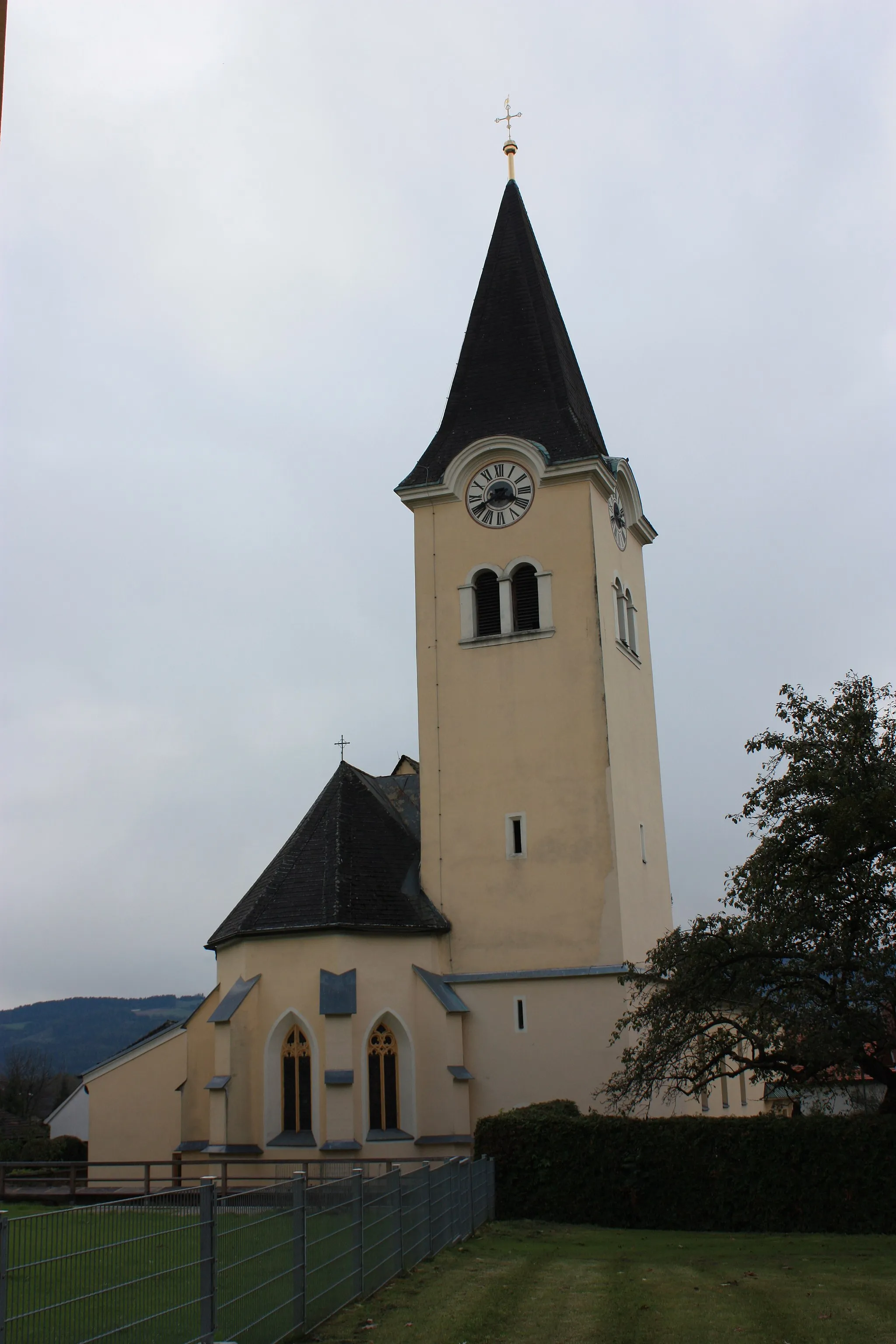
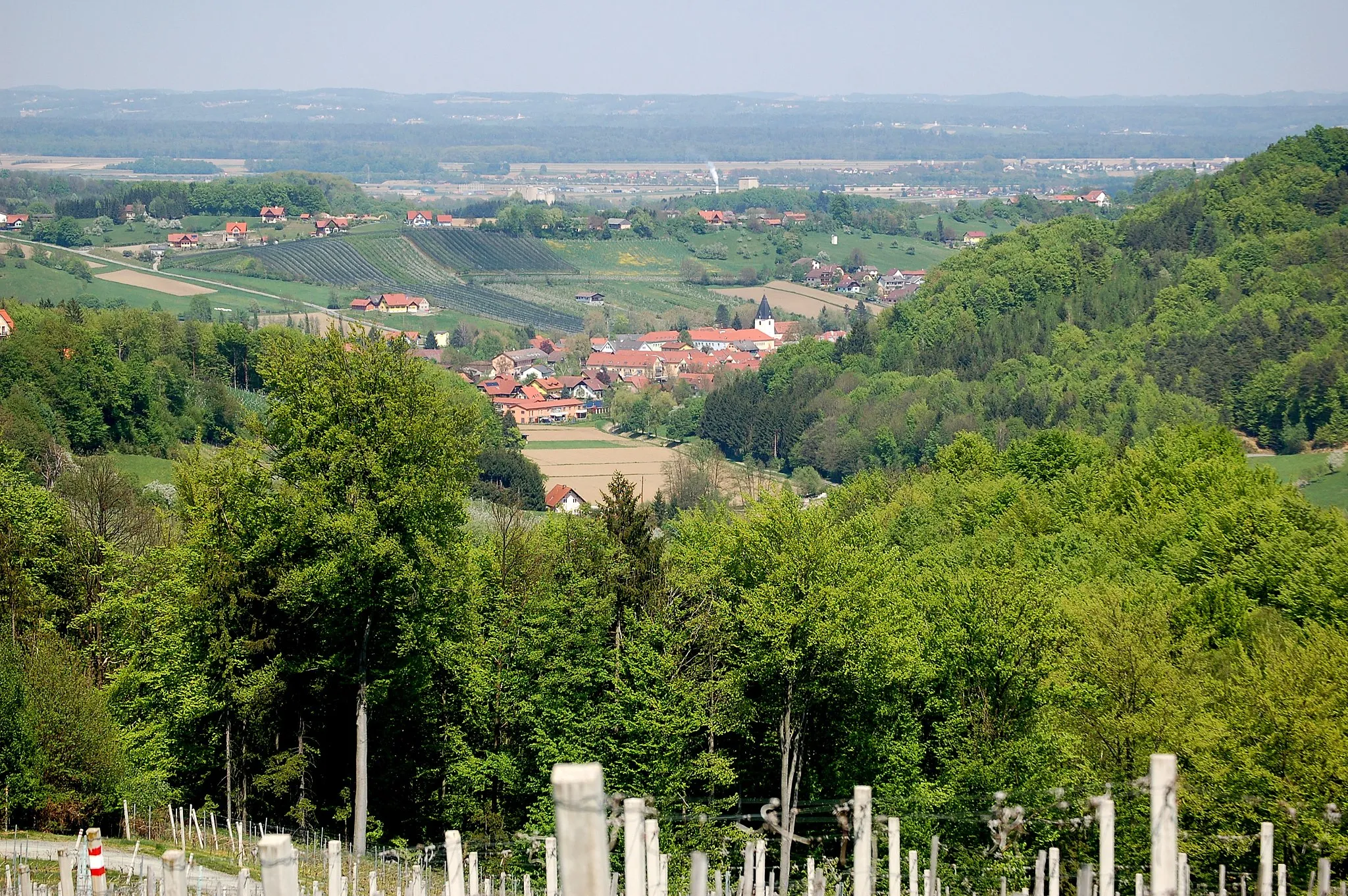
Charmante Stadt mit einem anspruchsvollen Anstieg zum Berg Boč.
Fahrradrouten rund um Polzela
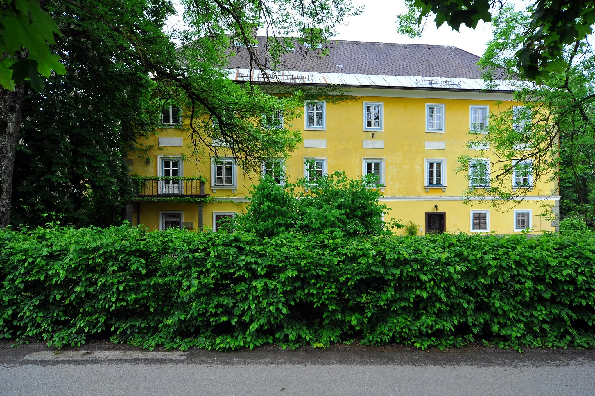
Polzela ist eine charmante Stadt in der Region Vzhodna Slovenija, die sich gut für Radfahrer eignet. Die Umgebung bietet viele malerische Routen durch Wiesen und Wälder. In der Nähe können Radfahrer den Anstieg zum Berg Boč erkunden, der eine Herausforderung für alle Fahrradfahrer darstellt.
![Karten-Miniaturansicht der Radinspiration "Epic Road Cycling Tour in Vzhodna Slovenija" in Vzhodna Slovenija, Slovenia. Erstellt vom Tarmacs.app-Routenplaner für Radtouren](https://images.tarmacs.app/cycling-routes/routemaps/600/slovenia/vzhodna-slovenija/polzela/road/14213.webp)
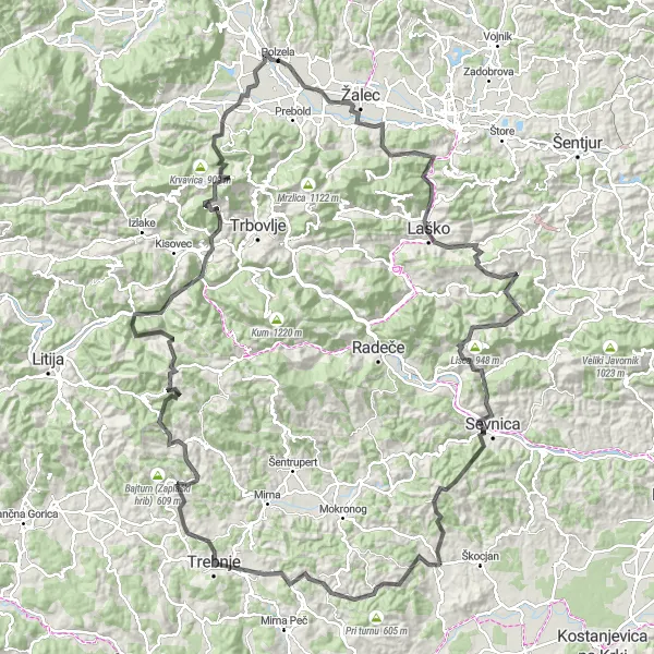
Embark on a 173 km epic road cycling tour through the stunning landscapes of Vzhodna Slovenija.
This challenging route offers cyclists the opportunity to explore the diverse regions of Vzhodna Slovenija, from picturesque villages to historic landmarks. With a total ascent of 4033 m, this tour is perfect for experienced cyclists looking for an unforgettable adventure.
![Karten-Miniaturansicht der Radinspiration "Panoramic Road Cycling Route near Polzela" in Vzhodna Slovenija, Slovenia. Erstellt vom Tarmacs.app-Routenplaner für Radtouren](https://images.tarmacs.app/cycling-routes/routemaps/600/slovenia/vzhodna-slovenija/polzela/road/14287.webp)
Enjoy a 117 km scenic road cycling route with panoramic views and cultural highlights.
This picturesque route offers cyclists the opportunity to explore the natural beauty and cultural heritage of Vzhodna Slovenija. With a total ascent of 2344 m, this route provides a rewarding experience for cyclists of all levels.
![Karten-Miniaturansicht der Radinspiration "Die Krog-Route: eine malerische Road-Bike-Tour in Vzhodna Slovenija" in Vzhodna Slovenija, Slovenia. Erstellt vom Tarmacs.app-Routenplaner für Radtouren](https://images.tarmacs.app/cycling-routes/routemaps/600/slovenia/vzhodna-slovenija/polzela/road/14201.webp)
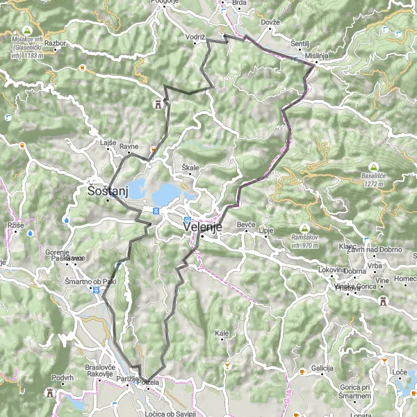
Eine abwechslungsreiche Strecke mit pittoresken Dörfern und idyllischen Landschaften
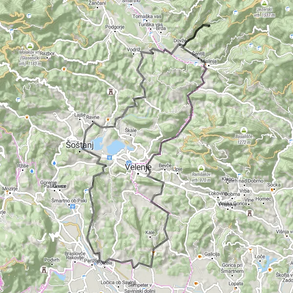
Die Krog-Route ist eine 64 km lange Road-Bike-Tour mit 1491 m Aufstieg. Von Krog führt die Strecke über Šoštanj, Tičnica und Vodriž nach Mislinja und Stropnik. Weiter geht es über Kovačev hrib zurück nach Polzela. Die Route besticht durch malerische Dörfer, idyllische Landschaften und anspruchsvolle Anstiege, die Radfahrer jeden Levels begeistern werden.
![Karten-Miniaturansicht der Radinspiration "Die Žalec-Route: eine entspannte Gravel-Bike-Tour durch Vzhodna Slovenija" in Vzhodna Slovenija, Slovenia. Erstellt vom Tarmacs.app-Routenplaner für Radtouren](https://images.tarmacs.app/cycling-routes/routemaps/600/slovenia/vzhodna-slovenija/polzela/gravel/14193.webp)
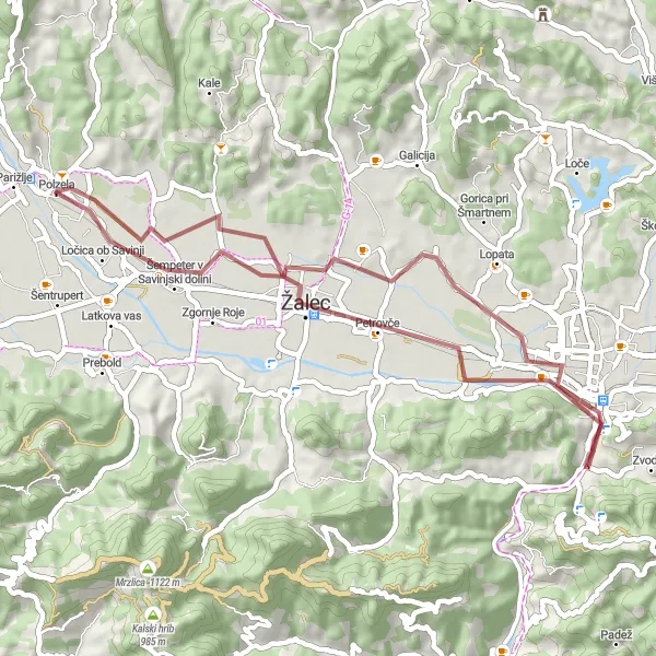
Eine gemütliche Strecke durch malerische Landschaften und charmante Dörfer
Die Žalec-Route ist eine 43 km lange Gravel-Bike-Tour mit 137 m Aufstieg. Die Strecke führt von Žalec über Puša und Celje zurück nach Polzela. Die Route besticht durch malerische Landschaften, charmante Dörfer und idyllische Wege, ideal für gemütliches Radfahren und Naturerkundungen.
![Karten-Miniaturansicht der Radinspiration "Die Polzela-Runde: eine epische Road-Bike-Tour durch Vzhodna Slovenija" in Vzhodna Slovenija, Slovenia. Erstellt vom Tarmacs.app-Routenplaner für Radtouren](https://images.tarmacs.app/cycling-routes/routemaps/600/slovenia/vzhodna-slovenija/polzela/road/220750.webp)
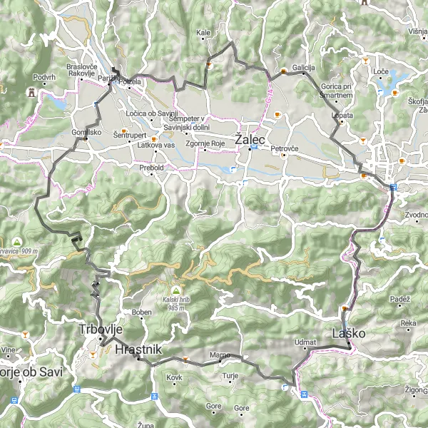
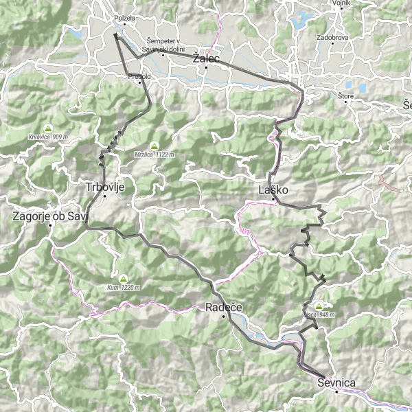
Eine anspruchsvolle, aber lohnende Route mit atemberaubenden Panoramablicken
Die Polzela-Runde ist eine 85 km lange Road-Bike-Tour mit 1665 m Aufstieg. Sie führt vom charmanten Polzela über Dominik und Očnjak nach Celje und Laško. Von dort aus geht es weiter über Konik und Trbovlje bis nach Dolčev grič. Die Strecke bietet eine abwechslungsreiche Landschaft und anspruchsvolle Anstiege, ideal für erfahrene Radfahrer.
![Karten-Miniaturansicht der Radinspiration "Die Ljubno-Runde: eine malerische Road-Bike-Tour entlang der Savinji" in Vzhodna Slovenija, Slovenia. Erstellt vom Tarmacs.app-Routenplaner für Radtouren](https://images.tarmacs.app/cycling-routes/routemaps/600/slovenia/vzhodna-slovenija/polzela/road/14196.webp)
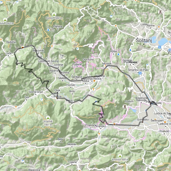
Eine abwechslungsreiche Tour mit malerischen Dörfern und natürlicher Schönheit
Die Ljubno-Runde ist eine 89 km lange Road-Bike-Tour mit 1871 m Aufstieg. Von Polzela führt die Strecke über Pikl, Tiber und Vrhi nach Kogez und Ljubno ob Savinji. Weiter geht es über Štefnov vrh (Inžičev vrh), Mozirje und Vimperk - Vinski vrh. Die Tour bietet malerische Dörfer, idyllische Landschaften und abwechslungsreiche Strecken entlang des Flusses Savinji, ideal für Naturliebhaber und erfahrene Radfahrer.
![Karten-Miniaturansicht der Radinspiration "Road Cycling Adventure from Polzela" in Vzhodna Slovenija, Slovenia. Erstellt vom Tarmacs.app-Routenplaner für Radtouren](https://images.tarmacs.app/cycling-routes/routemaps/600/slovenia/vzhodna-slovenija/polzela/road/14207.webp)
Embark on a 160 km long road cycling adventure with breathtaking views and challenging ascents.
This route will take you through picturesque villages, historical landmarks, and beautiful natural scenery. With a total ascent of 3383 m, this challenging ride offers a rewarding experience for avid cyclists looking to explore Vzhodna Slovenija.
![Karten-Miniaturansicht der Radinspiration "Die Velenje-Runde: eine herausfordernde Road-Bike-Tour durch Vzhodna Slovenija" in Vzhodna Slovenija, Slovenia. Erstellt vom Tarmacs.app-Routenplaner für Radtouren](https://images.tarmacs.app/cycling-routes/routemaps/600/slovenia/vzhodna-slovenija/polzela/road/14204.webp)
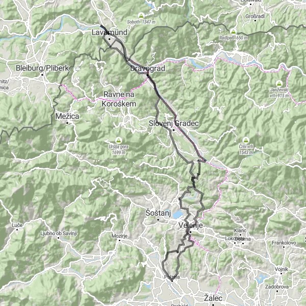
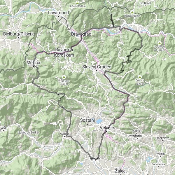
Eine epische Strecke mit anspruchsvollen Anstiegen und atemberaubenden Panoramen
Die Velenje-Runde ist eine 126 km lange Road-Bike-Tour mit 2484 m Aufstieg. Die Strecke führt von Kozjak über Velenje, Jesenjakov vrh und Tomaška vas nach Skala und weiter über Dravograd und Lavamünd. Der Rückweg führt über Kurijev vrh, Grajski grič und Škale bis nach Odraž. Die Tour bietet anspruchsvolle Anstiege, malerische Landschaften und spannende Highlights entlang der Strecke.
Scenic Road Cycling Loop starting near Polzela
![Karten-Miniaturansicht der Radinspiration "Scenic Road Cycling Loop starting near Polzela" in Vzhodna Slovenija, Slovenia. Erstellt vom Tarmacs.app-Routenplaner für Radtouren](https://images.tarmacs.app/cycling-routes/routemaps/600/slovenia/vzhodna-slovenija/polzela/road/14215.webp)
Embark on an 81 km long road cycling adventure through the charming landscapes of Vzhodna Slovenija.
This scenic route offers cyclists the chance to explore the picturesque villages and natural beauty of Vzhodna Slovenija. With a total ascent of 1922 m, this ride provides a perfect balance of challenge and relaxation for cyclists of all levels.
Sehenswerte Rennradtour von Polzela
![Karten-Miniaturansicht der Radinspiration "Sehenswerte Rennradtour von Polzela" in Vzhodna Slovenija, Slovenia. Erstellt vom Tarmacs.app-Routenplaner für Radtouren](https://images.tarmacs.app/cycling-routes/routemaps/600/slovenia/vzhodna-slovenija/polzela/road/14211.webp)
Entdecken Sie malerische Dörfer und schöne Aussichten auf dieser 80 km langen Strecke.
Diese Route führt Sie durch die charmante Landschaft von Vzhodna Slovenija, vorbei an historischen Höhepunkten und atemberaubenden Aussichtspunkten. Genießen Sie die malerische Umgebung und die Herausforderung der 2040 m Höhenmeter auf dieser abwechslungsreichen Strecke.
In der Nähe befinden sich Fahrradrouten:
![Bild von Kühnsdorf](https://images.tarmacs.app/cycling-routes/covers/austria/karnten/kuehnsdorf-3.webp)
![Bild von Völkermarkt](https://images.tarmacs.app/cycling-routes/covers/austria/karnten/voelkermarkt-5.webp)
![Bild von Deutschlandsberg](https://images.tarmacs.app/cycling-routes/covers/austria/steiermark/deutschlandsberg-5.webp)
![Bild von Sankt Stefan](https://images.tarmacs.app/cycling-routes/covers/austria/karnten/sankt-stefan-5.webp)
![Bild von Gamlitz](https://images.tarmacs.app/cycling-routes/covers/austria/steiermark/gamlitz-5.webp)
![Bild von Kleinedling](https://images.tarmacs.app/cycling-routes/covers/austria/karnten/kleinedling-5.webp)
![Bild von Priel](https://images.tarmacs.app/cycling-routes/covers/austria/karnten/priel-4.webp)
![Bild von Hörtendorf](https://images.tarmacs.app/cycling-routes/covers/austria/karnten/hoertendorf-5.webp)
Benachbarte Regionen:
![Bild von Burgenland](https://images.tarmacs.app/cycling-routes/covers/austria/burgenland/jennersdorf-3.webp)
![Bild von Niederösterreich](https://images.tarmacs.app/cycling-routes/covers/austria/niederosterreich/mautern-5.webp)
![Bild von Kärnten](https://images.tarmacs.app/cycling-routes/covers/austria/karnten/priel-2.webp)
![Bild von Styria](https://images.tarmacs.app/cycling-routes/covers/austria/steiermark/mitterdorf-im-muerztal-3.webp)
![Bild von Oberösterreich](https://images.tarmacs.app/cycling-routes/covers/austria/oberosterreich/schoerfling-4.webp)
![Bild von Tirol](https://images.tarmacs.app/cycling-routes/covers/austria/tirol/fliess-3.webp)
![Bild von Panonska Hrvatska](https://images.tarmacs.app/cycling-routes/covers/croatia/panonska-hrvatska/osijek-1.webp)
![Bild von Jadranska Hrvatska](https://images.tarmacs.app/cycling-routes/covers/croatia/jadranska-hrvatska/crikvenica-5.webp)
![Bild von Grad Zagreb](https://images.tarmacs.app/cycling-routes/covers/croatia/grad-zagreb/kraljevec-kupinecki-1.webp)
![Bild von Sjeverna Hrvatska](https://images.tarmacs.app/cycling-routes/covers/croatia/sjeverna-hrvatska/gjurgevac-5.webp)
![Bild von Nyugat-Dunántúl](https://images.tarmacs.app/cycling-routes/covers/hungary/nyugat-dunantul/janoshaza-3.webp)
![Bild von Venetien](https://images.tarmacs.app/cycling-routes/covers/italy/veneto/brugine-5.webp)
![Bild von Zahodna Slovenija](https://images.tarmacs.app/cycling-routes/covers/slovenia/zahodna-slovenija/zelezniki-2.webp)