![Cover image](https://images.tarmacs.app/cycling-routes/covers/switzerland/espace-mittelland/saint-aubin-sauges-5.webp)
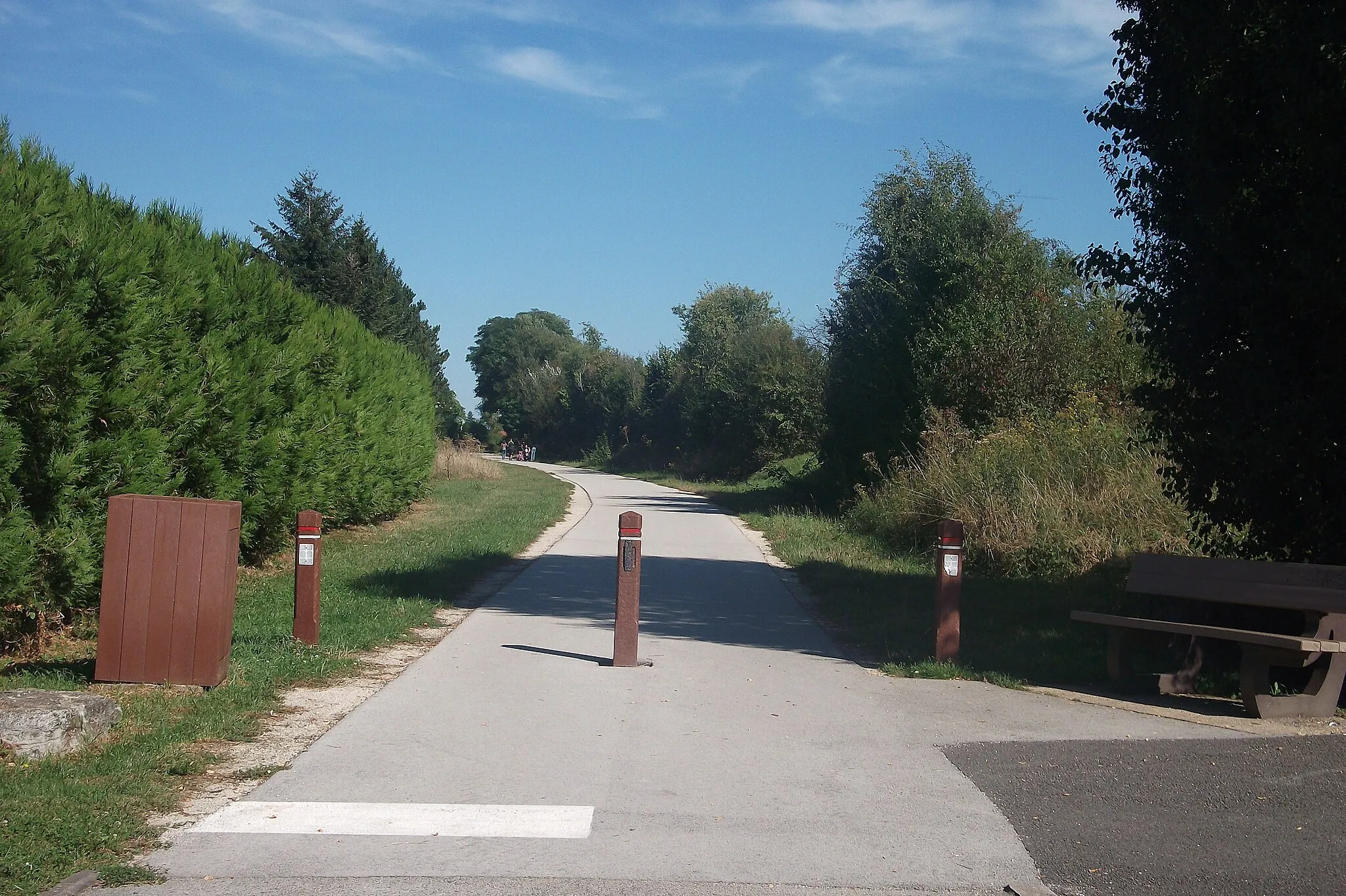
Raziščite Saint-Aubin-Sauges na kolesu
Kolesarske poti od Saint-Aubin-Sauges
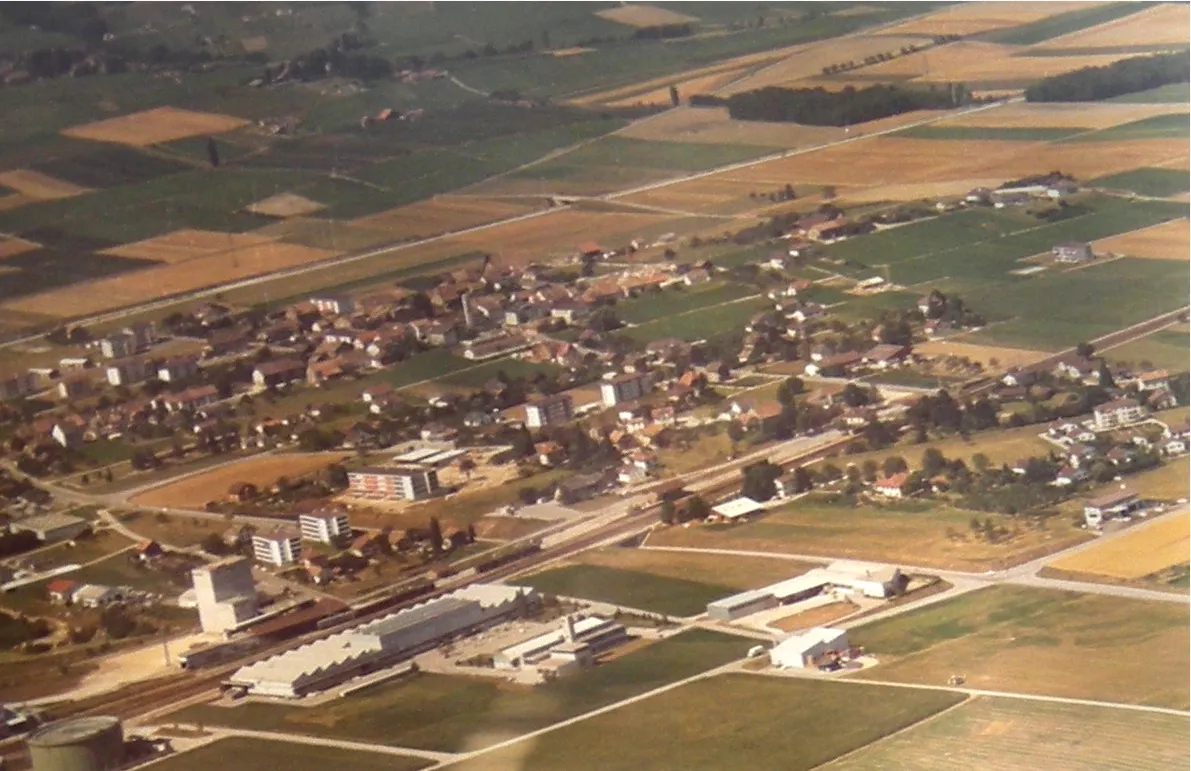
Saint-Aubin-Sauges je odlično izhodišče za cestne kolesarje, ki želijo raziskati okoliško pokrajino. Lokacija ponuja številne priložnosti za vzpone in spuste ter razgled na okoliške kraje.
![Zemljevid v pomanjšavi "Exploration of the gravel roads near Saint-Aubin-Sauges" kolesarske inspiracije v Espace Mittelland, Switzerland. Generirano z načrtovalcem kolesarskih poti Tarmacs.app](https://images.tarmacs.app/cycling-routes/routemaps/600/switzerland/espace-mittelland/saint-aubin-sauges/gravel/164597.webp)
Embark on a cycling adventure through the hidden gems near Saint-Aubin-Sauges
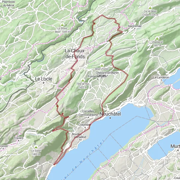
Cycle through the charming villages of La Chaux-de-Fonds, Sonvilier, and Valangin on this 107km route with a total ascent of 2727m. From historic landmarks to natural wonders, this route offers a true exploration of the region.
Extended gravel route from Saint-Aubin-Sauges
![Zemljevid v pomanjšavi "Extended gravel route from Saint-Aubin-Sauges" kolesarske inspiracije v Espace Mittelland, Switzerland. Generirano z načrtovalcem kolesarskih poti Tarmacs.app](https://images.tarmacs.app/cycling-routes/routemaps/600/switzerland/espace-mittelland/saint-aubin-sauges/gravel/164611.webp)
Embark on a longer gravel adventure starting from Saint-Aubin-Sauges
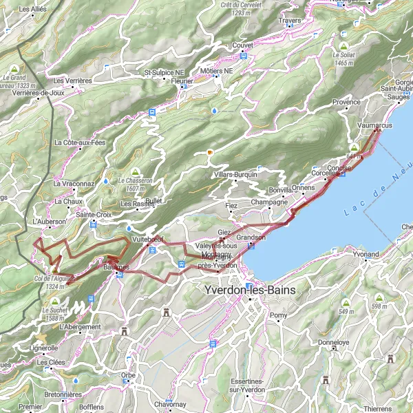
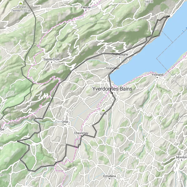
Cycle through the diverse landscapes of Giez, Baulmes, and Grandson on this 78km route with a total ascent of 1608m. From stunning viewpoints to charming villages, this route offers a true exploration of the region.
![Zemljevid v pomanjšavi "Road cycling challenge near Saint-Aubin-Sauges" kolesarske inspiracije v Espace Mittelland, Switzerland. Generirano z načrtovalcem kolesarskih poti Tarmacs.app](https://images.tarmacs.app/cycling-routes/routemaps/600/switzerland/espace-mittelland/saint-aubin-sauges/road/164619.webp)
Take on the road cycling challenge with stunning vistas near Saint-Aubin-Sauges
With a challenging ascent of 3136m and a distance of 121km, this road route offers a true test for cycling enthusiasts. From the quaint village of Bonvillars to the breathtaking views at Mont Châteleu, this journey is filled with memorable moments.
![Zemljevid v pomanjšavi "Gorski izziv okoli Saint-Aubin-Sauges" kolesarske inspiracije v Espace Mittelland, Switzerland. Generirano z načrtovalcem kolesarskih poti Tarmacs.app](https://images.tarmacs.app/cycling-routes/routemaps/600/switzerland/espace-mittelland/saint-aubin-sauges/gravel/193088.webp)
Raziemite 67-kilometrska pot, ki vas bo popeljala skozi neskončne gozdove in griče
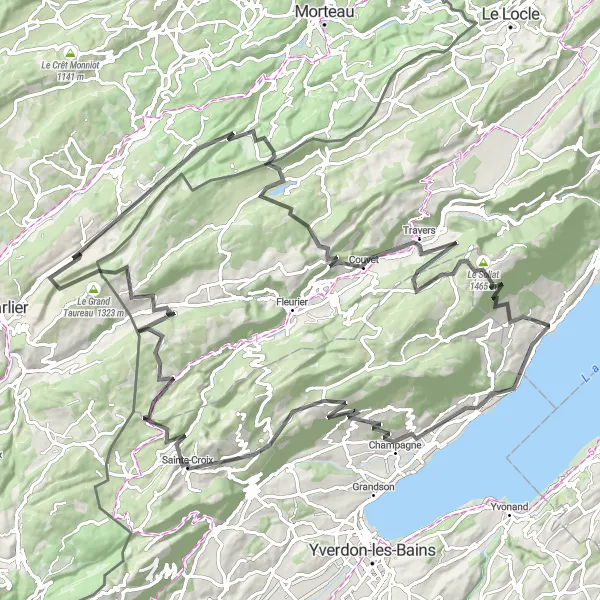
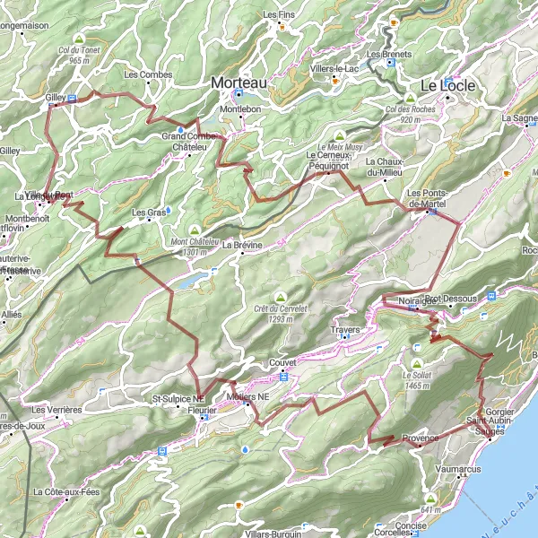
Ta 67 kilometrov dolga pot ponuja raznoliko teren in spektakularne razglede na poti. Med vožnjo boste premagovali vzpone in spuste ter se čudili lepotam narave. Pot vas pripelje skozi Montalchez, Couvet, Crêt du Cervelet, La Chaux-du-Milieu, Brot-Dessus, Signal du Lessy in Gorgier.
![Zemljevid v pomanjšavi "Pustolovska kolesarska pot skozi slikovite kraje" kolesarske inspiracije v Espace Mittelland, Switzerland. Generirano z načrtovalcem kolesarskih poti Tarmacs.app](https://images.tarmacs.app/cycling-routes/routemaps/600/switzerland/espace-mittelland/saint-aubin-sauges/road/164579.webp)
Naporna pot z mnogimi vzponi in razgledi
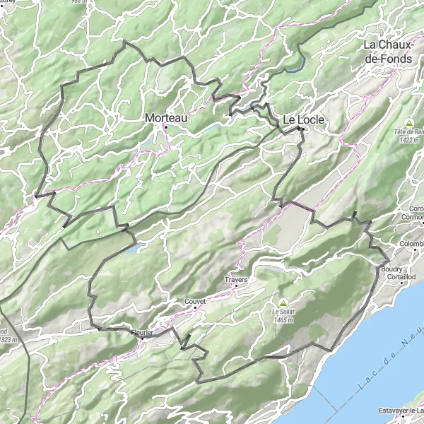
S to 133 km dolgo potjo in 3216 m vzpona boste doživeli edinstveno kolesarsko avanturo. Pot vas vodi skozi Mutrux, Fleurier in Villers-le-Lac ter vam nudi priložnost za raziskovanje raznolikih pokrajin in kulturnih znamenitosti.
![Zemljevid v pomanjšavi "Rustikalna makadamska kolesarska pot" kolesarske inspiracije v Espace Mittelland, Switzerland. Generirano z načrtovalcem kolesarskih poti Tarmacs.app](https://images.tarmacs.app/cycling-routes/routemaps/600/switzerland/espace-mittelland/saint-aubin-sauges/gravel/164581.webp)
Pustolovsko kolesarjenje po raznolikih terenih
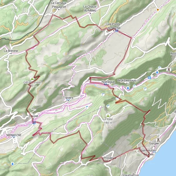
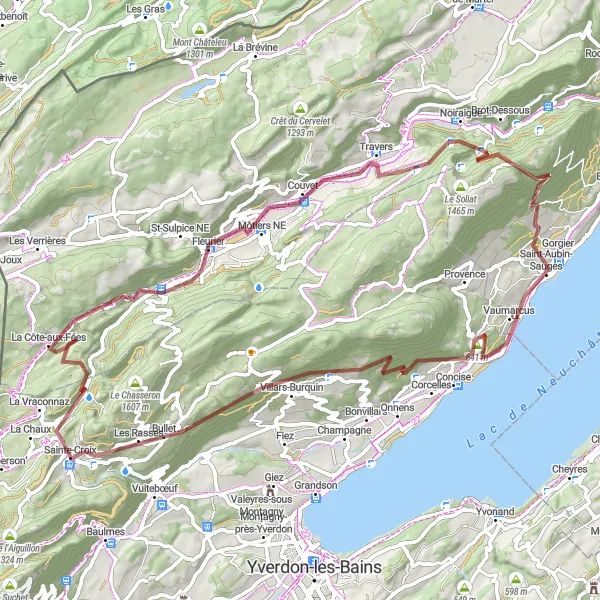
76 km dolgo gravel kolesarsko pot s 2186 m vzpona ponuja edinstveno pustolovščino po slikovitih pokrajinah. Pot vas vodi skozi Concise, Sainte-Croix in Creux-du-Van ter vam omogoča odkrivanje naravnih lepot in čudovitih razgledov.
![Zemljevid v pomanjšavi "Uživaška kolesarska pot skozi širno pokrajino" kolesarske inspiracije v Espace Mittelland, Switzerland. Generirano z načrtovalcem kolesarskih poti Tarmacs.app](https://images.tarmacs.app/cycling-routes/routemaps/600/switzerland/espace-mittelland/saint-aubin-sauges/road/164612.webp)
Sproščujoča pot z raznolikimi razgledi
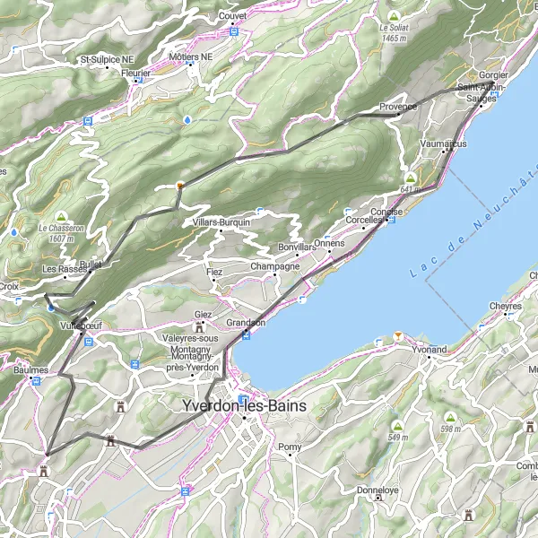
68 km dolga pot s 1156 m vzpona vas popelje skozi idilične kraje kot so Valeyres, Bullet in Boudry. Ta pot ponuja sproščujočo kolesarsko izkušnjo ob prečudoviti naravi in številnih zanimivih točkah ob poti.
![Zemljevid v pomanjšavi "Krožna kolesarska pot skozi Saint-Aubin-Sauges" kolesarske inspiracije v Espace Mittelland, Switzerland. Generirano z načrtovalcem kolesarskih poti Tarmacs.app](https://images.tarmacs.app/cycling-routes/routemaps/600/switzerland/espace-mittelland/saint-aubin-sauges/road/164657.webp)
Razburljiva pot s čudovitimi razgledi
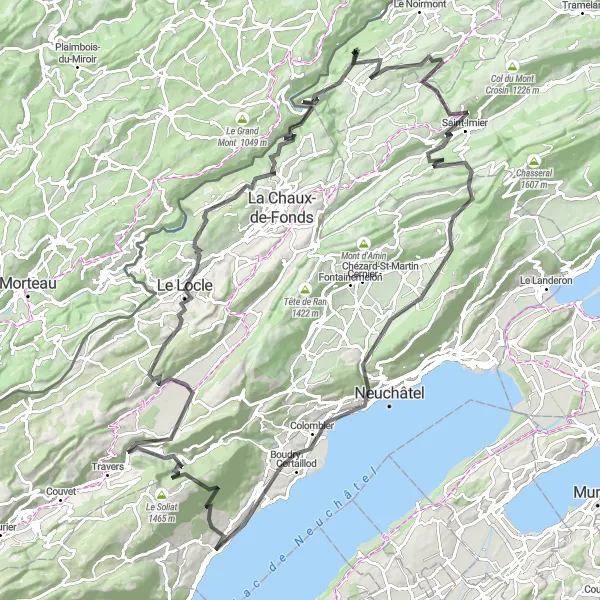
Izjemna kolesarska pot, polna raznolikih pokrajin in zanimivosti, ki zajema 131 km in 3365 m vzpona. Pot vas vodi skozi slikovite kraje kot so Le Locle, Mont Soleil in Cortaillod.
![Zemljevid v pomanjšavi "Raznolika kolesarska pot skozi okolico Saint-Aubin-Sauges" kolesarske inspiracije v Espace Mittelland, Switzerland. Generirano z načrtovalcem kolesarskih poti Tarmacs.app](https://images.tarmacs.app/cycling-routes/routemaps/600/switzerland/espace-mittelland/saint-aubin-sauges/road/164587.webp)
Razburljiva pot med slikovitimi kraji
Ta 98 km dolga pot s 1381 m vzpona vas popelje skozi Grandson, Les Clées in Montalchez. Raznolike pokrajine in zanimive točke ob poti vas bodo navdušile.
![Zemljevid v pomanjšavi "Scenic gravel route with panoramic views" kolesarske inspiracije v Espace Mittelland, Switzerland. Generirano z načrtovalcem kolesarskih poti Tarmacs.app](https://images.tarmacs.app/cycling-routes/routemaps/600/switzerland/espace-mittelland/saint-aubin-sauges/gravel/164582.webp)
Immerse yourself in the scenic beauty of the gravel roads near Saint-Aubin-Sauges
With a total ascent of 3257m and a distance of 108km, this gravel route offers a challenging yet rewarding experience. From the picturesque village of Montalchez to the panoramic views at Signal du Lessy, every moment of this journey is filled with natural beauty.
Kolesarske poti v bližini:
Bližnje regije:
![Slika Région lémanique](https://images.tarmacs.app/cycling-routes/covers/switzerland/region-lemanique/gland-1.webp)
![Slika Nordwestschweiz](https://images.tarmacs.app/cycling-routes/covers/switzerland/nordwestschweiz/riehen-5.webp)
![Slika Zentralschweiz](https://images.tarmacs.app/cycling-routes/covers/switzerland/zentralschweiz/hunenberg-1.webp)
![Slika Ticino](https://images.tarmacs.app/cycling-routes/covers/switzerland/ticino/cadenazzo-2.webp)
![Slika Freiburg](https://images.tarmacs.app/cycling-routes/covers/germany/freiburg/zimmern-ob-rottweil-2.webp)
![Slika Franche-Comté](https://images.tarmacs.app/cycling-routes/covers/france/franche-comte/vesoul-4.webp)
![Slika Alsace](https://images.tarmacs.app/cycling-routes/covers/france/alsace/wittisheim-3.webp)
![Slika Rhône-Alpes](https://images.tarmacs.app/cycling-routes/covers/france/rhone-alpes/mezeriat-1.webp)
![Slika Piemonte](https://images.tarmacs.app/cycling-routes/covers/italy/piemonte/molare-3.webp)