![Cover image](https://images.tarmacs.app/cycling-routes/covers/france/rhone-alpes/montboucher-sur-jabron-3.webp)
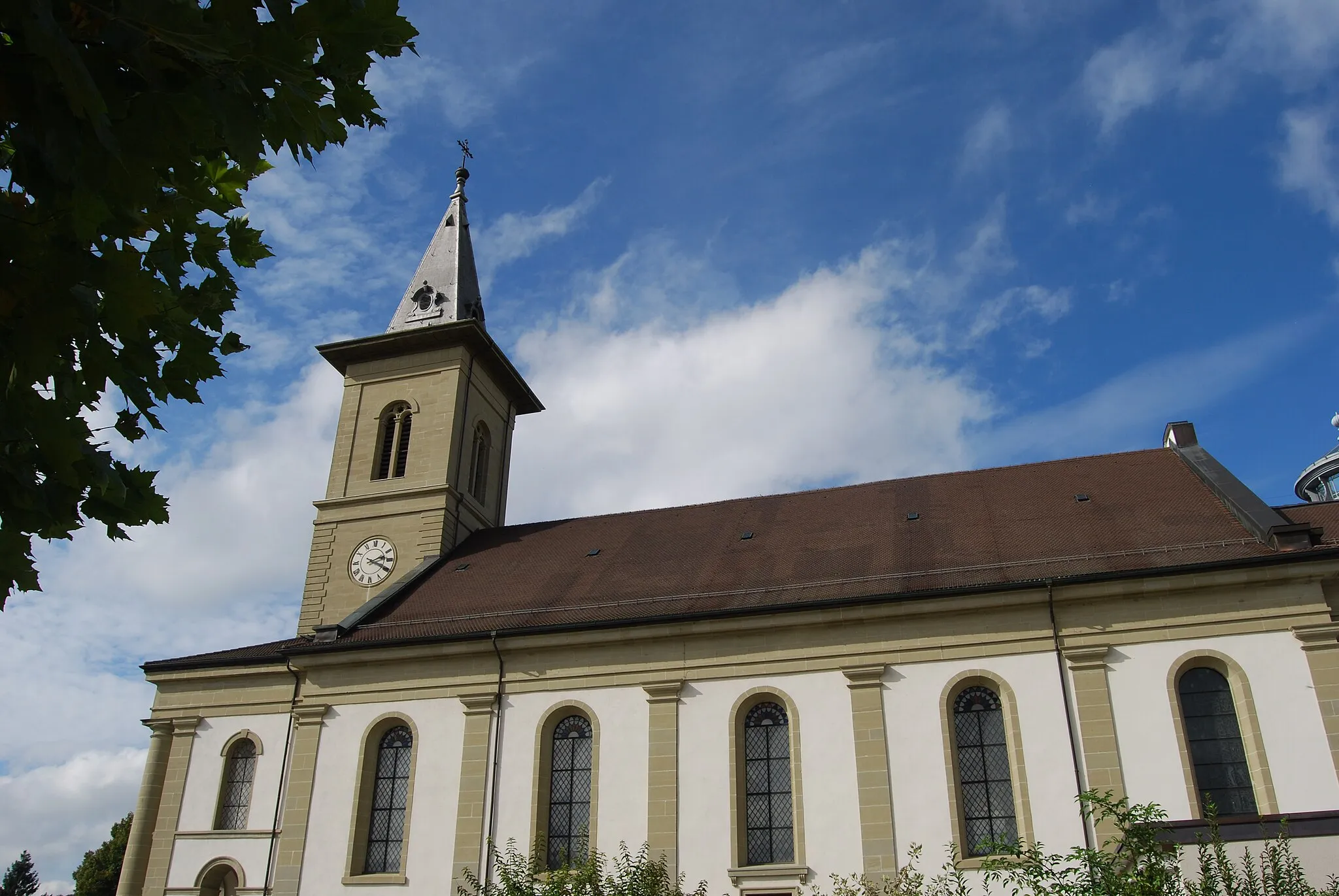
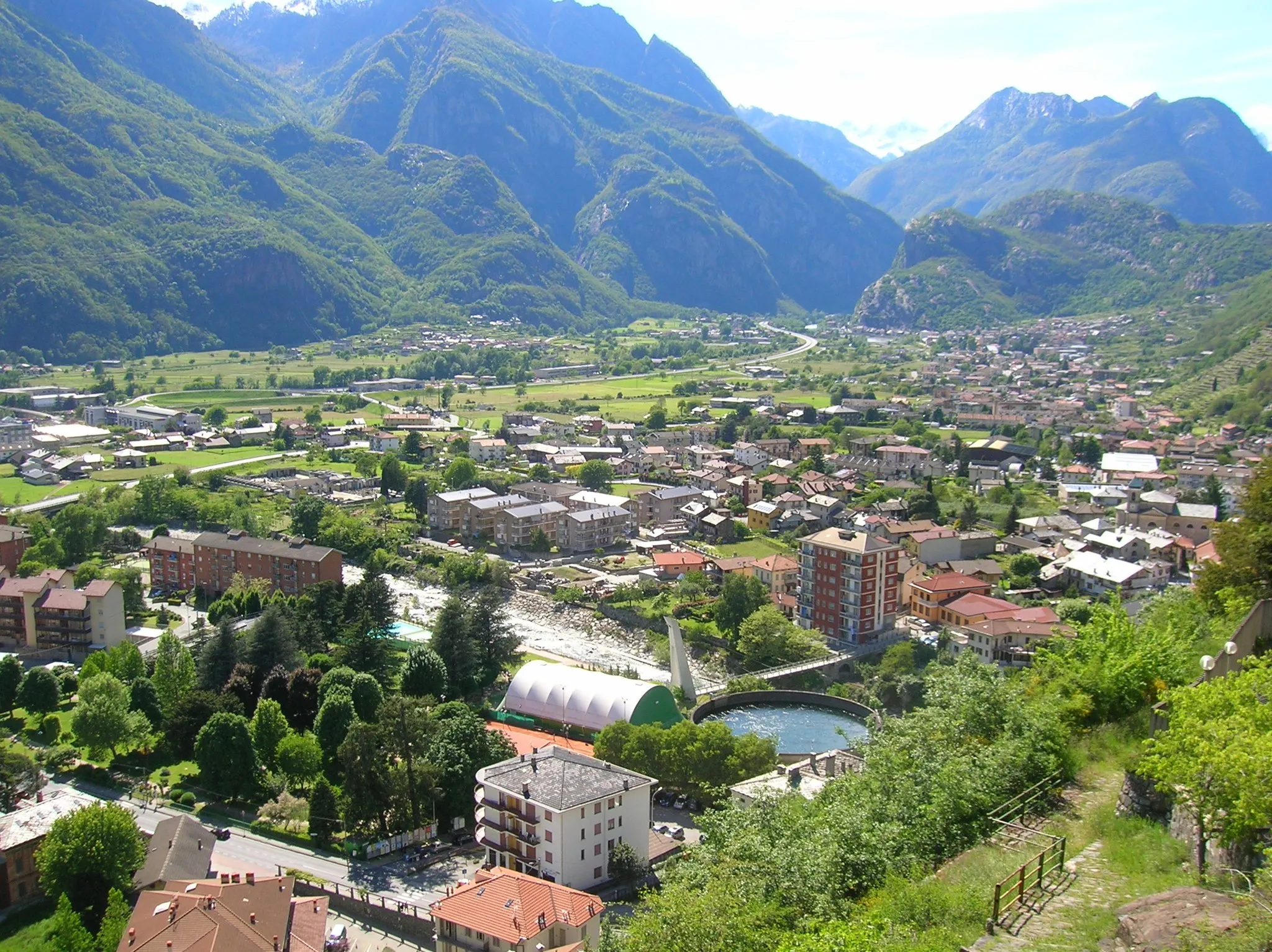
Ihanteellinen pyöräilykohde
Pyöräilyreitit alkaen Montboucher-sur-Jabron
Montboucher-sur-Jabron on ihanteellinen paikka pyöräilijöille Rhône-Alpeilla. Alueen monipuolinen maasto ja hyvät pyöräilytiet houkuttelevat niin maantie- kuin sorapyöräilijöitä. Lähellä sijaitsee myös joitakin suosittuja pyöräilypolkuja, jotka tarjoavat haastetta pyöräilijöille.
![Karttaminiaatyyri "Montboucher-sur-Jabron - Montélimar Gravel Cycling Route" pyöräilyinspiraatiosta alueella Rhône-Alpes, France. Luotu Tarmacs.app pyöräilyreittisuunnittelijalla](https://images.tarmacs.app/cycling-routes/routemaps/600/france/rhone-alpes/montboucher-sur-jabron/gravel/107317.webp)
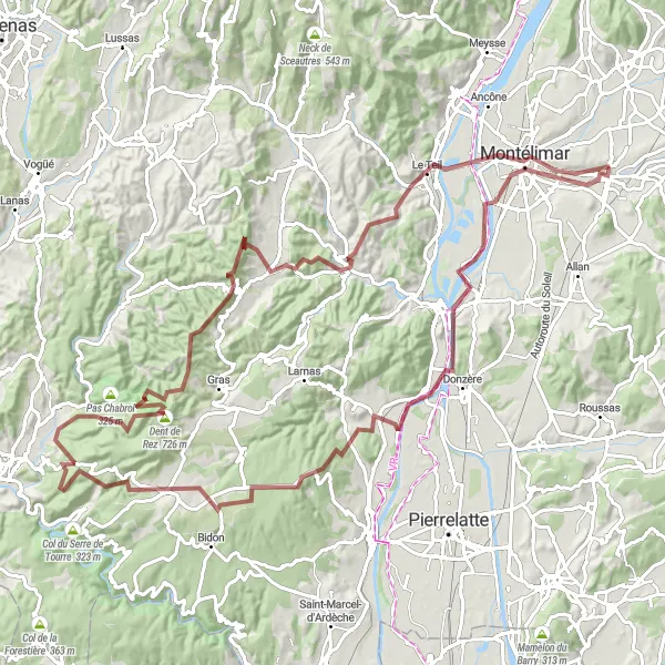
Explore rugged landscapes and cultural sites on this challenging gravel cycling route
This gravel cycling route takes you through diverse terrain, from Montboucher-sur-Jabron to Montélimar, passing highlights such as Châteauneuf-du-Rhône and Valvignères. With a distance of 111 kilometers and over 2000 meters of ascent, this route is recommended for experienced gravel cyclists seeking an adventure off the beaten path. Discover hidden gems, natural wonders, and historical sites as you pedal through the rugged beauty of the Rhône-Alpes region.
![Karttaminiaatyyri "Espeluche - Malataverne Road Cycling Route" pyöräilyinspiraatiosta alueella Rhône-Alpes, France. Luotu Tarmacs.app pyöräilyreittisuunnittelijalla](https://images.tarmacs.app/cycling-routes/routemaps/600/france/rhone-alpes/montboucher-sur-jabron/road/107331.webp)
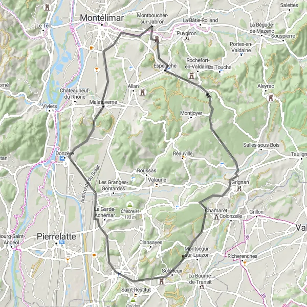
Cycle through historic villages and enjoy panoramic views on this scenic road cycling route
This road cycling route showcases the beauty of the Rhône-Alpes region, with highlights including Espeluche and Belvédère de la Vierge. With a distance of 69 kilometers and 600 meters of ascent, this route is suitable for intermediate cyclists looking for a rewarding ride. Explore charming villages, historical sites, and breathtaking viewpoints along the way.
![Karttaminiaatyyri "Haastava retki Château de la Tourretten kautta" pyöräilyinspiraatiosta alueella Rhône-Alpes, France. Luotu Tarmacs.app pyöräilyreittisuunnittelijalla](https://images.tarmacs.app/cycling-routes/routemaps/600/france/rhone-alpes/montboucher-sur-jabron/road/107364.webp)
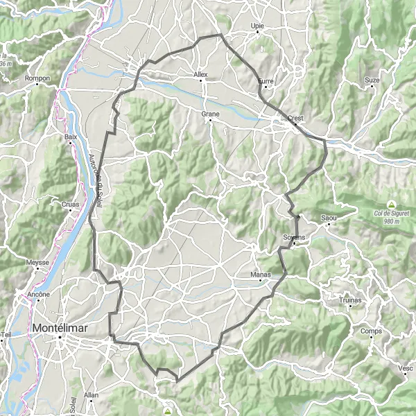
Kiehtova kierros Loriol-sur-Drômen maisemissa
Tämä vaativa reitti vie sinut läpi kauniiden kylien ja vuorten, kuten Col de Rotissonin ja Table d'orientationin. Matkalla voit ihailla upeaa Saint-Vincent-de-Durfortin linnaa ja Château de la Tourrettea, sekä maisemia Marsannen viiniviljelmille.
![Karttaminiaatyyri "Montboucher-sur-Jabron - Espeluche - Réauville - Chantemerle-lès-Grignan - Le Jarrus - Chanteperdirx - Les Granges-Gontardes - Malataverne - Montboucher-sur-Jabron" pyöräilyinspiraatiosta alueella Rhône-Alpes, France. Luotu Tarmacs.app pyöräilyreittisuunnittelijalla](https://images.tarmacs.app/cycling-routes/routemaps/600/france/rhone-alpes/montboucher-sur-jabron/road/107327.webp)
Explore the charming villages and scenic landscapes on this 62 km road cycling route near Montboucher-sur-Jabron.
Cycle through picturesque villages like Espeluche and Réauville, enjoy the stunning views from Col du Colombier, and pass by historical sites like Chantemerle-lès-Grignan. With a total ascent of 736 meters, this route offers a mix of challenging climbs and rewarding descents for road cycling enthusiasts.
![Karttaminiaatyyri "Gravel-seikkailu Mont Rachasin maisemissa" pyöräilyinspiraatiosta alueella Rhône-Alpes, France. Luotu Tarmacs.app pyöräilyreittisuunnittelijalla](https://images.tarmacs.app/cycling-routes/routemaps/600/france/rhone-alpes/montboucher-sur-jabron/gravel/107348.webp)
Kulje Aleyraccin kautta La Begude-de-Mazenciin
Tämä reitti tarjoaa upeita gravel-osuuksia ja vie läpi kauniiden metsien ja kylien, kuten La Touche ja Mont Rachas. Vaihteleva maasto ja maisema tarjoavat monipuolisen pyöräilykokemuksen, joka sopii niin kokeneille kuin aloittelijoillekin.
![Karttaminiaatyyri "Retkireitti Montboucher-sur-Jabroniin" pyöräilyinspiraatiosta alueella Rhône-Alpes, France. Luotu Tarmacs.app pyöräilyreittisuunnittelijalla](https://images.tarmacs.app/cycling-routes/routemaps/600/france/rhone-alpes/montboucher-sur-jabron/road/107330.webp)
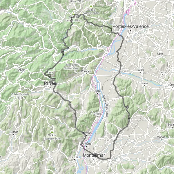
Ihastuttava tie Privasiin ja takaisin
Tämä reitti tarjoaa upeita näkymiä matkan varrella ja kiehtovia pysähdyspaikkoja, kuten Théâtre gallo-romain ja Col du Benas. Ascentti ylös ja alas tarjoaa haasteen, mutta myös palkitsee upeilla maisemilla vihreästä maaseudusta.
![Karttaminiaatyyri "Montboucher-sur-Jabron - Rochemaure - Saint-Vincent-de-Barrès - Baix - Les Tourrettes - Montboucher-sur-Jabron" pyöräilyinspiraatiosta alueella Rhône-Alpes, France. Luotu Tarmacs.app pyöräilyreittisuunnittelijalla](https://images.tarmacs.app/cycling-routes/routemaps/600/france/rhone-alpes/montboucher-sur-jabron/road/107312.webp)
Experience the diverse terrain and cultural richness of this 64 km road cycling route starting near Montboucher-sur-Jabron.
Discover the historic sites of Rochemaure and Saint-Vincent-de-Barrès, enjoy the breathtaking views from Point de vue, and explore the charming village of Baix. With a total ascent of 465 meters, this route offers a mix of flat sections and challenging climbs, making it suitable for intermediate cyclists.
![Karttaminiaatyyri "Montboucher-sur-Jabron - Joannade - Viviers - Saint-Andéol-de-Berg - Aubenas - Fontalazon - Aizac - Saint-Joseph-des-Bancs - Rocher de la table - Alissas - Andance - Rochemaure - Montboucher-sur-Jabron" pyöräilyinspiraatiosta alueella Rhône-Alpes, France. Luotu Tarmacs.app pyöräilyreittisuunnittelijalla](https://images.tarmacs.app/cycling-routes/routemaps/600/france/rhone-alpes/montboucher-sur-jabron/road/107362.webp)
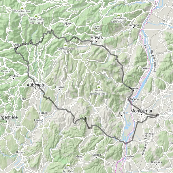
Embark on a challenging 147 km road cycling odyssey through the scenic landscapes and historic towns near Montboucher-sur-Jabron.
Experience the cultural richness of Viviers and Aubenas, conquer the steep climbs of Saint-Andéol-de-Berg and Fontalazon, and admire the natural beauty of Aizac and Saint-Joseph-des-Bancs. With a total ascent of 2393 meters, this route is designed for experienced cyclists seeking an unforgettable adventure in the heart of Rhône-Alpes.
![Karttaminiaatyyri "Montboucher-sur-Jabron - La Bâtie-Rolland - Dieulefit - Col du Serre - Roche-Saint-Secret-Béconne - Col de Novezan - Rocher de l'Aiguille - Puyméras - Visan - Chantemerle-lès-Grignan - Col du Colombier - Montboucher-sur-Jabron" pyöräilyinspiraatiosta alueella Rhône-Alpes, France. Luotu Tarmacs.app pyöräilyreittisuunnittelijalla](https://images.tarmacs.app/cycling-routes/routemaps/600/france/rhone-alpes/montboucher-sur-jabron/road/107309.webp)
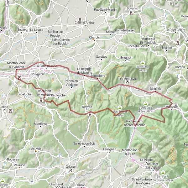
Embark on a challenging 136 km road cycling adventure through the diverse landscapes and historic landmarks near Montboucher-sur-Jabron.
Discover the hidden gems of La Bâtie-Rolland and Dieulefit, conquer the steep climb to Col du Serre, and marvel at the majestic Rocher de l'Aiguille. With a total ascent of 1756 meters, this route is perfect for experienced cyclists looking for a test of endurance and a rewarding exploration of the region's natural beauty.
![Karttaminiaatyyri "Montboucher-sur-Jabron - Aouste-sur-Sye Road Cycling Route" pyöräilyinspiraatiosta alueella Rhône-Alpes, France. Luotu Tarmacs.app pyöräilyreittisuunnittelijalla](https://images.tarmacs.app/cycling-routes/routemaps/600/france/rhone-alpes/montboucher-sur-jabron/road/143573.webp)
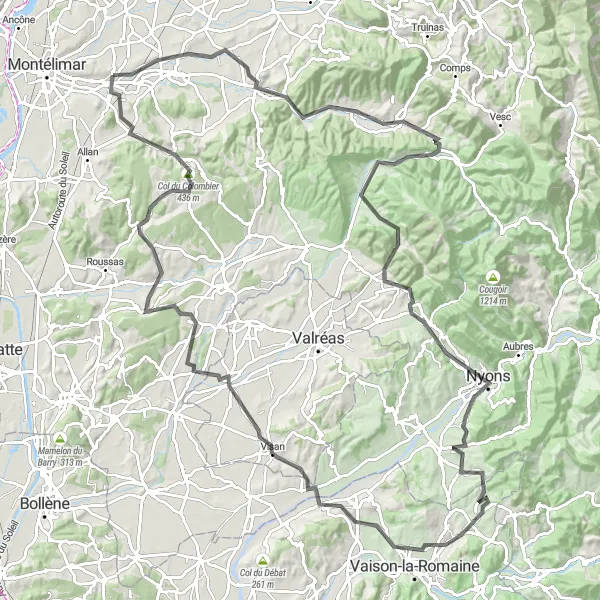
Discover picturesque villages and stunning landscapes on this challenging road cycling route
This road cycling route takes you through the beautiful Rhône-Alpes region, passing by highlights such as Saint-Marcel-lès-Sauzet and Col des Deux Serres. With almost 100 kilometers of distance and nearly 1000 meters of ascent, this route offers a great challenge for experienced cyclists. Enjoy the charming French countryside and the scenic views along the way.
Lähellä olevat pyöräilyreitit:
Läheiset alueet:
![Kuva kohteesta Région lémanique](https://images.tarmacs.app/cycling-routes/covers/switzerland/region-lemanique/riddes-1.webp)
![Kuva kohteesta Espace Mittelland](https://images.tarmacs.app/cycling-routes/covers/switzerland/espace-mittelland/belfaux-5.webp)
![Kuva kohteesta Bourgogne](https://images.tarmacs.app/cycling-routes/covers/france/bourgogne/hurigny-2.webp)
![Kuva kohteesta Franche-Comté](https://images.tarmacs.app/cycling-routes/covers/france/franche-comte/foucherans-1.webp)
![Kuva kohteesta Languedoc-Roussillon](https://images.tarmacs.app/cycling-routes/covers/france/languedoc-roussillon/valergues-5.webp)
![Kuva kohteesta Auvergne](https://images.tarmacs.app/cycling-routes/covers/france/auvergne/domerat-5.webp)
![Kuva kohteesta Provence-Alpes-Côte d’Azur](https://images.tarmacs.app/cycling-routes/covers/france/provence-alpes-cote-dazur/evenos-2.webp)
![Kuva kohteesta Piemonte](https://images.tarmacs.app/cycling-routes/covers/italy/piemonte/lesa-2.webp)
![Kuva kohteesta Valle d’Aosta/Vallée d’Aoste](https://images.tarmacs.app/cycling-routes/covers/italy/valle-daosta-vallee-daoste/pont-saint-martin-4.webp)