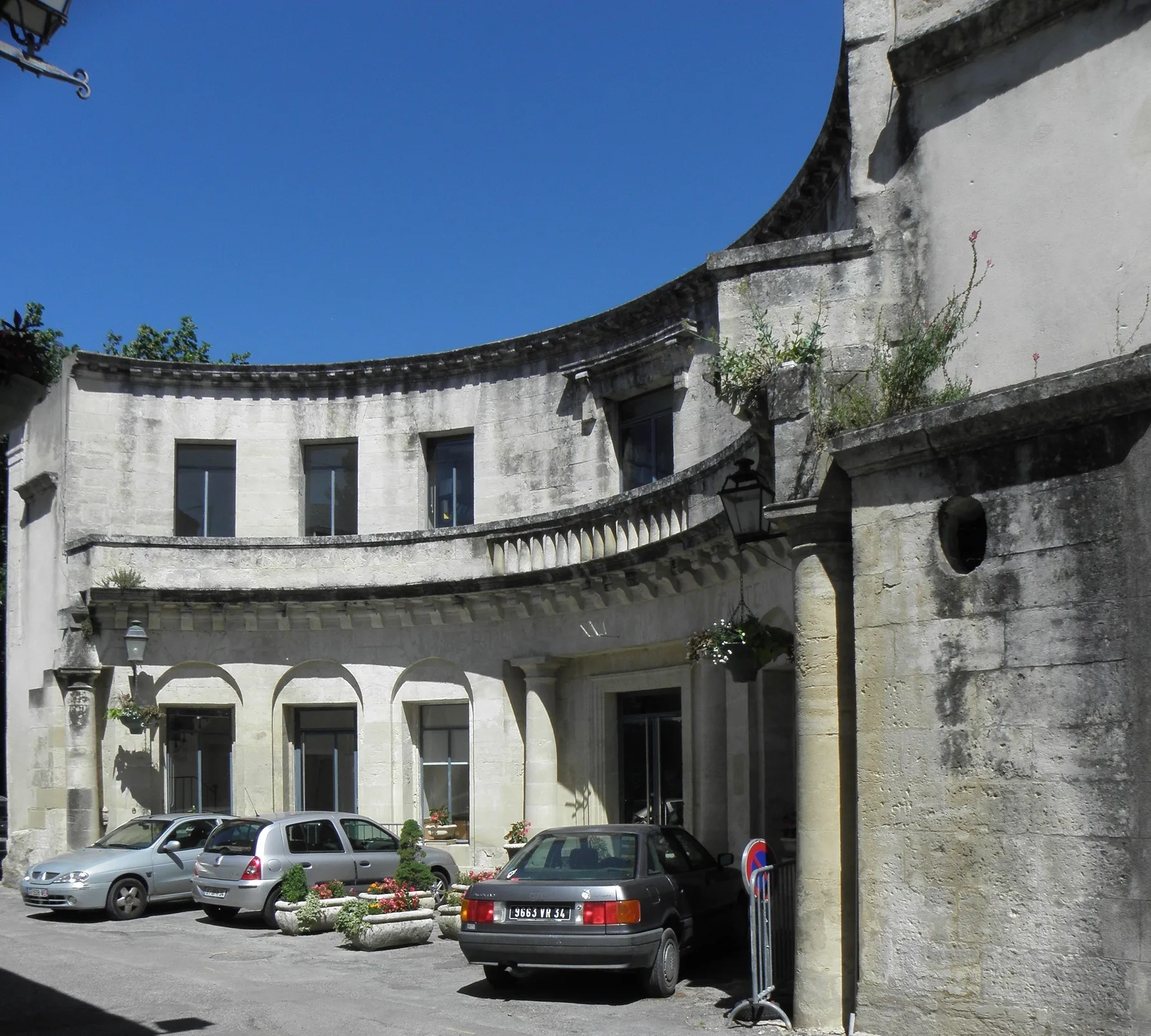
Mielenkiintoiset mahdollisuudet pyöräilijöille.
Pyöräilyreitit alkaen Saint-Agreve
Saint-Agrève voi tarjota mielenkiintoisia pyöräilymahdollisuuksia, mutta alueella ei ole erityisen tunnettuja pyöräilykohteita lähellä. Maisemat ja reitit voivat silti houkutella pyöräilijöitä tutkimaan aluetta.

Embark on an adventurous gravel cycling journey near Saint-Agrève.
This gravel cycling route offers a thrilling ride through the rugged terrain of Rhône-Alpes, with an ascent of 2048 meters over 83 kilometers. Highlights include the picturesque Saint-Martin-de-Valamas and the iconic Col du Gerbier de jonc. Enjoy the natural beauty of Mont Signon and Les Vastres, and don't miss the breathtaking views from Mont Chiniac.

Tee ainutlaatuinen pyöräilymatka kohti Les Vastresia ja Rocher d'Aigletia
Tämä 127 kilometrin mittainen maantiepyöräreitti tarjoaa upeita näkymiä ja historiallisia kohteita, kuten Rocher d'Aiglet ja Laussonne. Suosittelemme tätä reittiä maiseman ystäville ja pyöräilijöille, jotka arvostavat haastavia nousuja ja monipuolisia maisemia.
Scenic road cycling route with challenging climbs and breathtaking views
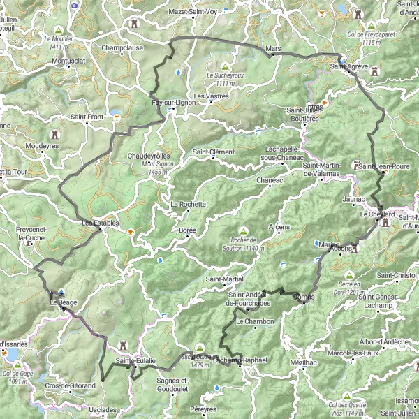
The route from Saint-Agrève to Les Estables offers a challenging ascent to Col de Joux with rewarding panoramic views. Passing through picturesque villages like Accons and Lachamp-Raphaël, cyclists can enjoy the serene beauty of the Rhône-Alpes region. Highlights include the unique rock formation Suc d'Ourseyre and the charming village of Le Béage. The final stretch to Les Estables provides a sense of accomplishment with stunning vistas of Rocher d'Aiglet and Mont Chiniac in the distance.
Tutustu upeisiin maisemiin matkalla kohti Saint-Bonnet-le-Froidia ja Col des Baraqueshia
Tämä 42 kilometrin mittainen hiekkatiepyöräreitti tarjoaa haastavia osuuksia ja upeita maisemia kokeneille pyöräilijöille. Suosittelemme tätä reittiä seikkailunhaluisille pyöräilijöille, jotka haluavat kokea Välimeren alueen luonnonkauneuden ja historialliset kohteet.
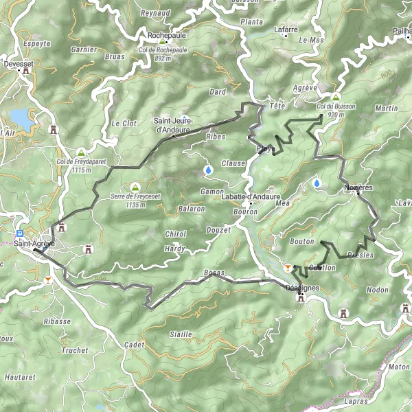
Nauti upeasta pyöräilykokemuksesta kohti Nozièresia ja Désaignesia
Tämä 49 kilometrin mittainen maantiepyöräreitti tarjoaa haastavia nousevia osuuksia kohti upeita maisemia ja historiallisia kohteita. Suosittelemme tätä reittiä kokeneille pyöräilijöille, jotka haluavat testata kuntoaan ja nauttia Ranskan kauniista maisemista.
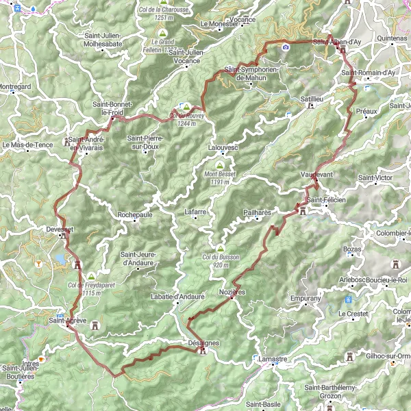
Exciting gravel cycling route with diverse terrain and cultural highlights
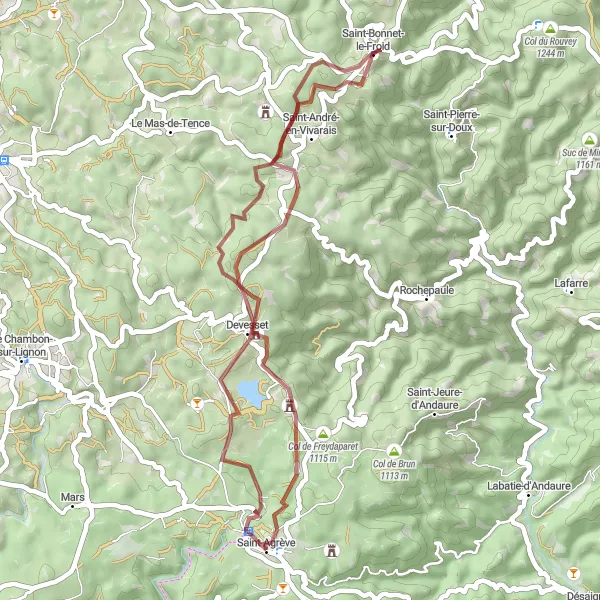
The gravel route from Saint-Agrève to Saint-Alban-d'Ay showcases the natural beauty of the Rhône-Alpes region with challenging climbs and scenic views. Cyclists will pass through rustic villages like Devesset and Saint-Bonnet-le-Froid, where they can experience the local culture and hospitality. Highlights include the picturesque Col des Baraques and the historic Porte du Bourg de l'Homme (porte de Lalle). The route offers a mix of rugged terrain and smooth gravel paths, providing a thrilling adventure for gravel cycling enthusiasts.
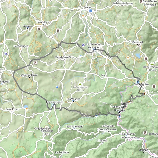
Enjoy a scenic road cycling adventure starting near Saint-Agrève.
This road cycling route offers a pleasant ride through the picturesque scenery of the Rhône-Alpes region, with an ascent of 1165 meters over 63 kilometers. Highlights include the charming village of Intres and the historic town of Fay-sur-Lignon. Admire the beauty of Les Bastiers and the peaceful surroundings of Le Chambon-sur-Lignon, before reaching the summit of Mont Chiniac.

Explore the stunning Rhône-Alpes region on this challenging road cycling route.
This road cycling route near Saint-Agrève offers breathtaking views and a challenging ascent of 2359 meters over 105 kilometers. The highlights include the picturesque Châteauneuf-de-Vernoux and the charming village of Beauvène. Don't miss the panoramic views from Table d'orientation and the historic town of Le Cheylard.
Maalauksellinen Hiekkatiepyöräilyreitti Saint-Maurice-de-Lignoniin: Montbarnier ja Pont de Confolent

Tee upea pyöräilymatka kohti Sainte-Sigolènea ja Montfaucon-en-Velayta
Tämä 110 kilometrin mittainen hiekkatiepyöräreitti tarjoaa upeita näköaloja ja historiallisia nähtävyyksiä, kuten Pont de Confolent ja Saint-Maurice-de-Lignon. Suosittelemme tätä reittiä kaikille pyöräilyharrastuksen ystäville, jotka haluavat kokea Ranskan maaseudun kauneuden ja kulttuuriperinnön.

Matkaa syvälle kulttuuriperintöön Rhônen-Alppien kauniissa maisemissa.
Tämä 134 kilometrin pyöräilyreitti tarjoaa upeita näkymiä ja haastavia nousuja kohti Beauvènen, Saint-Étienne-de-Serren ja Creysseillesin kohteita. Reitin huippukohtia ovat esimerkiksi Col de l'Escrinet ja Table d'orientation -kohteet, jotka tarjoavat upeat panoraamanäkymät ympäröivään luontoon. Matkalla koet myös Mézilhacin, Jaunacin, Saint-Julien-Boutièresin ja Mont Chiniacin viehättävät maisemat.
Lähellä olevat pyöräilyreitit:
Läheiset alueet: