![Cover image](https://images.tarmacs.app/cycling-routes/covers/france/rhone-alpes/aix-les-bains-5.webp)
Miejsce z wieloma malowniczymi trasami rowerowymi.
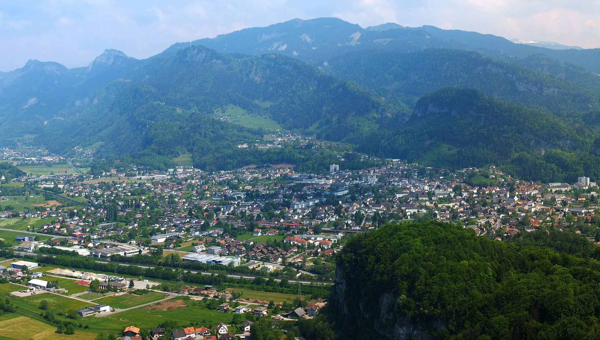
Trasy rowerowe wokół Aix-les-Bains
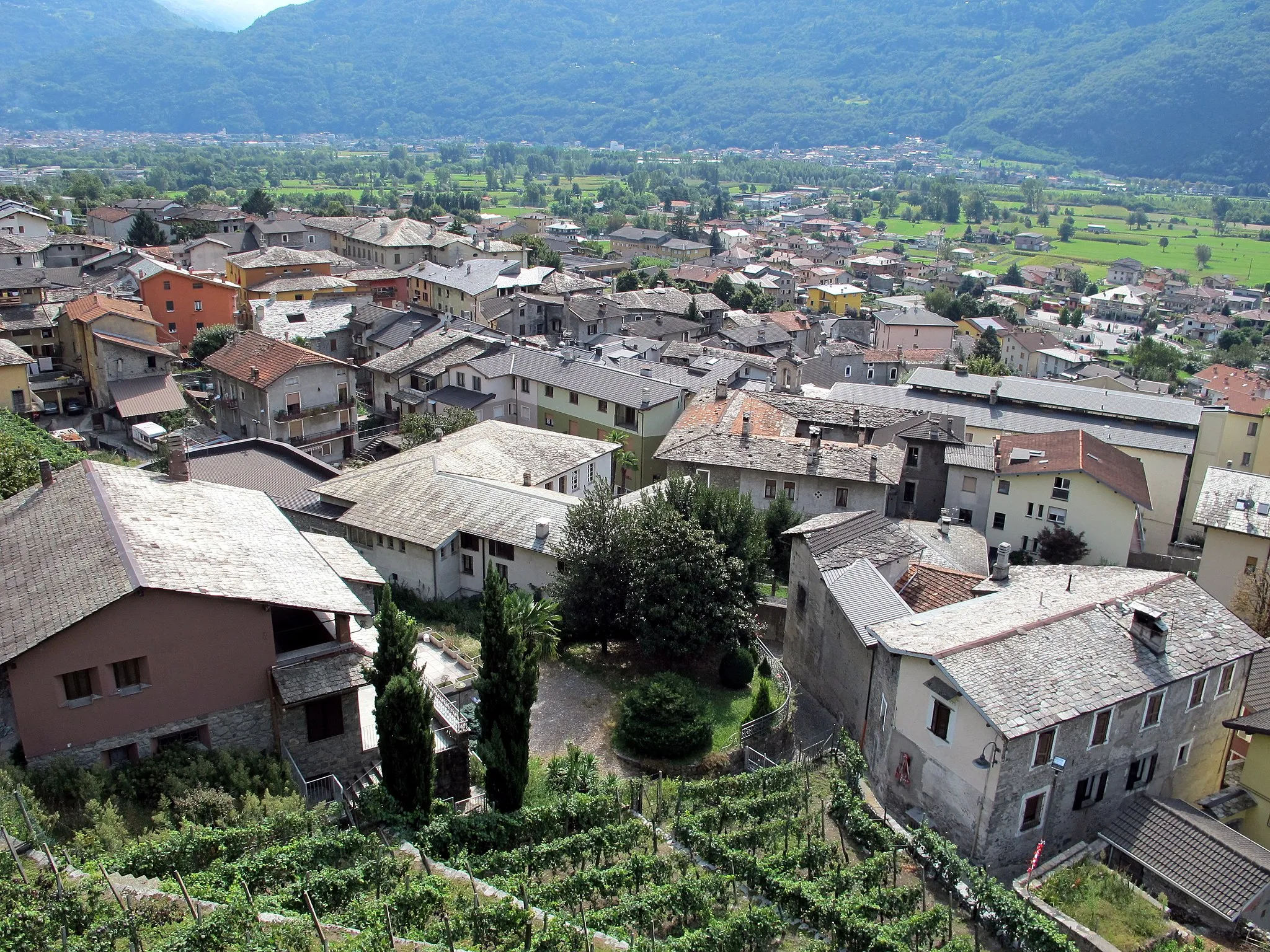
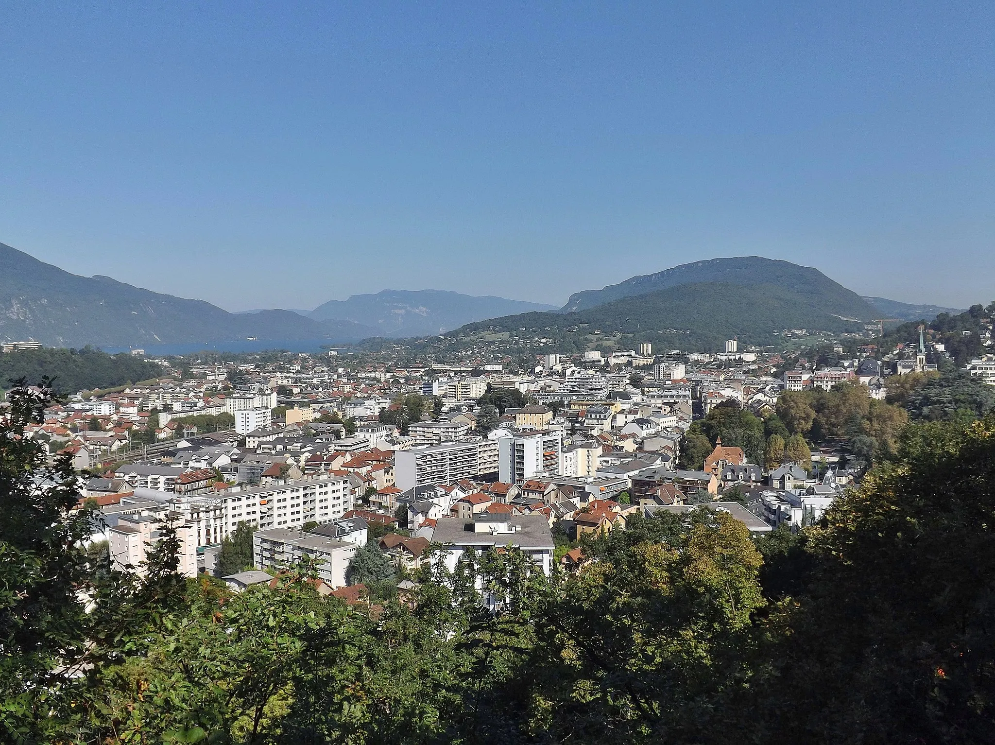
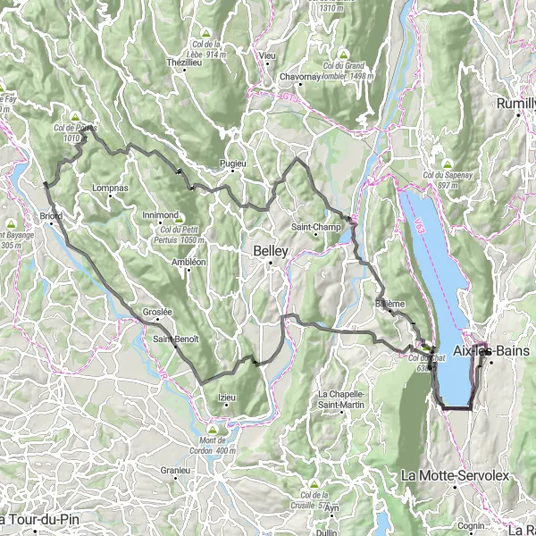
Aix-les-Bains to miejscowość położona w regionie Rodan-Alpy we Francji. Z perspektywy rowerzysty szosowego czy gravelowca, okolica oferuje wiele malowniczych tras o zróżnicowanym stopniu trudności. W pobliżu znajdują się znane podjazdy, które przyciągają miłośników kolarstwa z całego świata.
![Miniatura mapy "Trasa widokowa z Aix-les-Bains" - trasy rowerowej w Rhône-Alpes, France. Wygenerowane przez planer tras rowerowych Tarmacs.app](https://images.tarmacs.app/cycling-routes/routemaps/600/france/rhone-alpes/aix-les-bains/road/259878.webp)
Przejeżdżaj przez malownicze miejsca Rhône-Alpes
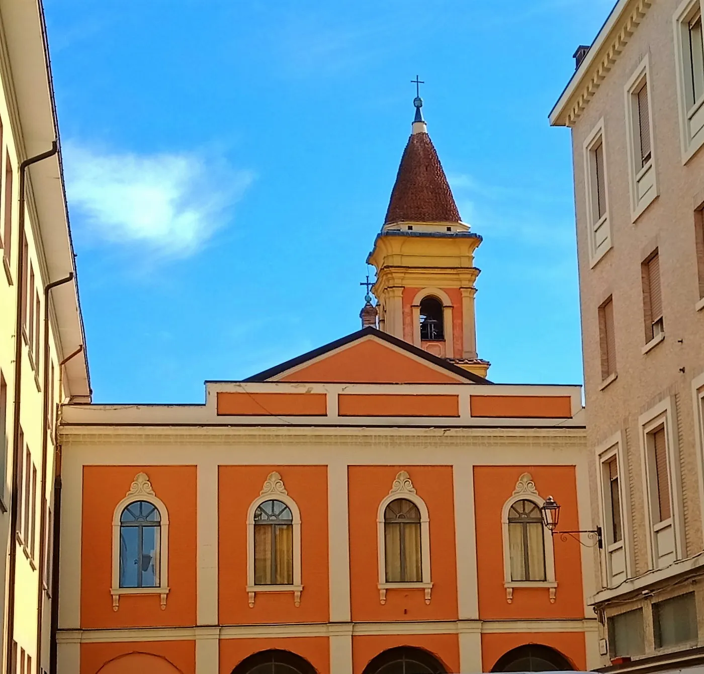
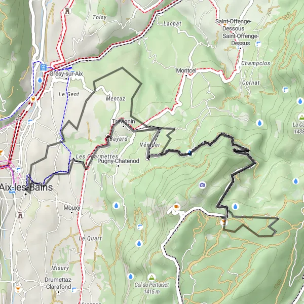
Twoja podróż rozpocznie się w Aix-les-Bains, a następnie poprowadzi przez urokliwe miejsca takie jak Belvédère de la Grande Molière, Roc du Cornillon i Col des Fosses. Na trasie znajdują się także inne ważne punkty, takie jak Palais épiscopal i Grand Hôtel. To niezwykła trasa z pięknymi widokami i różnorodnymi punktami do zwiedzania.
Challenging Ride to Arc de Campanus
![Miniatura mapy "Challenging Ride to Arc de Campanus" - trasy rowerowej w Rhône-Alpes, France. Wygenerowane przez planer tras rowerowych Tarmacs.app](https://images.tarmacs.app/cycling-routes/routemaps/600/france/rhone-alpes/aix-les-bains/road/259744.webp)
Embark on a thrilling road cycling adventure through the rolling hills and challenging climbs of the Rhône-Alpes region.
Prepare for a challenging ride through the scenic landscapes surrounding Aix-les-Bains. Conquer the demanding ascent to Col du Goléron and revel in the sense of accomplishment at the Arc de Campanus. Explore the charming villages of Frangy and Sallenôves, and soak in the beauty of the countryside. Don't miss the picturesque views from Belvédère and the reservoir de la Combe along the way.
Szybka trasa z Aix-les-Bains
![Miniatura mapy "Szybka trasa z Aix-les-Bains" - trasy rowerowej w Rhône-Alpes, France. Wygenerowane przez planer tras rowerowych Tarmacs.app](https://images.tarmacs.app/cycling-routes/routemaps/600/france/rhone-alpes/aix-les-bains/road/259748.webp)
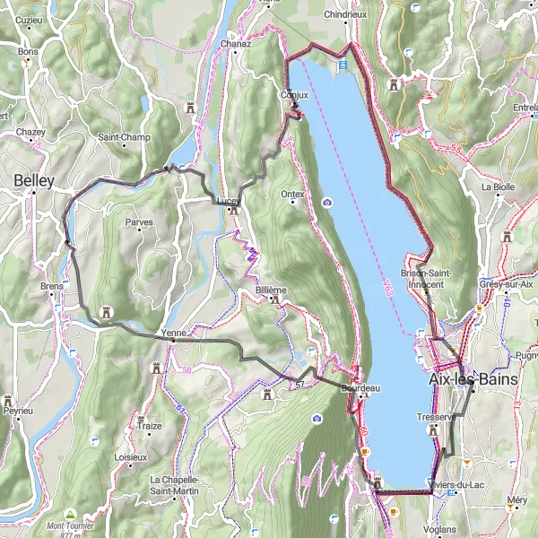
Przejeżdżaj przez urocze wsie i łąki
Ruszasz z Aix-les-Bains i przemierzasz malownicze miejsca jak Panorama, Yenne i Château de Lucey. Trasa prowadzi także przez Brison-Saint-Innocent i kończy się na Belvédère. To szybka i urozmaicona podróż dla każdego miłośnika rowerów.
![Miniatura mapy "Windy Road through Alpine Beauty" - trasy rowerowej w Rhône-Alpes, France. Wygenerowane przez planer tras rowerowych Tarmacs.app](https://images.tarmacs.app/cycling-routes/routemaps/600/france/rhone-alpes/aix-les-bains/road/259899.webp)
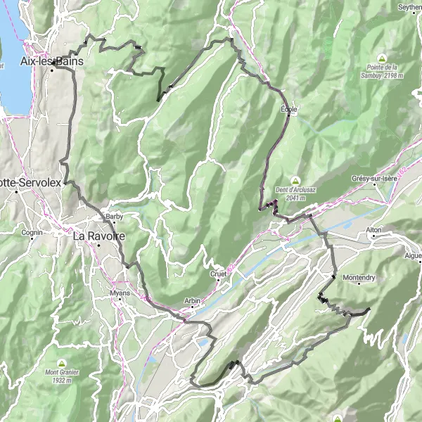
Discover the charm of the French Alps on this challenging road cycling route.
Embark on a thrilling journey through the picturesque landscapes surrounding Aix-les-Bains. Admire the stunning views as you tackle the demanding ascent to Col du Frêne and Mont Fauge. Make sure to take a break at the charming Chapelle de Saint-Saturnin and enjoy the panoramic vista from Belvédère du Bois Vidal. Conquer the challenging climbs and feel the rush of the descent on this unforgettable adventure.
![Miniatura mapy "Przejażdżka wokół Aix-les-Bains z widokiem na Arc de Campanus" - trasy rowerowej w Rhône-Alpes, France. Wygenerowane przez planer tras rowerowych Tarmacs.app](https://images.tarmacs.app/cycling-routes/routemaps/600/france/rhone-alpes/aix-les-bains/road/259757.webp)
Trasa oferuje wiele punktów widokowych i malowniczych miejsc
Ta trasa prowadzi przez wiele uroczych miejsc, takich jak Panorama czy Lavours, oferując rowerzystom wiele okazji do podziwiania krajobrazu. Arc de Campanus to jedno z najbardziej imponujących miejsc na trasie, które warto odwiedzić.
![Miniatura mapy "Scenic Route to Trévignin" - trasy rowerowej w Rhône-Alpes, France. Wygenerowane przez planer tras rowerowych Tarmacs.app](https://images.tarmacs.app/cycling-routes/routemaps/600/france/rhone-alpes/aix-les-bains/road/259817.webp)
Pedal through the rolling hills and charming villages of the Rhône-Alpes region on this scenic road cycling route.
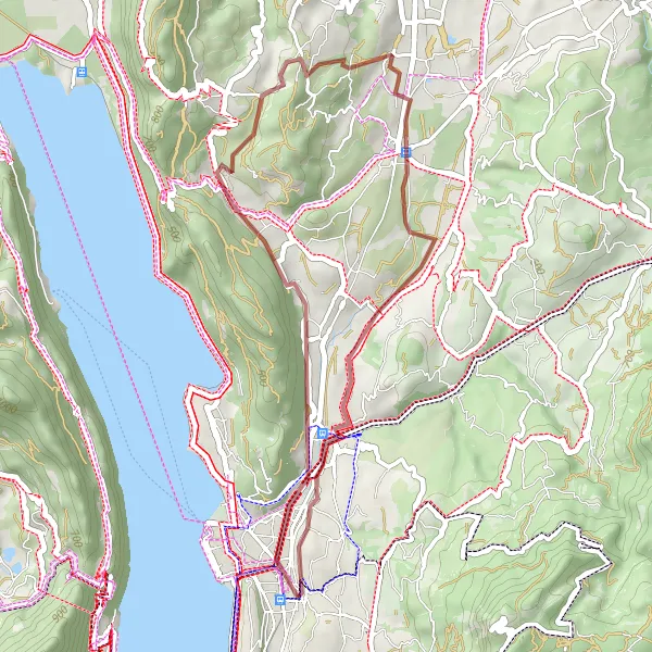
Embark on a leisurely ride through the idyllic countryside surrounding Aix-les-Bains. Enjoy the gentle ascent to La Tour de L'Angle Est and soak in the panoramic views from Belvédère. Discover the hidden gem of Trévignin and explore the vibrant town of Crolles. Conclude your journey at the picturesque Résidence Mirabeau and relax in its tranquil setting.
![Miniatura mapy "Trasa rowerowa z Aix-les-Bains przez Motz" - trasy rowerowej w Rhône-Alpes, France. Wygenerowane przez planer tras rowerowych Tarmacs.app](https://images.tarmacs.app/cycling-routes/routemaps/600/france/rhone-alpes/aix-les-bains/road/259742.webp)
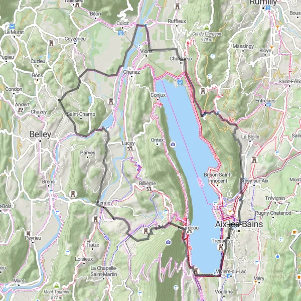
Przejażdżka z pięknymi widokami i uroczymi miejscowościami
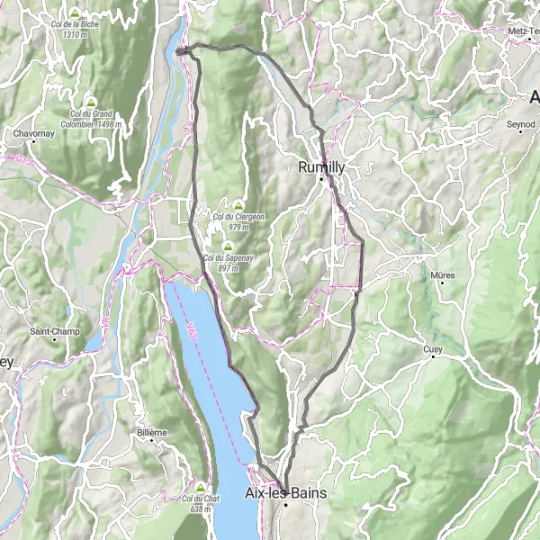
Ta trasa oferuje rowerzystom możliwość podziwiania pięknych widoków i odwiedzenia uroczych miejsc, takich jak Chindrieux czy Rumilly. Motz to kolejne urocze miasteczko na trasie, które warto odwiedzić.
![Miniatura mapy "Gravel Adventure to Arc de Campanus" - trasy rowerowej w Rhône-Alpes, France. Wygenerowane przez planer tras rowerowych Tarmacs.app](https://images.tarmacs.app/cycling-routes/routemaps/600/france/rhone-alpes/aix-les-bains/gravel/259734.webp)
Embark on an off-road cycling expedition through the rugged terrain and scenic vistas near Aix-les-Bains.
Embark on a thrilling gravel adventure through the picturesque landscapes of the Rhône-Alpes region. Challenge yourself with the rugged terrain as you pedal through Entrelacs and reach the stunning Arc de Campanus. Enjoy the peaceful serenity of Belvédère de Corsuet and take in the natural beauty of the surroundings. Immerse yourself in the raw beauty of nature on this unforgettable gravel cycling journey.
![Miniatura mapy "Trasa wokół Aix-les-Bains przez Col du Granier" - trasy rowerowej w Rhône-Alpes, France. Wygenerowane przez planer tras rowerowych Tarmacs.app](https://images.tarmacs.app/cycling-routes/routemaps/600/france/rhone-alpes/aix-les-bains/road/259775.webp)
Wspaniała trasa z pięknymi widokami i wymagającymi podjazdami
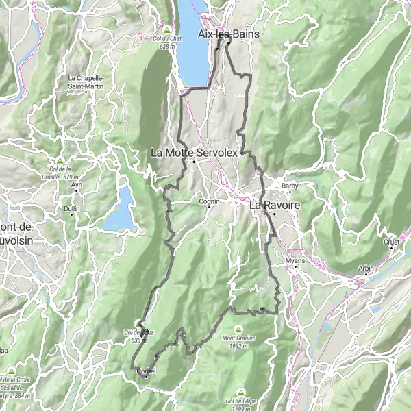
Trasa ta oferuje wiele wyzwań w postaci podjazdów, jednak nagradza rowerzystów malowniczymi widokami na trasie. Przejazd przez Col du Granier to prawdziwy punkt kulminacyjny, a Belvédère de la Grande Molière daje możliwość odpoczynku i podziwiania okolicy.
![Miniatura mapy "Wielka wycieczka rowerowa z Aix-les-Bains do Château de Tresserve" - trasy rowerowej w Rhône-Alpes, France. Wygenerowane przez planer tras rowerowych Tarmacs.app](https://images.tarmacs.app/cycling-routes/routemaps/600/france/rhone-alpes/aix-les-bains/road/259920.webp)
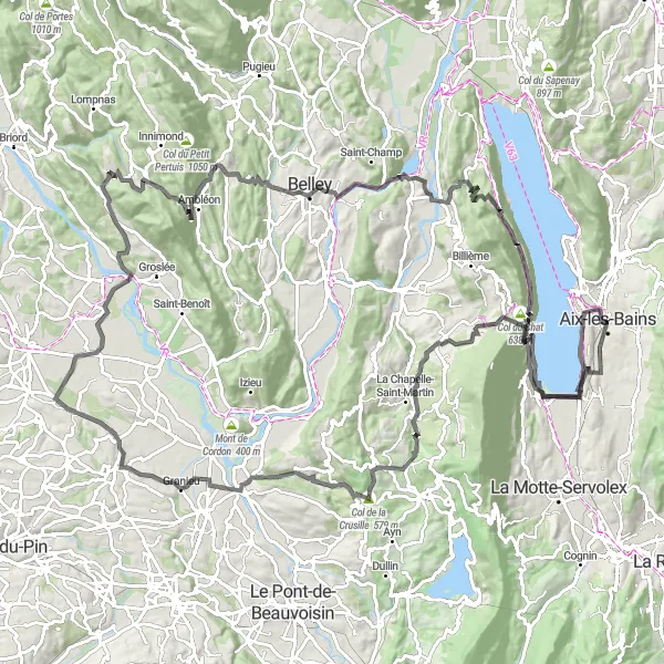
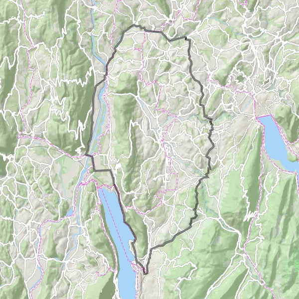
Długa trasa z wieloma punktami widokowymi i miejscami kulturowymi
Ta trasa oferuje rowerzystom możliwość przejechania długiego dystansu, podziwiania pięknych widoków i odwiedzenia interesujących miejsc, takich jak Bénonces czy Col du Chat. Château de Tresserve to historyczny zamek, który warto zobaczyć podczas wycieczki.
Trasy rowerowe w okolicy:
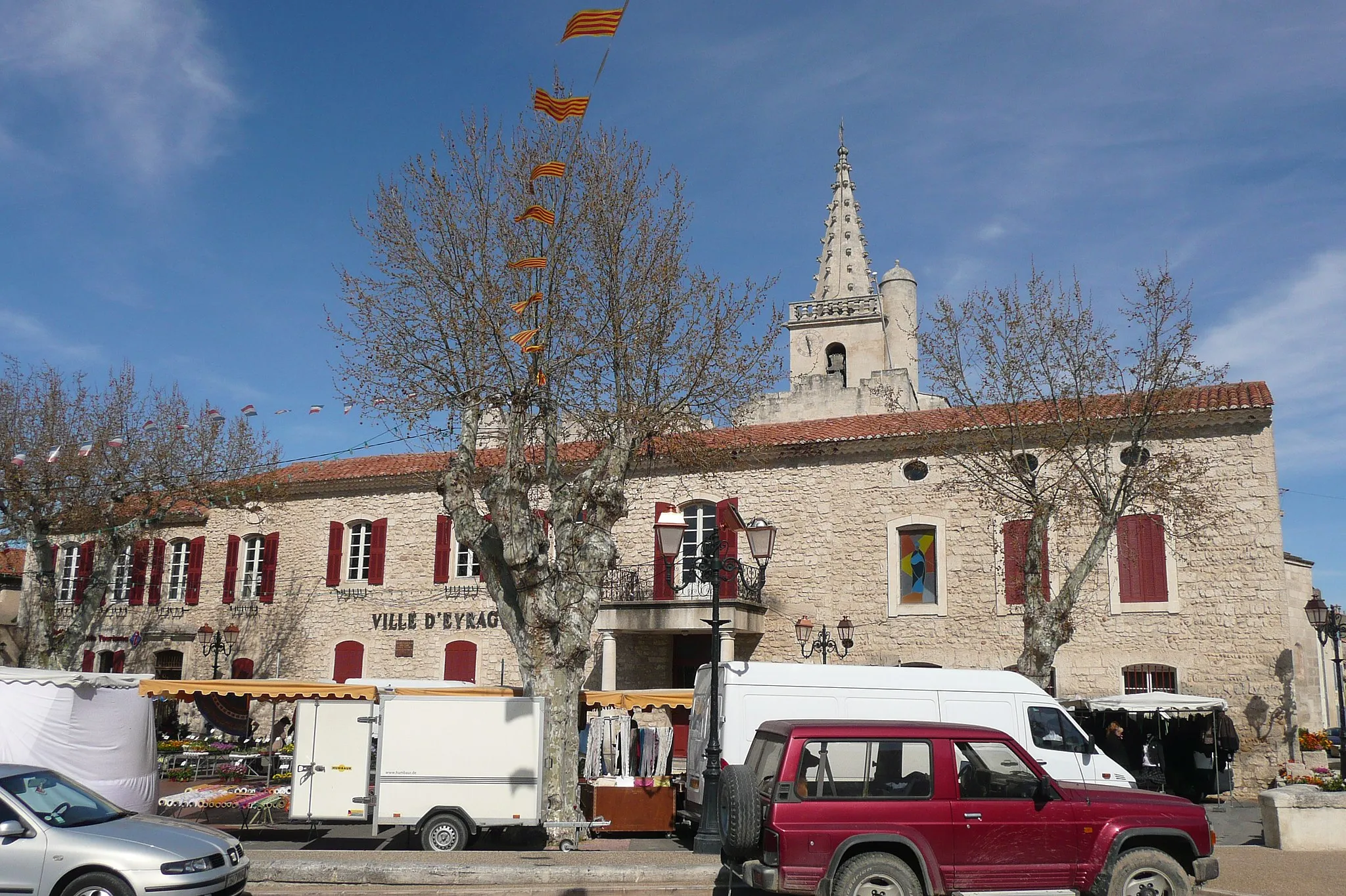
![Zdjęcie: Courmayeur](https://images.tarmacs.app/cycling-routes/covers/italy/valle-daosta-vallee-daoste/courmayeur-4.webp)
![Zdjęcie: Morgex](https://images.tarmacs.app/cycling-routes/covers/italy/valle-daosta-vallee-daoste/morgex-4.webp)
![Zdjęcie: Bardonecchia](https://images.tarmacs.app/cycling-routes/covers/italy/piemonte/bardonecchia-4.webp)
Sąsiednie regiony:
![Zdjęcie: Vorarlberg](https://images.tarmacs.app/cycling-routes/covers/austria/vorarlberg/goetzis-3.webp)
![Zdjęcie: Région lémanique](https://images.tarmacs.app/cycling-routes/covers/switzerland/region-lemanique/moudon-4.webp)
![Zdjęcie: Espace Mittelland](https://images.tarmacs.app/cycling-routes/covers/switzerland/espace-mittelland/uetendorf-3.webp)
![Zdjęcie: Katalonia](https://images.tarmacs.app/cycling-routes/covers/spain/cataluna/begur-2.webp)
![Zdjęcie: Bourgogne](https://images.tarmacs.app/cycling-routes/covers/france/bourgogne/couternon-3.webp)
![Zdjęcie: Franche-Comté](https://images.tarmacs.app/cycling-routes/covers/france/franche-comte/thise-2.webp)
![Zdjęcie: Languedoc-Roussillon](https://images.tarmacs.app/cycling-routes/covers/france/languedoc-roussillon/vergeze-5.webp)
![Zdjęcie: Midi-Pyrénées](https://images.tarmacs.app/cycling-routes/covers/france/midi-pyrenees/bouloc-5.webp)
![Zdjęcie: Auvergne](https://images.tarmacs.app/cycling-routes/covers/france/auvergne/beaumont-5.webp)
![Zdjęcie: Prowansja-Alpy-Lazurowe Wybrzeże](https://images.tarmacs.app/cycling-routes/covers/france/provence-alpes-cote-dazur/eyragues-4.webp)
![Zdjęcie: Piemont](https://images.tarmacs.app/cycling-routes/covers/italy/piemonte/nole-3.webp)
![Zdjęcie: Dolina Aosty](https://images.tarmacs.app/cycling-routes/covers/italy/valle-daosta-vallee-daoste/quart-5.webp)
![Zdjęcie: Liguria](https://images.tarmacs.app/cycling-routes/covers/italy/liguria/savona-4.webp)
![Zdjęcie: Lombardia](https://images.tarmacs.app/cycling-routes/covers/italy/lombardia/traona-5.webp)
![Zdjęcie: Emilia-Romania](https://images.tarmacs.app/cycling-routes/covers/italy/emilia-romagna/sassuolo-5.webp)