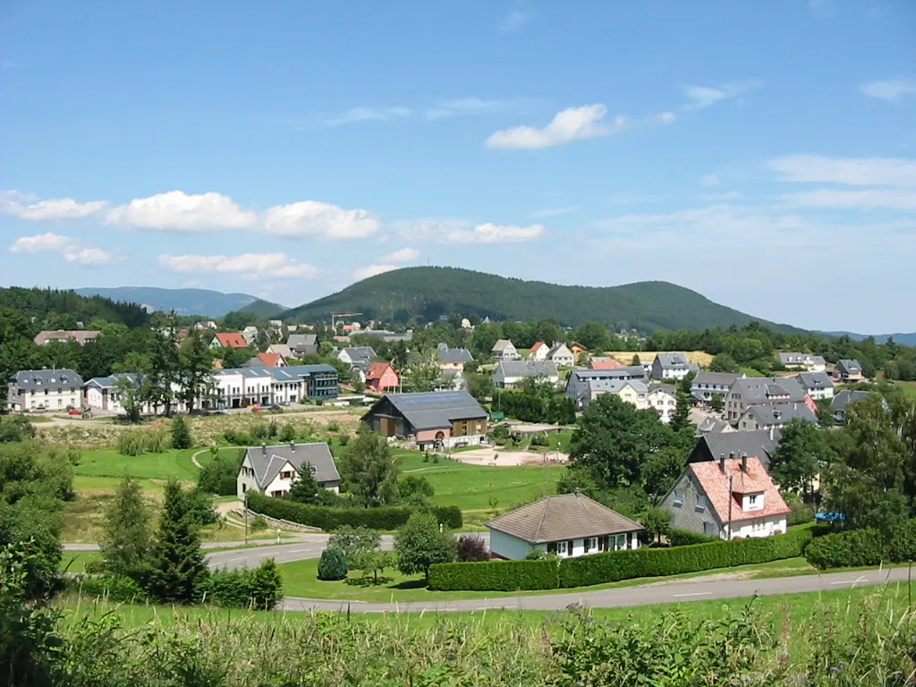
Cyclist's paradise with access to the iconic Route des Crêtes and stunning countryside roads.
Cycling routes from Labaroche
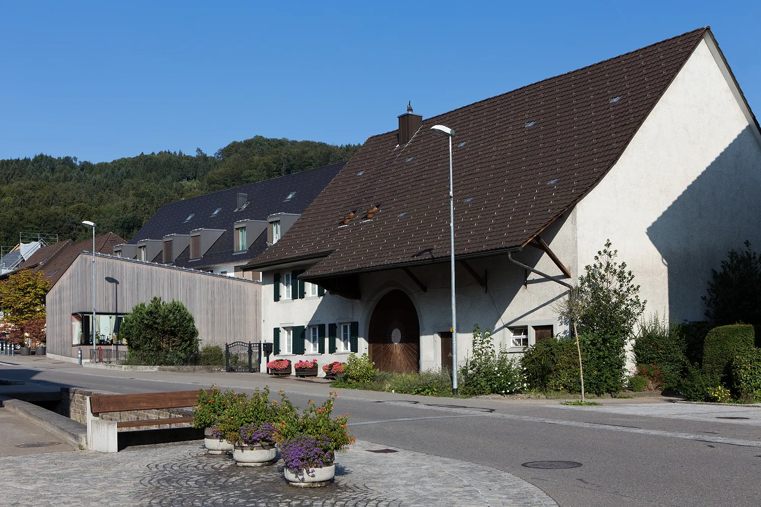
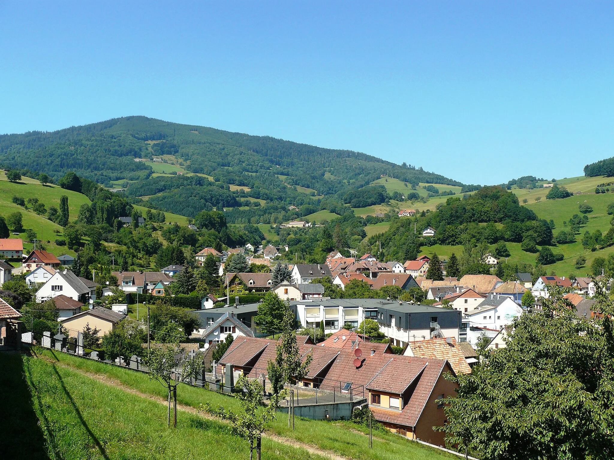
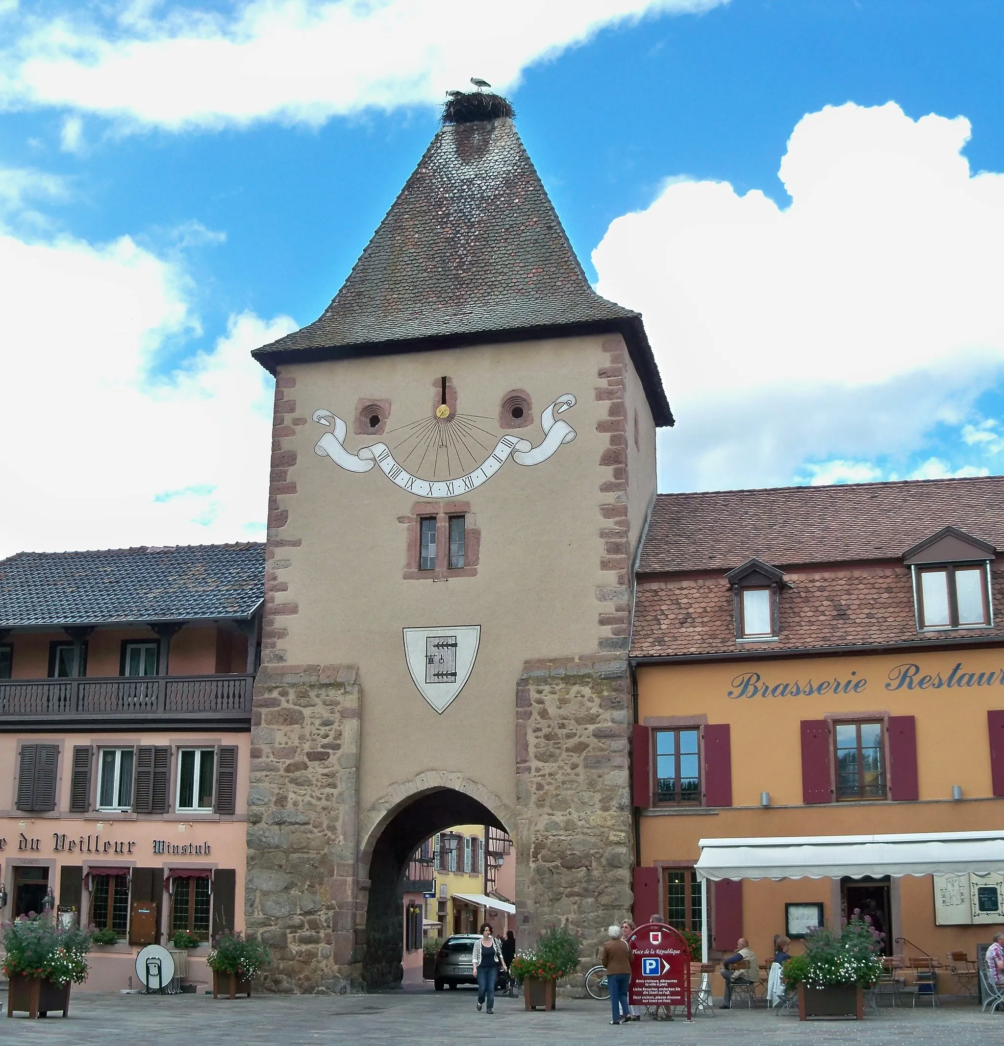
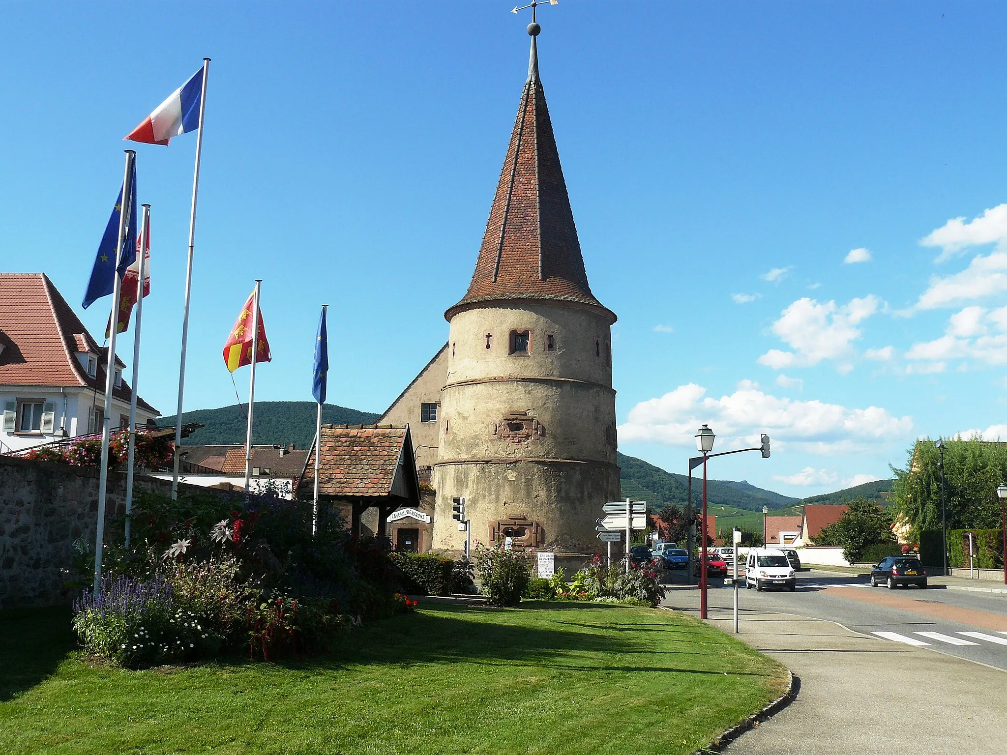
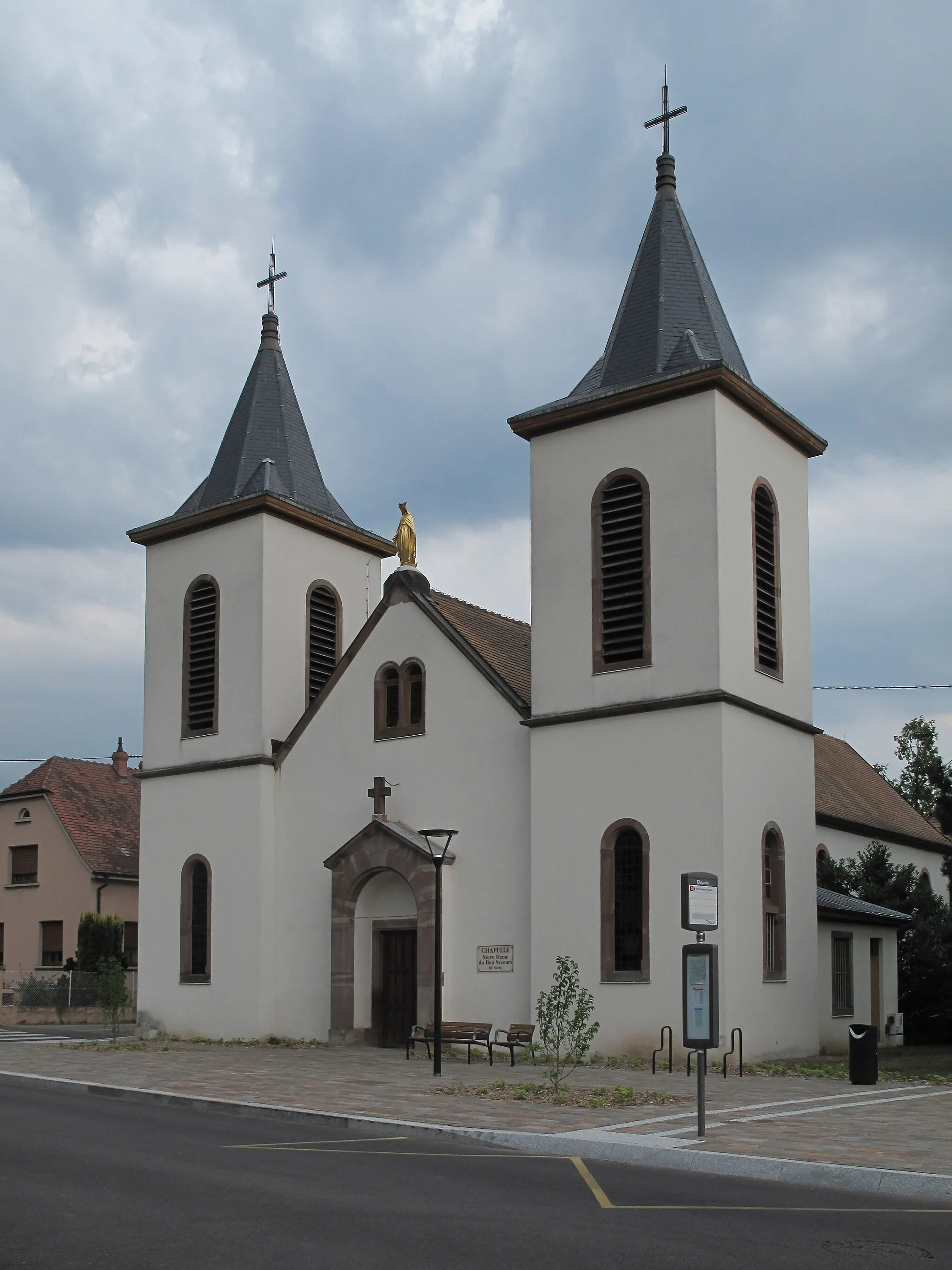
Labaroche is a charming locality situated in Alsace, France. As a road and gravel cyclist, you will appreciate the scenic countryside roads and beautiful landscapes around Labaroche. The terrain is mostly hilly, offering challenging climbs and thrilling descents. One well-known cycling spot nearby is the Route des Crêtes, a famous road that provides breathtaking views of the Vosges Mountains. Labaroche itself is not a major tourist destination, but it attracts cyclists looking for peaceful rides amid nature. Overall, it is a cyclist's paradise with stunning routes and access to the iconic Route des Crêtes.
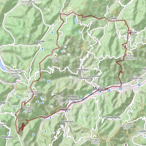
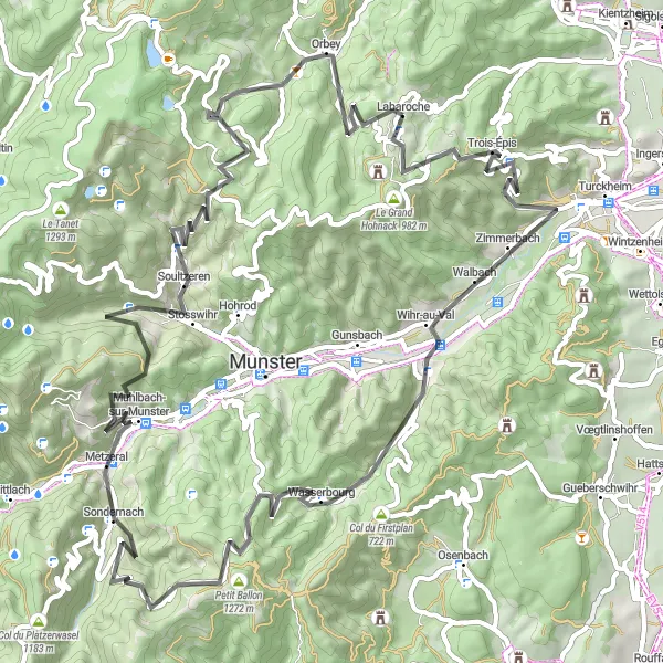
Experience the rugged beauty of the Vosges Mountains on this 72 km gravel route
Embark on an exciting gravel adventure exploring the rugged beauty of the Vosges Mountains. This 72 km route includes a challenging ascent of 1920m and takes you through picturesque villages and breathtaking landscapes. Highlights along the way include Labaroche, Le Grand Hohnack, Narrenstein, Metzeral, Abri du Neurod, Rainkopf, Col de la Schlucht, Cascade du Rudlin, Col du Calvaire, and Orbey. With a difficulty rating of 3 and an epicness rating of 3, this gravel route promises a thrilling experience for intermediate-level riders looking to push their limits and immerse themselves in the natural beauty of the Vosges Mountains.
Gravel adventure in Alsace
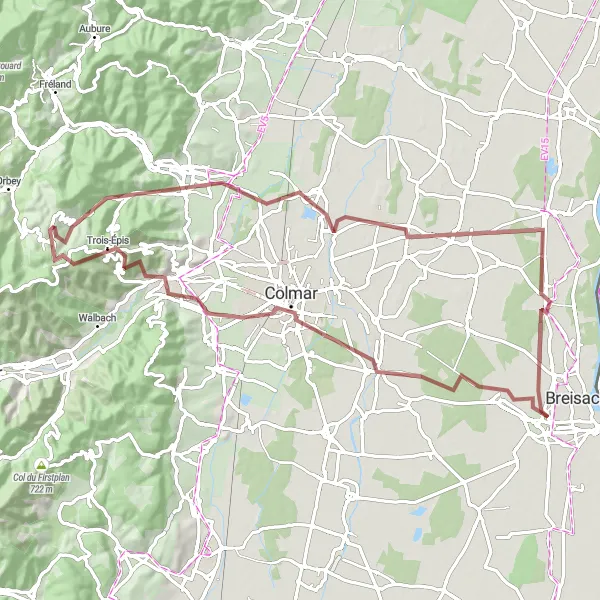
Embark on a gravel adventure through the picturesque countryside of Alsace
This gravel route offers a unique experience through the scenic landscapes of Alsace. With a distance of 78 kilometers and an ascent of 716 meters, it is suitable for gravel enthusiasts. The route starts near Labaroche and covers highlights such as Houssen, Kunheim, Quai de la Poissonerie, Colmar, Turckheim, and Le Grand Hohnack. The difficulty level is rated as a 3, making it accessible to well-trained amateurs. The epicness factor is a 3, with various charming spots to discover. Explore the charming villages, vineyards, and picturesque routes of Alsace while enjoying the thrill of gravel riding.
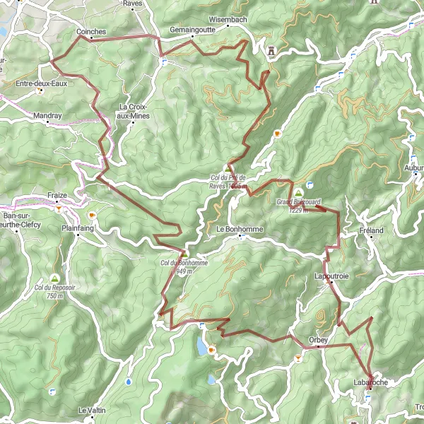
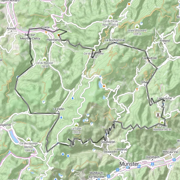
Embark on an adventurous journey through the unknown roads of Alsace
Enthusiast adventurers will love this gravel route that takes you through the lesser-known roads of Alsace. With a distance of 80 kilometers and an ascent of 2,582 meters, it is a challenging ride for gravel aficionados. The route starts near Labaroche and covers highlights such as Orbey, Col du Calvaire, La Séboue, Col des Journaux, Coinches, Les Cigales, Table d'orientation, and Lapoutroie. The difficulty level is rated as a 5, making it suitable for experienced gravel riders looking for a tough challenge. The epicness factor is a 4, with hidden gems and breathtaking viewpoints to discover. Brace yourself for an exciting journey through the unknown roads of Alsace.
Discover the beauty of Munster Valley on this 81 km road cycling route
Immerse yourself in the natural beauty of Munster Valley on this 81 km road cycling route. With a total climb of 2061m, this scenic ride will take you through charming villages and across rolling hills. Don't miss highlights such as Labaroche, Le Grand Hohnack, Walbach, Wasserbourg, Steinberg, Muhlbach-sur-Munster, Reichsackerkopf, Col du Wettstein, and Orbey. With a difficulty rating of 2 and an epicness rating of 3, this route offers a delightful mix of challenging climbs and breathtaking scenery. Experience the charm of Munster Valley as you pedal through villages with half-timbered houses and along winding roads surrounded by lush greenery.
Scenic cycling route through the beautiful landscapes of Labaroche
Experience stunning scenery and challenging ascents on this road cycling route in Labaroche, Alsace. The route is 85 kilometers long with a total ascent of 1986 meters. Cyclists can expect to pass through a number of highlights, including Château du Hohnack, Le Grand Hohnack, Soultzeren, Col de la Schlucht, Roche de boslimpre, Ban-sur-Meurthe-Clefcy, Col du Bonhomme, Le Bonhomme, and Orbey.
Scenic Road Cycling in Alsace

Explore the beauty of Alsace through rolling hills and charming villages
Take in the enchanting landscapes of Alsace on this 108 km road cycling route. With a total ascent of 2345m, this road adventure will test your endurance. Starting in Labaroche, pedal through picturesque villages and enjoy magnificent views of the surrounding countryside. Highlights along the way include Labaroche, Col du Wettstein, Col du Calvaire, Fraize, Col du Plafond, Corcieux, Taintrux, Pierre de Laître, Mandray, Table d'orientation, and Lapoutroie. With a difficulty rating of 3 and an epicness rating of 3, this scenic road cycling route is perfect for intermediate riders looking to explore the beauty of Alsace at their own pace.

Breathtaking gravel ride with stunning views
Embark on a thrilling gravel adventure through the picturesque Vosges Mountains. This 106 km route is not for the faint-hearted, with a challenging ascent of 3111m. Experience the natural beauty of Alsace as you pedal through enchanting villages and enjoy sweeping vistas. The route takes you past highlights such as Le Grand Hohnack, Luttenbach-près-Munster, Mittlach, Rainkopf, La Bresse, Col de Grosse Pierre, Xonrupt-Longemer, Col du Surceneux, Le Valtin, and Col du Calvaire. With a difficulty rating of 4 and an epicness rating of 4, this gravel adventure promises an exhilarating experience you won't forget.
Scenic road tour of Alsace
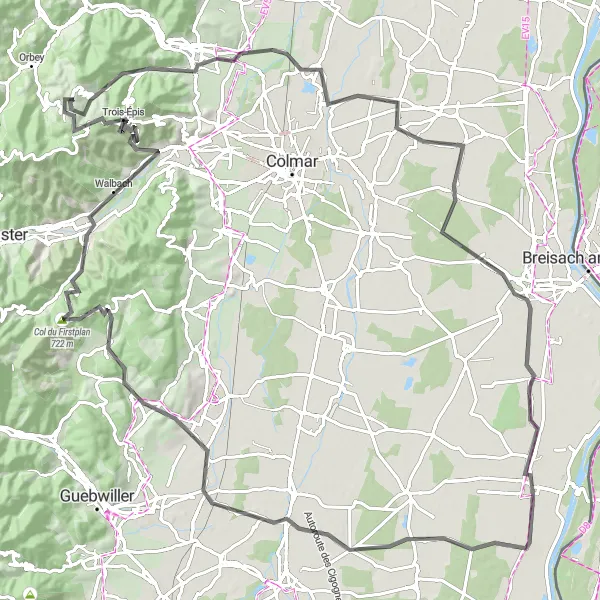
Indulge in a scenic road tour of Alsace's picturesque routes and charming villages
Experience the beauty of Alsace on this scenic road tour through charming villages and picturesque routes. Covering a distance of 120 kilometers and ascending 1,166 meters, it is a longer but relatively easier ride suitable for road cyclists. The route starts near Labaroche and includes highlights such as Houssen, Bischwihr, Heiteren, Réguisheim, Table d'orientation, Soultzmatt, Col du Firstplan, Walbach, Trois-Épis, and Le Grand Hohnack. The difficulty level is rated as 2, making it suitable for well-trained amateurs. The epicness factor is a 3, with various charming spots to explore. Immerse yourself in the scenic beauty of Alsace and indulge in its rich culture and history on this exceptional road tour.
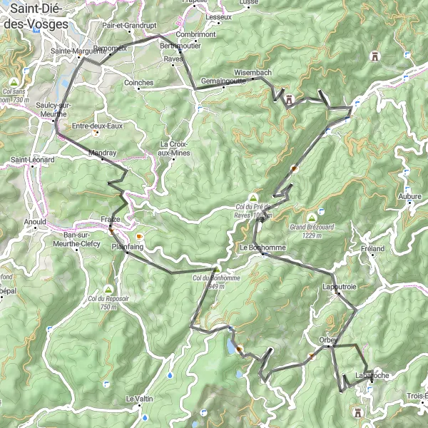
Ride through the rolling hills of the Vosges Mountains
This route takes you on a grand tour of the Vosges Mountains, offering a scenic and challenging ride. With a total distance of 96 kilometers and an ascent of 2,366 meters, it is suitable for experienced cyclists. The route starts near Labaroche and covers highlights such as Col du Calvaire, Fraize, Col de Mandray, Ban-de-Laveline, Sainte-Marie-aux-Mines, Table d'orientation, and Lapoutroie. The difficulty level is rated as a 4 out of 5, making it perfect for well-trained amateurs. The epicness factor is also a 4, with several noteworthy and picturesque spots along the way. Enjoy the stunning natural beauty of the Vosges Mountains and test your cycling skills on this challenging route.

Uncover the hidden gems of the Vosges Mountains on this gravel cycling adventure
Discover the hidden gems of the Vosges Mountains on this thrilling gravel cycling route. Covering a distance of 67 kilometers and ascending 2,353 meters, it is a challenging ride for gravel enthusiasts. The route starts near Labaroche and takes you through highlights such as Orbey, Col de Chamont, Hirzberg, Sainte-Croix-aux-Mines, Spitzenberg, Riquewihr, and Ammerschwihr. The difficulty level is rated as a 4, making it suitable for experienced gravel riders. The epicness factor is a 4, with stunning landscapes and charming villages to explore. Immerse yourself in the natural beauty of the Vosges Mountains and uncover its hidden treasures on this adventurous route.
Cycling routes nearby:


Nearby regions: