Cycling through scenic Bretagne
Cycling routes from Saint-Gregoire
Saint-Grégoire is a locality located in the Bretagne region of France. From a cyclist's perspective, Saint-Grégoire provides a mix of road and gravel cycling routes amidst the beautiful Bretagne landscape. Cyclists can enjoy peaceful rides through scenic countryside or explore local attractions such as the Mont-Saint-Michel. A notable cycling spot near Saint-Grégoire is the Mur-de-Bretagne climb, which offers a challenging ascent. In conclusion, Saint-Grégoire is a recommended destination for cyclists looking to indulge in both outdoor adventure and cultural exploration.
Gravel Trails of Saint-Grégoire
Cycle through enchanting gravel trails surrounding Saint-Grégoire and get lost in the tranquility
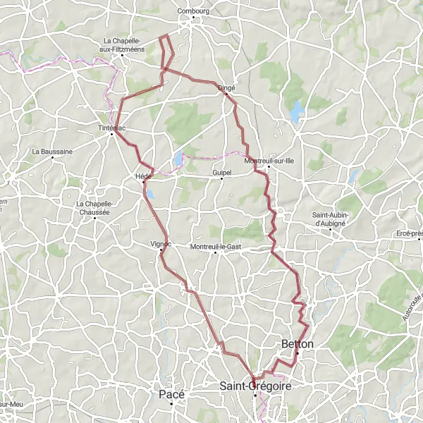
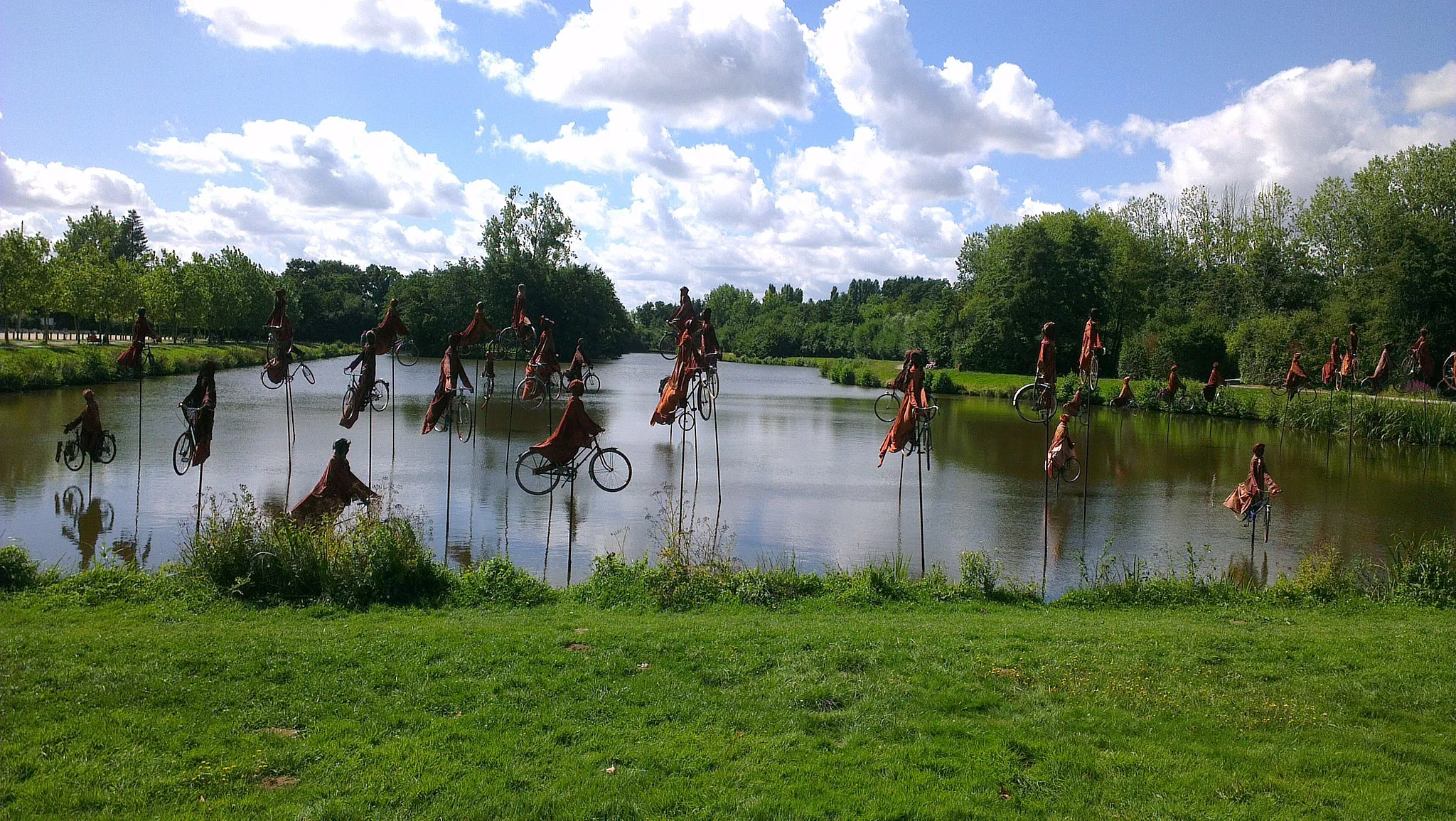
Explore the rustic beauty of Bretagne on this picturesque 79-kilometer gravel cycling route, featuring 365 meters of elevation. Experience the charm of off-road cycling as you traverse through scenic highlights that offer a taste of traditional French countryside life.

Embark on a thrilling road cycling adventure around Saint-Grégoire and uncover breathtaking landscapes
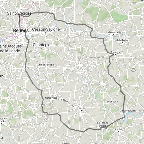
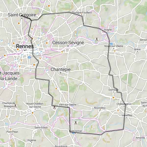
Unleash the road cyclist within you with this picturesque 72-kilometer route, featuring 469 meters of challenging elevation. Along the way, discover charming towns and captivating highlights that showcase the beauty of Bretagne.
Embark on a scenic road cycling journey around Saint-Grégoire and revel in the breathtaking panoramas
Immerse yourself in the beauty of Bretagne as you tackle this picturesque 97-kilometer road cycling route with a challenging total ascent of 644 meters. Along the way, marvel at stunning highlights and soak in the region's natural and cultural treasures.

A scenic 28 km gravel loop around Betton and Thorigné-Fouillard
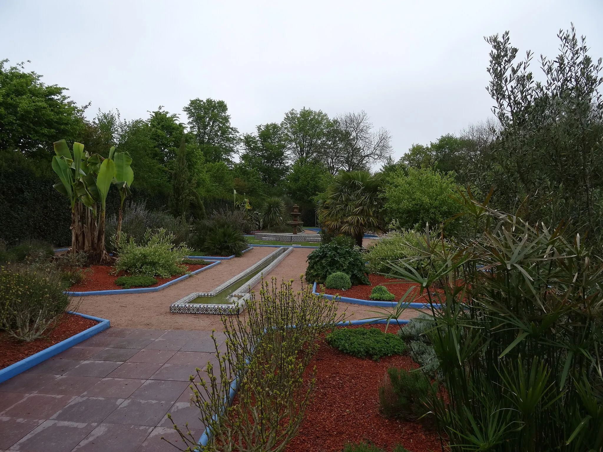
Discover the beauty of Brittany on this 28 km gravel route that takes you on a scenic loop around Betton and Thorigné-Fouillard. With a gentle ascent of 158m, this route is perfect for a leisurely ride through the picturesque countryside. Explore the charming town of Betton, known for its beautiful gardens and parks. Pedal through Thorigné-Fouillard, a vibrant commune with a rich history. Don't miss Maurepas, a scenic village with stunning views of the surrounding landscapes.

Discover the picturesque villages of the Ille-et-Vilaine region
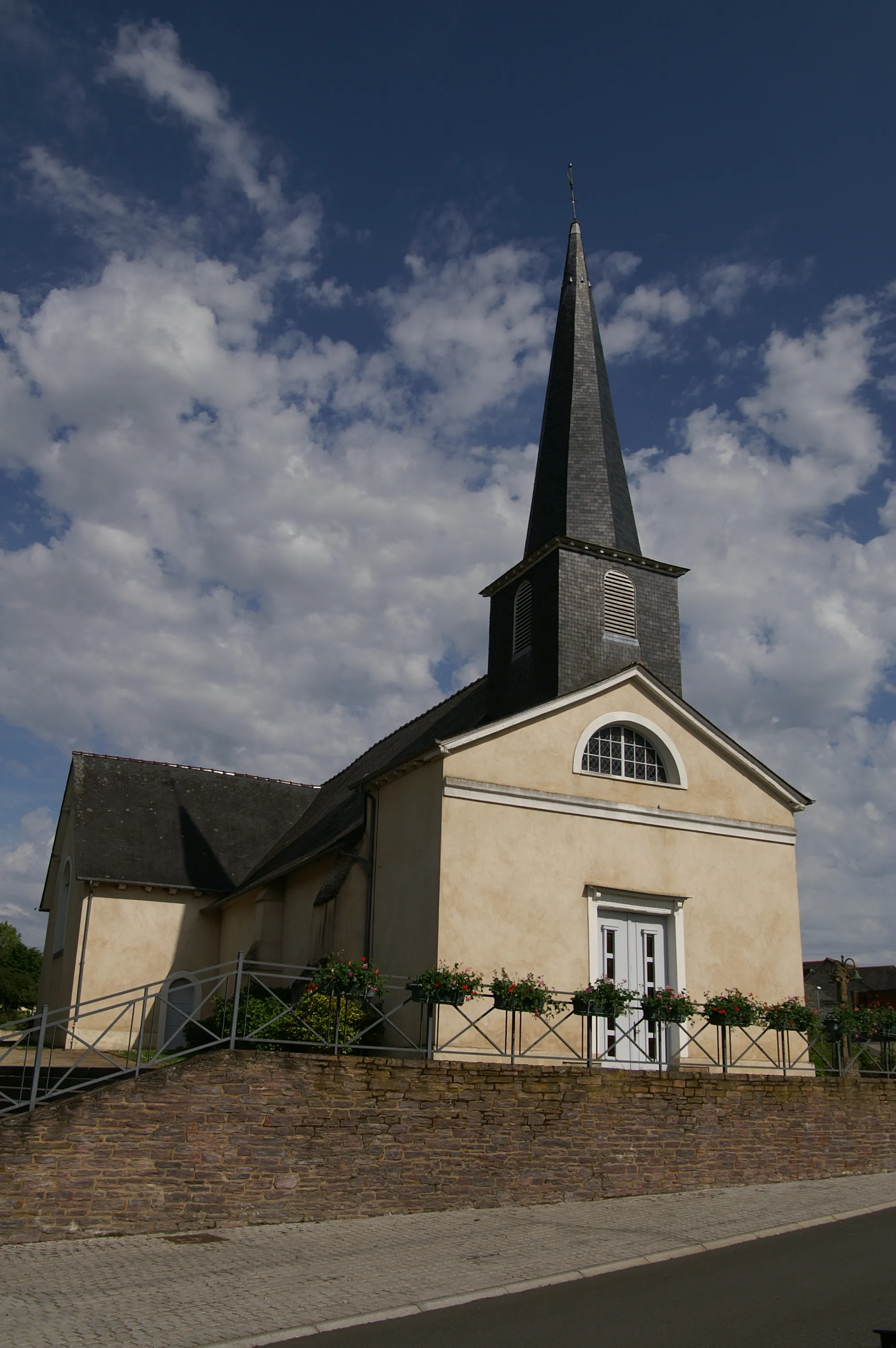
This road cycling route showcases the beauty of the small picturesque villages in the Ille-et-Vilaine region. With a distance of 57 km and an ascent of 434 m, it is suitable for intermediate cyclists. Immerse yourself in the authentic charm of Bretagne as you pass through these scenic villages.

Venture through the gravel roads and rolling countryside surrounding Saint-Grégoire
Experience the best of rural Bretagne on this challenging yet rewarding gravel cycling route. Ascend a total of 598 meters over a distance of 105 kilometers, as you discover picturesque highlights along the way.
Rennes and Beyond

Explore Rennes and its surroundings on this road cycling route
This road cycling route takes you on a journey through the charming town of Rennes and its surrounding areas. With a distance of 68 km and an ascent of 426 m, it is suitable for well-trained amateurs. The route provides a mix of urban riding through Rennes and scenic countryside roads.
Embark on a scenic road cycling loop to Châteaugiron
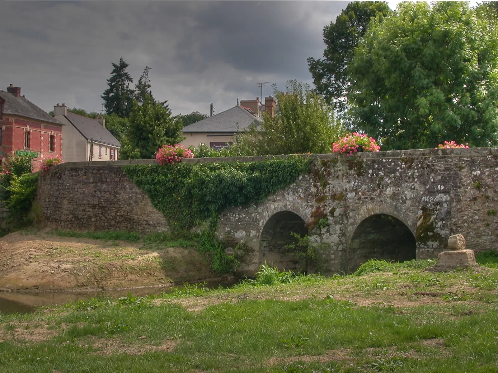
This road cycling route takes you on a scenic loop to the historic town of Châteaugiron. With a distance of 57 km and an ascent of 383 m, it is suitable for moderate-level cyclists. Experience the charm of rural Bretagne as you pedal through picturesque landscapes.
A challenging 89 km road route exploring the stunning landscapes around Melesse
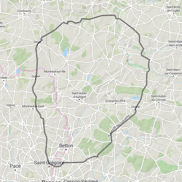
Embark on a challenging road cycling adventure through the breathtaking landscapes surrounding Melesse. This 89 km route offers a thrilling experience with a significant ascent of 662m, ideal for well-trained amateurs seeking an exhilarating ride. Ride through Melesse and Dingé, enjoying the picturesque countryside and charming villages along the way. Don't miss the medieval town of Rimou and the tranquil village of Saint-Ouen-des-Alleux. Explore Liffré and Thorigné-Fouillard before reaching Le Bas de la Lande, a lovely rural location to conclude your journey.
Nature and Gravel

Immerse yourself in nature on this gravel cycling route
Escape into nature on this gravel cycling route through Bretagne's rural landscapes. With a distance of 86 km and an ascent of 431 m, it is a challenging but rewarding journey for experienced cyclists. Discover scenic natural highlights and charming villages along the way.
Cycling routes nearby:
Nearby regions: