Cycling paradise in Pays-de-la-Loire
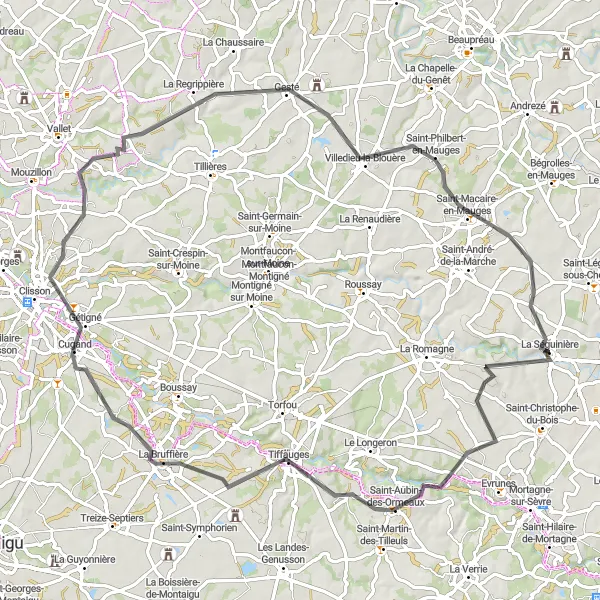
Cycling routes from La Seguiniere
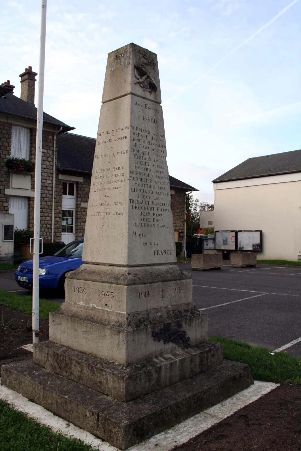
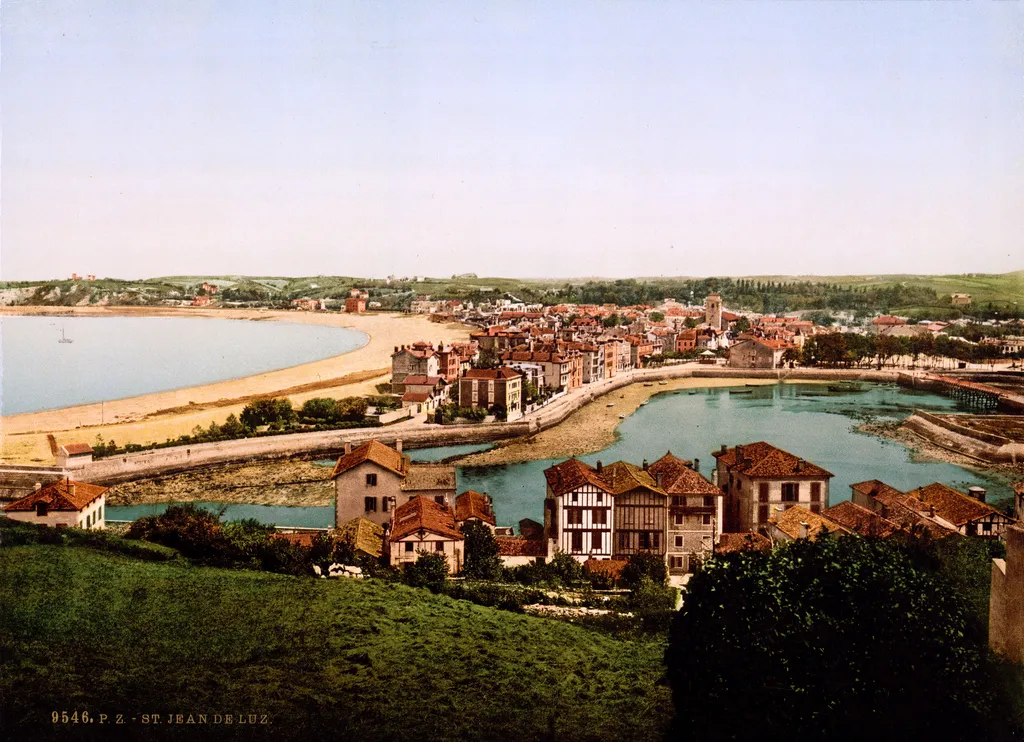
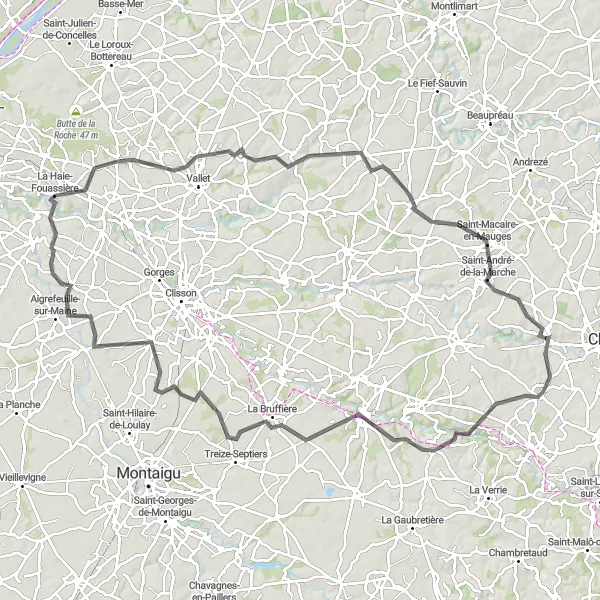
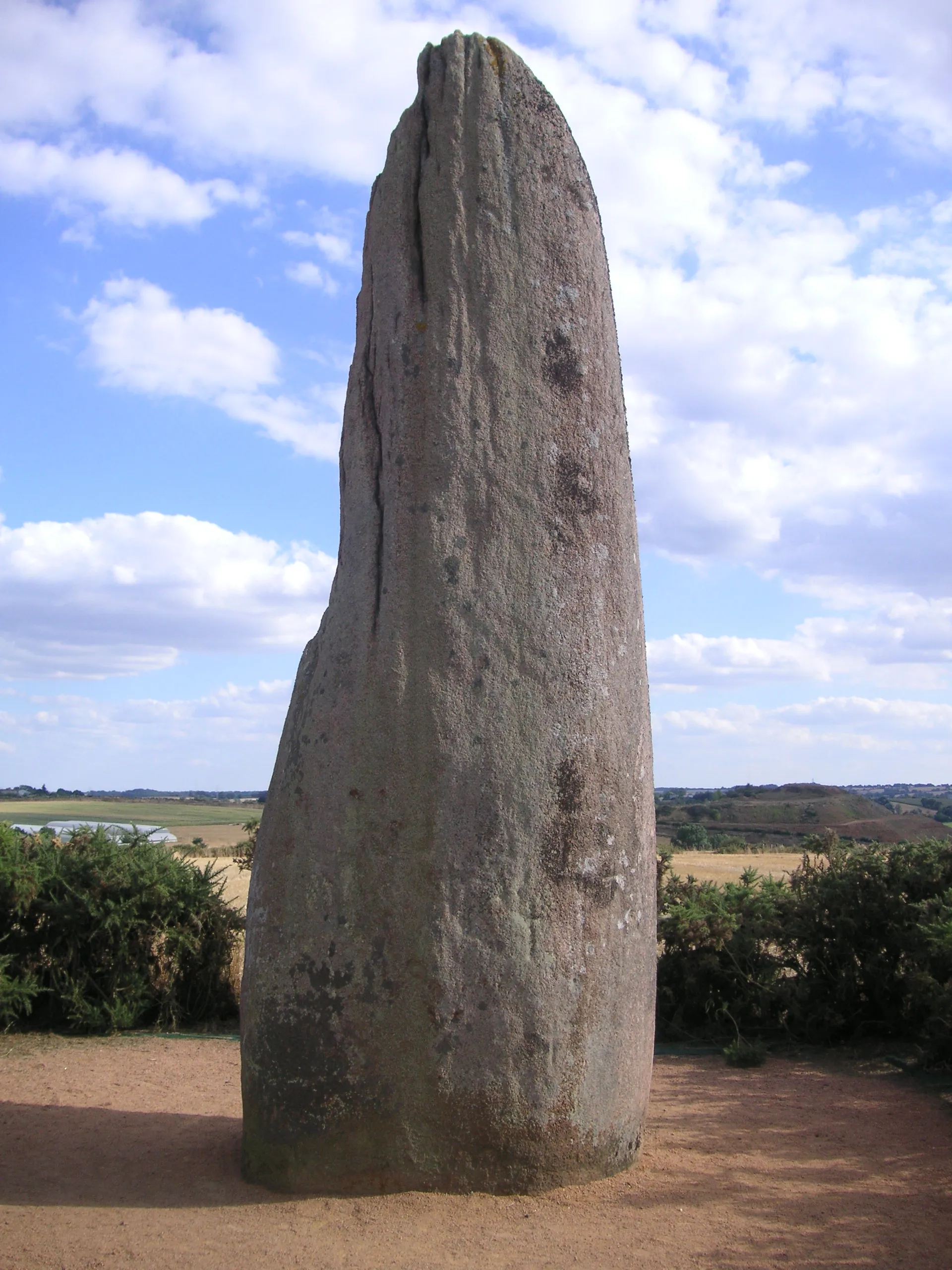
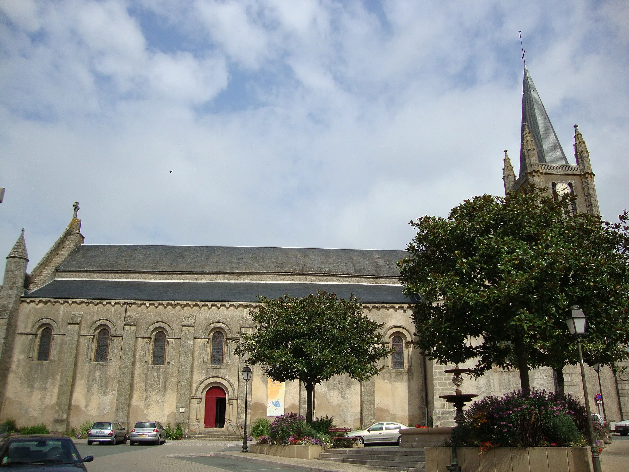
La Séguinière is a locality in the Pays-de-la-Loire region of France. From a cyclist's perspective, the area offers both road and gravel cycling opportunities. The town is surrounded by picturesque countryside, with quiet country roads perfect for exploring on two wheels. Nearby, cyclists can visit the Loire River and its beautiful cycling paths. La Séguinière is also known for its proximity to the town of Cholet, which hosts the famous Cholet-Pays de la Loire cycling race. With its cycling-friendly roads and scenic landscapes, La Séguinière is a great destination for cyclists of all levels.
Discover the natural beauty and historical charm of Villedieu-la-Blouère.
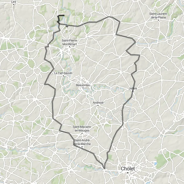
Immerse yourself in the history and natural beauty of Villedieu-la-Blouère with this road cycling route near La Séguinière. With an ascent of 755 meters and a distance of 96 kilometers, it offers a challenge suitable for well-trained amateurs. Along the way, you will pass through Saint-Rémy-en-Mauges, Site de Courossé, and Botz-en-Mauges before reaching Saint-Quentin-en- Mauges and Jallais. The route also takes you through the charming village of Le May-sur-Èvre, known for its scenic landscapes and historical sites. Immerse yourself in the local culture and explore the beauty of this hidden gem. Suitable for road bikes, this route offers a unique blend of history, nature, and cycling.
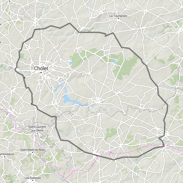
La Séguinière Grand Tour
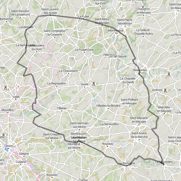
Discover the charming landscapes and historical towns on this road cycling route from La Séguinière
Embark on a memorable journey as you cycle through picturesque landscapes, charming towns, and historical landmarks on the La Séguinière Grand Tour. This road cycling route offers a perfect mix of both natural beauty and cultural richness. With a total distance of 93 kilometers and an ascent of 743 meters, this route promises a challenging yet rewarding experience for well-trained amateur cyclists. Explore stunning highlights that include the historic towns of Montfaucon-Montigné, Saint-Laurent-des-Autels, Saint-Rémy-en-Mauges, and Beaupréau.
Explore the enchanting countryside and traditional villages of Pays de la Loire on this cycling adventure.
Experience the charm and tranquility of the Pays de la Loire countryside on this road cycling route starting from La Séguinière. Covering a distance of 89 kilometers with an ascent of 649 meters, this route is suitable for intermediate-level cyclists. Pedal through idyllic landscapes, passing by picturesque villages, old chapels, and rolling farmlands. Immerse yourself in the region's rich history, cultural heritage, and stunning natural scenery as you explore Les Landes-Genusson, Montaigu, and other captivating villages along the way.
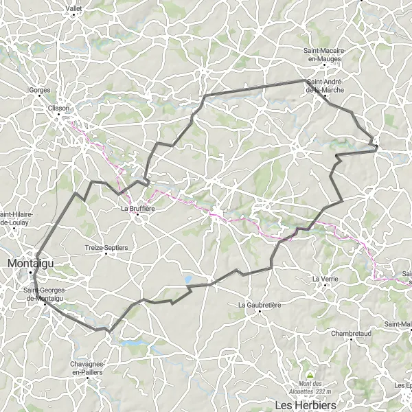
Cugand Loop
Pedal through the scenic countryside and picturesque villages of Cugand.
Experience the beauty of rural France with this road cycling route starting near La Séguinière. With an ascent of 640 meters and a distance of 83 kilometers, it offers a moderate challenge for well-trained amateurs. Along the way, you will pass through Cugand and La Regrippière before reaching Saint-Philbert-en-Mauges. Take in the breathtaking landscapes and enjoy the peaceful atmosphere of the countryside. Suitable for road bikes, this route provides a perfect opportunity to discover the hidden gems and natural beauty of the region.
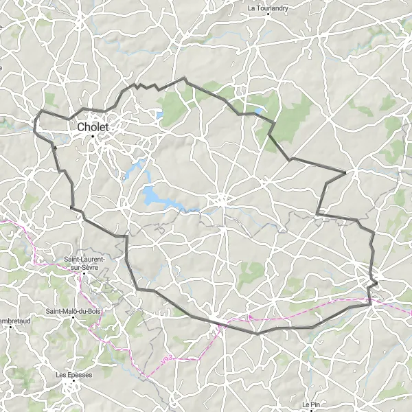
Discover the charm of Pays de la Loire on this challenging cycling route.
This round-trip cycling route starting from La Séguinière allows you to experience the picturesque countryside and charming towns of Pays de la Loire. With a total distance of 92 kilometers and an ascent of 701 meters, this route is suitable for well-trained amateur cyclists. The landscape varies from rolling hills to quaint villages and historical landmarks, providing a truly immersive and memorable journey. The route showcases the region's rural beauty and offers glimpses into its rich history and culture.
Embark on a scenic journey through the peaceful countryside surrounding La Séguinière.
Escape the hustle and bustle of city life and immerse yourself in the tranquility of the countryside on this road cycling route starting from La Séguinière. With a total distance of 91 kilometers and an ascent of 556 meters, this route offers a moderate challenge for cyclists of all levels. Enjoy the picturesque landscapes of rolling hills, quaint villages, and lush green fields as you pedal through Les Poteries, Somloire, and other charming rural areas. This route provides a peaceful and rejuvenating experience, allowing you to connect with nature and discover the hidden gems of Pays de la Loire.
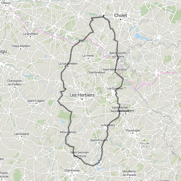
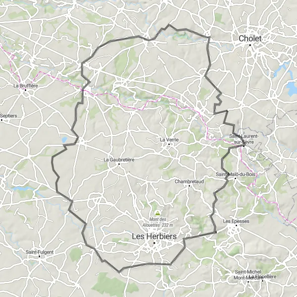
Cycle through Saint-Laurent-sur-Sèvre and discover its historic treasures.
Embark on a scenic adventure through the historic town of Saint-Laurent-sur-Sèvre with this road cycling route near La Séguinière. With an ascent of 955 meters and a distance of 112 kilometers, it offers a challenge suitable for well-trained amateurs. Along the way, you will pass through Les Epesses and Mont Mercure before reaching Saint-Germain-de-Prinçay and Mesnard-la-Barotière. The route also takes you through Beaurepaire and Saint-Aubin-des-Ormeaux, two charming villages with their own unique charms. Explore the rich history and cultural heritage of this region while enjoying the beautiful landscapes it has to offer. Suitable for road bikes, this route provides a perfect mix of history, nature, and cycling.
Nuaillé Loop
Discover the charming town of Nuaillé along this scenic cycling route.
This road cycling route starting from La Séguinière will take you through picturesque landscapes and historical sites. With an ascent of 506 meters and a distance of 88 kilometers, it offers a moderate challenge for well-trained amateurs. Along the way, you will pass through Les Cerqueux and Nueil-les-Aubiers before reaching the impressive Château de Mauléon. The route is suitable for road bikes and provides a great opportunity to explore the beautiful Pays de la Loire region.
Le May-sur-Èvre Circuit
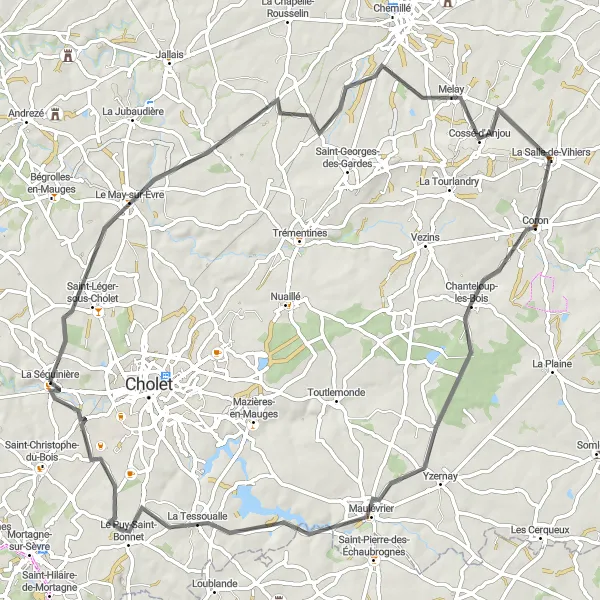
Embark on a scenic adventure through Le May-sur-Èvre.
Experience the natural beauty of the Le May-sur-Èvre region with this road cycling route starting near La Séguinière. With an ascent of 490 meters and a distance of 81 kilometers, it offers a moderate challenge for well-trained amateurs. Along the way, you will pass through Cossé-d'Anjou and Chanteloup-les-Bois before reaching the charming village of La Tessoualle. The route provides stunning views of the countryside and allows you to appreciate the peaceful atmosphere of this hidden gem. Suitable for road bikes, this route is perfect for nature enthusiasts and those seeking a tranquil cycling experience.
Embark on a scenic cycling journey through the idyllic vineyards of Loire Valley.
This road cycling route starting from La Séguinière takes you through some of the most picturesque landscapes in Loire Valley. With a total distance of 110 kilometers and an ascent of 681 meters, this route is suitable for intermediate-level cyclists. Pedal past neat rows of vineyards, charming villages, and peaceful countryside, and get a taste of the region's renowned wines at local wineries along the way. This route provides stunning vistas, cultural experiences, and an opportunity to indulge in the exquisite flavors of the Loire Valley.
Cycling routes nearby:


Nearby regions: