Conquer legendary climbs in Hauteville-Lompnes
Cycling routes from Hauteville-Lompnes
Hauteville-Lompnes, located in Rhône-Alpes, France, is a cycling-friendly locality with stunning mountain landscapes. The area is renowned for its challenging climbs, attracting both professional and amateur cyclists. Cyclists can tackle famous climbs like Col de la Biche and Col du Grand Colombier, which offer breathtaking views at the summit. Hauteville-Lompnes also provides well-maintained roads and scenic routes for road and gravel cyclists to enjoy. With its mountainous terrain and cycling infrastructure, it is an excellent choice for adventurous cyclists.
A challenging gravel route with a scenic mountain climb
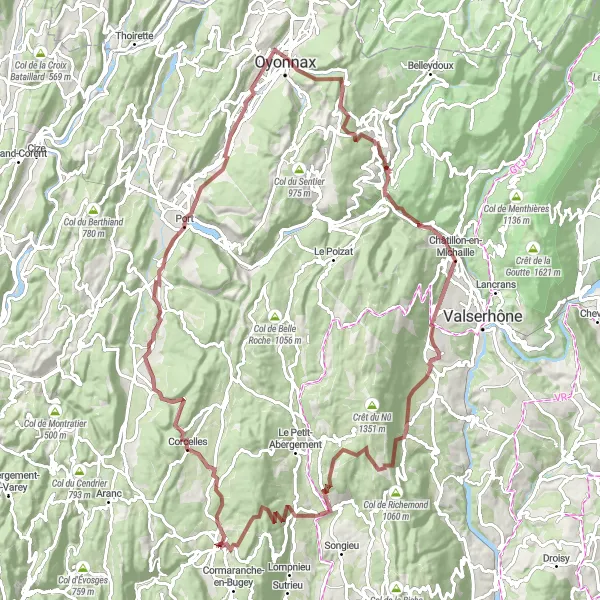
The Gravel Mountain Loop is a challenging cycling route starting near Hauteville-Lompnes in the Rhône-Alpes region of France. This 85-kilometer gravel route offers a unique cycling experience with a total ascent of 1802 meters. The highlight of the route is the legendary Col de la Berche, offering breathtaking panoramic views at the top. Other highlights along the route include Corlier, Poncin, Panorama de la boucle de l'Ain, Napt, Brénod, and Lompnes. This route is recommended for experienced gravel riders who enjoy climbing and stunning scenic views.
The Countryside Gravel Adventure
Experience the beauty of the countryside on this scenic gravel route
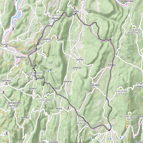
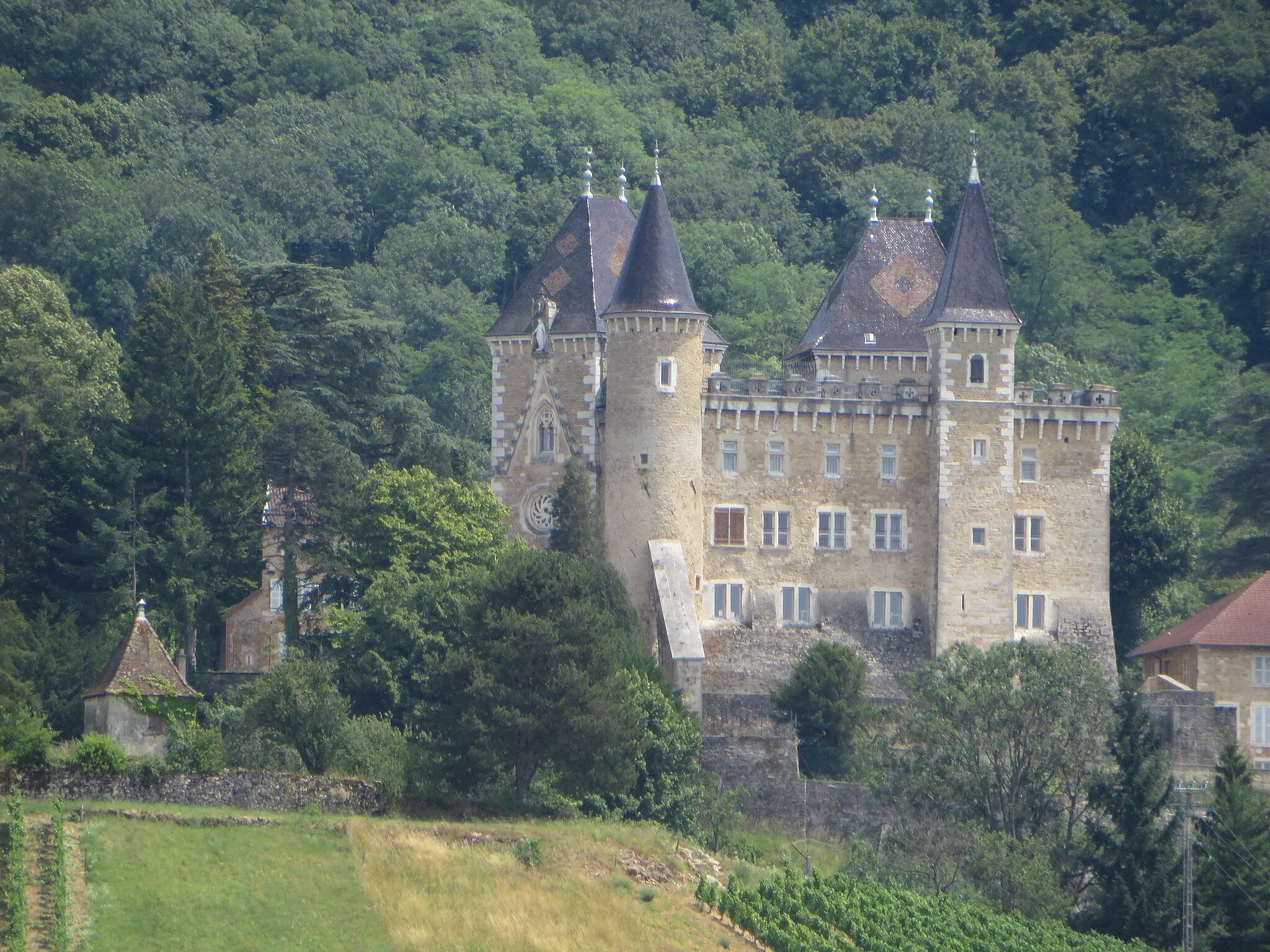
The Countryside Gravel Adventure is a captivating cycling route starting near Hauteville-Lompnes in the Rhône-Alpes region of France. With a total distance of 82 kilometers and an ascent of 1270 meters, this gravel route takes riders on a picturesque journey through the stunning countryside. Highlights along the route include Lompnes, Col du Cendrier, Mont Olivet, Château de La Roche, Saint-Martin-du-Mont, Col de Montratier, and Cascade de la Charabotte. This route offers an excellent opportunity to explore charming villages and enjoy the serenity of the French countryside.
A thrilling cycling route featuring the picturesque town of Thezillieu and the challenging climb of Col du Ballon.
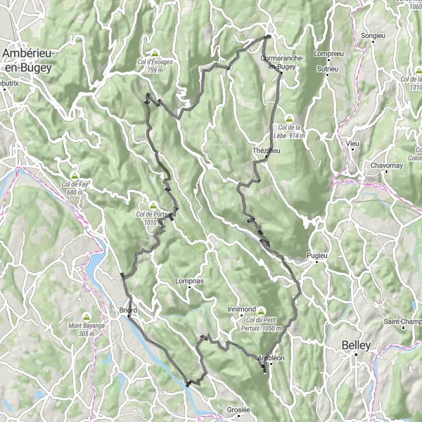
This road cycling route near Hauteville-Lompnes showcases the beauty of the region, taking riders through stunning landscapes and challenging climbs. Starting in Hauteville-Lompnes, you'll cycle through Thézillieu, a charming town known for its traditional architecture. As you continue, the highlight of the route is the ascent of Col du Ballon, offering breathtaking views of the surrounding mountains. The overall route is 104 kilometers long, with a total ascent of 2306 meters. It is suitable for well-trained road cyclists seeking a challenging yet rewarding ride.

Embark on an adventurous gravel cycling journey through the Alps
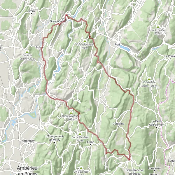
The Alpine Gravel Challenge is a thrilling cycling route starting near Hauteville-Lompnes in the Rhône-Alpes region of France. This 94-kilometer gravel route provides breathtaking alpine landscapes and a total ascent of 1876 meters. The route features highlights such as the majestic Col de la Berche, Corlier, Allement, Grand-Corent, Panorama de la boucle de l'Ain, Mont de Nurieux, Saint-Martin-du-Frêne, Brénod, and Lompnes. Cyclists with experience in riding challenging terrains will appreciate the diverse and scenic beauty offered by this route.
The Challenging Road Ride
Conquer the challenging hills on this scenic road cycling adventure
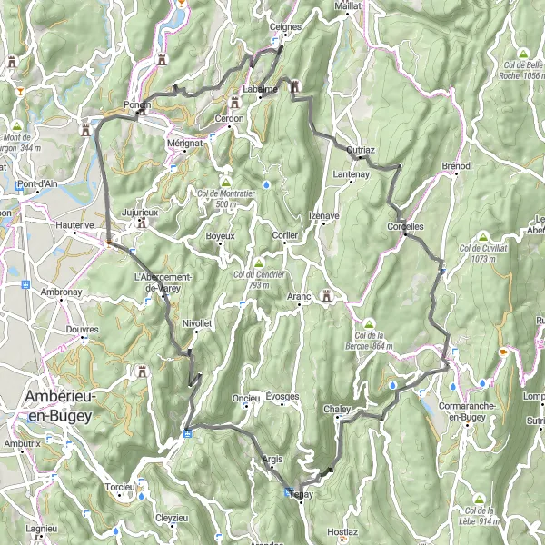
The Challenging Road Ride is an exhilarating cycling route starting near Hauteville-Lompnes in the Rhône-Alpes region of France. With a total distance of 78 kilometers and an ascent of 1556 meters, this road route provides a thrilling challenge for riders with its hilly terrain and scenic beauty. Highlights along the route include Malix, Saint-Rambert-en-Bugey, Poncin, Outriaz, and Hauteville-Lompnes. This route is recommended for experienced cyclists looking to push their limits while enjoying the stunning landscapes of the region.
The Scenic Road Loop

Embrace the beauty of the Rhône-Alpes region on this scenic road cycling tour
The Scenic Road Loop is a breathtaking cycling route starting near Hauteville-Lompnes in the Rhône-Alpes region of France. With a total distance of 132 kilometers and an ascent of 1374 meters, this road route offers a delightful experience for road cycling enthusiasts. Highlights along the route include Tenay, Torcieu, Vue sur la plaine de l'Ain, Crans, Signal, Le Plantay, Saint-André-le-Bouchoux, La Tranclière, Neuville-sur-Ain, Col de Montratier, and Hauteville-Lompnes. This route is recommended for cyclists who appreciate scenic landscapes and enjoy exploring charming villages.

Enjoy a scenic ride connecting Col de la Berche with the picturesque Glacières de Sylans.
This road cycling route near Hauteville-Lompnes provides a scenic journey through the charming landscape. Starting in Hauteville-Lompnes, you'll ascend Col de la Berche, a fantastic climb offering panoramic views. Continuing on, you'll have the opportunity to visit Glacières de Sylans, a unique sight featuring ice grottoes formed naturally over centuries. With a distance of 63 kilometers and an ascent of 1152 meters, this route offers a moderate challenge suitable for well-trained amateur cyclists.

Embark on a gravel adventure through the alluring Col de la Croix de l'Orme circuit.
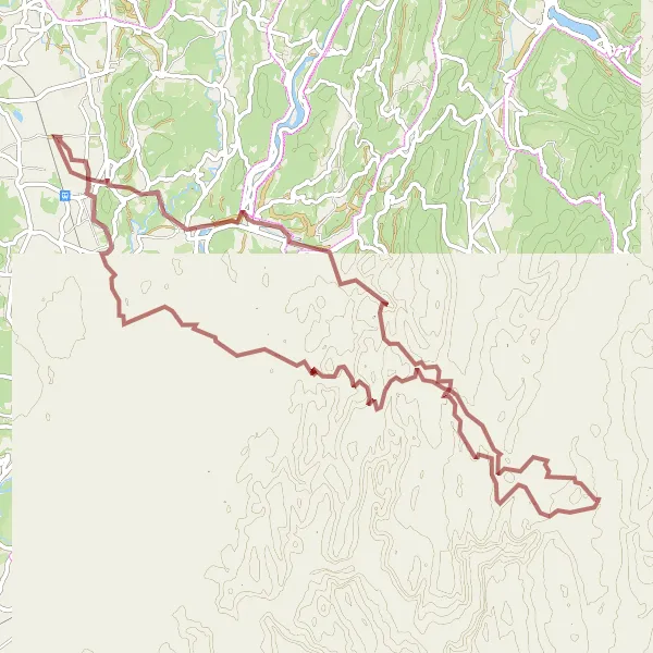
This gravel cycling route near Hauteville-Lompnes is an exciting adventure for those seeking a unique experience. The course spans 120 kilometers and involves a total ascent of 3425 meters, making it suitable for experienced gravel riders. The highlight of this route is Col de la Croix de l'Orme, offering an exhilarating climb with stunning views. Along the way, you'll also pass through the scenic villages of Villes and Brénaz, providing opportunities to appreciate the local charm and tranquility of the region.
Unravel the beauty of Outriaz and conquer the challenging climb to Col de Valorse.
This gravel cycling route near Hauteville-Lompnes takes riders through picturesque villages and challenging terrain. The highlight of the route is the charming village of Outriaz, where you will be greeted by its delightful ambiance and traditional architecture. The course covers a distance of 105 kilometers with an ascent of 2377 meters, providing a moderate challenge suitable for well-trained amateur cyclists. The climax of the ride is the ascent to Col de Valorse, known for its steep gradients and splendid views.
Embark on an adventurous ride featuring the formidable Col de la Berche and unique Châtillon-de-Cornelle.
This road cycling route near Hauteville-Lompnes offers an adventurous experience for cyclists seeking challenges and captivating sights. With a distance of 57 kilometers and an ascent of 1086 meters, this route is suitable for intermediate-level riders. The ascent of Col de la Berche provides a thrilling challenge along with breathtaking vistas. Additionally, you'll have the chance to visit Châtillon-de-Cornelle, known for its distinctive architecture and enchanting atmosphere.
Cycling routes nearby:

Nearby regions: