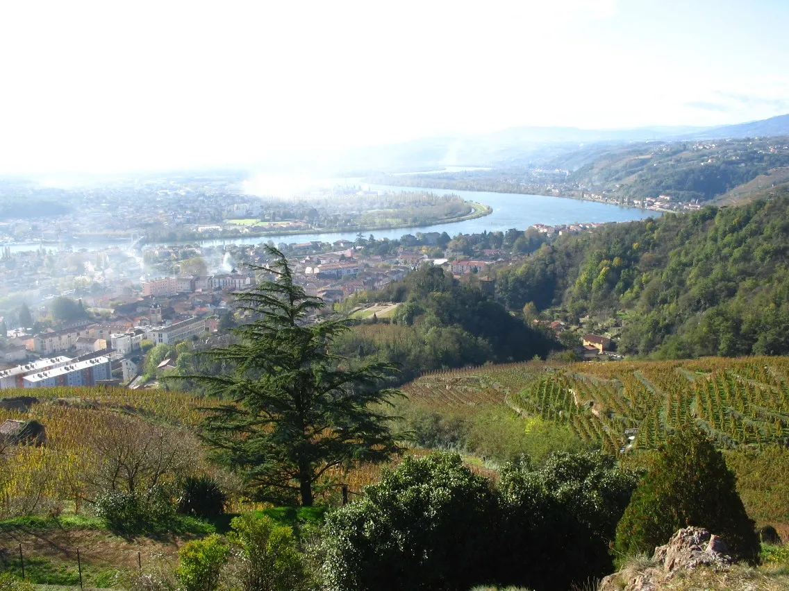
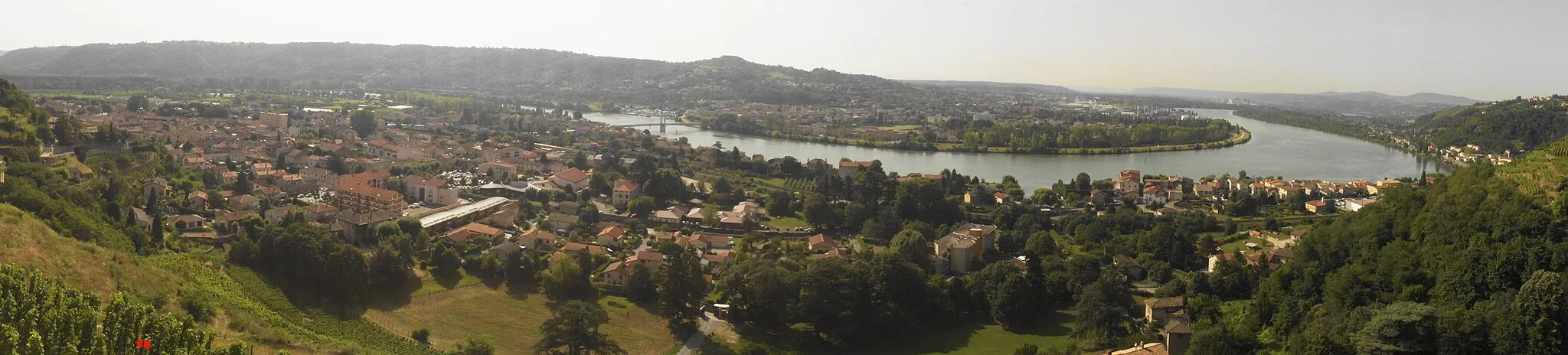
Scenic cycling routes amidst picturesque vineyards and valleys in Les Côtes-d'Arey.
Cycling routes from Les Cotes-d'Arey
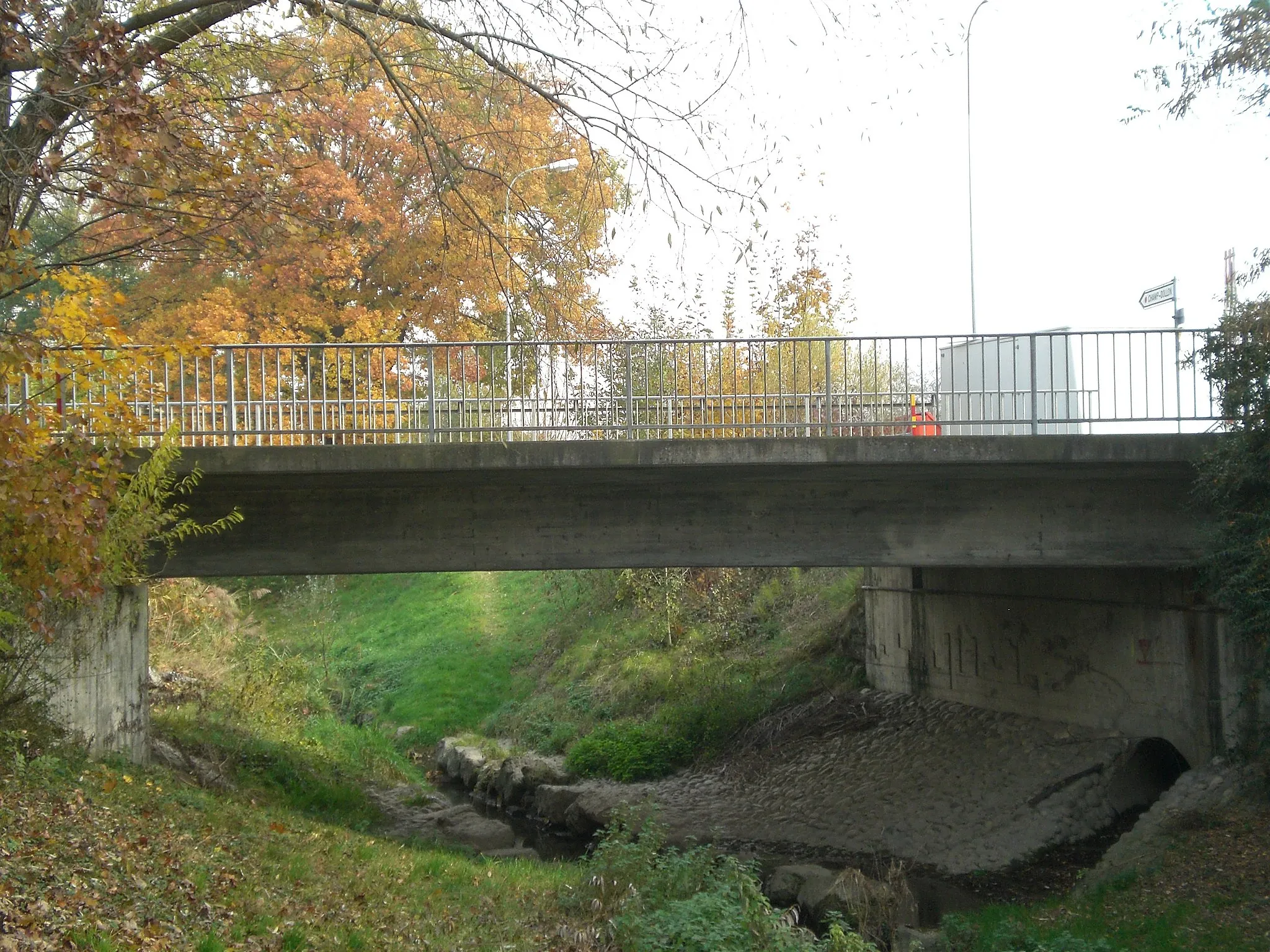
Located in the Rhône-Alpes region, Les Côtes-d'Arey offers picturesque cycling routes for road and gravel cyclists. The locality is surrounded by stunning natural landscapes, including vineyards and valleys, providing a beautiful backdrop for cycling adventures. The roads around Les Côtes-d'Arey are well-suited for cycling, with minimal traffic and diverse terrain. Cyclists can enjoy gentle rolling hills and challenging climbs in the vicinity. While there are no famous climbs directly nearby, the overall cycling experience and the tranquil atmosphere make Les Côtes-d'Arey a worthwhile destination.

Explore the scenic countryside of Rhône-Alpes on this gravel trail
Embark on an exciting gravel ride through the charming region of Les Côtes-d'Arey in Rhône-Alpes, France. This route offers a perfect blend of beautiful scenery, challenging terrain, and cultural highlights.
Embark on an epic gravel adventure from Saint-Alban-du-Rhône to Les Roches-de-Condrieu
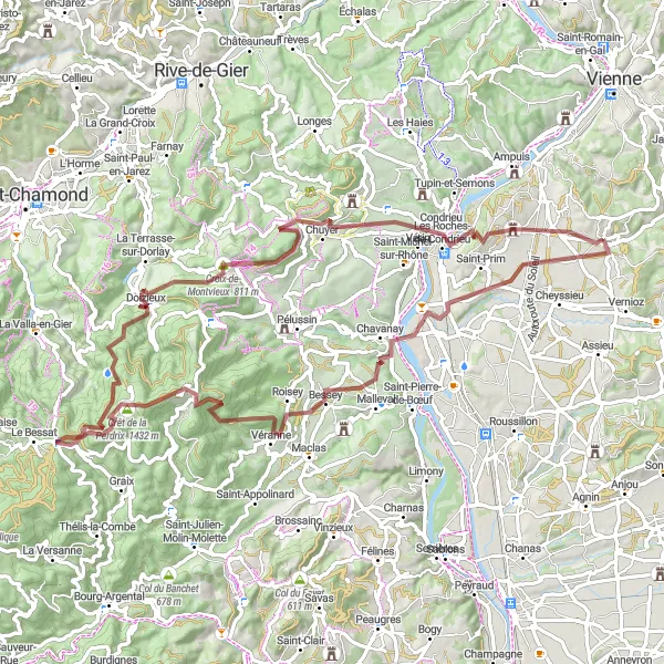
This gravel cycling route is perfect for experienced off-road cyclists looking for an epic challenge. Spanning a distance of 86 km with an ascent of 2136 meters, it offers breathtaking views and varied terrains. The highlight along the route is Crêt de l'Œillon, a peak offering panoramic views of the Rhône Valley. Overall, this route provides a thrilling experience, combining challenging climbs with stunning natural scenery.

Enjoy a scenic road bike ride from Saint-Sorlin-de-Vienne to Les Côtes-d'Arey
This road cycling route offers a picturesque journey from Saint-Sorlin-de-Vienne to Les Côtes-d'Arey. With a distance of 44 km and an ascent of 464 meters, it is suitable for moderately fit cyclists. The highlight along the route is Monsteroux-Milieu, a charming village known for its historical architecture and quaint streets. Overall, this route provides a pleasant cycling experience through the beautiful Rhône-Alpes countryside.
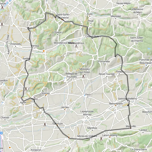
Experience the challenge of cycling from Saint-Sorlin-de-Vienne to Lens-Lestang
This road cycling route offers an exciting challenge for experienced cyclists. Spanning a distance of 76 km with an ascent of 887 meters, it is suitable for well-trained amateurs. The highlight along the route is Épinouze, a charming village known for its medieval castle and stunning views over the Rhône Valley. Overall, this route provides a satisfying combination of scenic landscapes and challenging terrain, making it a great choice for adventure-seekers.
Embark on an adventurous gravel ride from La Chapelle-de-Surieu to Les Côtes-d'Arey
This gravel cycling route is perfect for those seeking an off-road adventure. Starting in La Chapelle-de-Surieu and ending in Les Côtes-d'Arey, the route covers a distance of 58 km with an ascent of 763 meters. The highlight along the route is Saint-Rambert-d'Albon, a charming town with a rich history and picturesque architecture. Overall, this route provides a thrilling experience for gravel enthusiasts, with varied terrain and stunning natural scenery.
Les Côtes-d'Arey Gravel Route
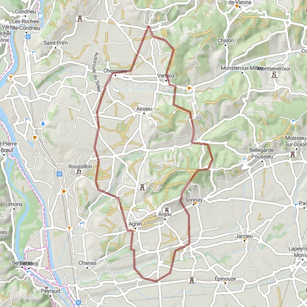
A scenic gravel route near Les Côtes-d'Arey
This gravel route near Les Côtes-d'Arey offers scenic views and challenging terrain. With a total ascent of 1067 meters over a distance of 63 kilometers, it is suitable for well-trained cyclists looking for a moderate challenge. The route passes through several highlights including Saint-Sorlin-de-Vienne, Saint-Julien-de-l'Herms, Pisieu, Moissieu-sur-Dolon, and finally ends in Les Côtes-d'Arey.
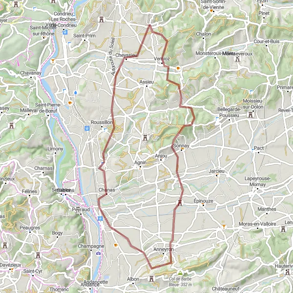
An adventurous gravel challenge near Les Côtes-d'Arey
For those seeking an adventurous gravel challenge, this route near Les Côtes-d'Arey is perfect. With a total ascent of 702 meters over a distance of 45 kilometers, it offers a moderate challenge suitable for intermediate cyclists. The highlights along the route include La Chapelle-de-Surieu, Agnin, and finally Les Côtes-d'Arey.
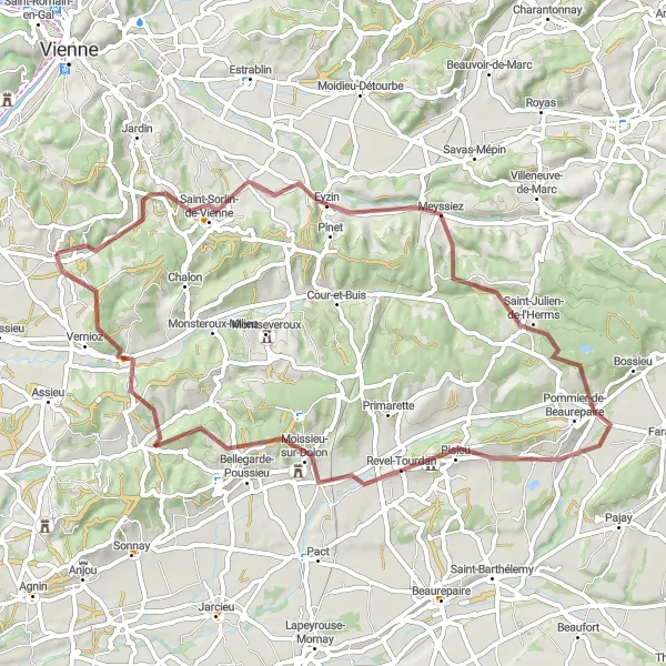
A scenic road route leading to Les Côtes-d'Arey
Experience stunning landscapes and charming villages along this scenic road route leading to Les Côtes-d'Arey. With a total ascent of 803 meters over a distance of 56 kilometers, it offers a moderate challenge suitable for experienced cyclists. The highlights along the route include Pont-Évêque, Oytier-Saint-Oblas, Moidieu-Détourbe, Monsteroux-Milieu, and finally Les Côtes-d'Arey.

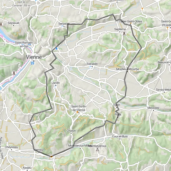
Exploring the scenic route from Pont-Évêque to Les Côtes-d'Arey
This road cycling route takes you through beautiful Rhône-Alpes countryside, starting from Pont-Évêque and ending in Les Côtes-d'Arey. With a distance of 61 km and an ascent of 724 meters, it offers a moderate challenge for amateur cyclists. The highlight along the route is the town of Moidieu-Détourbe, known for its charming streets and historic buildings. Overall, this route provides a great opportunity to enjoy the picturesque landscapes of Rhône-Alpes while getting some exercise.
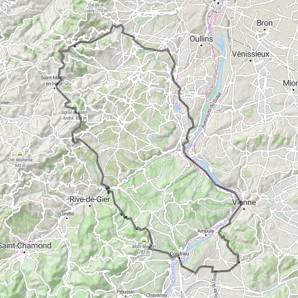
An adrenaline-filled road adventure starting in Les Côtes-d'Arey
Embark on an adrenaline-filled road adventure starting in Les Côtes-d'Arey. This route covers a distance of 117 kilometers with a total ascent of 1851 meters, providing a challenging experience for experienced cyclists. The highlights along the route include Saint-Prim, Mont Monnet, Châteauneuf, Table d'orientation, Saint-Martin-en-Haut, Crêt de la Madonne, Chaponost, Loire-sur-Rhône, Saint-Cyr-sur-le-Rhône, and ends in Les Côtes-d'Arey.
Cycling routes nearby:


Nearby regions: