Home to Legendary Climb Alpe d'Huez
Cycling routes from Saint-Clair-du-Rhone
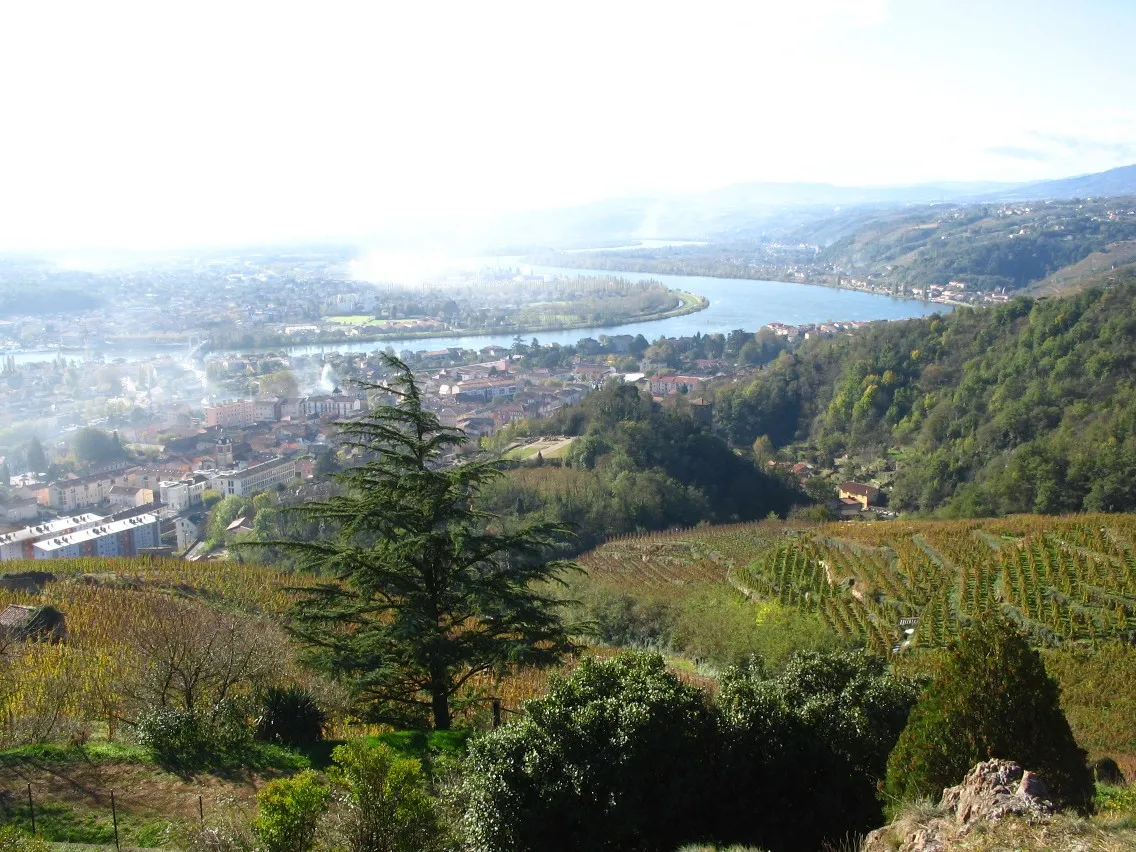
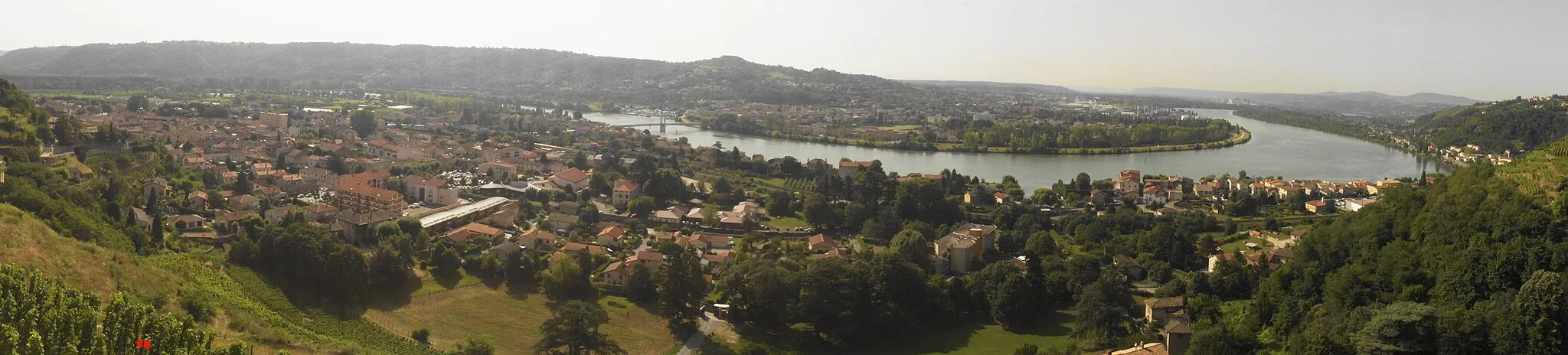
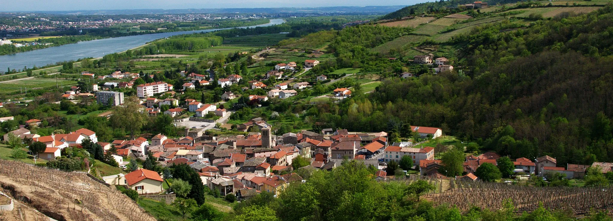
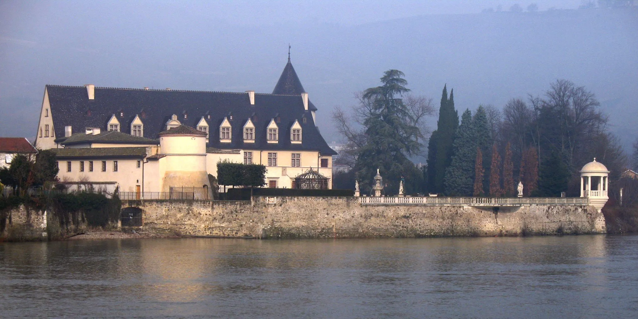
Saint-Clair-du-Rhône, located in the Rhône-Alpes region of France, is a cyclist's dream destination. The town offers a variety of challenging climbs and scenic routes, making it a popular choice for road cyclists. One famous cycling spot nearby is the Alpe d'Huez, a legendary climb that has been featured in the Tour de France. Overall, Saint-Clair-du-Rhône is a fantastic location for cyclists looking for tough climbs and breathtaking views.
Follow the riverside trails on this scenic gravel route
Enjoy the tranquility of riverside cycling with this scenic gravel route. With a total ascent of 943 meters and a distance of 80 kilometers, this route offers a pleasant and moderate adventure through the Rhône-Alpes region. Highlights along the way include Saint-Pierre-de-Bœuf, Calvaire des Trois Saints, Andance, Vallée de la Cance, Annonay, Brossainc, and Chavanay. Immerse yourself in the beautiful landscapes and experience the serenity of the riverside trails. Suitable for intermediate riders, this route provides a relaxing and soothing ride away from the hustle and bustle of the city.
Vineyard Adventure
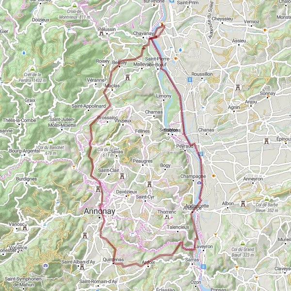
Experience the Rhône Valley's vineyards on this road cycling route
Cycle through the renowned vineyards of the Rhône Valley with this scenic road route. With a total ascent of 1237 meters and a distance of 77 kilometers, this route offers a challenging yet rewarding experience for wine enthusiasts. Highlights along the way include Chavanay, Croix-de-Montvieux, La Terrasse-sur-Dorlay, Rive-de-Gier, Échalas, and Les Roches-de-Condrieu. Take in the breathtaking landscapes and indulge in the flavors of the region's famous wines. Suitable for experienced riders, this route immerses you in the culture and beauty of the Rhône Valley vineyards.
Gravel Adventure
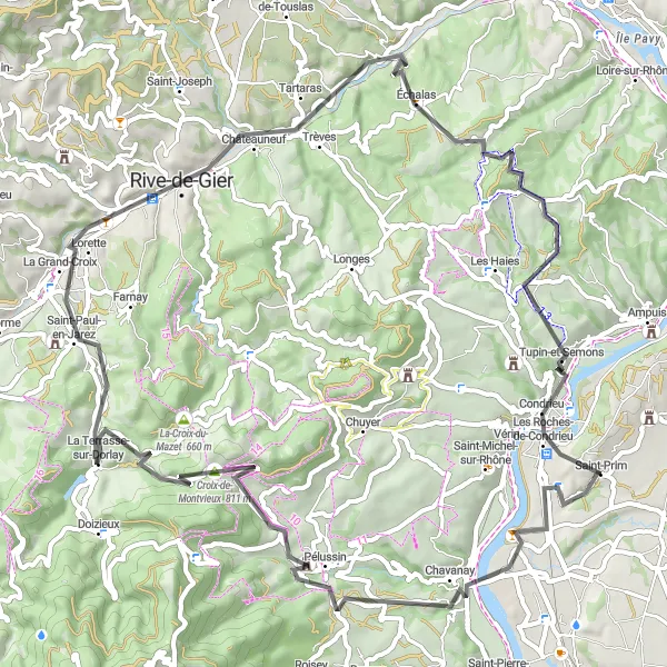
Off-road adventure through the rugged terrain of Rhône-Alpes
Embark on an off-road gravel adventure through the rugged terrain of Rhône-Alpes with this exciting route. With a total ascent of 1071 meters and a distance of 64 kilometers, this route offers a thrilling experience for gravel enthusiasts. Highlights along the way include Chavanay, Vinzieux, Col du Fayet, Boulieu-lès-Annonay, La Madone de Savas, Saint-Pierre-de-Bœuf, and Vérin. Explore the wild landscapes and enjoy the freedom of off-road cycling in the heart of nature. Suitable for experienced riders, this route takes you to remote and untouched areas, offering a unique and challenging adventure.
Rhône-Alpes Loop

Breathtaking ride through the Rhône-Alpes region
Experience the beauty of Rhône-Alpes with this scenic cycling route. With a total ascent of 1160 meters and a distance of 125 kilometers, this road route offers a challenging yet rewarding adventure. The route takes you through various highlights including Vienne, Belvédère de Pipet, Diémoz, Culin, Point de vue sur Moulin, Penol, Pact, Table d'orientation, and Clonas-sur-Varèze. Suitable for experienced riders, this route offers magnificent views and cultural attractions throughout.
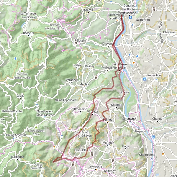
Conquer legendary climbs and discover hidden gems on this challenging gravel route
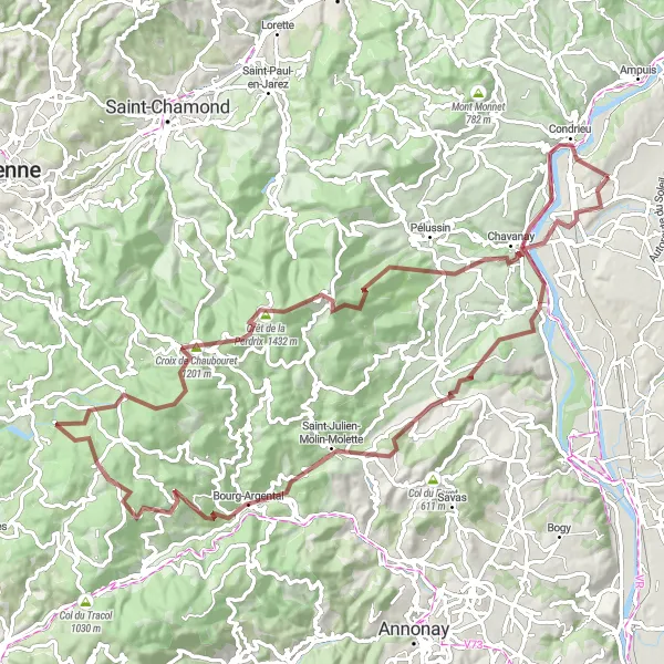
Prepare for the ultimate gravel adventure that will test your skills and endurance. This challenging route takes you through the stunning landscapes of Rhône-Alpes and offers a unique opportunity to conquer legendary climbs. With a total ascent of 2187 meters and a distance of 95 kilometers, this route is only suitable for experienced gravel riders. Experience the peace and tranquility of Saint-Prim, explore the scenic beauty of Chavanay, and challenge yourself on the demanding Col de la République. Bourg-Argental, Col du Banchet, Brossainc, and Saint-Alban-du-Rhône offer breathtaking views and unforgettable moments throughout the journey.
The Gravel Adventure

Explore the beautiful countryside of Rhône-Alpes on this gravel route
Embark on a scenic and adventurous journey through the stunning landscapes of Rhône-Alpes. This gravel route offers a unique opportunity to discover small villages, picturesque countryside, and breathtaking views. With a total ascent of 852 meters and a distance of 63 kilometers, this route is suitable for experienced gravel riders. Immerse yourself in the rural charm and natural beauty of Les Côtes-d'Arey, Monsteroux-Milieu, Primarette, Revel-Tourdan, Saint-Romain-de-Surieu, and Clonas-sur-Varèze. Get ready to be amazed by the hidden gems along the way.
Road Cycling Paradise
Embark on a scenic road cycling adventure in Rhône-Alpes
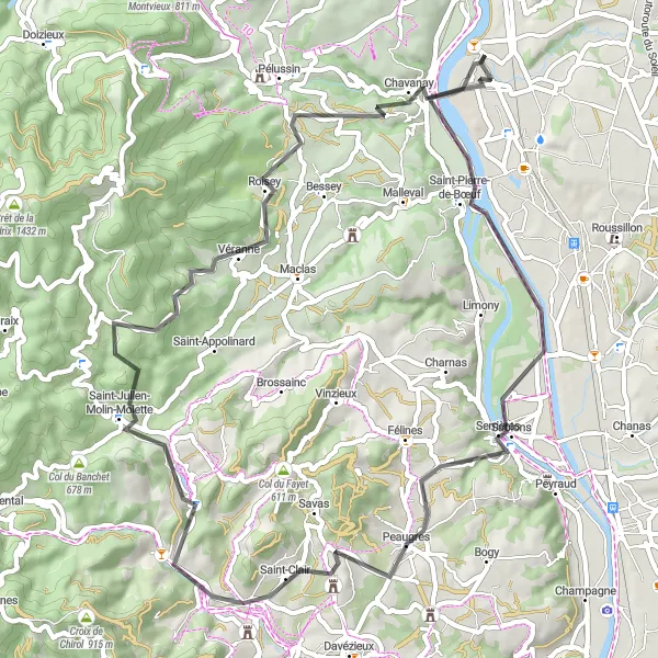
Experience a thrilling road cycling adventure through the breathtaking landscapes of Rhône-Alpes. With a total ascent of 839 meters and a distance of 64 kilometers, this road route is suitable for experienced cyclists. Explore the picturesque village of Saint-Pierre-de-Bœuf, enjoy the panoramic views from Point de Vue de la Madone, and marvel at the architectural wonders of Serrières. Don't miss the opportunity to visit the iconic La Madone de Boulieu and take in the natural beauty of the region. Véranne and Chavanay offer unique cultural experiences and enchanting landscapes that will leave you in awe.

Experience the local charm and natural beauty of Saint-Clair-du-Rhône
Embark on a delightful cycling journey through the enchanting region of Saint-Clair-du-Rhône. With a total ascent of 331 meters and a distance of 30 kilometers, this gravel route is perfect for riders of all levels. Experience the warm hospitality of Saint-Prim, appreciate the scenic landscapes of Les Côtes-d'Arey, and marvel at the beauty of Saint-Clair-du-Rhône. This route provides a great opportunity to explore the lesser-known attractions and secret spots of this picturesque region.
Embark on an epic road cycling adventure through iconic destinations
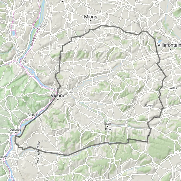
Prepare for the ultimate cycling adventure through some of the most iconic destinations in Rhône-Alpes. With a total ascent of 1009 meters and a distance of 104 kilometers, this road route is designed for experienced cyclists seeking a challenge. Explore the historic city of Vienne, admire the breathtaking views from Belvédère de Pipet, and soak in the beauty of Saint-Pierre-de-Chandieu. Discover the hidden charms of Saint-Quentin-Fallavier, Villeneuve-de-Marc, Cour-et-Buis, and Cheyssieu, each offering its own unique attractions and scenic landscapes. This route guarantees unforgettable moments and a true sense of adventure.
Challenging Rhône Valley Ride
Conquer the challenging terrain of the Rhône Valley
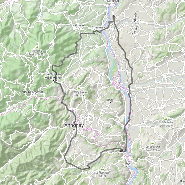
Take on the challenge of the Rhône Valley with this demanding road cycling route. With a total ascent of 1146 meters and a distance of 99 kilometers, this route is designed for experienced and well-trained cyclists. Highlights along the way include Salaise-sur-Sanne, Andancette, Calvaire des Trois Saints, Vallée de la Cance, Ardoix, Annonay, Véranne, and Chavanay. Test your skills and stamina as you conquer steep climbs and thrilling descents. Suitable for experienced riders seeking a physical and mental challenge, this route offers a mix of breathtaking landscapes and cultural attractions.
Cycling routes nearby:


Nearby regions: