Discover the Gravel Wonders: Nantua and Boucle de l'Ain
A gravel cycling route starting from Nantua
Embark on an exciting gravel adventure to discover the wonders of Nantua and Boucle de l'Ain.
Map
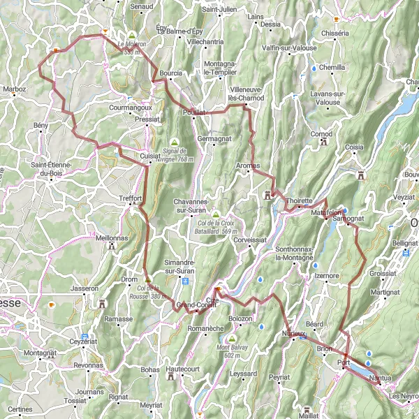
Take on the challenge of this 108-kilometer gravel route starting near Nantua. As you explore the rugged terrain, you'll be captivated by the breathtaking scenery. The route offers a variety of highlights, including the stunning Panorama de la boucle de l'Ain at 19 kilometers and the iconic Col de Matafelon at 89 kilometers. With its demanding ascent and epic views, this gravel route is perfect for experienced cyclists looking for an adventurous ride.
gravel
108 km
2253 m
Tough
Route profile
Highlights on the route
0 km
0 km
Start: Nantua Village centerNantua: A cycling paradise with stunning lake views and epic climbs.
Nantua is a locality in the Rhône-Alpes region of France. From a cyclist's perspective, Nantua offers a good mix of scenic and challenging routes. The region has a mix of flat and hilly terrain, allowing cyclists to enjoy various types of rides. The highlight of cycling in Nantua is the breathtakingly beautiful Lake Nantua, offering fantastic views throughout the ride. Cyclists can also take on the famous and challenging Col du Grand Colombier, a must-ride climb in the area. Overall, Nantua is a great choice for cyclists looking for a combination of scenic beauty and demanding routes.3 km
3 km
PortVillagePort, located at the 3-kilometer mark, is a small historic harbor town along the route.
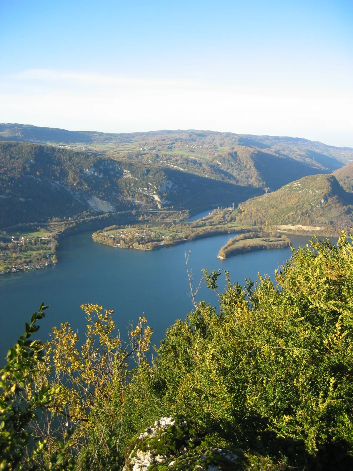
19 km
19 km
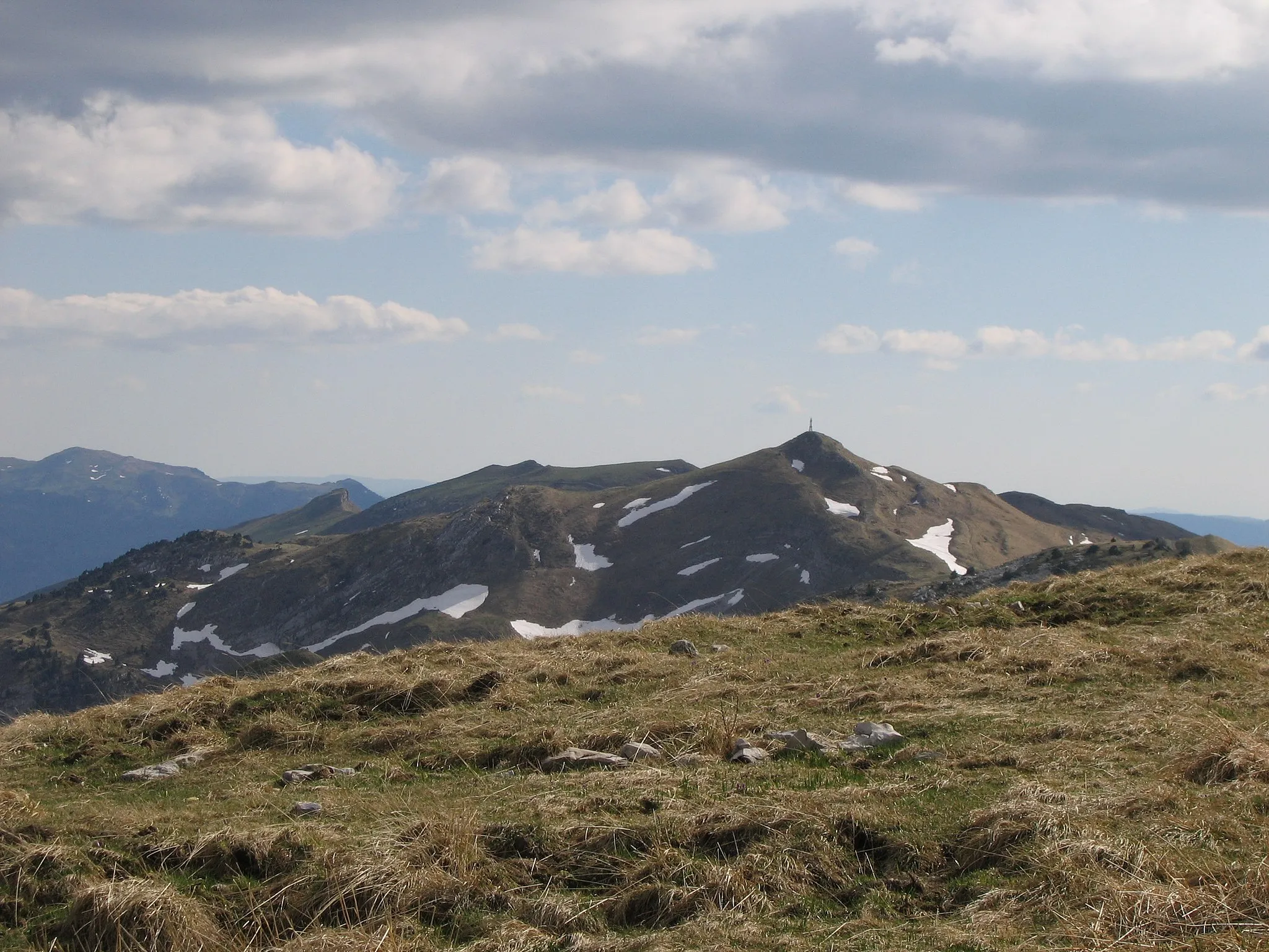
Panorama de la boucle de l'AinViewpointAt 19 kilometers, the Panorama de la boucle de l'Ain offers stunning panoramic views of the Ain River loop.
22 km
22 km
Grand-CorentVillageGrand-Corent, at the 22-kilometer mark, is a picturesque village surrounded by rolling hills and vineyards.
37 km
37 km
CuisiatVillageCuisiat, at 37 kilometers, is known for its nature reserve and beautiful hiking trails.
52 km
52 km
PirajouxVillagePirajoux awaits you at 52 kilometers, a charming village showcasing traditional Bresse architecture.
60 km
60 km
Le Moleron553 mPeakLe Moleron, at 60 kilometers, is a natural limestone cliff known for its unique rock formations.
69 km
69 km
PouillatVillageExperience the charming village of Pouillat, with its traditional wooden houses, at 69 kilometers.
85 km
85 km
ThoiretteVillageThoirette, at 85 kilometers, is situated on the banks of the Ain River and offers scenic views.
89 km
89 km
Col de Matafelon475 mMountain PassAt 89 kilometers, the breathtaking Col de Matafelon awaits you, providing a challenging climb and rewarding vistas.
102 km
102 km
Montréal-la-CluseVillageThe final highlight of this epic route is Montréal-la-Cluse, a historic town with beautifully preserved architecture and rich heritage.
108 km
108 km
Finish: Nantua Village centerNantua: A cycling paradise with stunning lake views and epic climbs.
Cycling routes from Nantua:
Adventurous Gravel Cycling with Crêt Torcet and Mont Cornet Epic Gravel Adventure with La Source de la Doye and Crêt Pourri Scenic Road Adventure with Belle Roche and Col de la Berche Nantua Loop: Climbing to the Beautiful Col de Richemond Short Gravel Loop Through Saint-Martin-du-Frêne Exploring the Source of the Doye - Gravel Adventure Nantua Challenge: Conquer the Col de la Biche Discover the Gravel Wonders: Nantua and Boucle de l'Ain Picturesque Villages and Scenic Routes: Nantua Adventure Scenic Beauty and Tranquil Villages: Explore Nantua's Countryside The Jura Mountains Challenge The Grand Alps Adventure
Cycling routes nearby: