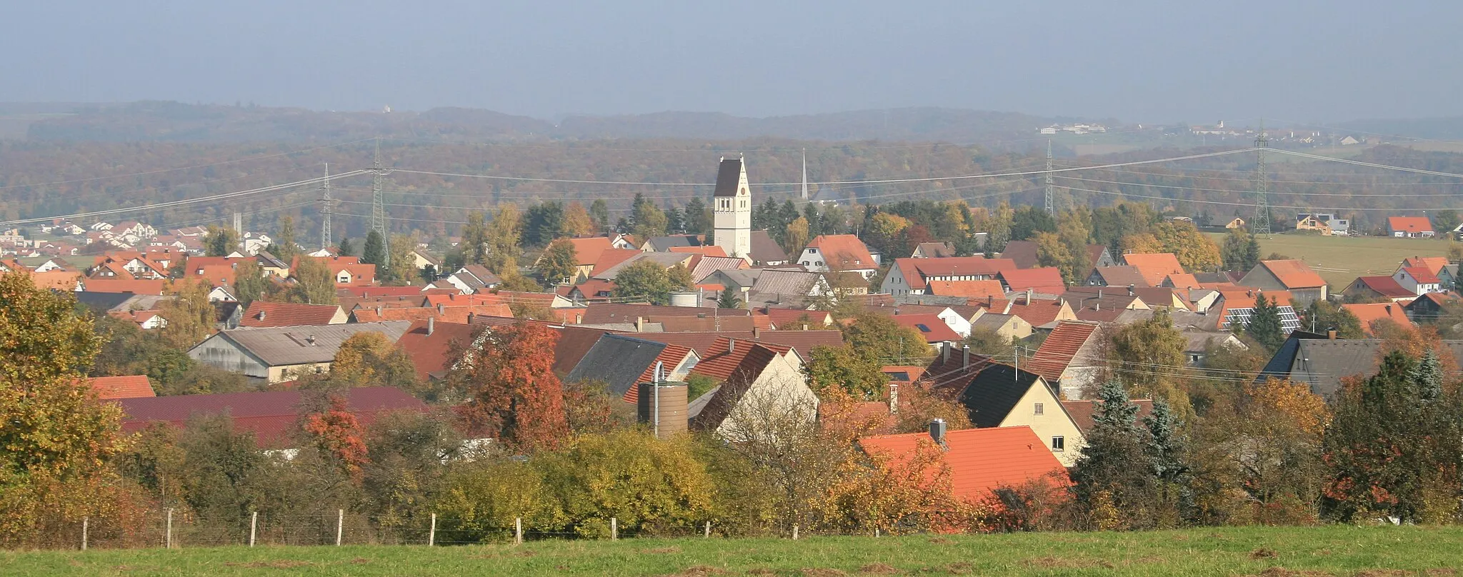
Take on the Black Forest hills while cycling through Dauchingen
Cycling routes from Dauchingen
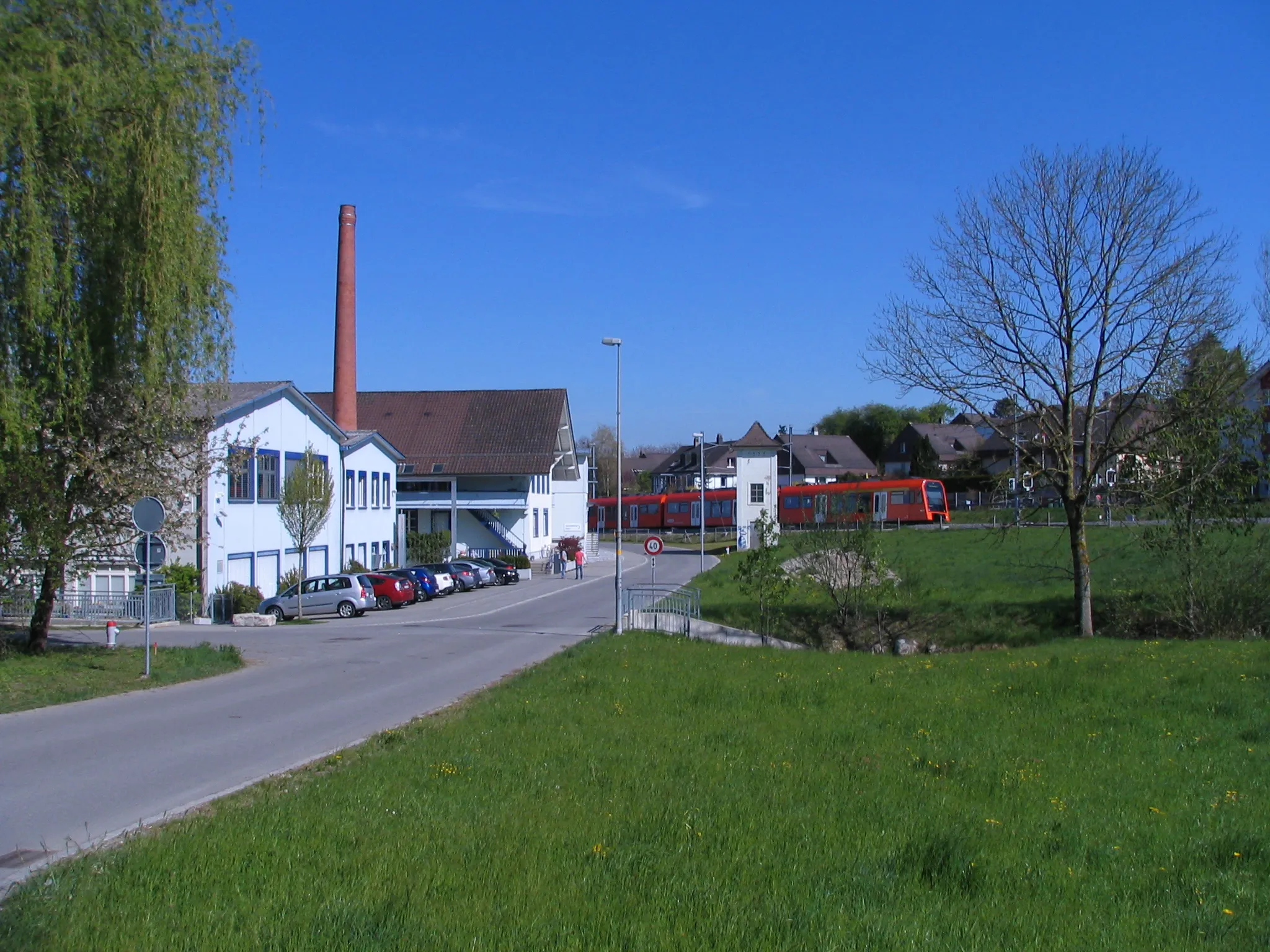
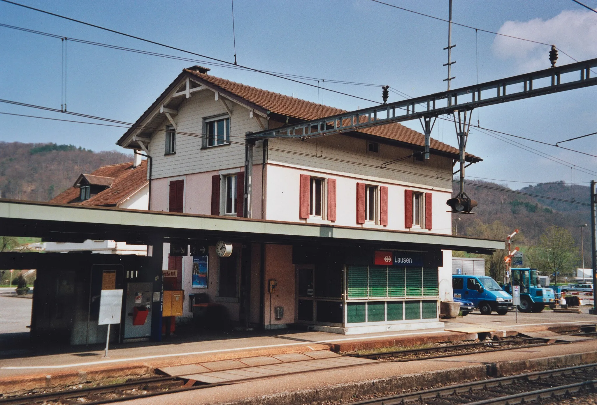
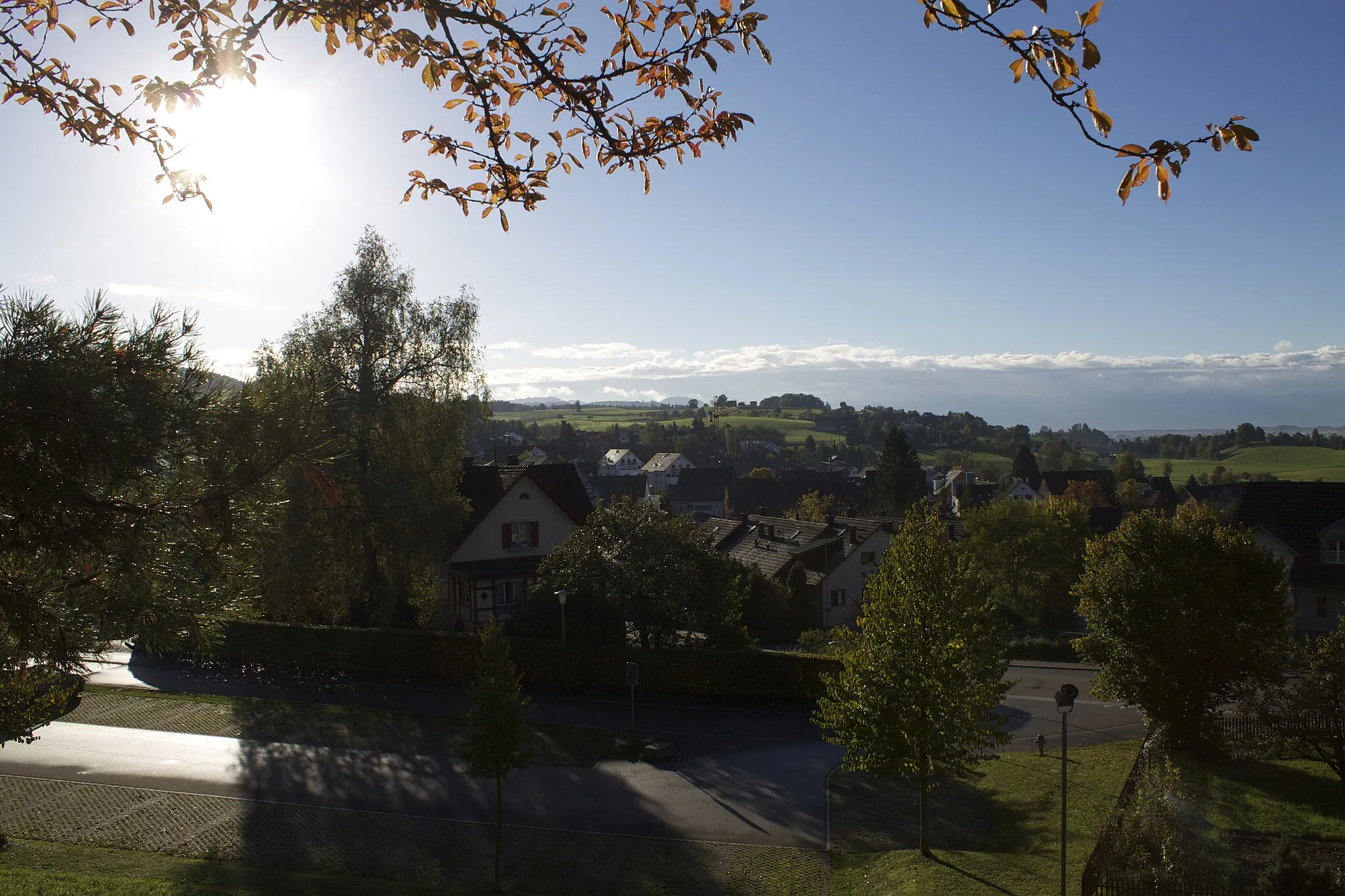
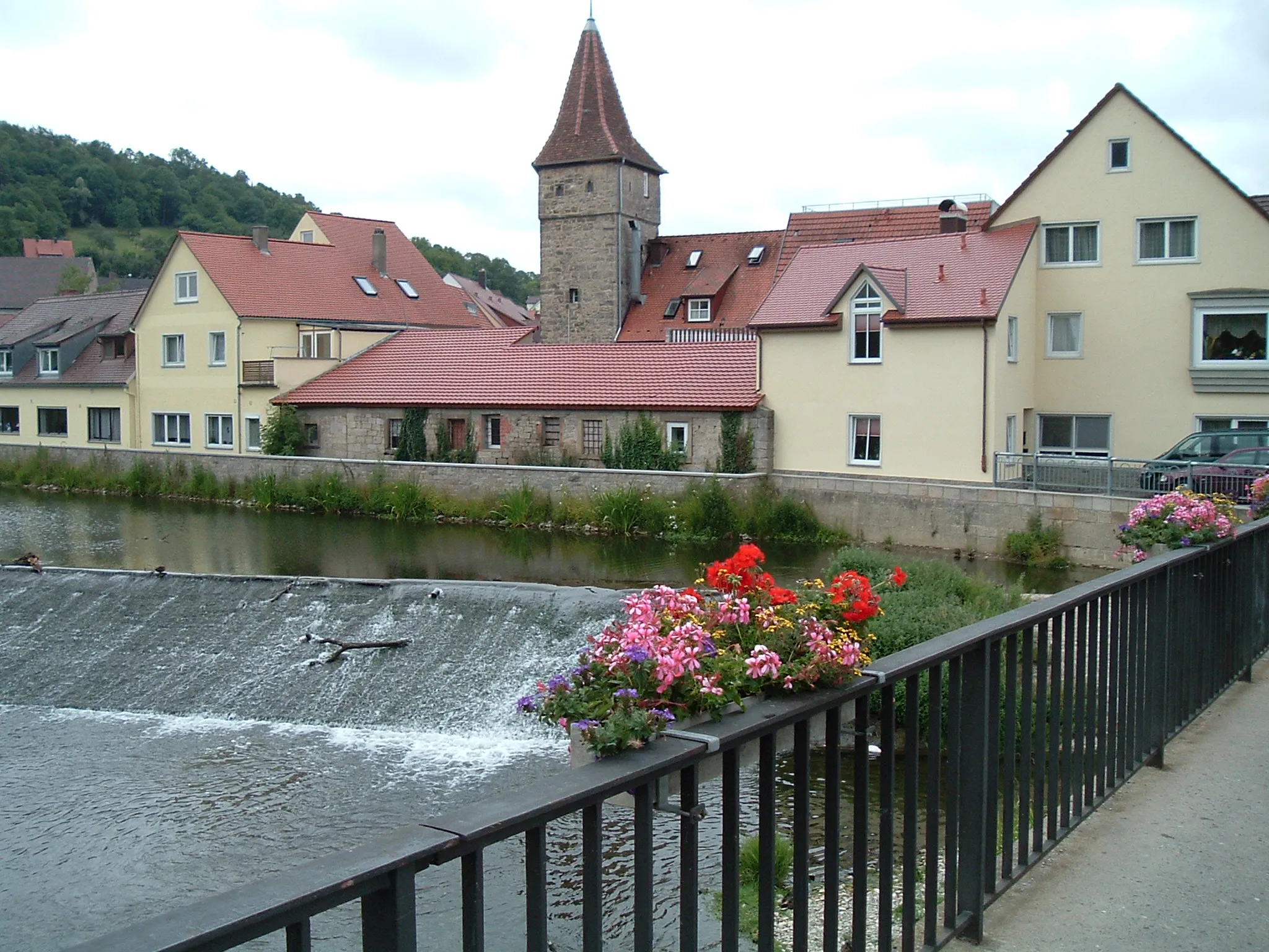
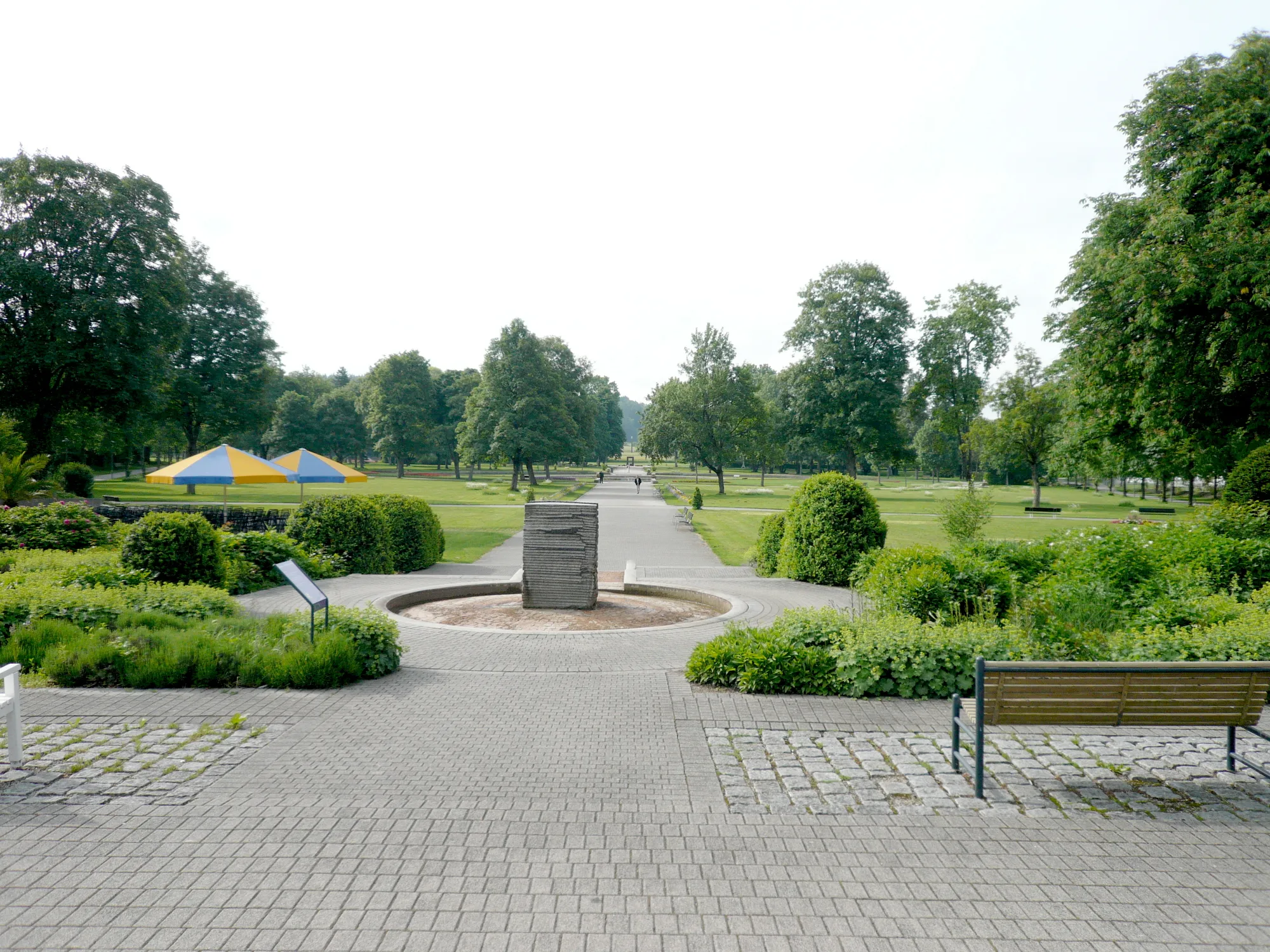
Dauchingen, located in Freiburg, Germany, offers great opportunities for road and gravel cycling. The locality boasts well-maintained cycling trails that wind through beautiful forests and meadows. Cyclists can explore the scenic hills of the Black Forest and ride along the famous Schwarzwaldhochstraße, known for its challenging climbs and breathtaking views. Dauchingen is an excellent starting point for cyclists looking to immerse themselves in nature and discover the charm of the surrounding region.
A thrilling gravel route with scenic mountain views
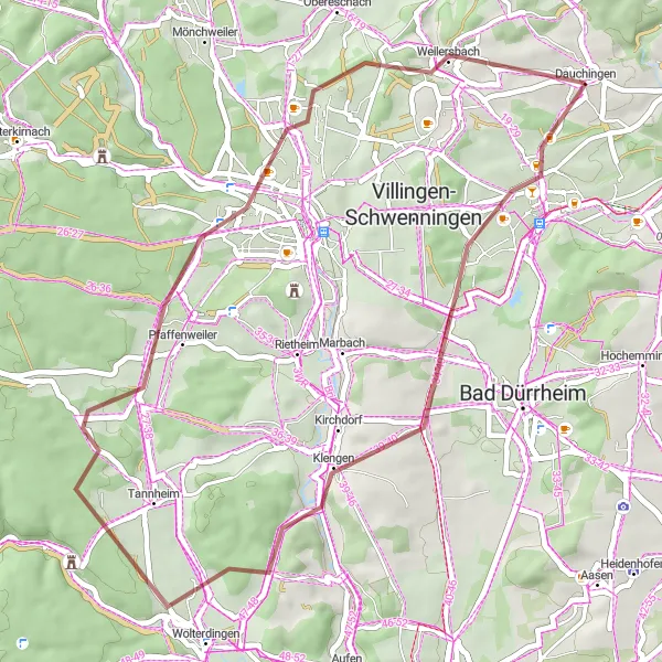
For those seeking an adventurous journey, this gravel route from Dauchingen to Pfaffenweiler is the perfect choice. With a distance of 43 km and an ascent of 576 m, this route offers a challenging yet rewarding experience. Highlights include Froschberg, offering panoramic views of the surrounding mountains, and Tonisbühl, known for its picturesque landscapes. Rated as a difficulty level 3, this route is suitable for cyclists with some off-road experience. Although not as epic as a legendary climb, it still provides an enjoyable gravel cycling experience.
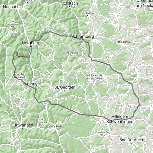
An epic road route through stunning landscapes
Embark on a breathtaking journey from Dauchingen to Hornberg with this road cycling route. Covering a total distance of 88 km and an ascent of 2002 m, this challenging route is perfect for experienced cyclists seeking an unforgettable adventure. You'll ride through Dauchingen, passing by iconic landmarks such as Aussichtsturm Wanne and Triberg. Highlights along the way include Sandbühl, where you can enjoy panoramic views of the surrounding landscapes, and Hornberg, famous for its charming Black Forest scenery. Rated as a difficulty level 5, this route offers a truly epic experience, deserving its rating of 4 on the epicness scale due to its scenic beauty and demanding climbs.
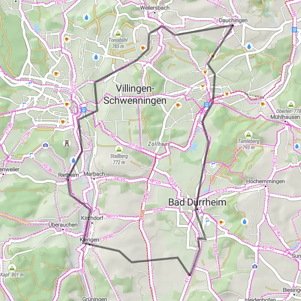
An enjoyable road route through scenic landscapes
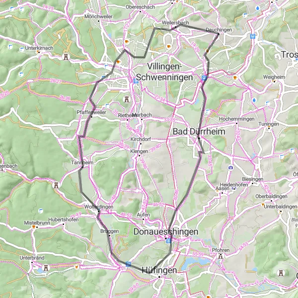
Enjoy a leisurely ride from Dauchingen to Bad Dürrheim with this road cycling route. Covering a distance of 34 km and an ascent of 260 m, this route is suitable for cyclists of all skill levels. Along the way, you'll pass through Hankenberg, Bad Dürrheim, and Ruine Warenburg. The highlight of the route is Aussichtsturm Wanne, offering panoramic views of the surrounding landscapes. Rated as a difficulty level 1, this route provides a relaxing cycling experience in the beautiful Black Forest.
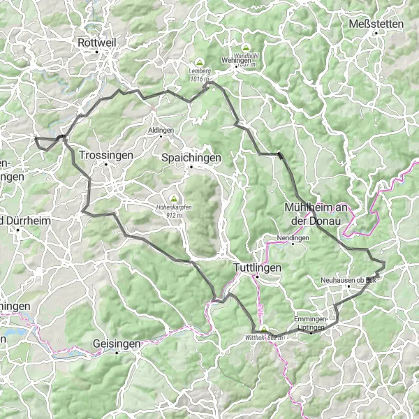
A scenic road route with stunning views
This road route takes you from Dauchingen to Deißlingen, offering a scenic and challenging ride. With a total distance of 102 km and an ascent of 1292 m, this route is perfect for experienced cyclists looking for a thrilling adventure. Along the way, you'll pass through Mühlheim an der Donau, Emmingen-Liptingen, and Schopfelenbühl. The highlights of this route include the historical Ruine Konzenberg and Schopfelenbühl, offering breathtaking panoramic views. Overall, this route is rated as a difficulty level 4, suitable for well-trained amateur cyclists. It is a truly epic cycling experience, deserving a rating of 4, given its beautiful scenery and challenging climbs.
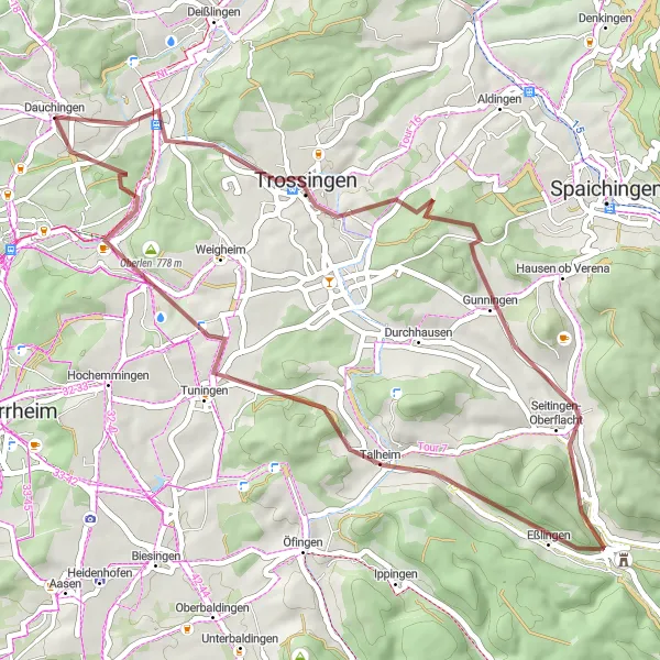
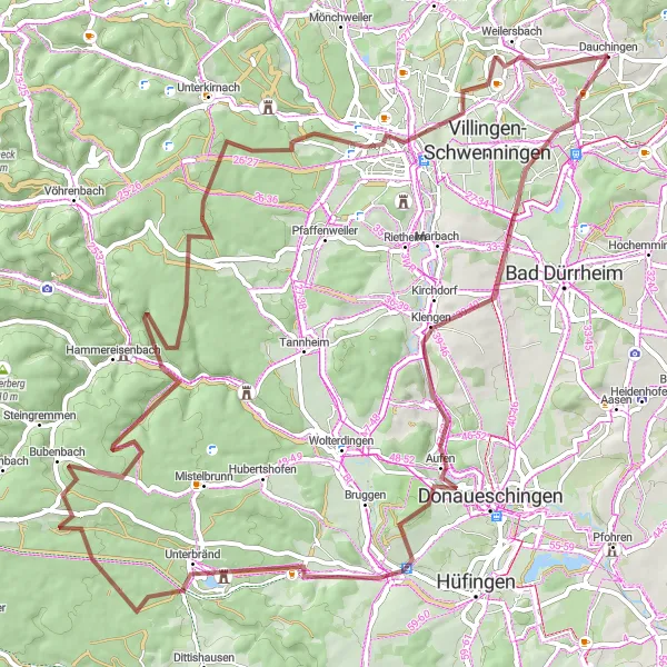
Embark on a scenic gravel cycling journey from Dauchingen to Seitingen-Oberflacht.
Experience the beauty of the region on this 46-kilometer gravel route with only 626 meters of ascent. The highlights of this route include Trossingen, Staufelberg, Gifiz, Schopfelenbühl, and Dauchingen. Cyclists will enjoy the varied terrain and picturesque landscapes. Rated with a difficulty level of 3, this route is suitable for moderately trained amateur cyclists looking for an enjoyable outdoor adventure. With an epicness rating of 2, it offers a satisfying and memorable experience.
Dauchingen to Tonisbühl
A scenic road route in the heart of the Black Forest
Experience the beauty of the Black Forest with this road cycling route from Dauchingen to Tonisbühl. Covering a distance of 54 km and an ascent of 448 m, this route is ideal for cyclists looking for a moderate challenge. Along the way, you'll pass through Hankenberg, Donaueschingen, and Pfaffenweiler. Highlights include Donaueschingen and its famous Danube river source, as well as Tonisbühl, offering stunning panoramic views. Rated as a difficulty level 2, this route is suitable for all skill levels. It provides a moderate cycling experience, deserving a rating of 3 on the epicness scale due to its scenic landscapes and interesting highlights.
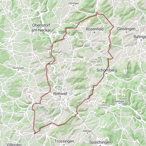
Embark on a scenic gravel route from Dauchingen through Flözlingen to Deißlingen.
This 74-kilometer gravel route with an ascent of 1104 meters offers a scenic journey from Dauchingen to Deißlingen via Flözlingen. Highlights along the way include Flözlingen, Tierstein, Epfendorf, Dautmergen, Wellendingen, and Deißlingen. The route provides a moderate challenge for amateur cyclists and rewards them with breathtaking natural landscapes. With a difficulty rating of 3 and an epicness level of 3, this route offers a balanced and enjoyable experience for cyclists. Flözlingen showcases its natural beauty, while Tierstein mesmerizes with its medieval castle ruin.
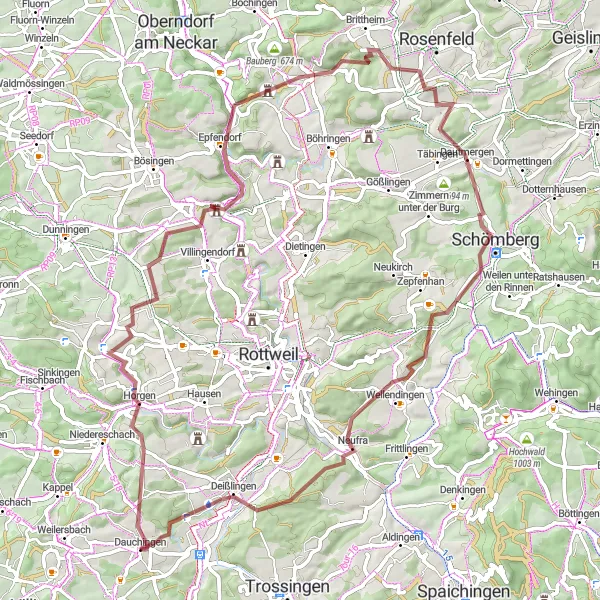
Embark on an exciting gravel adventure from Dauchingen to Deißlingen.
This 84-kilometer gravel route with an ascent of 1313 meters provides an adventurous and scenic journey. Highlights along the way include Villingendorf, Kapfkreuz, Epfendorf, Heiligenzimmern, Schömberg, Wellendingen, and Deißlingen. The route offers a moderately challenging ride with several rewarding climbs and descents. With a difficulty rating of 4, it is suitable for skilled amateur cyclists seeking a fulfilling outdoor experience. The route's epicness level is rated 3, offering a mix of stunning natural landscapes and quaint villages.
Dauchingen to Uhufelsen Loop
Cycle through beautiful landscapes and enjoy a scenic route to the top of Uhufelsen.
This round-trip cycling route starting in Dauchingen takes you through various highlights, including Froschberg, Schellenberg, Bräunlingen, Oberbränd, and Fohrenbühl. The route covers a distance of 80 kilometers with an ascent of 1180 meters. It is suitable for gravel bikes and offers stunning views of the surrounding countryside. The total ride difficulty is rated 4, making it ideal for well-trained amateurs. With an epicness rating of 3, this route offers a challenging yet enjoyable experience for cyclists.
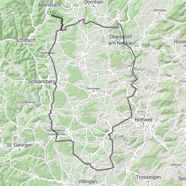
Experience beautiful landscapes and historical sites on this scenic road cycling route.
Cycle through the stunning countryside from Dauchingen to Zimmern ob Rottweil on this road cycling route. Covering a distance of 94 kilometers and an ascent of 1510 meters, this route provides a challenging yet rewarding experience for cyclists. Highlights along the way include Dauchingen, Hankenberg, Hardt, Aichhalden, Reutiner Berg, Schillerhöhe, Oberndorf am Neckar, and Zimmern ob Rottweil. With a difficulty level of 4, this route is suitable for experienced amateur cyclists seeking to explore the region's historical and natural sites. It has an epicness rating of 4, making it one of the most memorable cycling adventures in the area.
Cycling routes nearby:


Nearby regions: