Lahnstein to Rheinanschlusskaserne Road Route
A road cycling route starting from Lahnstein
A scenic road route from Lahnstein to Rheinanschlusskaserne offering picturesque river views
Map
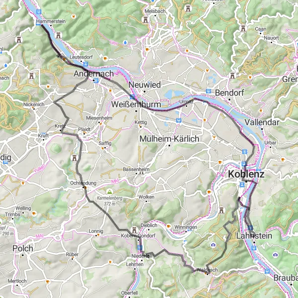
This 88-kilometer road route starts in Lahnstein and takes cyclists on a picturesque journey to Rheinanschlusskaserne. With an ascent of 879 meters, it provides a moderate challenge suitable for well-trained amateur cyclists. Along the way, cyclists will pass through highlights such as Kühkopf, Waldesch, Ochtendung, Plaidter Hümmerich, Krahnenberg, Rheintor, and Rheinanschlusskaserne, each offering its own unique charm and attractions.
road
88 km
879 m
Chill
Route profile
Highlights on the route
0 km
0 km
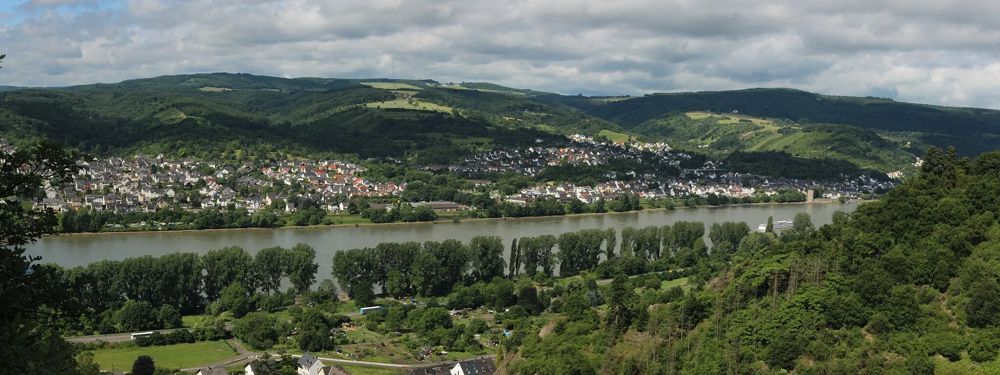
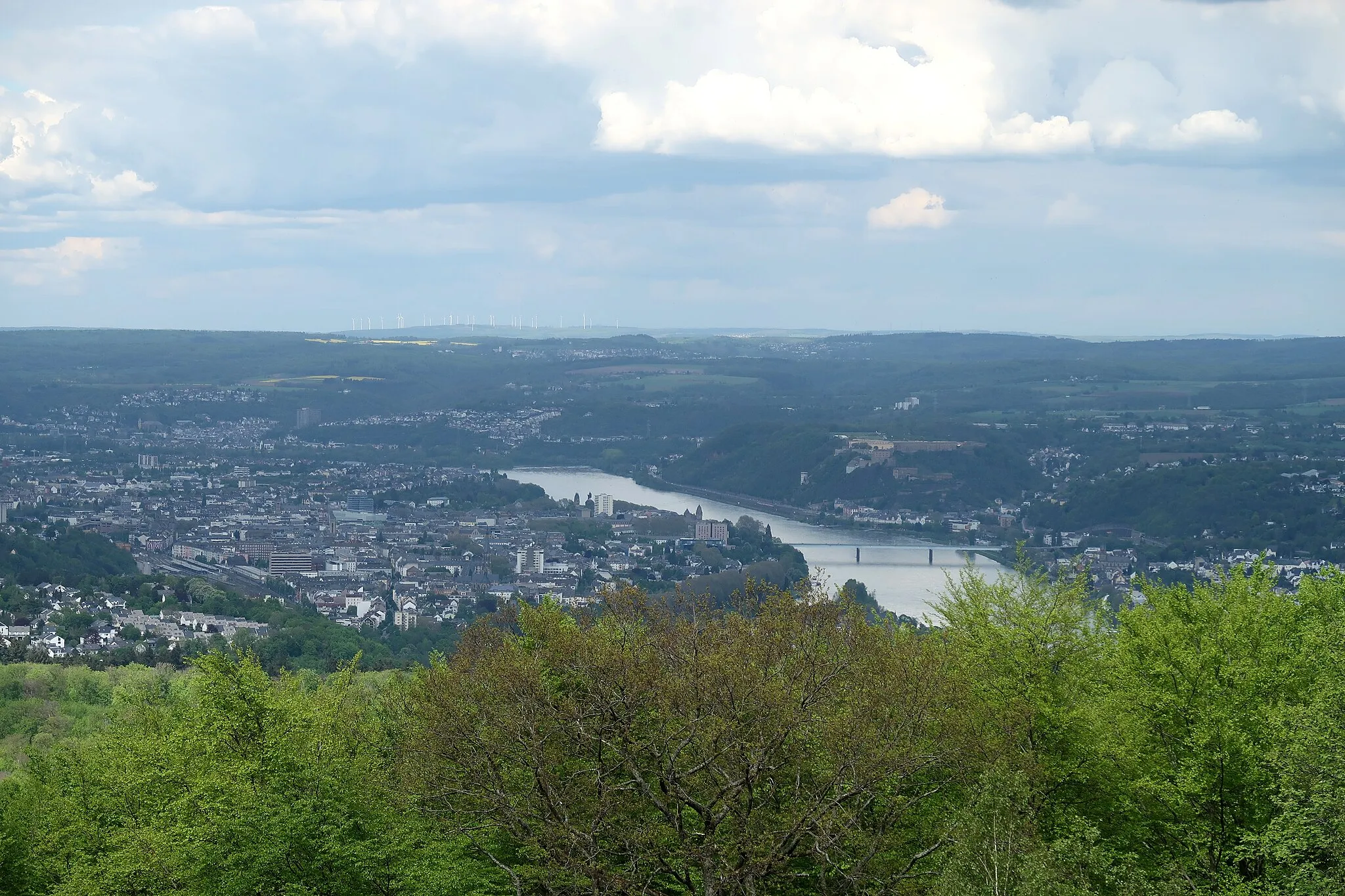
Start: Lahnstein City centerLahnstein: Cycle along the Rhine River and conquer the famous climb to Ehrenbreitstein Fortress in Lahnstein.
Lahnstein is a scenic town in Koblenz, Germany that offers a variety of cycling opportunities. As a road and gravel cyclist, you will find well-paved roads and a mix of challenging climbs and gentle slopes in the surrounding area. Lahnstein is situated along the Rhine River, providing cyclists with stunning river views during their rides. Nearby, the famous climb to the Ehrenbreitstein Fortress offers a challenging ascent for experienced cyclists. With its beautiful scenery and cycling-friendly routes, Lahnstein deserves a rank of 4.10 km
10 km
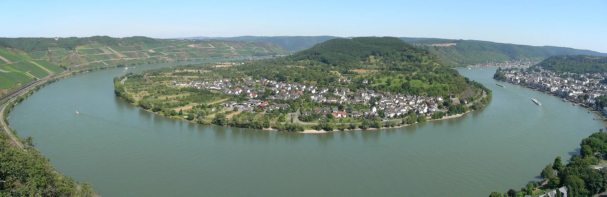
Kühkopf382 mPeakKühkopf, located 10 kilometers from the start, offers breathtaking panoramic views of the Rhine River and the surrounding countryside.
14 km
14 km
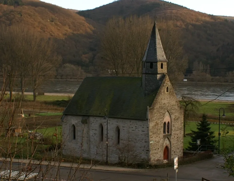
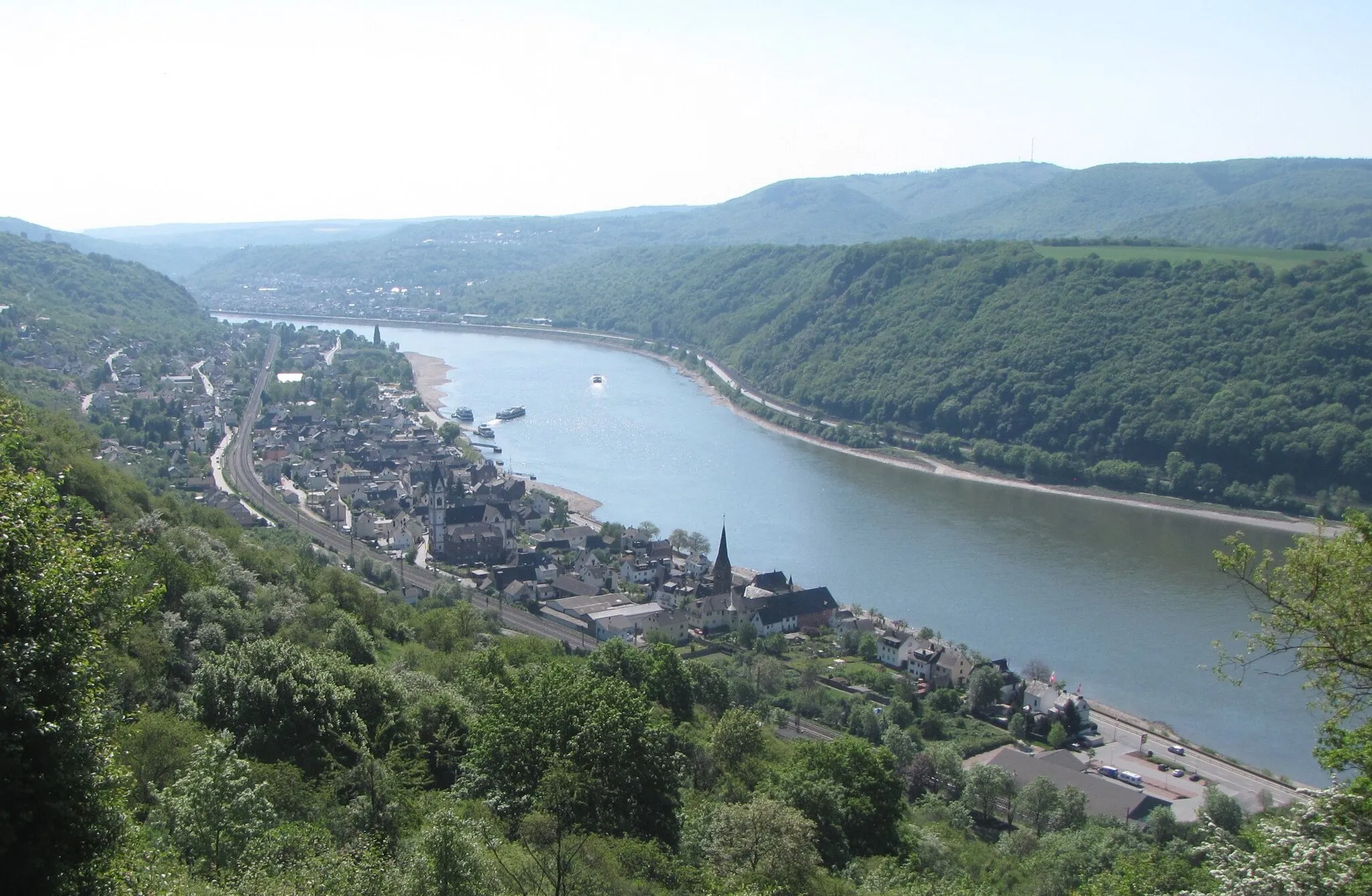
WaldeschVillageWaldesch, located 14 kilometers from the start, is a tranquil village known for its beautiful forests and peaceful hiking trails.
32 km
32 km
OchtendungVillageOchtendung, located 32 kilometers from the start, is a charming town with historic buildings, including a medieval fortress and a picturesque town square.
38 km
38 km
Plaidter Hümmerich259 mPeakPlaidter Hümmerich, located 38 kilometers from the start, is a popular hilltop viewpoint offering stunning vistas of the Rhine Valley.
59 km
59 km
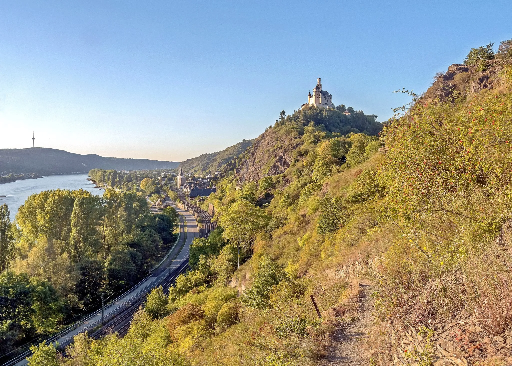
KrahnenbergViewpointKrahnenberg, located 59 kilometers from the start, features a majestic castle ruin with commanding views over the Rhine River.
60 km
60 km
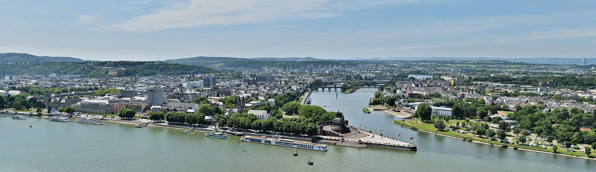
RheintorAttractionRheintor, located 60 kilometers from the start, is a well-preserved city gate that once served as an entrance to Koblenz.
82 km
82 km
RheinanschlusskaserneCastle RuinsRheinanschlusskaserne, located 82 kilometers from the start, is a military training facility offering a glimpse into Germany's defense history.
88 km
88 km
Finish: Lahnstein City centerLahnstein: Cycle along the Rhine River and conquer the famous climb to Ehrenbreitstein Fortress in Lahnstein.
Cycling routes from Lahnstein:
Cycling routes nearby: