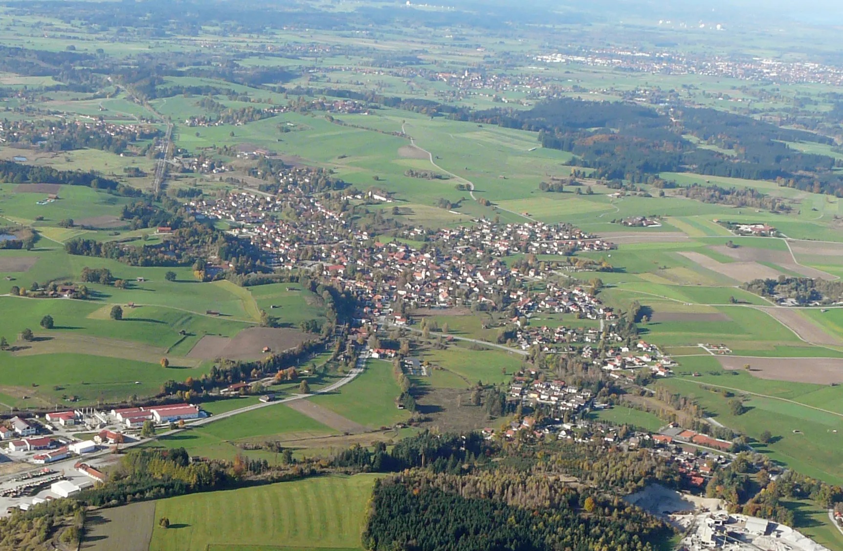
Immerse yourself in the stunning landscapes and famous climbs of Huglfing, Germany.
Cycling routes from Huglfing
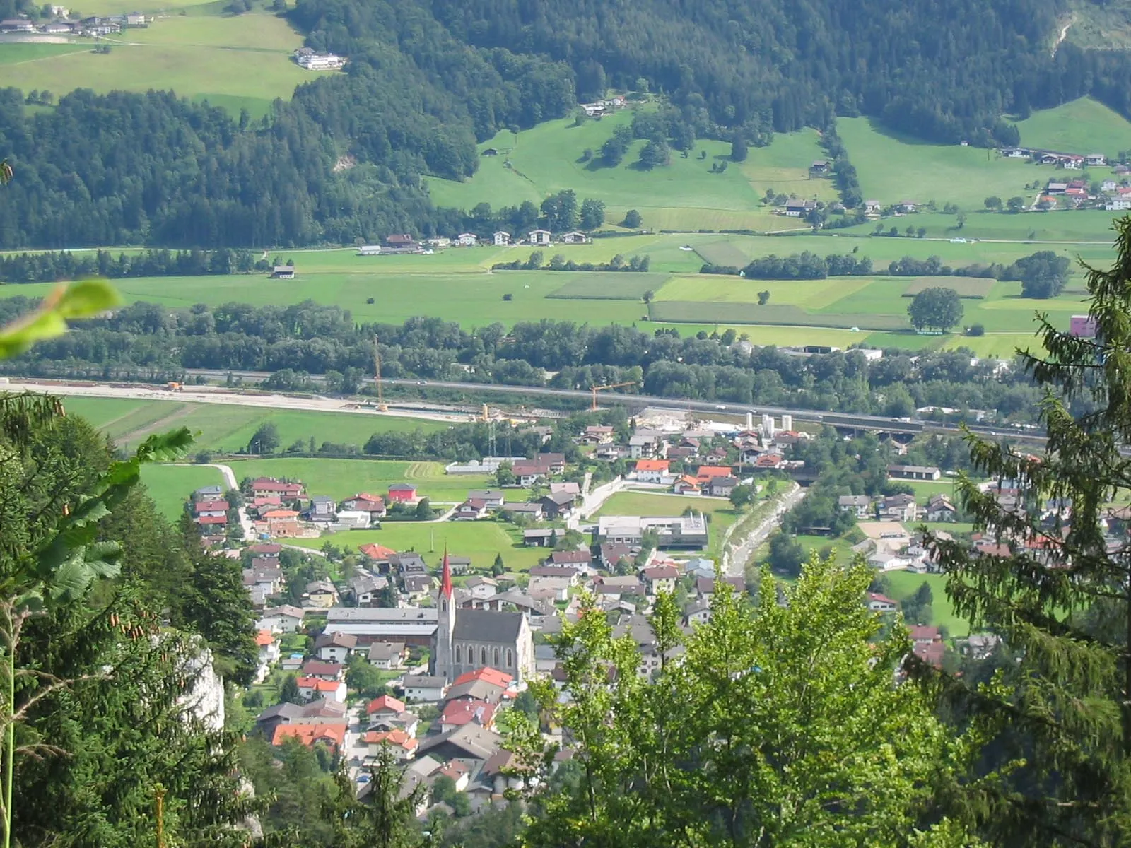
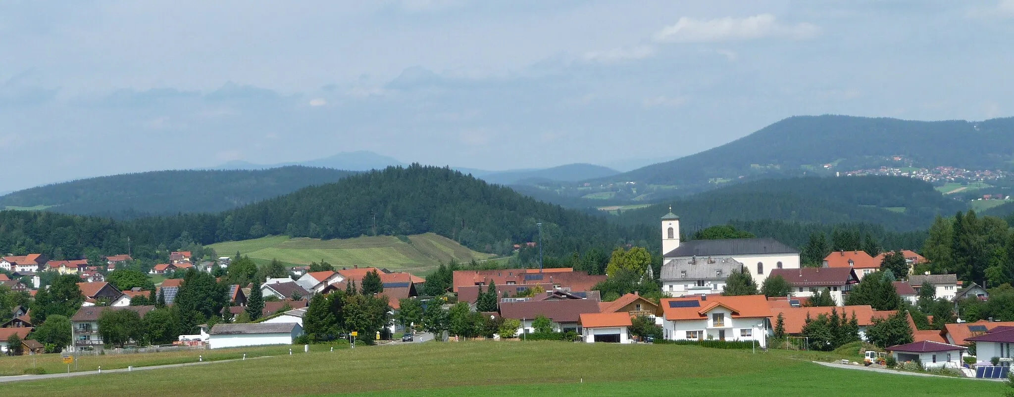
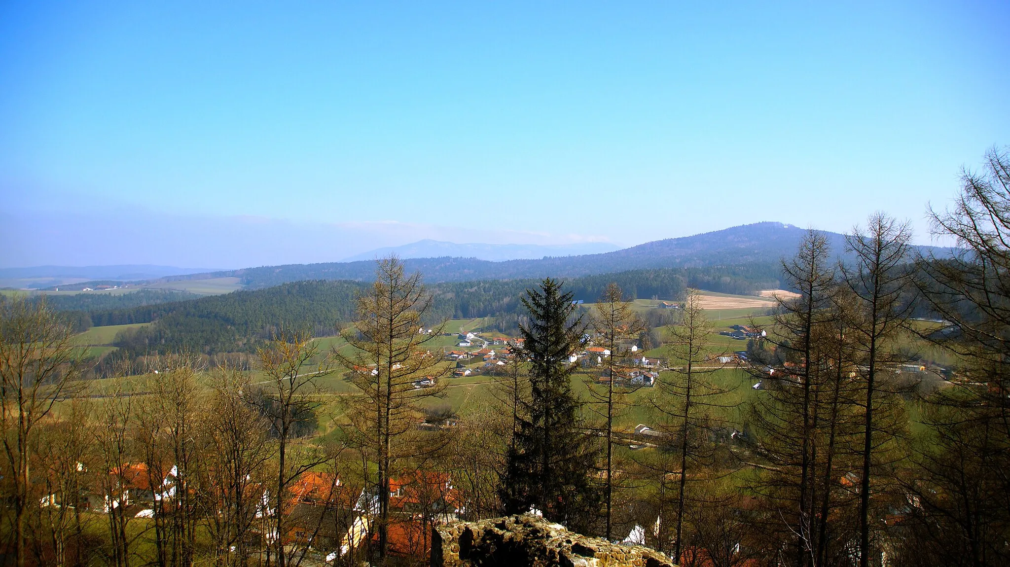
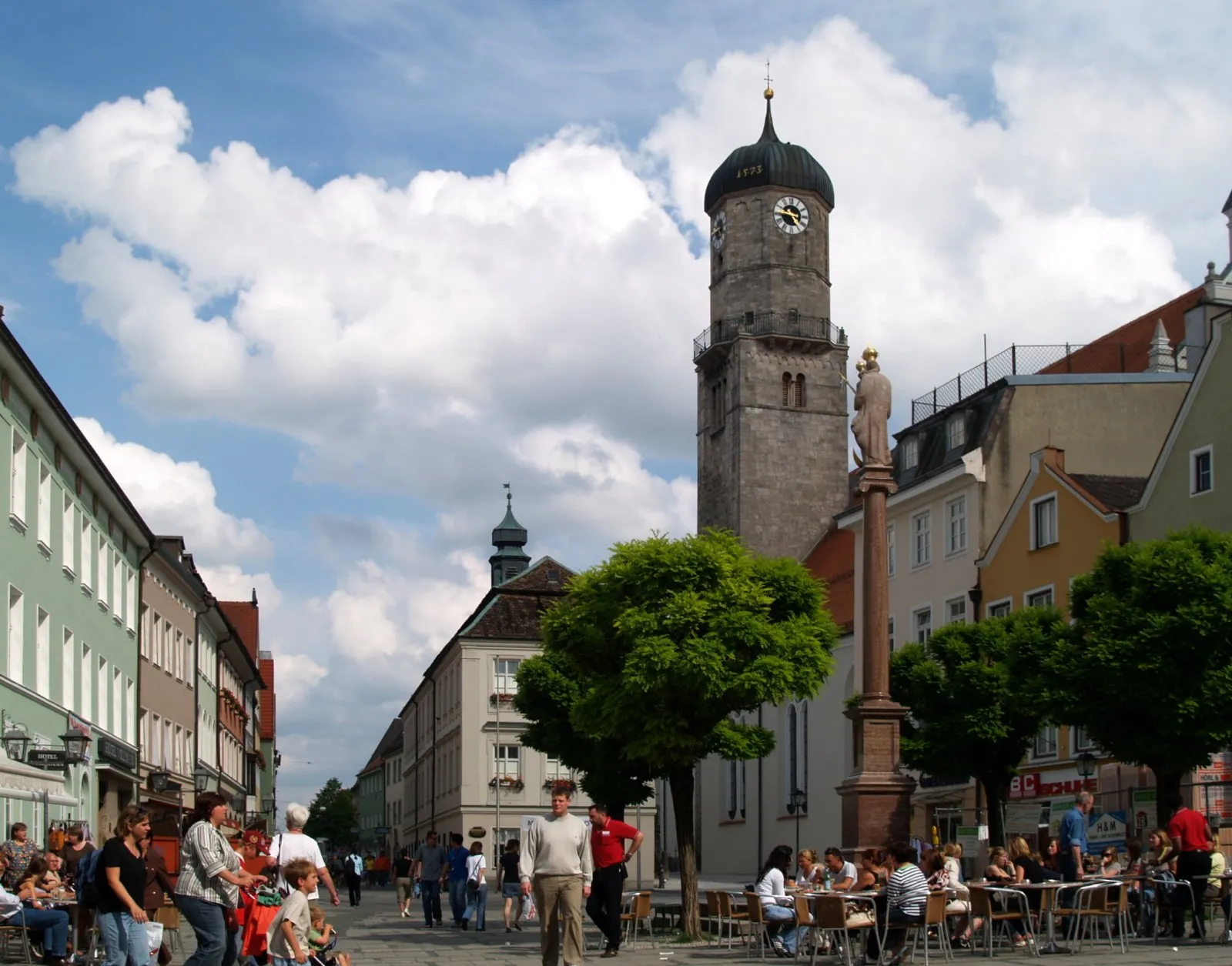
Huglfing, located in Bavaria, Germany, is a paradise for road and gravel cyclists. The region offers a mix of flat and hilly terrain, providing various challenges. You can enjoy breathtaking views of the German Alps on clear days and explore the picturesque villages and forests. Cyclists seeking a thrilling climbing experience can tackle the famous Franziskanerweg, a renowned climb nearby. With its stunning nature and well-maintained cycle routes, Huglfing is a must-visit destination for cycling enthusiasts.
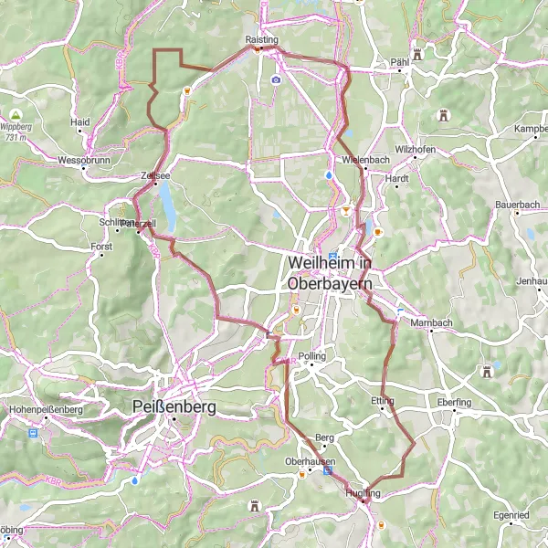
Embrace the rugged beauty of the Rameck region on this gravel loop
The Rameck Gravel Loop takes you on an adventurous journey through the stunning Rameck region. Starting near Huglfing, this 52-kilometer gravel route offers gravel cyclists a taste of Bavaria's rugged and scenic landscapes. With an ascent of 459 meters, this route is suitable for beginners and offers a variety of terrains, from rolling hills to forest trails. Some highlights along this gravel loop include Rameck, offering picturesque vistas of the surrounding countryside, the rustic beauty of Ammerberg, and Hahnenbühel, a small hill providing a challenging but rewarding climb.
Gravel Adventure near Huglfing
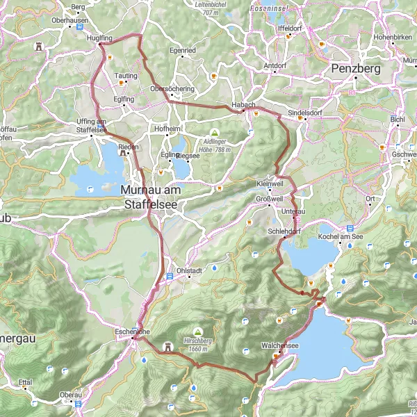
Explore the remote gravel roads and beautiful landscapes near Huglfing
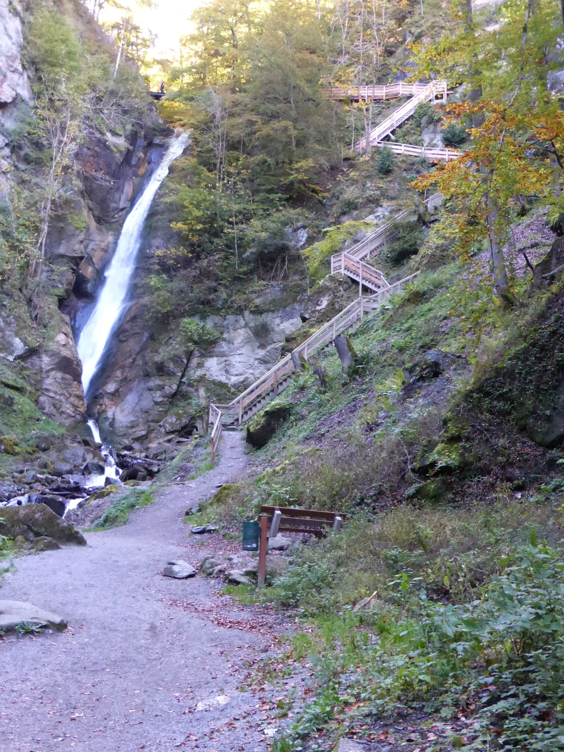
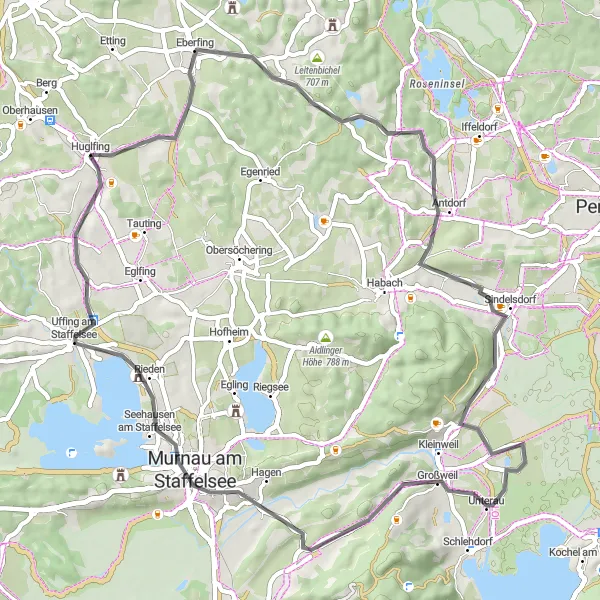
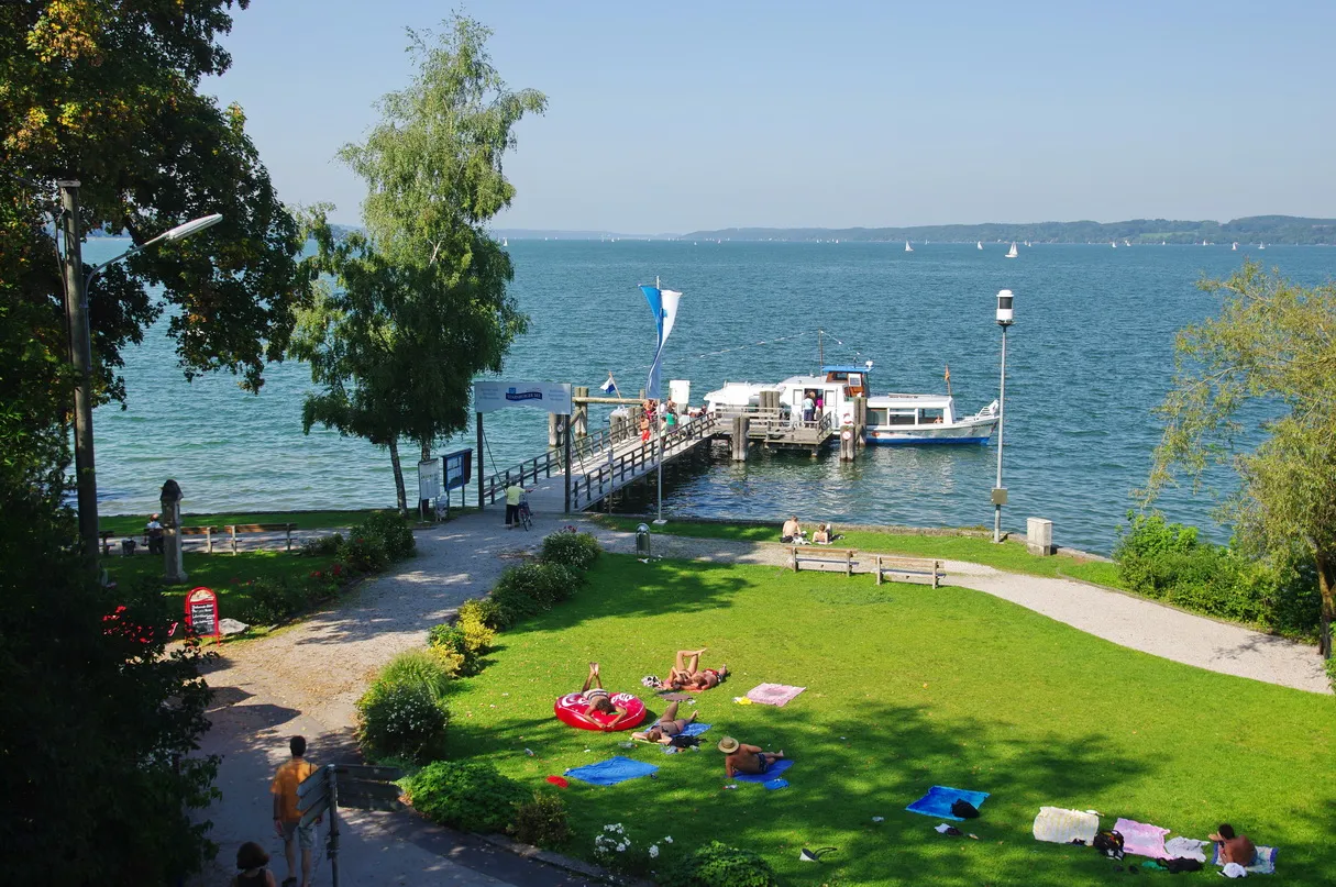
This gravel cycling route near Huglfing offers a thrilling adventure through stunning landscapes and secluded paths. With a total distance of 76 kilometers and an elevation gain of 1197 meters, this route is suitable for well-trained amateur cyclists seeking a challenge. The trail will take you to picturesque towns such as Steinberg and Habach, where you can discover their rich history and traditional Bavarian architecture. As you cycle through Schlehdorf, enjoy the stunning views of the shimmering Walchensee. The Ramskopf viewpoint offers panoramic vistas of the surrounding Bavarian Alps. For nature lovers, the Vest and Antlüßbichel highlights provide opportunities to immerse in serene natural environments. The route finishes in Murnau am Staffelsee, a charming town known for its connection to the art movement. Overall, this gravel adventure near Huglfing showcases the breathtaking beauty and cultural attractions of the Oberbayern region.
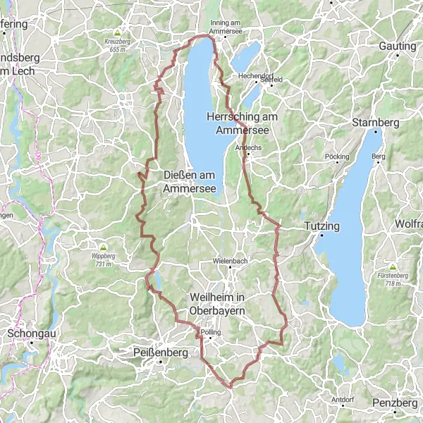
Venture into the scenic Ammerberg region on this gravel adventure
The Ammerberg Gravel Challenge takes you on an off-road adventure through the scenic Ammerberg region. This 99-kilometer gravel route starts near Huglfing and boasts a total ascent of 1,180 meters, making it a perfect choice for gravel enthusiasts seeking a challenge. The Ammerberg region offers a diverse landscape of rolling hills, expansive meadows, and dense forests, providing a captivating backdrop throughout the journey. Highlights of this gravel route include the Ammerberg mountain range, with its rugged terrain and panoramic views, the charming village of Paterzell, known for its traditional Bavarian houses, and Weinberg, a picturesque spot perfect for a rest break.
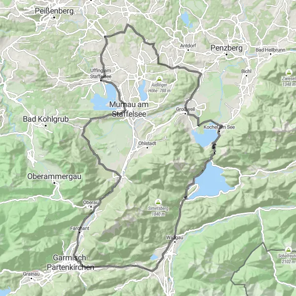
Explore the stunning Riedberg Pass and the picturesque Staffelsee on this challenging road cycling route.
Embark on a memorable journey through the picturesque landscapes of Oberbayern as you tackle the Riedberg Pass and soak in the beauty of Staffelsee. This route offers cyclists a challenging but rewarding experience, with breathtaking views and cultural highlights along the way. From the majestic peaks of Riedberg to the tranquil waters of Staffelsee, this route combines both natural beauty and historic charm.
Foothills and Countryside Loop
Explore the stunning Bavarian foothills and countryside
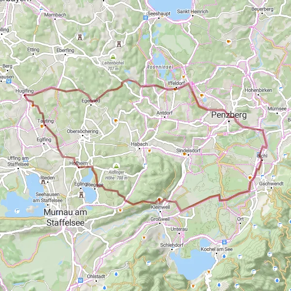
The Foothills and Countryside Loop takes you on a scenic tour through the breathtaking Bavarian foothills and picturesque countryside. The route starts near Huglfing and offers a mix of challenging climbs and gentle rolling hills, making it suitable for intermediate cyclists. With a total distance of 112 kilometers and an ascent of 1,236 meters, this road cycling route provides a rewarding challenge with stunning vistas along the way. The highlights of this route include the enchanting village of Riedberg, nestled among lush green meadows and offering a serene place to rest, the panoramic views of the Alps from Habach, and Kleinweil, a charming Bavarian village known for its traditional architecture and peaceful atmosphere.
Mühlfeld Circuit
Undulating route through quaint Bavarian villages
The Mühlfeld Circuit is a delightful cycling route that takes you through the charming Bavarian countryside. The route starts near Huglfing and winds its way through scenic landscapes and quaint villages. With a total distance of 147 kilometers and an ascent of 1,687 meters, this road biking route provides a challenging yet rewarding ride for experienced cyclists. The highlights along the route include the picturesque town of Eberfing, with its historic buildings and stunning views, the scenic Alpenpanorama stretch, where you can soak in breathtaking vistas of the Alps, and the idyllic Schönmühl, a perfect spot for a rest and refreshment stop.
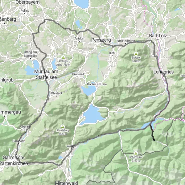
Embark on a challenging road cycling tour through the spectacular Alps and discover picturesque lakes along the way.
This road cycling route starting near Huglfing takes you on a challenging tour through the magnificent Alps while enjoying the beauty of the surrounding lakes. With a total distance of 118 km and an ascent of 1458 m, this route is suitable for experienced cyclists. The difficulty level is rated at 5/5, indicating its demanding nature, and it has an epicness factor of 4/5. Highlights include: - Hohenberg: Ride up to Hohenberg and enjoy the stunning views from this high vantage point. - Seeshaupt: Pass through Seeshaupt and take in the mesmerizing sights of Lake Starnberg. - Reindlschmiede: take a break at Reindlschmiede and admire the peaceful surroundings. - Wackersberg: Cycle through Wackersberg and enjoy its scenic landscapes and idyllic charm. - Weinberg: Stop by at Weinberg and explore its picturesque vineyards. - Brunnenberg: Climb up to Brunnenberg and enjoy the breathtaking panoramic view. - Sachenbach: Pass through Sachenbach, a charming village with stunning views of the Alps. - Brandenstein: Visit Brandenstein and admire its natural beauty and captivating landscapes. - Kochel am See: Cycle along Lake Kochel and take in the beautiful scenery. - Spatzenhausen: Pass through Spatzenhausen and experience its rural beauty. - Pullach: Visit Pullach and admire its historical sites and natural scenery. The highlights along this road route are ranked between 4/5 and 5/5, indicating their high attractiveness. The overall experience of this cycling tour is a challenging yet rewarding journey through spectacular mountain viewpoints and picturesque lakes.
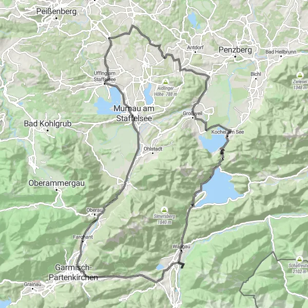
Cycle through beautiful Eberfing and enjoy the scenic Staffelsee
This road cycling route starting near Huglfing takes you through the charming village of Eberfing and offers stunning views of the Staffelsee. With a total distance of 56 km and an ascent of 462 m, it is suitable for a well-trained amateur cyclist. The route is moderately difficult (3/5) and has an epicness factor of 4/5. Highlights include: - Eberfing: Stop by in Eberfing and explore the idyllic Bavarian village full of traditional charm. - Hirtenberg: Enjoy the breathtaking view from Hirtenberg, located on top of a hill along the route. - Angerberg: Cycle through Angerberg and admire its natural beauty. - Dürnhausen: Pass through Dürnhausen and take in the picturesque scenery along the way. - Großweil: Make a stop in Großweil and discover its historical attractions. - Staffelsee: Take a break at the Staffelsee and enjoy the tranquil beauty of this Bavarian lake. The highlights are ranked between 4/5 to 5/5, indicating their high attractiveness. Overall, this cycling route offers a unique experience through scenic landscapes and cultural highlights.
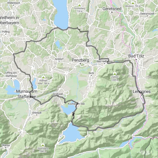
Embark on a thrilling gravel cycling adventure through stunning Alpenpanorama landscapes.
This gravel cycling route near Huglfing takes you on an adventurous tour through the beautiful Alpenpanorama landscapes. With a total distance of 56 km and an ascent of 544 m, this route is suitable for experienced gravel riders. The difficulty level is rated at 4/5 and it has a high epicness factor of 4/5. Highlights include: - Neuried: Visit Neuried, a charming village along the route, and enjoy its natural surroundings. - Alpenpanorama: Experience the breathtaking views of the Alpenpanorama landscapes, offering panoramic vistas and picturesque valleys. - Penzberg: Explore Penzberg, a vibrant town with a rich cultural history and stunning architecture. - Horn: Ride through Horn, a small village with architectural gems and scenic beauty. - Bichl: Take a break in Bichl and enjoy its beautiful surroundings and traditional Bavarian charm. - Kloster Benediktbeuern-Ausblick: Admire the panoramic view from the Kloster Benediktbeuern outlook point. - Kleinweil: Stop by in Kleinweil and discover its idyllic atmosphere and charming buildings. - Eschberg: Cycle up to Eschberg, a hill offering great views of the surrounding landscape. - Spatzenhausen: Pass through Spatzenhausen and experience its rural beauty. - Pullach: Visit Pullach and admire its historical sites and natural scenery. The highlights along this gravel route are ranked between 4/5 and 5/5, indicating their high attractiveness. The overall experience of this cycling tour is an adventurous journey through beautiful landscapes and cultural highlights.
Untouched Wilderness
Embark on a thrilling gravel cycling adventure through untouched wilderness and scenic forests.
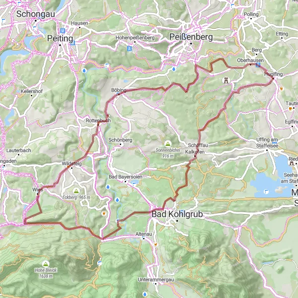
This gravel cycling route near Huglfing takes you through untouched wilderness and scenic forests, offering an off-the-beaten-path adventure. With a total distance of 66 km and an ascent of 1077 m, this route is suitable for experienced gravel riders. The difficulty level is rated at 4/5, indicating its challenging nature, and it has an epicness factor of 3/5. Highlights include: - Schweinberg: Make a stop in Schweinberg and explore the tranquil beauty of this hidden gem. - Kalkofen: Experience the natural serenity of Kalkofen, nestled deep within the forests along the route. - Hinterkehr: Cycle through Hinterkehr and immerse yourself in the atmospheric surroundings of this hidden spot. - Wetzstein: Visit Wetzstein and enjoy the peace and tranquility of this picturesque location. - Haldemooseck: Take a break at Haldemooseck and take in the breathtaking views from this scenic viewpoint. - Schildschwaig: Pass through Schildschwaig and appreciate the picturesque forest scenery. - Rottenbuch: Discover the charming village of Rottenbuch and experience its rural beauty. - Kreilhof: Stop by at Kreilhof and enjoy its peaceful atmosphere and natural surroundings. - Schnait: Cycle through Schnait and take in the beautiful landscapes. The highlights along this gravel route are ranked between 3/5 and 4/5, indicating their attractiveness. The overall experience of this cycling tour is an adventurous journey through untouched wilderness and picturesque forests.
Cycling routes nearby:


Nearby regions: