Cycling Haven in Oberfranken
Cycling routes from Litzendorf
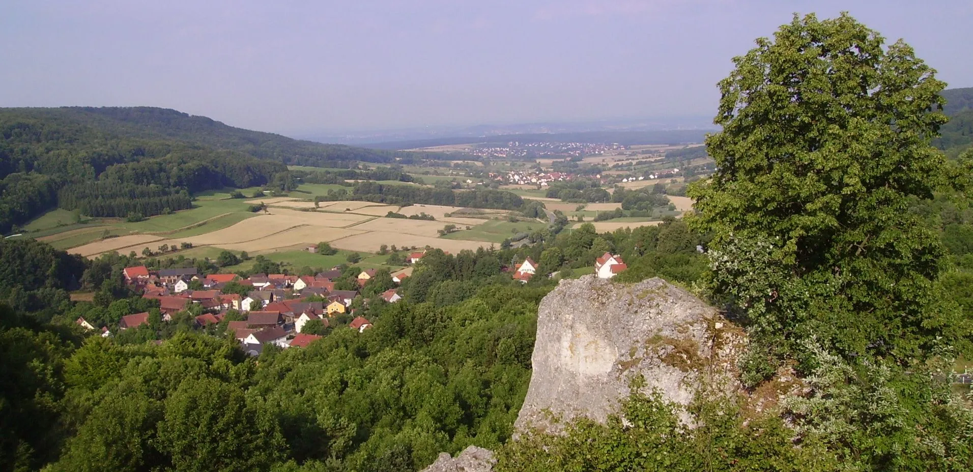
Litzendorf in Oberfranken, Germany, offers a diverse range of cycling opportunities. Cyclists can enjoy exploring the tranquil countryside and small villages, as well as testing their skills on challenging climbs. A noteworthy cycling spot nearby is the Alpe d'Huez, a breathtaking climb that has hosted several stages of the Tour de France. Litzendorf also has a well-connected network of cycling routes and dedicated paths, making it a cyclist-friendly locality. With its varied cycling options and famous climbs, Litzendorf earns a high rank of 4 on the cyclist perspective scale.
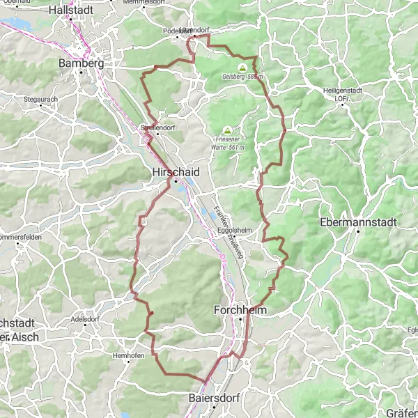
A challenging gravel route with a climb to Kreuzberg.
This gravel cycling route near Litzendorf is perfect for those seeking a challenging and adventurous ride. Covering a distance of 85 km and with an ascent of 1162 m, it offers a mix of gravel paths and scenic climbs. The highlight of the route is the climb to Kreuzberg, located at the 59 km mark. Prepare yourself for a demanding ascent and enjoy panoramic views from the top.
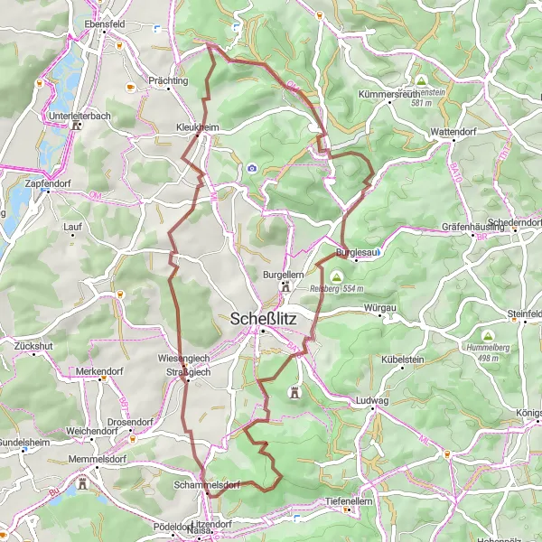
Explore the scenic Schammelsdorf and enjoy the challenging climb up Reisberg!
This gravel cycling route covers a distance of 46 km with a total ascent of 809 meters. Starting from Litzendorf, you will cycle through Schammelsdorf and experience the peaceful scenery of Wiesengiech. The highlight of this route includes the beautiful Schammelsberg and the challenging Reisberg climb. Overall, this route is suitable for intermediate cyclists and scores a 2 in difficulty and 3 in epicness.
Schammelsdorf Loop Road Route
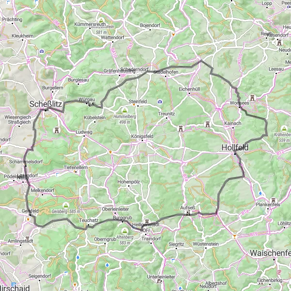
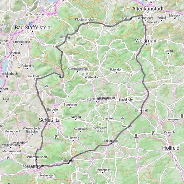
A scenic road route that includes a visit to Schammelsdorf.
This road cycling route near Litzendorf features a diverse mix of landscapes and terrain. With a total distance of 76 km and an ascent of 1132 m, it offers a challenging yet rewarding experience. The highlight of the route is the village of Schammelsdorf, located at the 0 km mark. Take a break to explore its charming streets and enjoy local Bavarian cuisine.
Zückshut Loop
Challenge yourself with the legendary Zückshut climb!
This road cycling route covers 89 km with a total ascent of 956 meters. Starting from Litzendorf, you will embark on a challenging ride with the highlight being the iconic Zückshut climb. Along the way, you will also come across scenic spots like Oberbrunn and Frauendorf. Overall, this route is suitable for experienced cyclists and scores a 4 in difficulty and 4 in epicness.
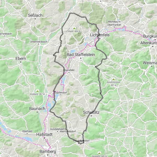
Experience the stunning Litzendorf-Blick and have a challenging climb up Burkheim!
This road cycling route takes you along an 80 km long path with a total ascent of 997 meters. Starting from Litzendorf, you will pass through charming towns like Schweisdorf and Frauendorf. The highlights of this route include the picturesque Litzendorf-Blick, which offers breathtaking views, and the challenging climb up Burkheim. Overall, this route is moderately difficult and scores a 3 in difficulty and 4 in epicness.

A scenic road cycling tour through the beautiful countryside.
This road cycling route takes you on a picturesque journey through the countryside near Litzendorf. With a distance of 50 km and an ascent of 635 m, it provides a moderately challenging ride suitable for amateur cyclists. One of the main highlights along the route is the Litzendorf-Blick viewpoint at the 1 km mark, offering panoramic views of the area.
A scenic gravel route with a visit to Villa Remeis.
Embark on a scenic gravel cycling adventure near Litzendorf, exploring the picturesque countryside. Covering a distance of 75 km and with an ascent of 737 m, this route offers a moderate challenge suitable for gravel enthusiasts. One of the highlights along the way is Villa Remeis, located at the 62 km mark. This historic villa, surrounded by beautiful gardens, provides a peaceful setting for a well-deserved break.
Starkenschwind Loop
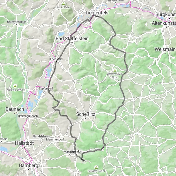
Explore the scenic beauty of Oberfranken on this challenging road cycling route.
The Starkenschwind Loop is a challenging road cycling route that takes you through the picturesque landscapes of Oberfranken, Germany. With a total distance of 77 kilometers and an elevation gain of 817 meters, this route will test the endurance and skill of even the most well-trained amateur cyclists. Starting in Litzendorf, the route passes through various highlights including Litzendorf-Blick, Ebensfeld, Seubelsdorf, Lehmigberg, Roßdorf am Berg, and Hummelberg.
Regnitztal Gravel Adventure

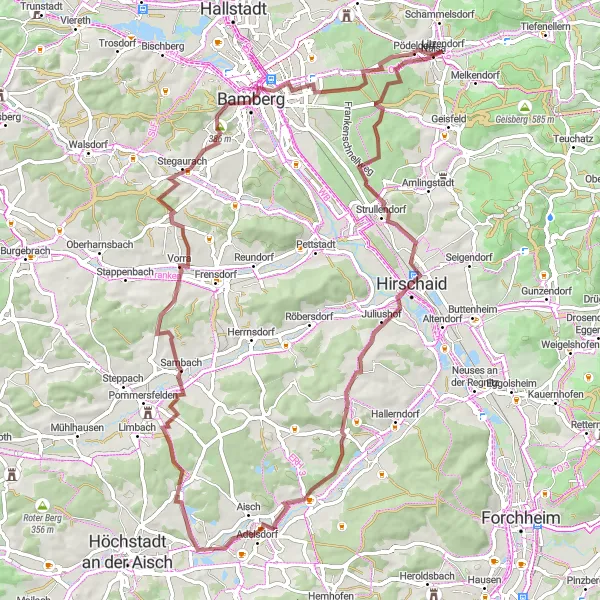
Get ready for an exciting adventure through the hills of Regnitztal!
This gravel cycling route spans over 70 km with a total ascent of 916 meters. Starting from Litzendorf, you will venture through scenic landscapes and picturesque villages like Geisberg and Kalteneggolsfeld. The highlights of this route include the beautiful views from Aussicht Regnitztal and the challenging climb up Naisa. Overall, this route is suitable for intermediate to experienced gravel cyclists and scores a 3 in difficulty and 3 in epicness.

A challenging gravel route with a visit to Modschiedel.
This gravel cycling route starting near Litzendorf takes you on a scenic adventure through the countryside. Covering a distance of 116 km and with an elevation gain of 1767 m, it is suitable for experienced gravel riders. One of the highlights along the route is the village of Modschiedel at the 33 km mark. Take some time to explore its idyllic surroundings before continuing your journey.
Cycling routes nearby:


Nearby regions: