Discovering the Natural Beauty
A road cycling route starting from Igel
Immerse yourself in nature as you cycle through picturesque landscapes.
Map
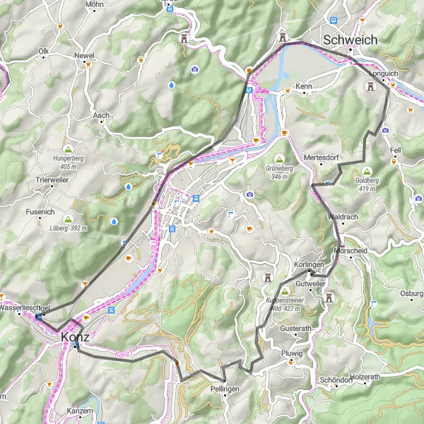
Escape into the tranquil natural beauty near Igel on this 60-kilometer road cycling route. With a total ascent of 906 meters, the route provides a moderate challenge suitable for intermediate levels. Enjoy riding through forests and vineyards, passing by Igel, a charming village known for its wine production. At 8 kilometers into the route, Kestenberg offers a breathtaking view of the hilly landscape. Don't miss the opportunity to visit Schweich, located at 21 kilometers, known for its beautiful riverfront promenade and vineyards. Take a moment at Granahöhe, a highlight at 59 kilometers, to admire the panoramic views of the Moselle River.
road
60 km
906 m
Chill
Route profile
Highlights on the route
0 km
0 km
Start: Igel Village centerIgel: Combining scenic vineyards, historical monuments, and challenging climbs in Trier region.
Igel is a locality situated in Trier region of Germany. It offers diverse cycling opportunities for road and gravel cyclists. The region is known for its picturesque vineyards, rolling hills, and historical monuments, providing cyclists with a unique blend of natural beauty and cultural heritage. Cyclists can explore the scenic countryside and visit famous landmarks like the Igel Column, a UNESCO World Heritage Site. Nearby, there are popular cycling locations such as the Saar-Hunsrück Nature Park and Moselle River, offering a mix of challenging climbs and beautiful landscapes. With its rich history and cycling-friendly atmosphere, Igel is an excellent destination for cyclists.0 km
0 km
IgelVillageIgel, at the start of the route, is a quaint village famous for its wine production and scenic setting.
8 km
8 km
Kestenberg248 mPeakKestenberg, at 8 kilometers, offers panoramic views of the surrounding countryside and lush vineyards.
21 km
21 km
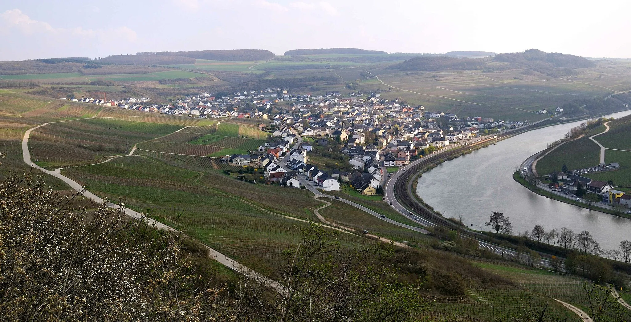
SchweichTownSchweich, at 21 kilometers, is a charming town known for its viticulture and picturesque riverside views.
28 km
28 km
Goldberg419 mPeakGoldberg, at 28 kilometers, is a picturesque hilltop village with medieval charm and stunning scenery.
38 km
38 km
KorlingenVillageKorlingen, at 38 kilometers, features traditional architecture and lovely countryside views.
39 km
39 km
Kuppensteiner Wild427 mPeakKuppensteiner Wild, at 39 kilometers, is a forested area known for its tranquil atmosphere and beautiful hiking trails.
47 km
47 km
PellingenVillagePellingen, at 47 kilometers, is a peaceful village surrounded by vineyards, orchards, and rolling hills.
59 km
59 km
GranahöheViewpoint60 km
60 km
Finish: Igel Village centerIgel: Combining scenic vineyards, historical monuments, and challenging climbs in Trier region.
Cycling routes from Igel:
Trier and Beyond Exploring the Scenic Countryside Discovering the Natural Beauty Gravel Adventure Moselle and Roman Delights Stunning Views of the Moselle River Exploring Forests and Landscapes on Gravel Roads Scenic Gravel Adventure with Cultural Highlights Trier's Beautiful Countryside Gravel Adventure Near Igel Trierweiler and Konz Loop Trier to Igel Loop Gravel Adventure: Wasserliesch to Igel Gravel Expedition: Trier to Konz
Cycling routes nearby: