Hilly Road Adventure
A road cycling route starting from Wasserliesch
Conquer challenging hills and enjoy breathtaking views along the way
Map
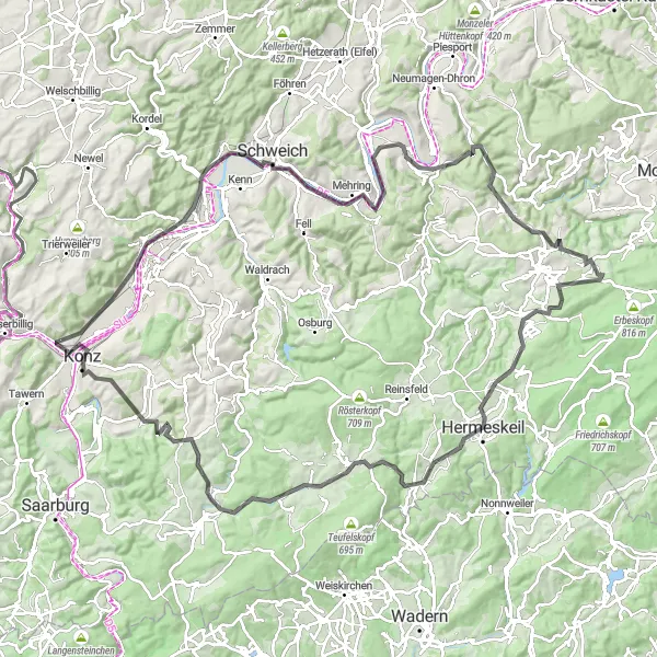
Embark on a hilly road adventure through the stunning landscapes of the Moselle region. With a total ascent of 1,755m and a distance of 122km, this route will put your climbing skills to the test. Enjoy picturesque villages, panoramic views, and the thrill of conquering challenging climbs.
road
122 km
1755 m
Tough
Route profile
Highlights on the route
0 km
0 km
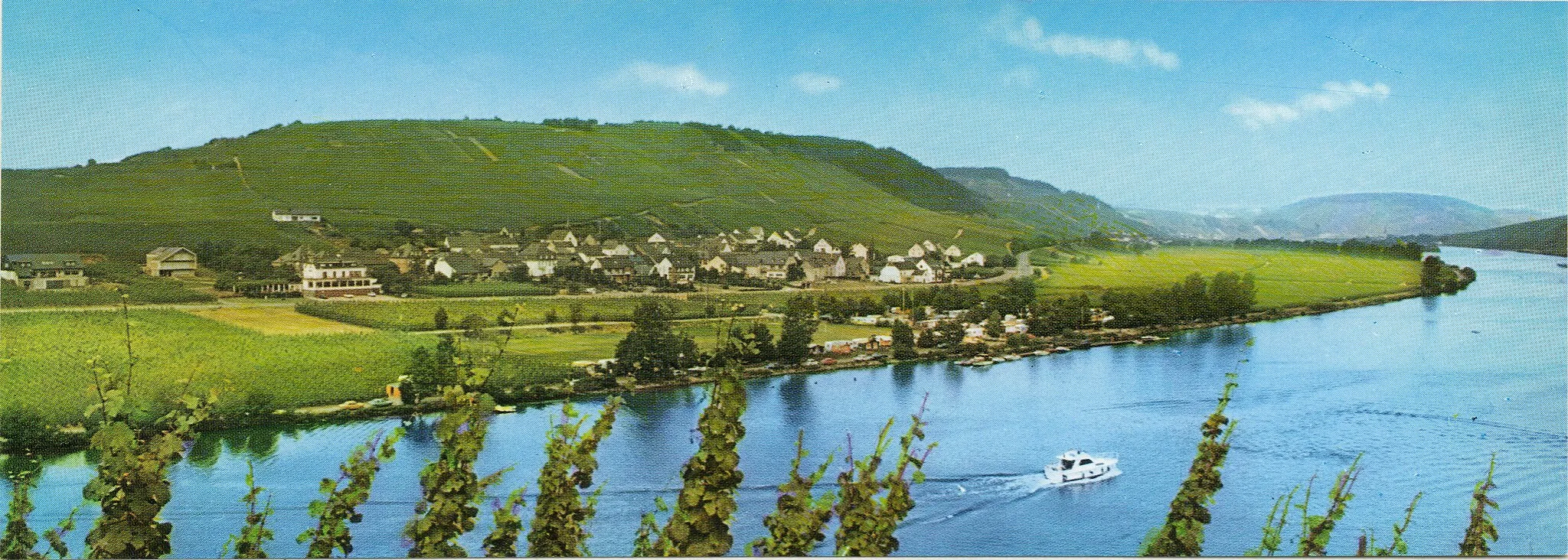
Start: Igel Village centerWasserliesch: Cycle through picturesque vineyards along the Moselle River in Wasserliesch, Trier, Germany.
Wasserliesch, located in Trier, Germany, is a charming locality that offers scenic cycling routes along the Moselle River. The area is known for its vineyards and wine production, providing a unique backdrop for cyclists. While not specifically renowned for well-known climbs, Wasserliesch presents an opportunity to indulge in leisurely rides while enjoying the beautiful countryside views. With its distinct charm and cycling-friendly atmosphere, Wasserliesch is a delightful choice for cyclists.0 km
0 km
IgelVillage8 km
8 km
Kestenberg248 mPeakKestenberg offers spectacular panoramic views of the Moselle Valley.
21 km
21 km
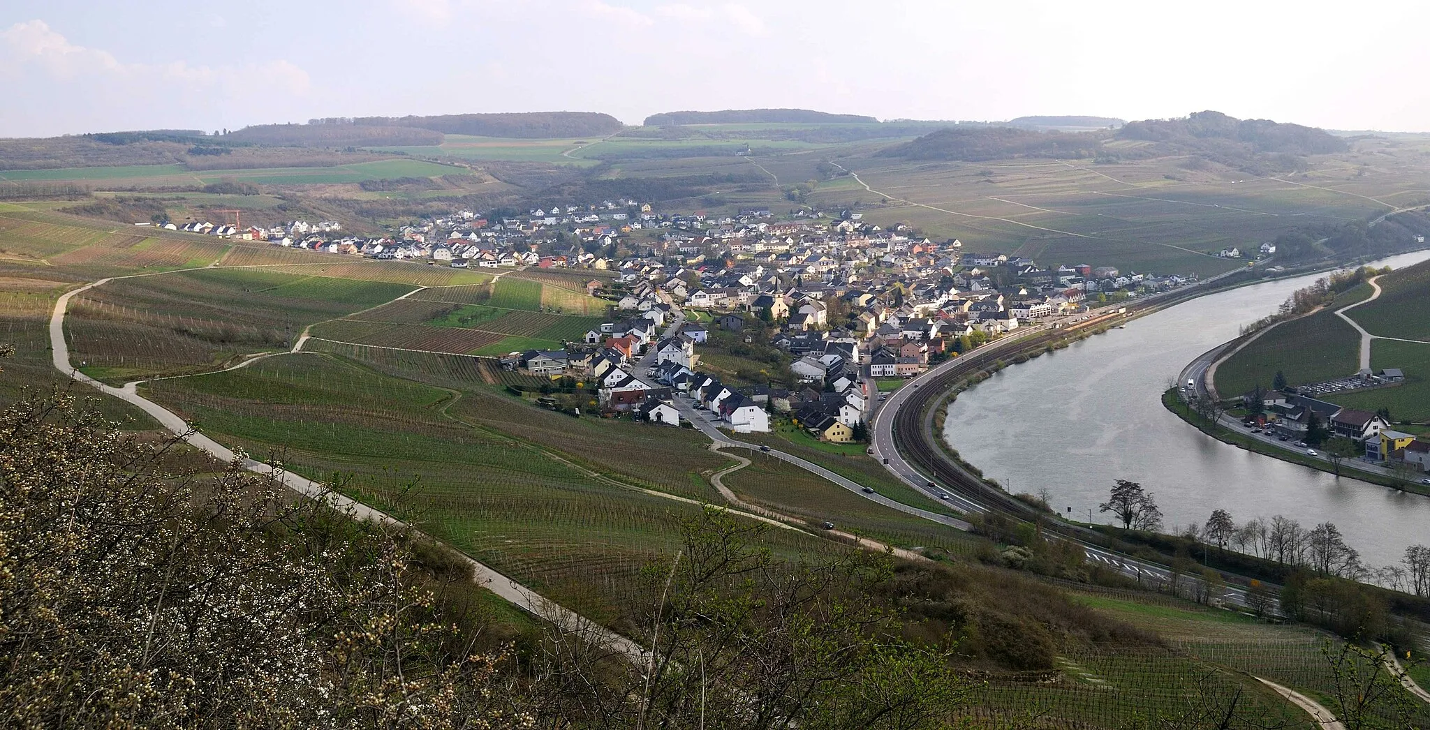
SchweichTownSchweich is a charming town known for its wine production. Take a break and sample some local wines.
22 km
22 km
Angelberg238 mPeakAngelberg boasts beautiful landscapes and offers a serene getaway from the busier parts of the region.
31 km
31 km
PölichVillagePölich is a picturesque village surrounded by vineyards, offering gorgeous views along the way.
41 km
41 km
Kronenberg375 mPeakKronenberg is known for its historical sites, including the ruins of an old castle.
49 km
49 km
BerglichtVillageBerglicht is a peaceful village with quaint architecture and lush countryside.
64 km
64 km
Röderberg640 mPeakRöderberg offers stunning vistas of the hilly landscape and the winding Moselle River.
76 km
76 km
HermeskeilTownHermeskeil is home to a fascinating aviation museum, showcasing a wide range of aircraft and artifacts.
83 km
83 km
Hasenknopf497 mPeakHasenknopf is a scenic hilltop with commanding views over the surrounding countryside.
100 km
100 km
HenternVillageHentern is famous for its beautiful woodlands, perfect for leisurely walks or nature photography.
105 km
105 km
Dreikopf501 mPeakDreikopf stands tall as one of the highlights of this route, offering breathtaking views from its peaks.
118 km
118 km
KonzTownKonz is situated at the confluence of the Saar and Moselle Rivers, providing a scenic setting for a rest.
120 km
120 km
GranahöheViewpointGranahöhe rewards riders with magnificent views of the surrounding valleys and forests.
122 km
122 km
Finish: Igel Village centerWasserliesch: Cycle through picturesque vineyards along the Moselle River in Wasserliesch, Trier, Germany.
Cycling routes nearby: