Cycle through picturesque countryside in Nüdlingen, Unterfranken, Germany.
Cycling routes from Nudlingen
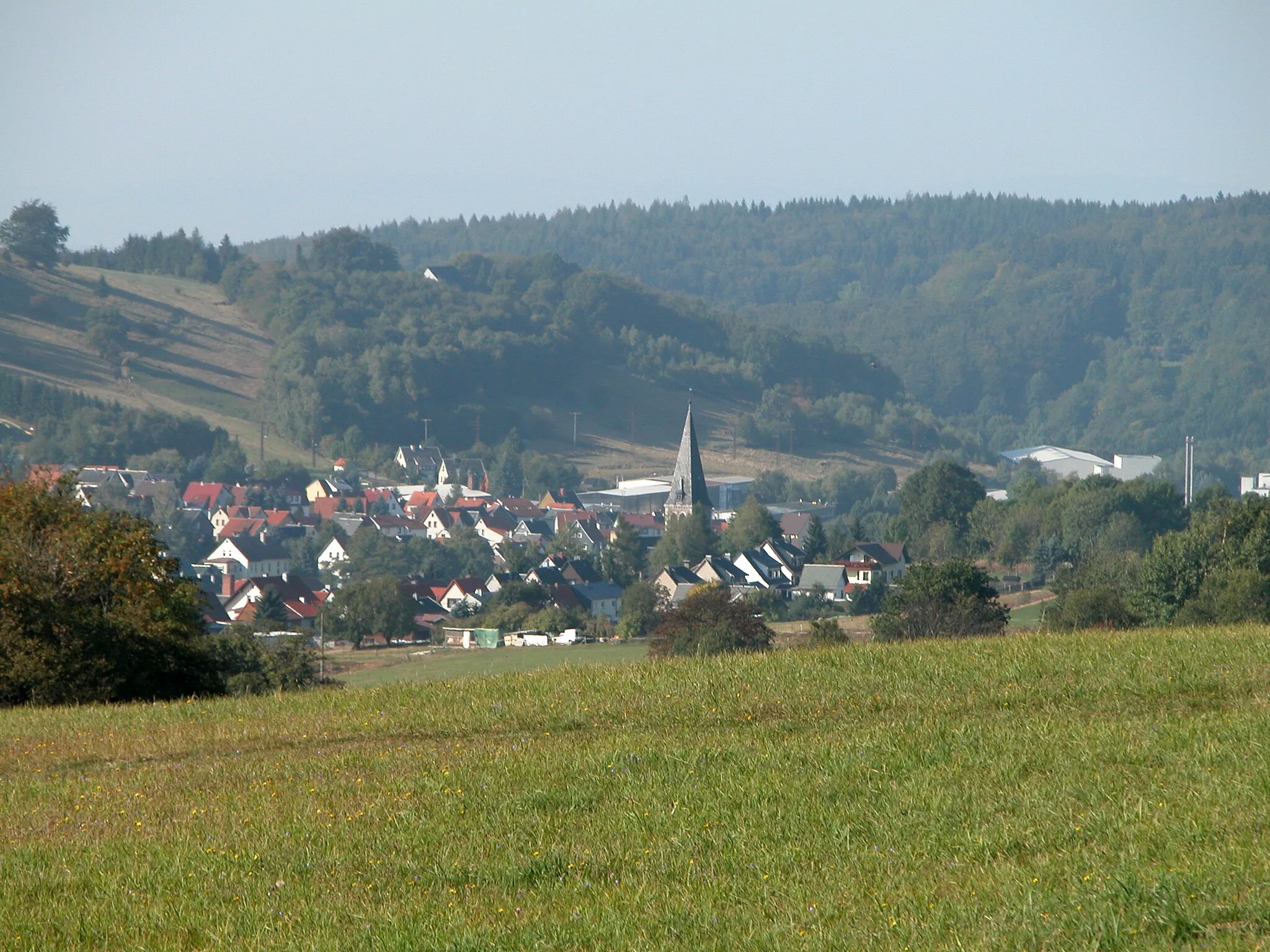
Nüdlingen, located in Unterfranken, Germany, offers a scenic cycling experience for both road and gravel cyclists. The locality offers a mix of well-paved roads and gravel paths that wind through picturesque countryside and charming villages. Cyclists can enjoy stunning views of rolling hills and vineyards as they explore the region. Nearby, the area is known for its excellent wine production, providing a perfect opportunity to taste some local varietals after a long ride. With its diverse terrain and cycling-friendly atmosphere, Nüdlingen ranks at a 4 from a cyclist's perspective.
Discover the stunning countryside on this road cycling route.
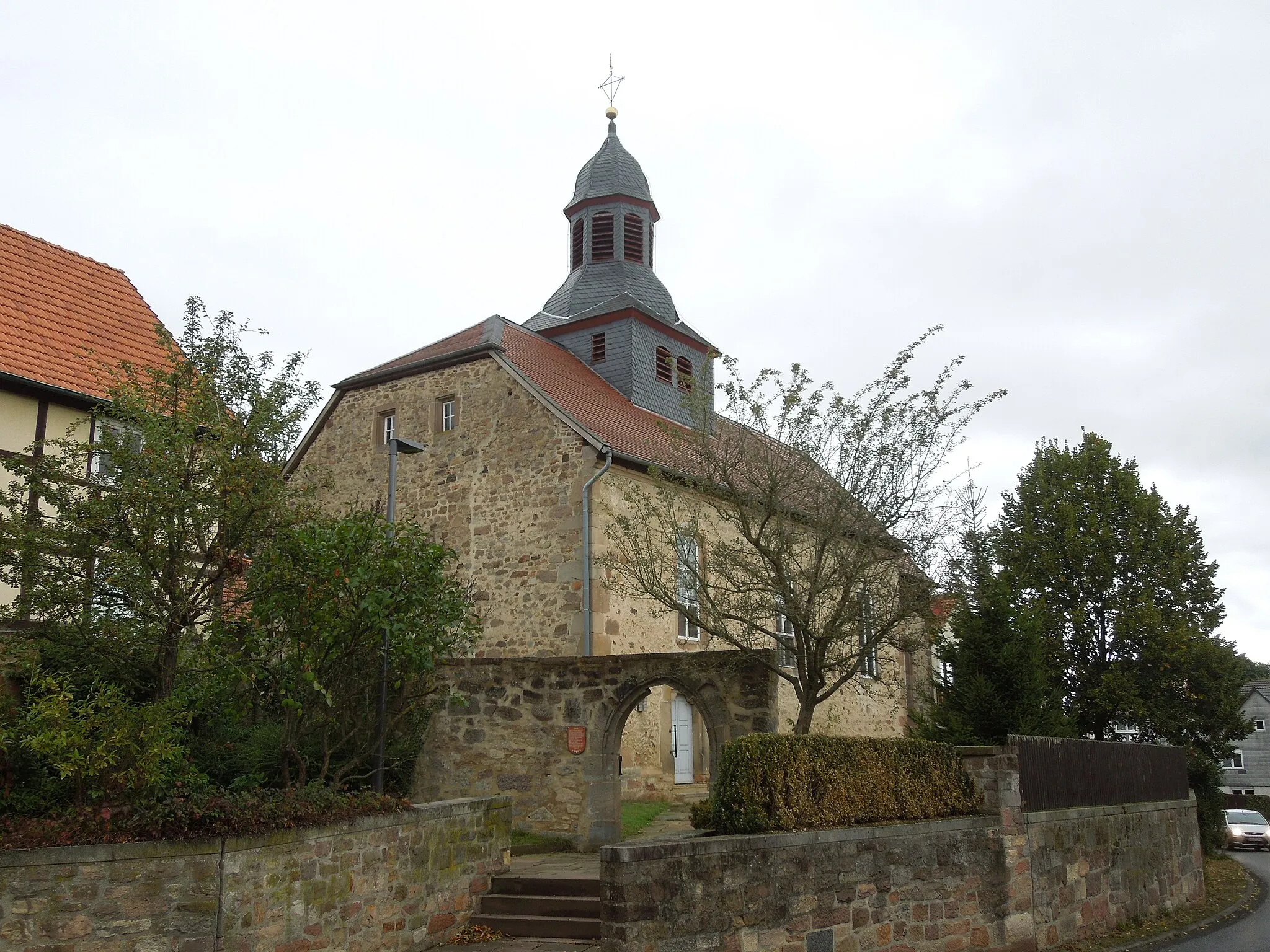
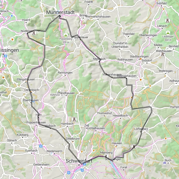
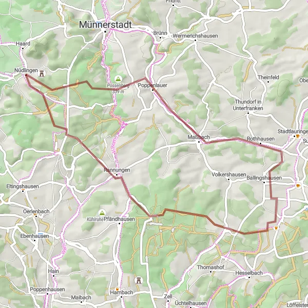
This road cycling route near Nüdlingen explores the beautiful countryside and cultural spots of the region. Starting in Nüdlingen, riders will pass through Münnerstadt, a town known for its well-preserved medieval architecture. Possenberg, a picturesque village nestled amidst rolling hills, offers scenic views. The vibrant cultural spot of Maßbach hosts an outdoor theater festival, adding a touch of artistic flair to the route. Reichmannshausen is a peaceful haven surrounded by lush forests, perfect for a nature break. Beerhüterturm provides stunning panoramic views of the surrounding countryside. Schweinfurt, a vibrant city with a rich industrial history, and the charming village of Poppenhausen complete this diverse road cycling adventure.
Balustrade Route
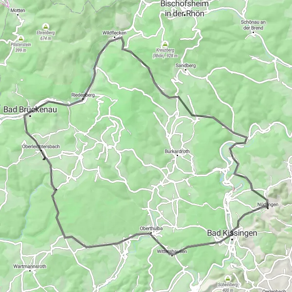
Ride through beautiful landscapes and experience the charm of Oberlightersbach and Riedenberg
The Balustrade Route is a road cycling route with a total distance of 84km and an elevation gain of 1253m. It takes you through picturesque landscapes and offers stunning views. Starting near Nüdlingen, the route passes through Oberthulba, Oberleichtersbach, Ehrenberg, Riedenberg, Guckaspaß, and Bad Bocklet. The difficulty level is rated as 3, suitable for well-trained amateurs. This route is an epic adventure with a score of 4 for its challenging climbs and beautiful sights.
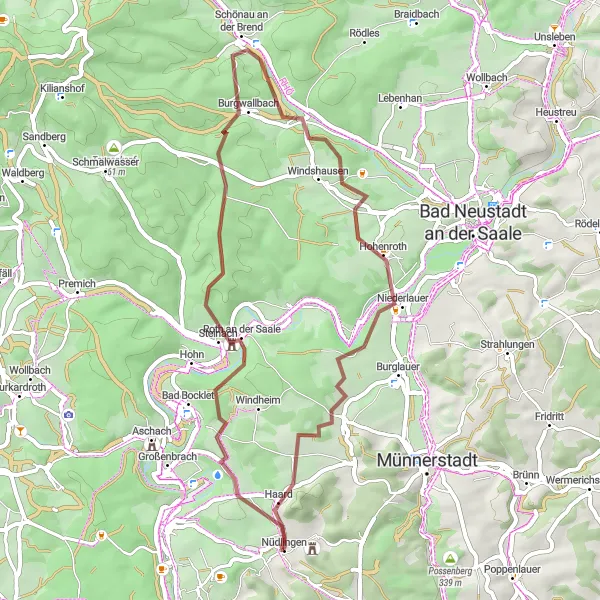
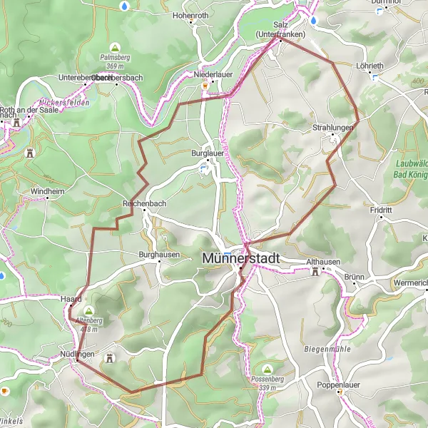
Experience the beauty of the region on this scenic gravel route.
This scenic gravel route near Nüdlingen highlights the natural beauty of the region. Starting in the charming village, the route passes by Balustrade, a popular cycling spot known for its picturesque views. Cyclists will then continue through Frankenbrunn, a quaint village with traditional half-timbered houses. Hassenbach awaits with its stunning waterfall, offering a peaceful and refreshing stop along the route. The ride continues to Klaushöhe, where cyclists can enjoy breathtaking panoramic views of the surrounding countryside. The route also features Kaskadentalhütte, a cozy mountain hut perfect for a rest stop. With its mix of natural attractions and gravel roads, this route promises a scenic and enjoyable cycling experience.
Embark on a thrilling gravel cycling journey near Nüdlingen
Get ready for an unforgettable adventure as you pedal through the enchanting landscapes of Unterfranken. This 65km gravel route offers thrilling ascents and breathtaking views. With a total ascent of 891m, this route is suitable for experienced cyclists seeking a challenging off-road experience.
The Gravel Adventure
Embark on a thrilling gravel cycling route from Nüdlingen
Experience the exhilarating beauty of Unterfranken as you tackle this challenging gravel route. With a total ascent of 926m over a distance of 46km, you'll be treated to stunning landscapes and cultural highlights along the way. This route is perfect for avid cyclists looking for an off-road adventure.
The Gravel Adventure
Venture through scenic gravel trails and discover the hidden gems of Unterfranken.
Embark on a thrilling gravel adventure through the picturesque landscapes of Unterfranken. This route offers a unique cycling experience, with diverse terrains and enchanting highlights along the way. Challenge yourself on this 52-kilometer route that takes you from Nüdlingen to Poppenlauer and back.
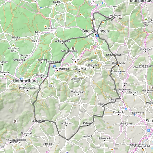
Epic Road Adventure
Embark on an epic road adventure through scenic landscapes.
This road cycling route near Nüdlingen is an epic adventure for experienced cyclists. Setting off from the village, riders will pass through Rannungen, a peaceful countryside retreat. The route features challenging climbs, including Feldherrenhügel, offering breathtaking views of the surrounding landscape. Schweinfurt, a vibrant city with a proud industrial heritage, provides a cultural stop along the way. Cyclists can also enjoy the bird sanctuary at Aussichtsturm Vogelschutzgebiet Garstadt and take in the historic architecture of Bergrheinfeld Rathaus. With stunning highlights and varied terrain, this road adventure promises an unforgettable experience.
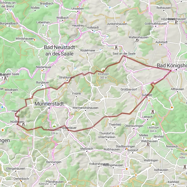
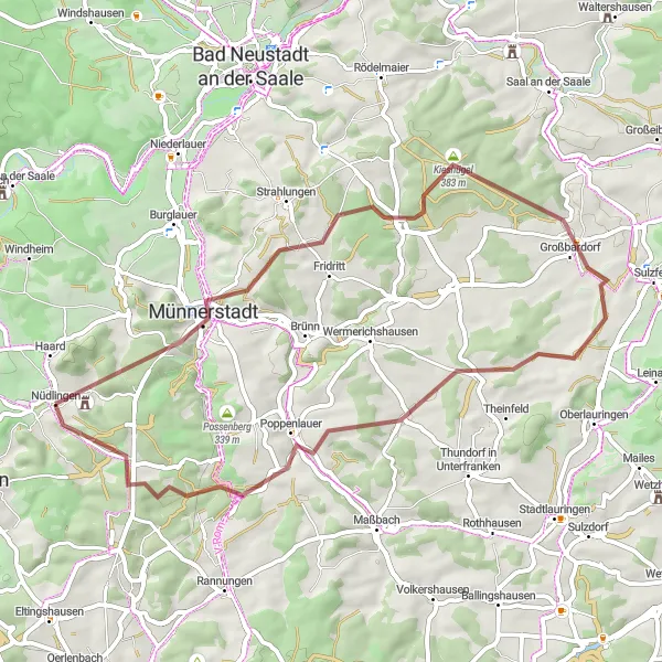
Travel back in time on this historical gravel loop.
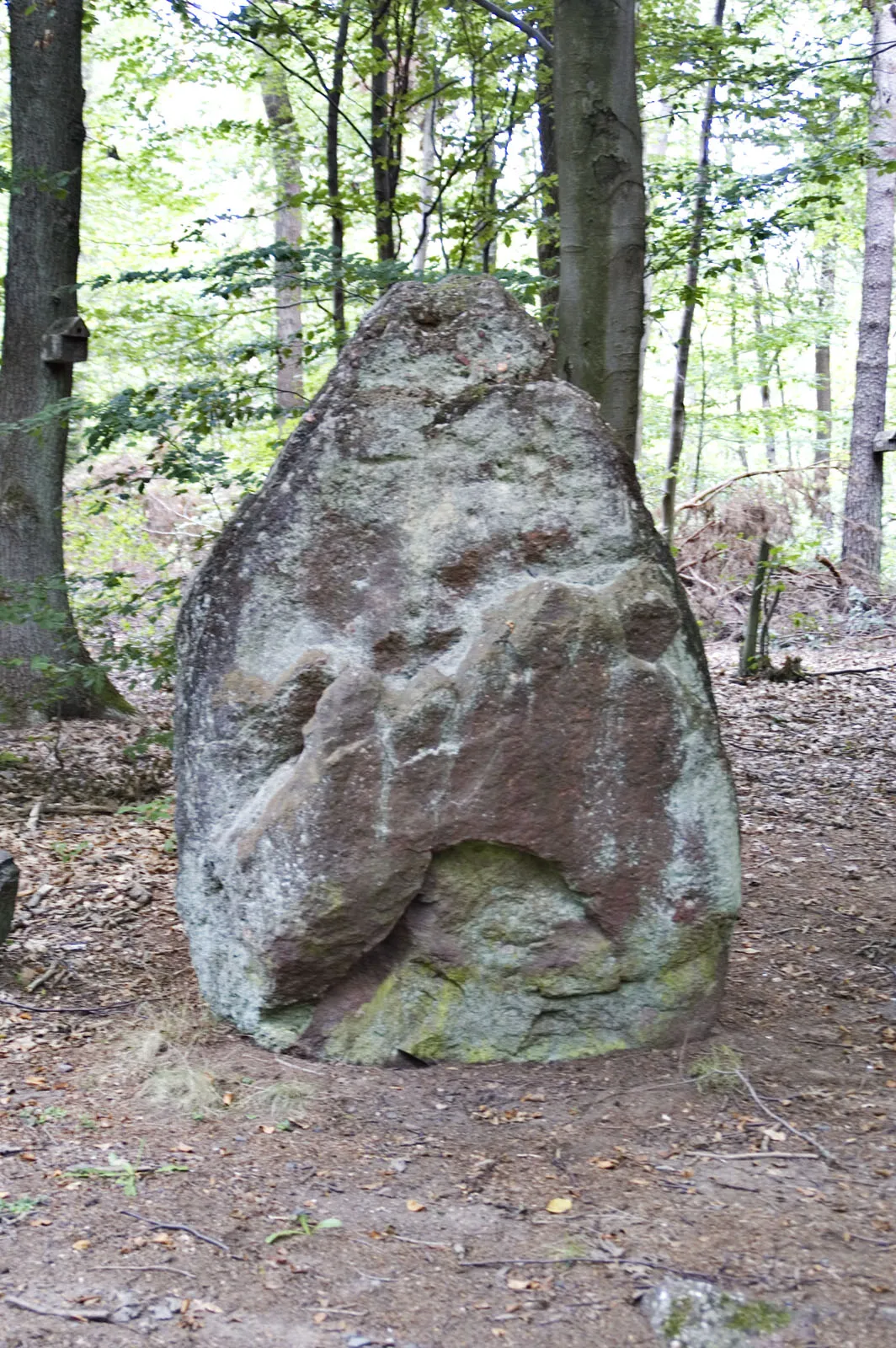
This historical gravel loop near Nüdlingen takes cyclists through picturesque villages and historical landmarks. Beginning in the charming village of Nüdlingen, riders will pass through Altenberg, a village known for its medieval architecture. Luitpold Höhe provides stunning panoramic views of the surrounding countryside. Strahlungen's picturesque village center and half-timbered houses add charm to the route. Münnerstadt, with its Baroque architecture and historic buildings, offers a unique cultural experience. For a picturesque ascent and panoramic views, the ruins of Schloßberg are not to be missed. With its historical highlights and scenic landscapes, this gravel loop offers a trip back in time.
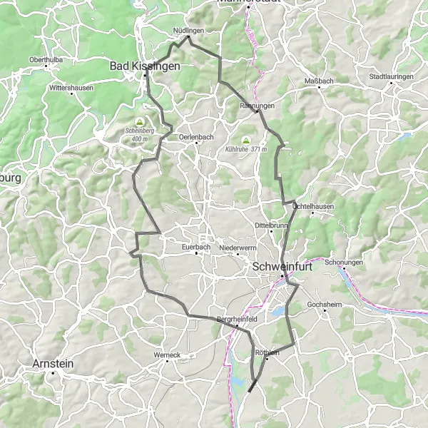
Discover the Beauty of Nüdlingen
Experience the beauty and nature of Nüdlingen and Bad Kissingen
This road cycling route explores the natural beauty of Nüdlingen and surrounding areas with a distance of 79km and an elevation gain of 967m. Starting in Nüdlingen, the route takes you through Sinnberg, Oerlenbach, Brebersdorf, Fuchsstadt, Balustrade, and Bad Kissingen. The difficulty level is rated as 3, suitable for well-trained amateurs. With an epicness score of 3, this route offers scenic countryside roads and a picturesque journey.
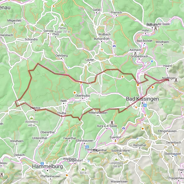
Discover the beauty of Possenberg and Feldherrenhügel gravel trails
The Discover Gravel Trails route is perfect for gravel enthusiasts looking to explore the scenic beauty of Nüdlingen and its surroundings. With a total distance of 47km and an elevation gain of 643m, this gravel route offers a thrilling adventure. The route takes you through Nüdlingen, Possenberg, Maßbach, Madenhausen, and Feldherrenhügel. The difficulty level is rated as 2, suitable for well-trained amateurs. With an epicness score of 2, this route provides beautiful scenic gravel trails and picturesque landscapes.
Cycling routes nearby:


Nearby regions: