Leisurely Cycling in Észak-Alföld
Cycling routes from Kotaj
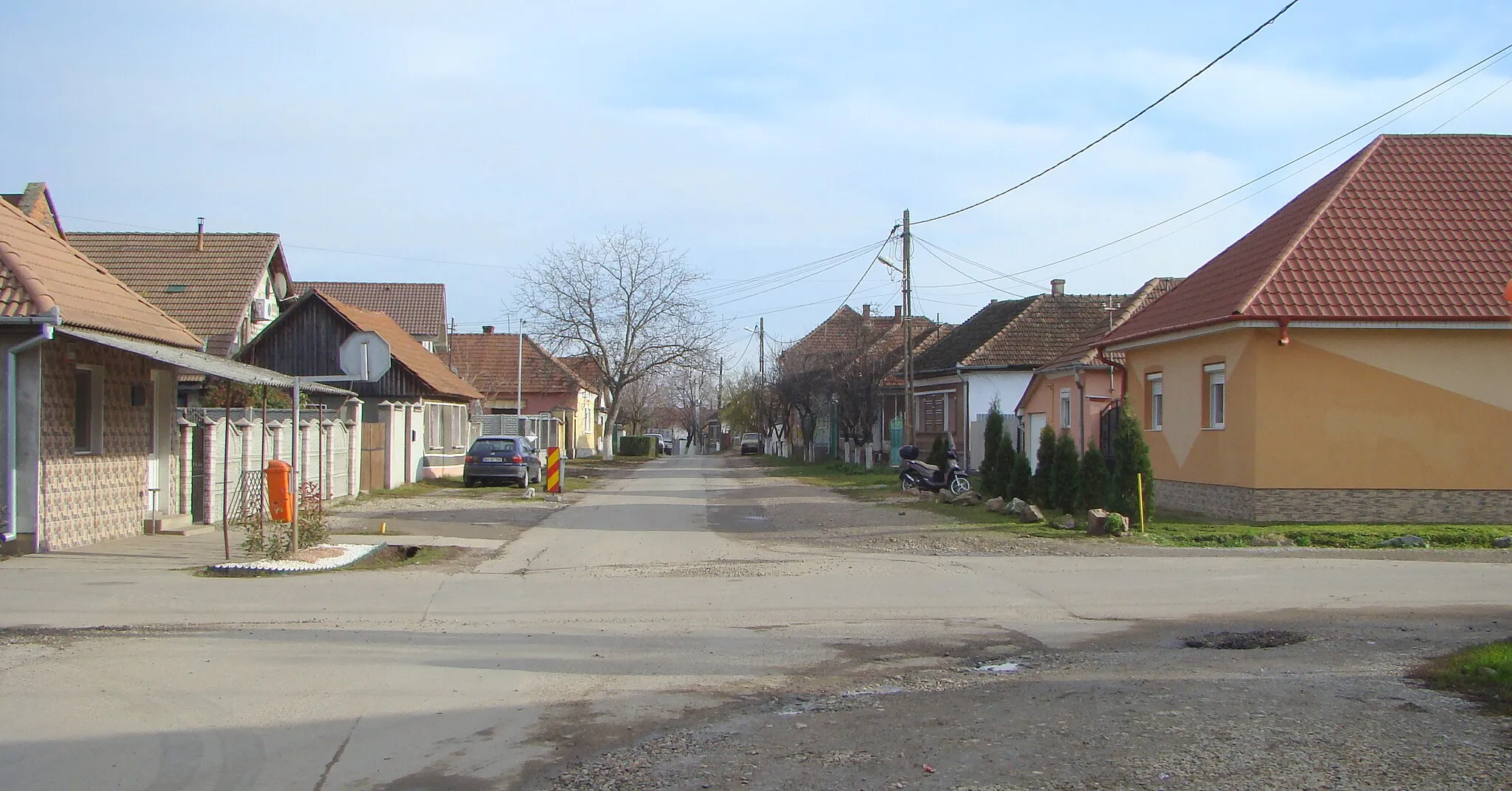
Kótaj is a locality situated in the Észak-Alföld region of Hungary. From a cyclist's point of view, Kótaj offers a mixture of flat roads and gently rolling hills, making it a suitable location for leisurely rides and beginner cyclists. Though lacking in famous cycling spots or noteworthy climbs, Kótaj provides cyclists with an opportunity to explore the region's beautiful countryside and enjoy peaceful rides. With its pleasant terrain and scenic views, Kótaj receives a rank of 3 on the cyclist perspective scale.
Gravel Adventure near Kótaj
Embark on a thrilling gravel journey through diverse landscapes surrounding Kótaj.
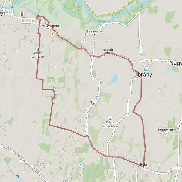
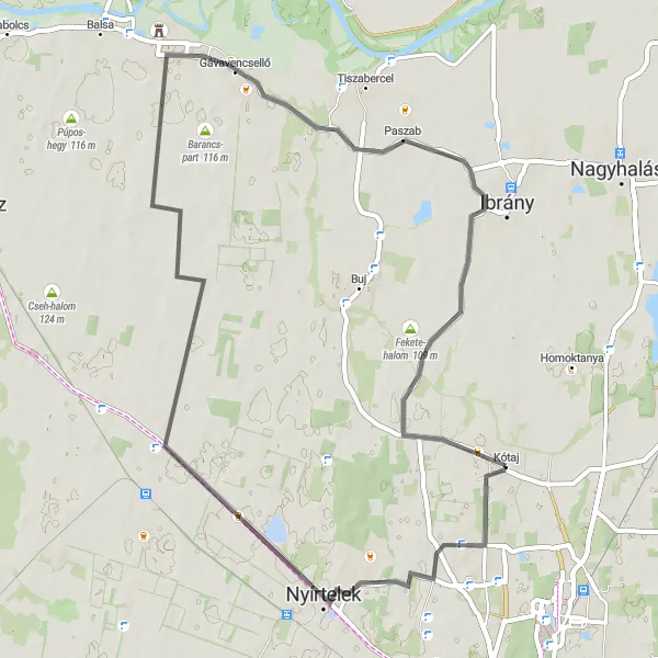
Take on the challenge of this gravel cycling route, offering an exhilarating ride through varied terrains. Covering a distance of 43 km with an ascent of 35 meters, this route takes you along the scenic Barancs-part riverside and the picturesque village of Paszab. Discover the hidden beauty of Köztársaság út as you cycle through its charming streets. Conclude your adventure back in Kótaj, appreciating the untouched countryside that accompanies you throughout the entire journey.

Embark on a cultural journey through the historic sites of Kótaj and its surroundings
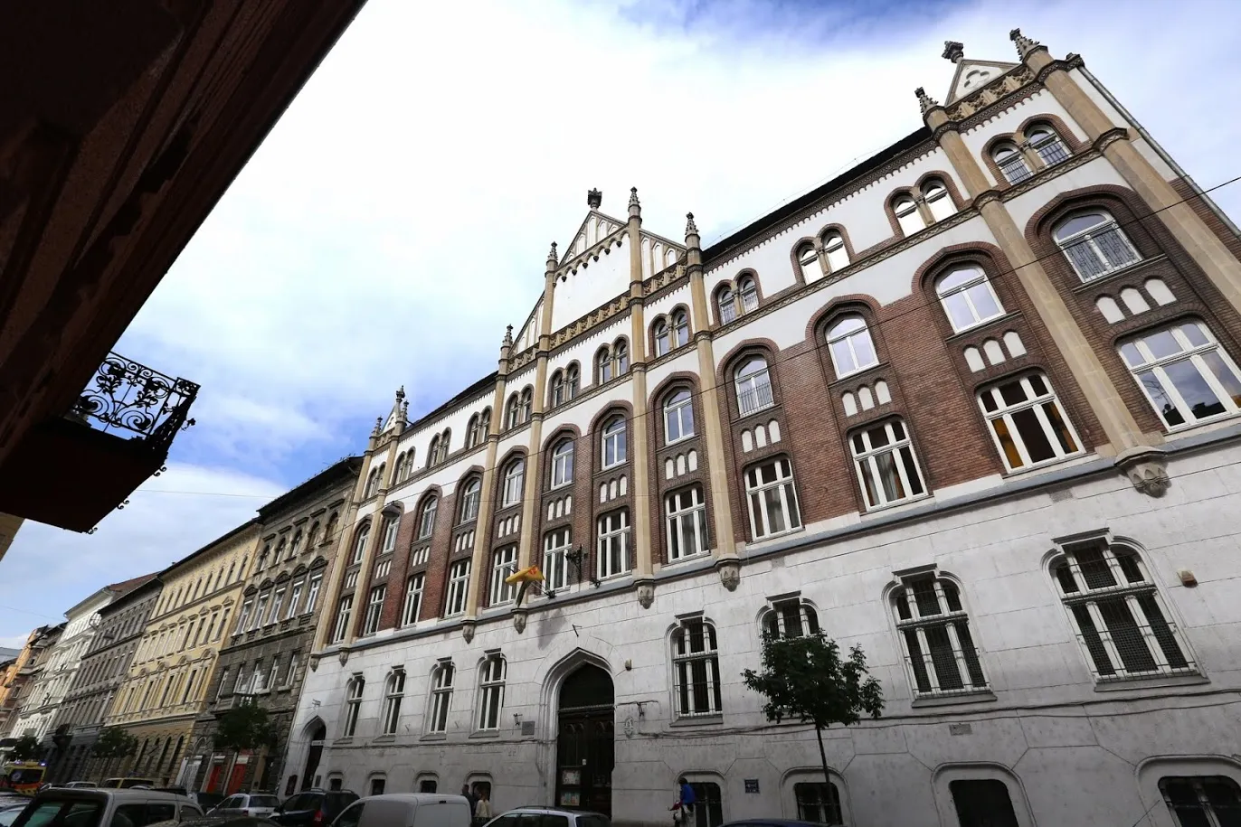
The Kótaj Heritage Ride is a road cycling route that covers a distance of 80 kilometers and has an elevation gain of 19 meters. This route is perfect for cyclists who are interested in exploring the rich history and heritage of Kótaj and its neighboring towns. Along the way, you'll pass by numerous historic landmarks and architectural gems. It's a unique opportunity to learn about the region's past while enjoying a scenic bike ride.
Gravel Adventure
Take on the challenge of this gravel cycling route and discover the rugged beauty of the Hungarian countryside
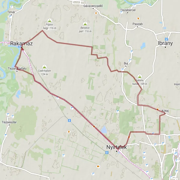
The Gravel Adventure is a challenging cycling route that covers a distance of 54 kilometers and features an elevation gain of 41 meters. This route is ideal for experienced cyclists who are looking for an off-road adventure through the rural landscapes of Hungary. As you navigate the gravel paths and untouched trails, you'll be rewarded with breathtaking vistas and glimpses of wildlife. It's an opportunity to explore the hidden gems of the country and immerse yourself in nature.
Alföld Countryside Tour
Immerse yourself in the beauty of the Alföld countryside on this picturesque road cycling route
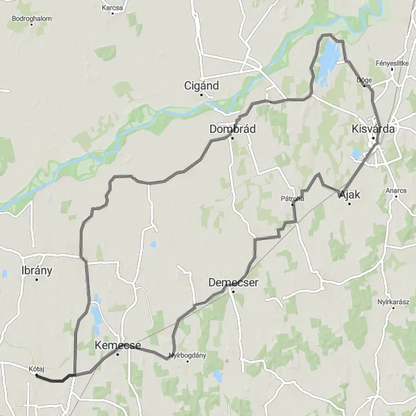
The Alföld Countryside Tour is a road cycling route that spans across 101 kilometers and features an elevation gain of 74 meters. This route takes cyclists through the serene countryside of the Észak-Alföld region, immersing them in the area's natural beauty. Along the way, you'll pass through quaint villages and spot local wildlife. It's a perfect route for those who want to escape the hustle and bustle of city life and enjoy a peaceful and scenic ride.
Discover the hidden treasures of Nyírszőlős and its surrounding areas on this road cycling route
The Nyírszőlős Explorer is a road cycling route that spans across 107 kilometers and features an elevation gain of 62 meters. This route takes cyclists through the charming town of Nyírszőlős and its picturesque surroundings. Along the way, you'll pass by historic sites, beautiful vineyards, and quaint villages. It's a perfect route for those who want to combine cultural exploration with outdoor adventure.
Experience the vastness of the Hungarian Alföld region on this road cycling route
The Alföld Loop is a road cycling route that takes you through the scenic Észak-Alföld region in Hungary. With a distance of 55 kilometers and an elevation gain of 54 meters, this route offers a relatively easy ride for cyclists of all levels. As you pedal through the countryside, you'll be rewarded with beautiful views of rolling hills and picturesque villages. It's a great way to immerse yourself in the rural beauty of Hungary.

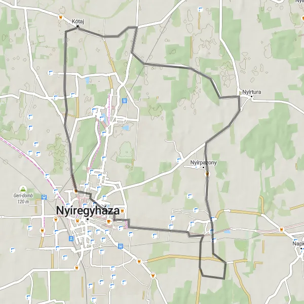
Embark on a challenging yet captivating journey through the hills and valleys near Kótaj.
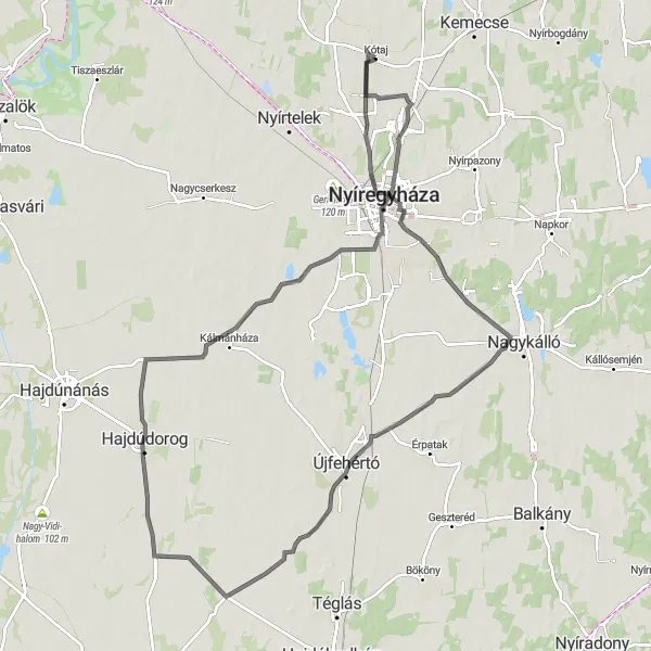
Get ready for a thrilling road cycling adventure through the hilly terrain near Kótaj. Covering a distance of 130 km and an ascent of 143 meters, this route will put your skills to the test. The route takes you through key highlights such as the scenic Kemecse hill, the picturesque town of Gégény, and the charming villages of Szabolcsbáka and Ilk. Conquer the Ricsó-hegy hill and revel in the sense of accomplishment it brings. This challenging route offers a perfect blend of natural beauty and physical exertion.
Relish the charm of Észak-Alföld region on this road cycling route near Kótaj.
Immerse yourself in the scenic beauty of the Észak-Alföld region with this road cycling route. Cover a distance of 43 km and tackle an ascent of 27 meters as you traverse through picturesque landscapes. Discover the captivating views from the Izsó-domb hill and Nyírszőlős village. Enjoy the tranquility of Örökösföld and take in the peacefulness it offers on your journey. Appreciate the diverse topography that accompanies you throughout, making for an enjoyable and rewarding cycling experience.
Kótaj Gravel Adventure

Embark on an exciting gravel adventure starting from Kótaj
Discover the rugged beauty of Észak-Alföld as you embark on this thrilling 35km gravel cycling route starting from Kótaj. With a moderate ascent of 36m, this route offers a perfect balance of challenge and enjoyment. Ride through picturesque landscapes, visit historical landmarks, and soak in the charm of Nyíregyháza and Nyírszőlős along the way.

Discover the flat and expansive beauty of the Great Hungarian Plain on this road cycling route.
Experience the vastness and tranquility of the Észak-Alföld region as you pedal along this scenic road cycling route. With a distance of 90 km and an ascent of 109 meters, this route offers a smooth ride through picturesque countryside. Along the way, you'll encounter intriguing highlights such as the Izsó-domb hill, the Finánc domb kilátó lookout tower, and the charming village of Tarcal. The route also passes by the Előhegy and Szabolcs hills, offering breathtaking panoramic views. End your journey in the lively town of Buj and soak in the local culture.
Cycling routes nearby:

Nearby regions: