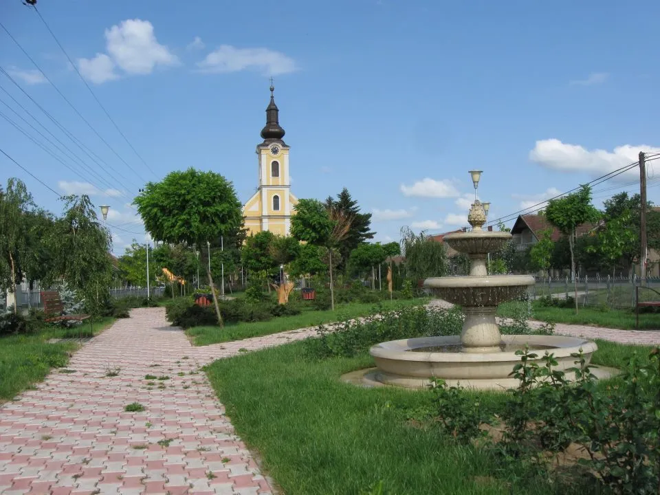
Explore charming villages and scenic landscapes while cycling in Taktaharkány.
Cycling routes from Taktaharkany
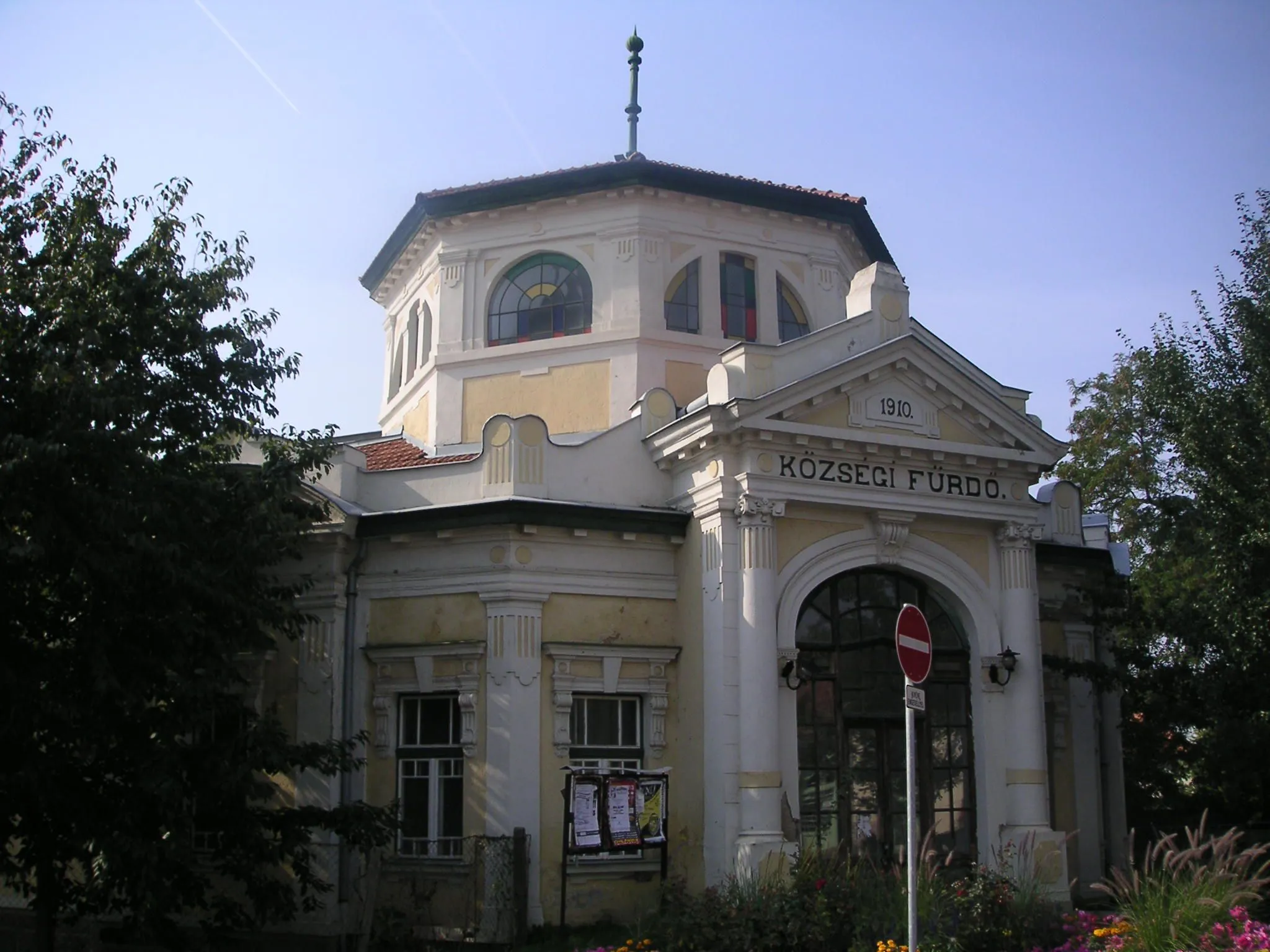
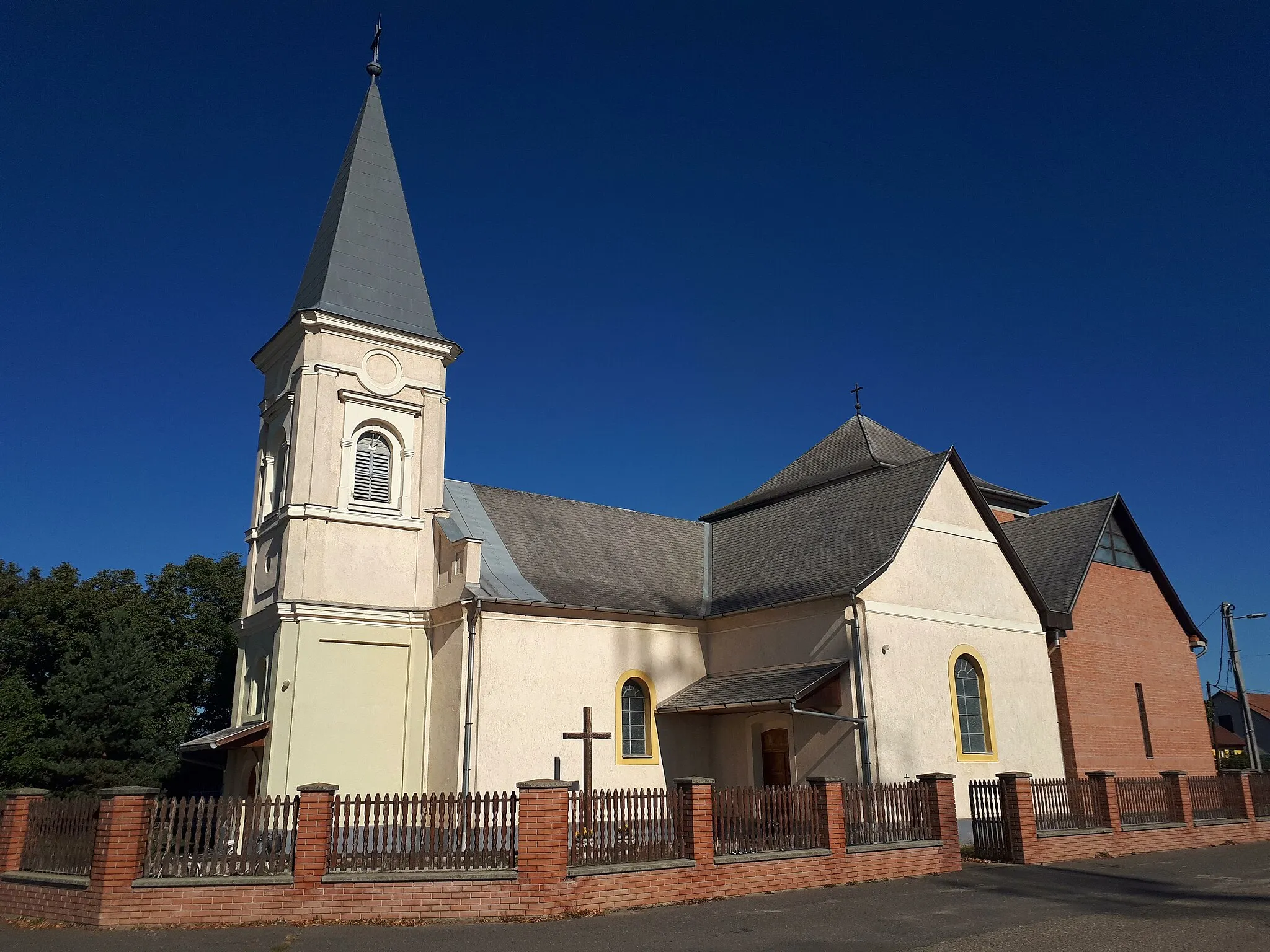
Taktaharkány is a locality in Hungary, situated in the Észak-Magyarország region. As a road and gravel cyclist, Taktaharkány offers scenic and diverse cycling routes suitable for different skill levels. The region is characterized by beautiful landscapes with rolling hills and charming villages. Although Taktaharkány doesn't have any famous cycling-related spots or notable climbs nearby, its picturesque scenery and peaceful roads make it an enjoyable destination for cyclists seeking leisurely rides. Taking into account its scenic beauty, Taktaharkány is rated as a 3 in terms of cycling-friendliness.
Discover the hidden gems of rural Hungary while enjoying a road cycling adventure
Discover the hidden gems of rural Hungary on this road cycling route, which takes you to the idyllic villages of Tiszalúc and Csozsnya-tető. With a moderate difficulty level, it is suitable for well-trained amateur cyclists. The route covers a total distance of 106 kilometers with an ascent of 251 meters.
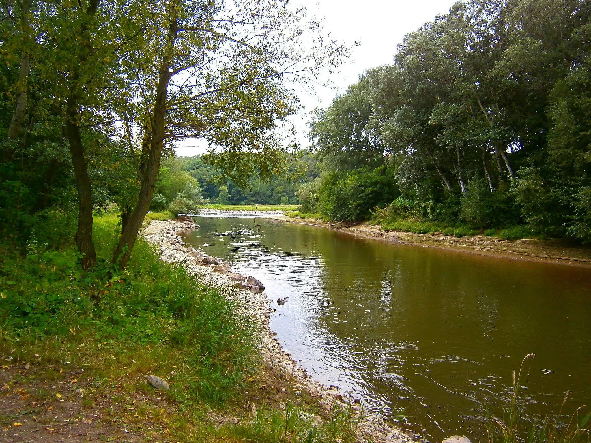
Embark on an exciting gravel adventure through the picturesque landscapes of northern Hungary
Experience the natural beauty and rich cultural heritage of northern Hungary with this diverse gravel cycling route. Starting near Taktaharkány, the route takes you through charming villages, lush forests, and hilly terrains, offering breathtaking views along the way.
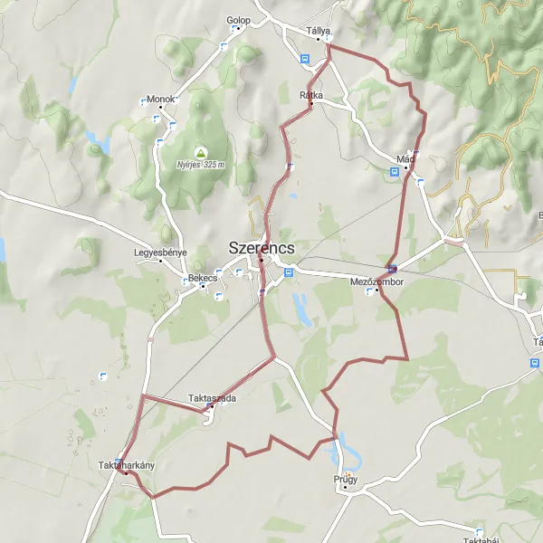
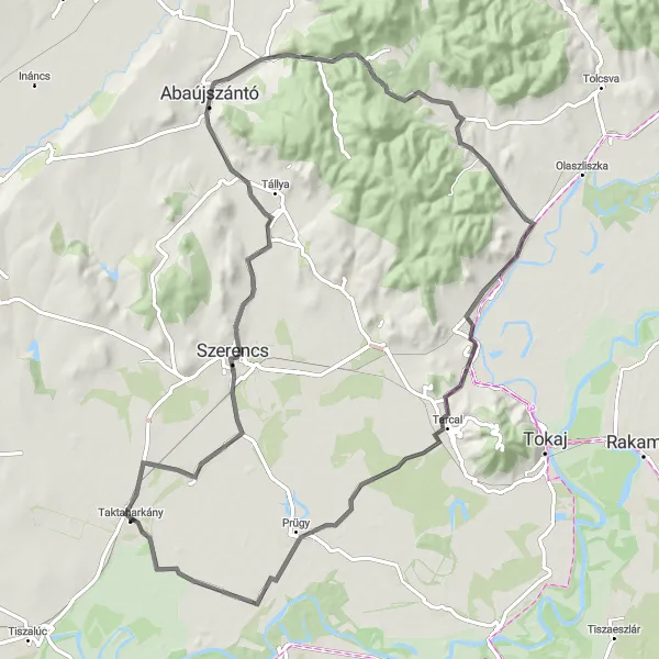
A scenic route with charming villages and beautiful landscapes
This gravel route takes you through the picturesque villages of Szerencs and Mezőzombor, offering stunning views of the surrounding landscapes. With a moderate difficulty level, it is perfect for well-trained amateur cyclists looking to enjoy some off-road adventure. The ride covers a distance of 55 kilometers and includes an ascent of 241 meters.
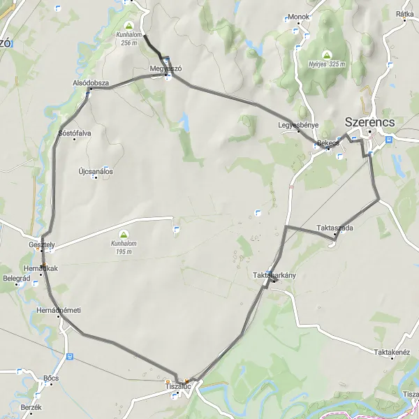
Experience the thrill of road cycling and explore cultural gems
This road route takes you through the vibrant towns of Gesztely and Bekecs, offering a mix of cultural experiences and picturesque landscapes. With a moderate difficulty level, it is suitable for well-trained amateur cyclists. The ride covers a distance of 64 kilometers with an ascent of 353 meters.
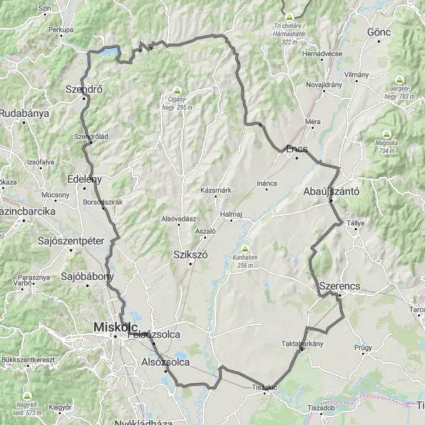
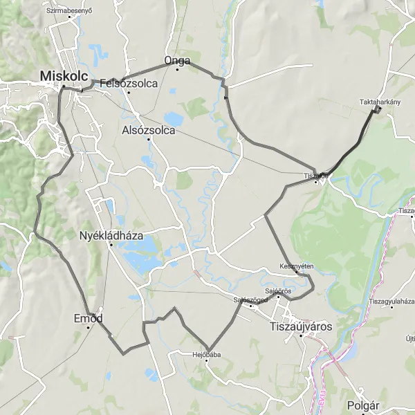
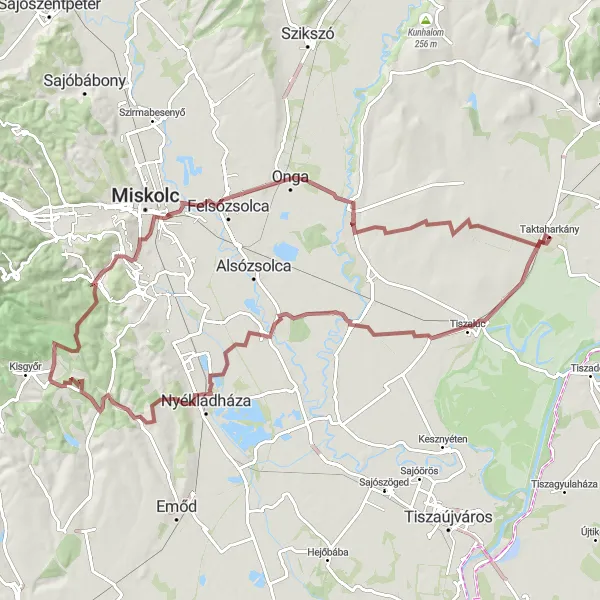
Embark on a scenic road cycling adventure through the picturesque Borsodszirák region
The Borsodszirák Loop is a road cycling adventure that takes you through the charming landscapes of the Borsodszirák region. With a distance of 176 kilometers and an ascent of 717 meters, this route offers a challenging yet rewarding experience for cyclists. Highlights along the way include the panoramic views from the Taktaharkány and Bőcs lookout points, the historic town of Szirmabesenyő, and the stunning natural beauty of the Szendrőlád region. Immerse yourself in the rich history and majestic landscapes as you pedal through this scenic route.
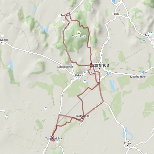
The Szada Route
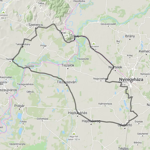
Experience the breathtaking view from the Taktaszada lookout tower
The Szada Route is a road cycling adventure that takes you through picturesque landscapes, historic towns, and beautiful vineyards. The route starts near Taktaharkány and covers a distance of 166 kilometers with an ascent of 117 meters. It offers a perfect mix of challenging climbs and smooth descents, making it suitable for well-trained amateur cyclists. Along the way, you'll encounter stunning highlights such as the Kunhalom hill, Tarcal village, and the famous wine-growing region of Tokaj.
The Hilltop Adventure
Embark on a cycling journey through scenic routes and hilltop towns
The Hilltop Adventure route is a road cycling tour that takes you through some of the most scenic routes and hilltop towns near Taktaharkány. Covering a distance of 87 kilometers with an ascent of 371 meters, this route offers a perfect balance of challenging climbs, smooth descents, and picturesque landscapes. Highlights along the way include the historic town of Abaújszántó, the fascinating Medve-barlang cave, and the charming village of Taktakenéz.
Immerse yourself in nature and discover hidden gems
This gravel route takes you through stunning natural landscapes, including a visit to the beautiful villages of Bőcs and Miskolctapolca. With a higher difficulty level, it is recommended for experienced cyclists. The ride covers a distance of 95 kilometers and includes a challenging ascent of 540 meters.
The Gravel Adventure
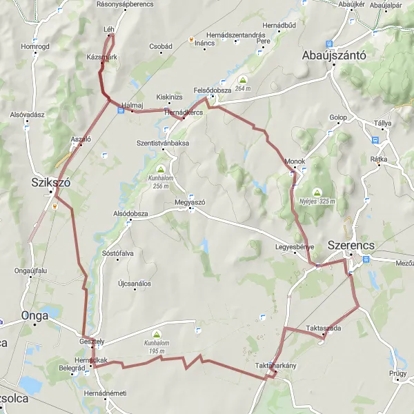
Experience the thrill of gravel cycling in Hungary's stunning countryside
The Gravel Adventure route offers a thrilling cycling experience starting near Taktaharkány. Covering a distance of 84 kilometers with an ascent of 313 meters, this route is perfect for gravel enthusiasts seeking an exciting off-road adventure. Along the way, you'll encounter highlights such as the picturesque villages of Gesztely and Aszaló, as well as the challenging ascent of the Nagy-hegy hill. The route also takes you through the beautiful landscapes of Hernádkércs and Bekecs, providing breathtaking views and a sense of natural tranquility.
The Challenging Gravel Loop
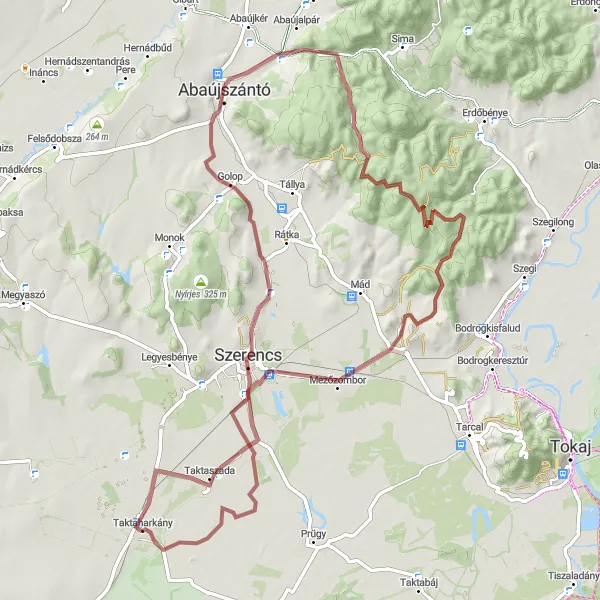
Take on the challenge of a challenging gravel loop near Taktaharkány
The Challenging Gravel Loop offers a thrilling off-road cycling experience for adventure enthusiasts near Taktaharkány. Spanning a distance of 82 kilometers with an ascent of 600 meters, this route is designed to test your skills and endurance. Highlights along the way include the historic village of Mezőzombor, the panoramic views from the Kilátóterasz lookout point, and the beautiful landscapes of the Szerencs region. Be prepared to tackle the steep ascent of the Aranka-tető hill and feel the adrenaline rush as you conquer the challenging terrain.
Cycling routes nearby:


Nearby regions: