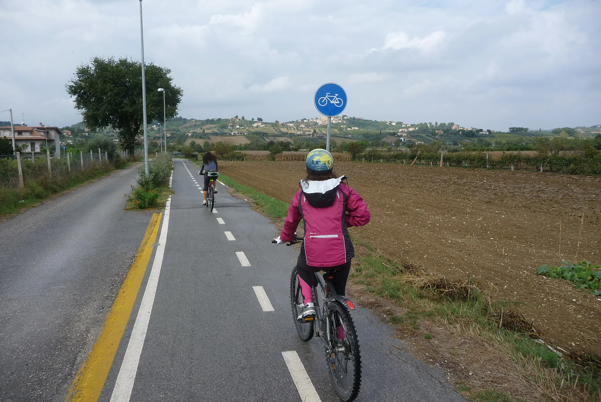
Cycling in the heart of Tuscany, with access to a famous cycling event.
Cycling routes from Santa Croce sull'Arno
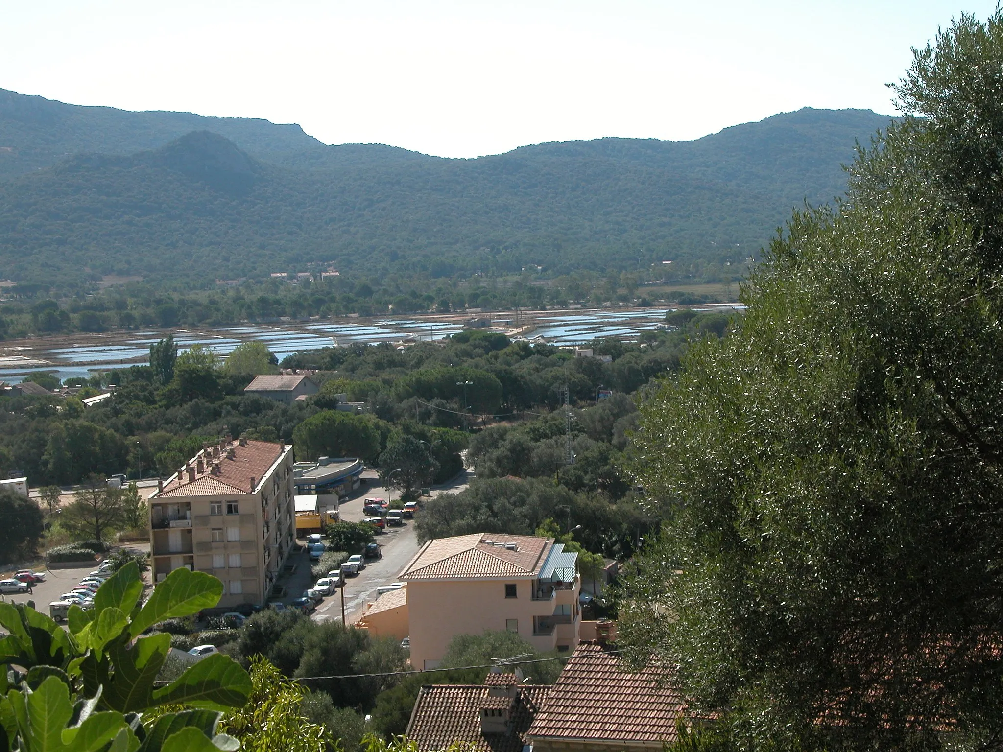
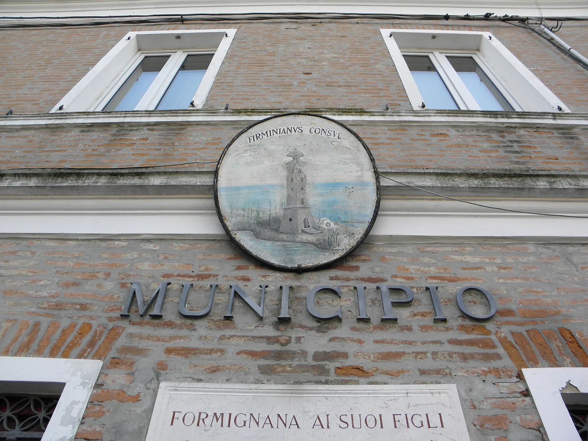
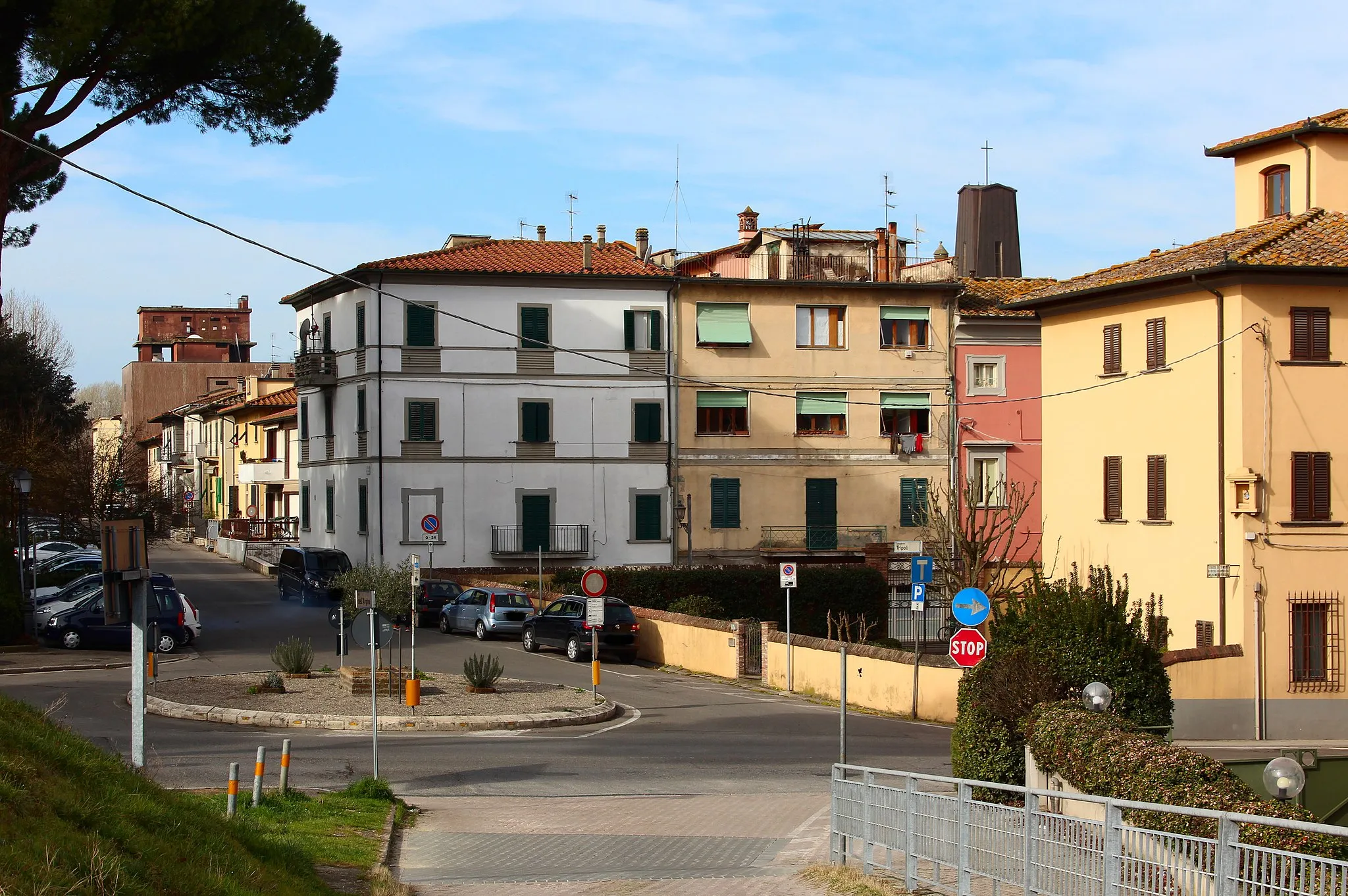
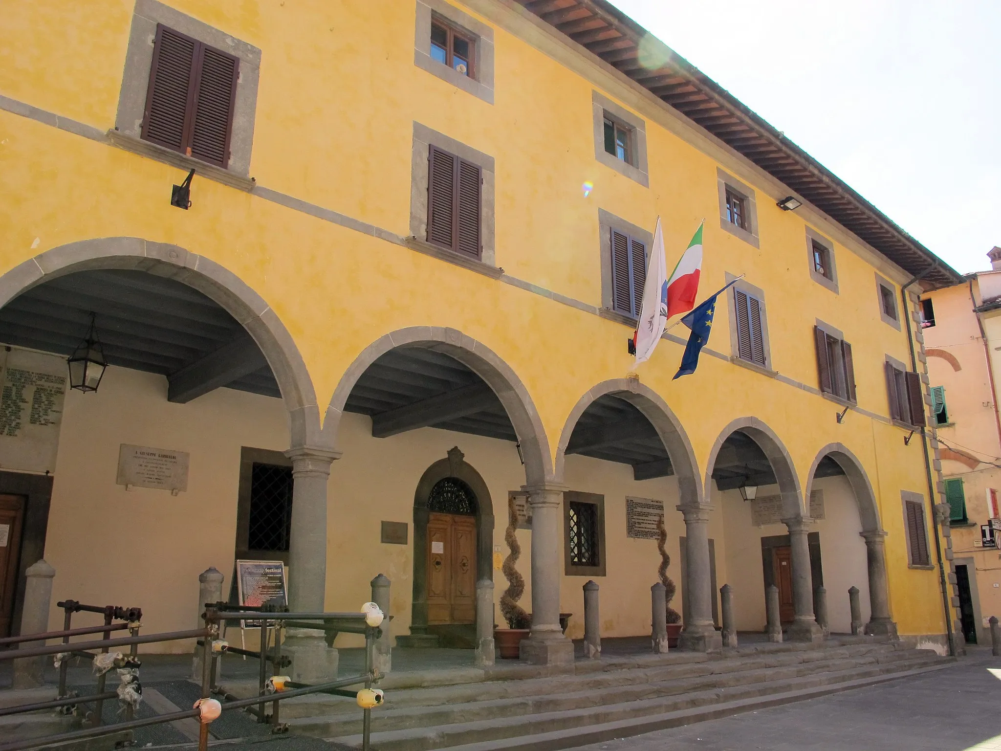
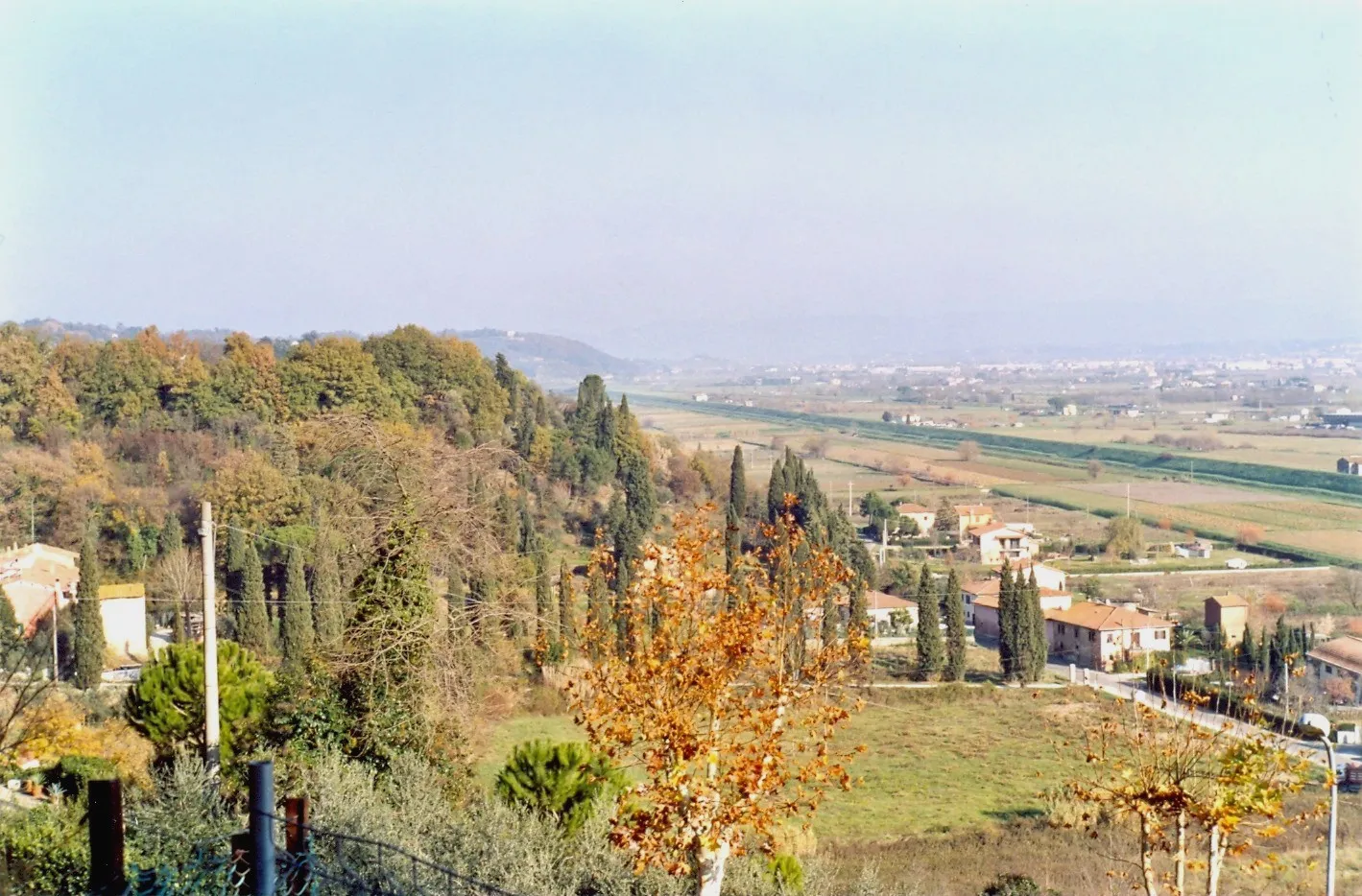
Santa Croce sull'Arno, located in the Tuscany region of Italy, is a bustling town that caters to both road and gravel cyclists. The region is known for its flat and well-maintained roads, making it ideal for beginners or those looking for a more relaxed ride. Santa Croce sull'Arno is also home to a famous cycling event, the Gran Fondo Gimondi-Bianchi, which attracts professional and amateur cyclists alike. The town offers several cycling-friendly accommodations and amenities, making it a perfect starting point for exploring the surrounding area. Overall, Santa Croce sull'Arno is a must-visit location for cyclists of all levels.
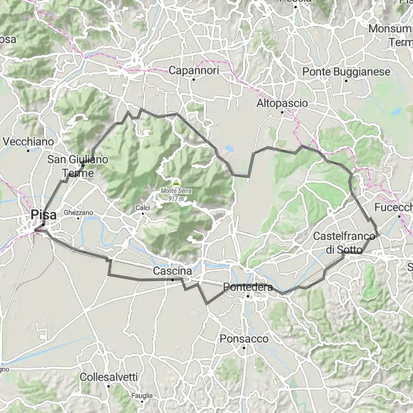
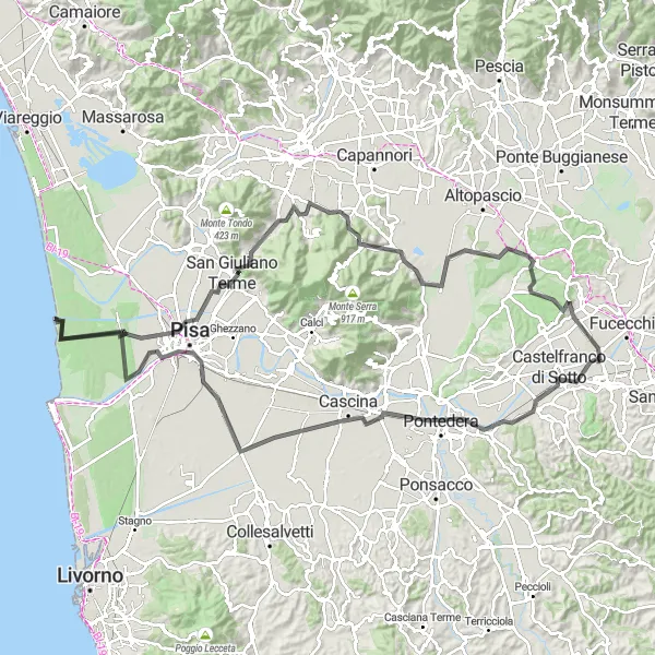
Discover the beauty of Tuscany on an unforgettable road cycling route to Pisa
Embark on a scenic road cycling journey from Santa Croce sull'Arno to Pisa. With a distance of 93 kilometers and an ascent of 436 meters, this route offers a mix of breathtaking views and historic landmarks. Highlights include the town of Pontedera and the world-famous city of Pisa with its iconic Leaning Tower. Rated with a difficulty level of 3, this route is suitable for intermediate cyclists seeking a memorable travel experience.
Embark on a gravel adventure through the charming towns of San Donato and Ponte Buggianese.
This gravel route offers a moderate level of difficulty, suitable for well-trained amateur cyclists. With a distance of 58 kilometers and an ascent of 440 meters, it provides an enjoyable cycling experience with picturesque landscapes along the way. The epicness of the route is rated 2 out of 5, offering a scenic ride through the Tuscan countryside. Highlights include San Donato, a small medieval town known for its historic center, and Ponte Buggianese, which boasts beautiful views of the surrounding hills.
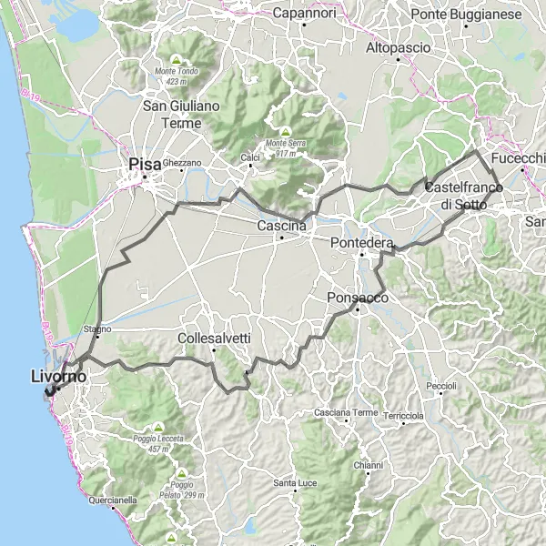
Embark on a scenic road cycling journey along the Tuscan coast
This road cycling route offers a challenging adventure along the scenic Tuscan coast. Covering a distance of 125 kilometers, the route includes a 608-meter ascent. Highlights include the charming towns of Ponsacco and Fauglia, as well as the beautiful Livorno. With a difficulty level of 4, this route is perfect for experienced cyclists seeking a coastal exploration.
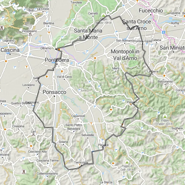
Exploring the Val d'Arno Gravel
A thrilling gravel ride through the Val d'Arno region
This circular gravel route takes you through the beautiful Val d'Arno region, providing stunning views of the surrounding Tuscan countryside. With a moderate difficulty level, the route includes a 664-meter ascent over 46 kilometers. Highlights along the way include the historic Campanile di San Pietro and the charming town of Palaia.
Embark on a scenic road trip from Castelfranco di Sotto to the iconic Leaning Tower of Pisa.
This road cycling route offers a challenging yet rewarding adventure for well-trained amateur cyclists. With a distance of 123 kilometers and an ascent of 629 meters, it provides a diverse and picturesque journey through the Tuscan countryside and iconic tourist destinations. The route's epicness is rated 4 out of 5, as it takes riders through charming towns such as Pontedera and Ospedaletto, and offers a glimpse of the famous Leaning Tower of Pisa. Starting in Castelfranco di Sotto and finishing in Sant'Andrea di Compito, this route guarantees a memorable and culturally rich cycling experience.
Heritage Gravel Path
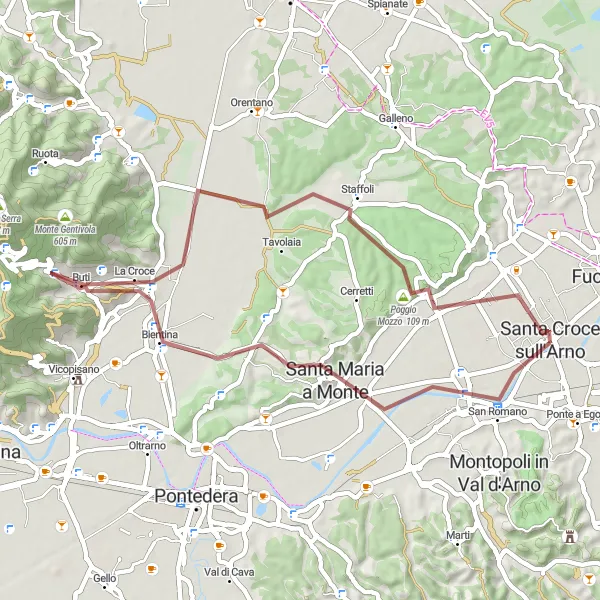
A captivating gravel route through Tuscan heritage sites
Experience the fascinating heritage of Tuscan towns with this gravel route. Covering 46 kilometers with a moderate level of difficulty, the route takes you to notable sites such as the historic Castelfranco di Sotto and Santa Maria a Monte. Enjoy the scenic beauty while encountering the cultural richness along the way, including the charming Poggio Mozzo.
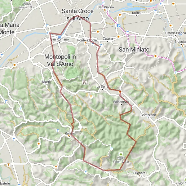
Embark on a challenging road journey from Santa Croce sull'Arno to the scenic Poggio Mozzo.
This road cycling route is designed for well-trained amateur cyclists seeking a challenging and adventurous experience. With a distance of 82 kilometers and an ascent of 703 meters, it tests riders' endurance while offering spectacular views of Tuscany's countryside. The route's epicness is rated 3 out of 5, as it passes through historic towns like Poggio Mozzo and Palaia, providing a glimpse into the region's rich cultural heritage. Starting and ending in Santa Croce sull'Arno, this route combines the beauty of the Tuscan landscape with exciting challenges along the way.
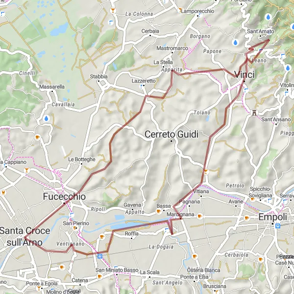
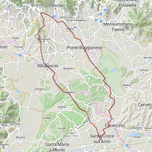
Immerse yourself in the beauty of Fucecchio and take in the scenic views of Anchiano.
This gravel route offers a moderately challenging cycling experience, suitable for well-trained amateurs. With a distance of 47 kilometers and an ascent of 392 meters, it provides a rewarding journey through the Tuscan countryside. The route's epicness is rated 2 out of 5, highlighting the scenic beauty of Fucecchio and Anchiano. Fucecchio offers picturesque landscapes and charming streets to explore, while Anchiano provides panoramic views of the surrounding hills. Starting and ending in Santa Croce sull'Arno, this route showcases the rich history and natural beauty of Tuscany.
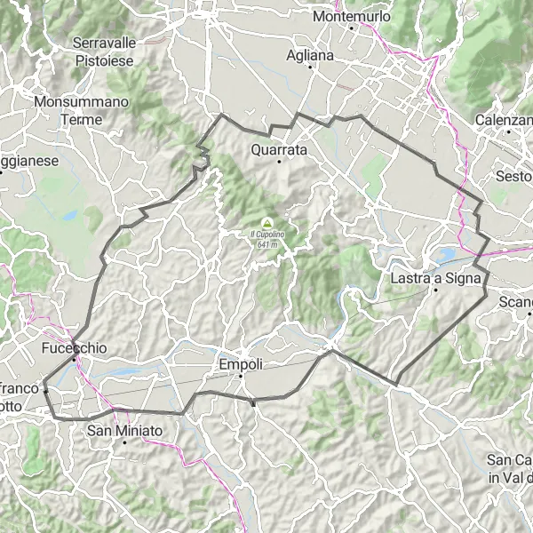
Embark on a exhilarating road cycling challenge among the Tuscan hills
Get ready for a challenging road cycling adventure through the breathtaking Tuscan hills. This 99-kilometer route includes a 722-meter ascent, providing a thrilling experience for cyclists. Highlights along the way include the picturesque Lamporecchio and the historic Ponte a Egola. With a difficulty level of 5, this route is recommended for experienced cyclists seeking an exhilarating challenge.
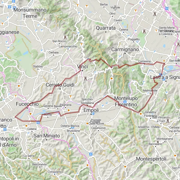
Discover the birthplace of Leonardo da Vinci in Vinci and soak in the charm of Signa.
This gravel route takes you through the picturesque Tuscan countryside, with highlights including Vinci, the birthplace of Leonardo da Vinci, and Signa, a charming town known for its beautiful landscape. The route offers a moderate difficulty level, making it suitable for well-trained amateurs. With a distance of 78 kilometers and an ascent of 923 meters, it provides a challenging yet rewarding cycling experience. The route's epicness is rated 3 out of 5, as it showcases some of Tuscany's most scenic views and cultural landmarks.
Cycling routes nearby:

Nearby regions: