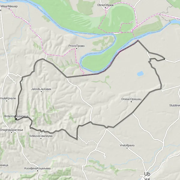
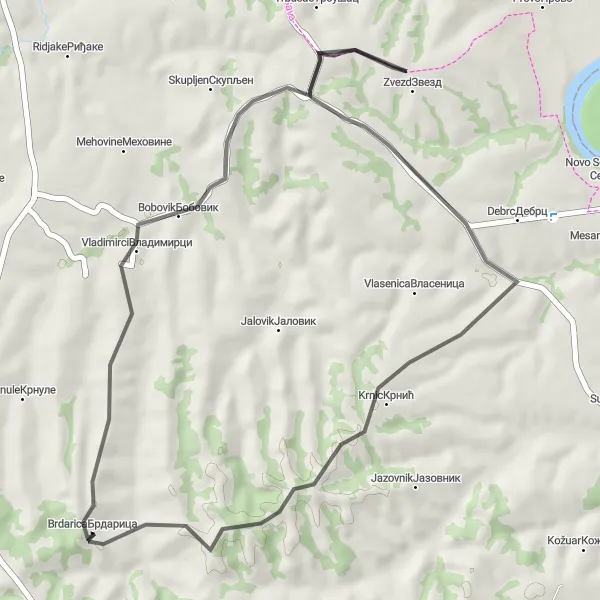
Brdarica: A Cycling Paradise in Serbia's Šumadije i Zapadne Srbije Region
Cycling routes from Brdarica
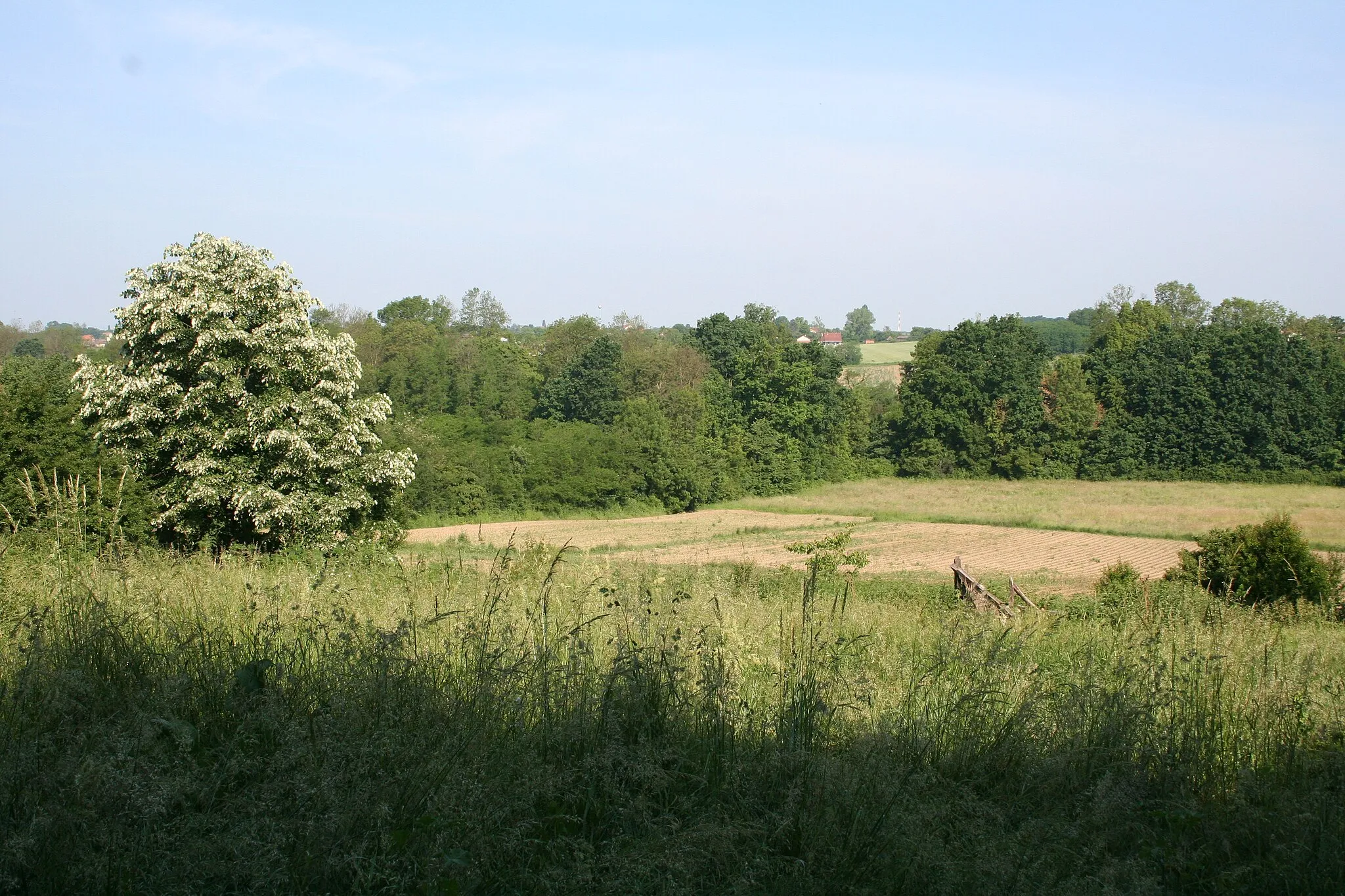
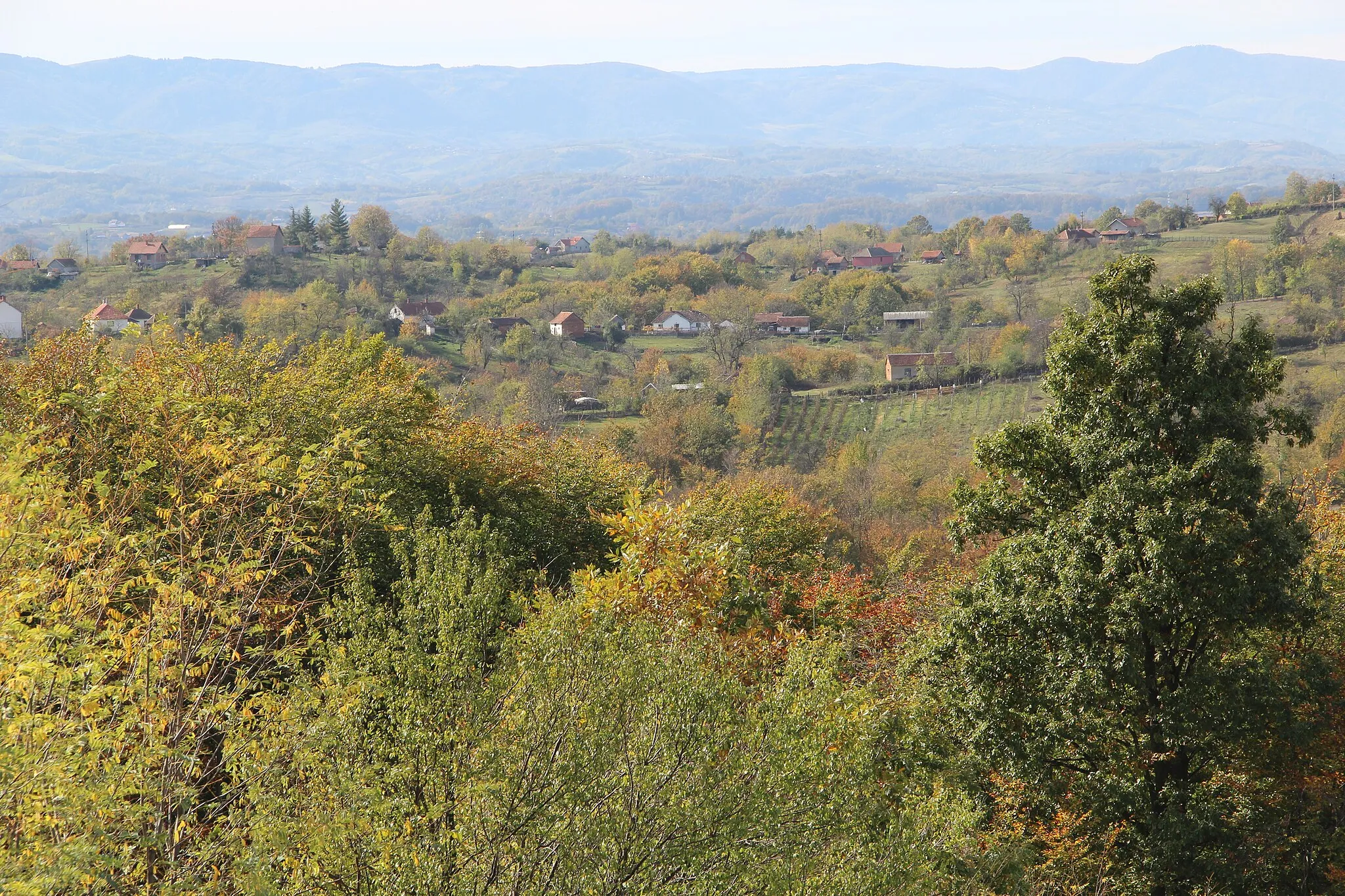
The locality of Brdarica in the Šumadije i Zapadne Srbije region of Serbia offers a rewarding cycling experience. Its scenic roads and gravel paths provide a variety of options for road and gravel cyclists. Cyclists can enjoy the picturesque countryside and explore the natural beauty of the region. One of the famous cycling routes nearby is the climb to Brdarica, a challenging ascent known for its stunning vistas. With its cyclist-friendly environment and notable climbs, Brdarica is a great destination for both experienced and amateur cyclists.
Embark on the Kamenica Adventure and explore the charming village of Kamenica.
The Kamenica Adventure is a road cycling route with an ascent of 745 meters and a distance of 53 kilometers. This route provides a moderate challenge for cyclists and is perfect for a shorter ride. The highlight of this route is the village of Kamenica, where you can explore the charming streets and experience the local culture. Difficulty: 2 Epicness: 2
Experience the beauty of Western Serbia on this scenic cycling route
This round-trip cycling route near Brdarica takes you through the stunning landscapes of western Serbia. With a total distance of 74 kilometers and an ascent of 632 meters, it offers a challenging but rewarding experience for cyclists. The route encompasses picturesque villages, rolling hills, and breathtaking vistas.
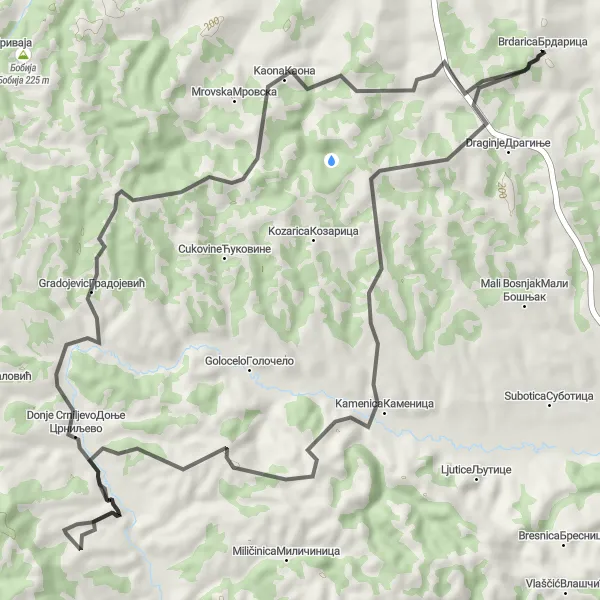
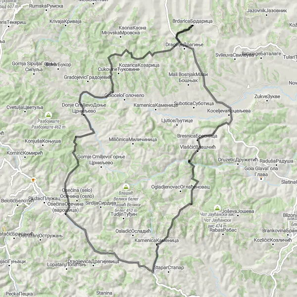
A thrilling cycling experience through the captivating landscapes of Ljutice
Embark on an exciting cycling journey through the captivating region of Šumadije i Zapadne Srbije in Serbia, starting near Brdarica. This road route offers a challenging and exhilarating experience, showcasing the natural beauty and cultural heritage of Ljutice and its surroundings. With a total ascent of 1112 meters and a distance of 81 kilometers, this route guarantees an unforgettable adventure for cyclists seeking a thrilling and rewarding expedition. Highlights of the journey include the scenic spots of Ljutice, Vlasic Veliki beleg, Osecina, and Gradojevic. Prepare yourself for an epic ride filled with breathtaking panoramas and cultural discoveries.
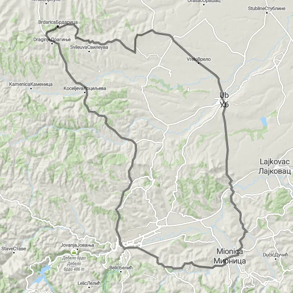
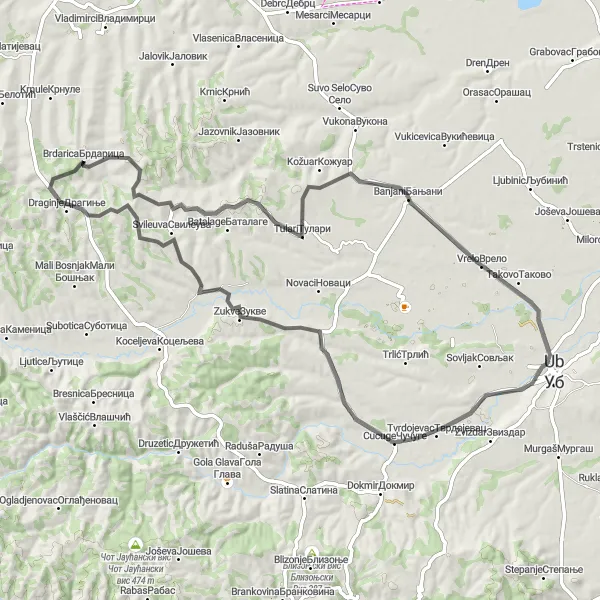
Take on the Valjevo Challenge and conquer the steep climbs of Banjani.
The Valjevo Challenge is a demanding road cycling route with an ascent of 1415 meters and a distance of 125 kilometers. The highlight of this route is the challenging climb up to Banjani, a small village known for its steep slopes and panoramic views. Cyclists who are looking for a tough workout and a sense of accomplishment will find this route to be highly rewarding. Difficulty: 4 Epicness: 4
The Osečina Odyssey
Embark on the Osečina Odyssey and discover the beauty of the Osečina region.
The Osečina Odyssey is a road cycling route that takes you on a scenic journey through the Osečina region. With an ascent of 1129 meters and a distance of 89 kilometers, this route offers a moderate challenge for cyclists. The highlight of this route is the village of Osečina, where you can rest and enjoy the local culture. Difficulty: 3 Epicness: 3
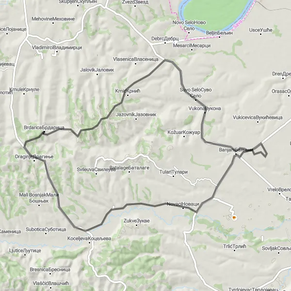
Exploring the Beauty of Brdarica
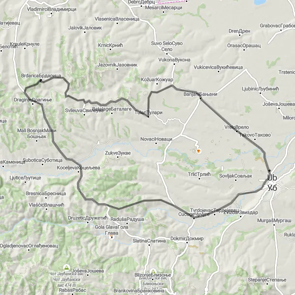
A cycling adventure through Brdarica and its surrounding areas
Embark on a cycling journey through the picturesque region of Šumadije i Zapadne Srbije in Serbia, starting near Brdarica. This route offers breathtaking sceneries and a challenging yet rewarding experience for cyclists of all levels. With a total ascent of 605 meters and a distance of 74 kilometers, this road route provides the opportunity to witness the natural beauty of the region. Whether you are a seasoned cyclist or a beginner, this route promises excitement and enjoyment. Throughout the journey, you will encounter various highlights, including the scenic spots of Tulari, Banjani, Cucuge, Zukve, and Draginje.
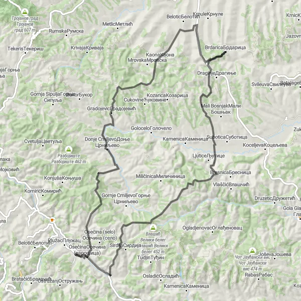
The Draginje Loop
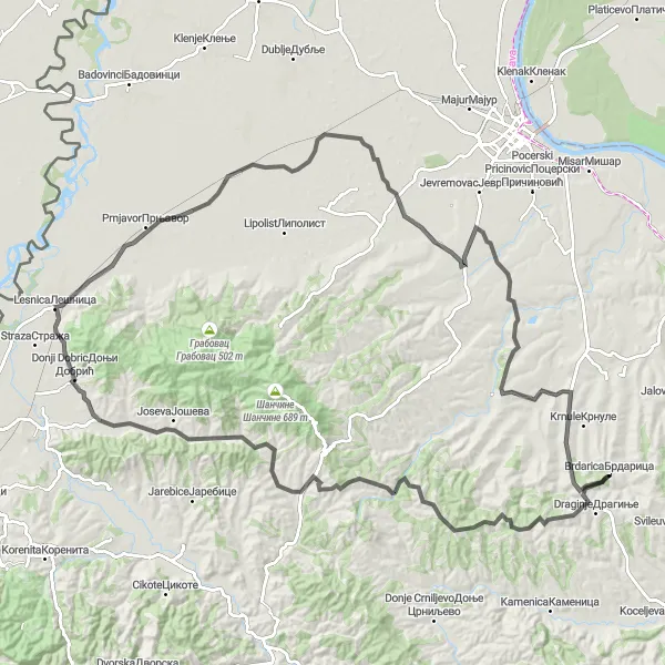
Experience the beautiful Draginje loop with stunning views and a challenging climb.
The Draginje Loop is a scenic round-trip cycling route near Brdarica. With a distance of 121 kilometers and an ascent of 797 meters, this road route provides a challenging ride for experienced cyclists. The highlight of this route is the picturesque village of Draginje, located at the 3-kilometer mark, where you can take a break and enjoy the tranquility of rural Serbia. The Draginje Loop is best suited for cyclists who are looking for a challenging workout combined with beautiful scenery. Difficulty: 3 Epicness: 3
The Bobovik Loop
Discover the beauty of the Bobovik Loop and enjoy scenic landscapes along the way.
The Bobovik Loop is a road cycling route that takes you on a scenic journey through the countryside. With an ascent of 541 meters and a distance of 88 kilometers, this route provides a moderate challenge for cyclists of all levels. The highlight of this route is the village of Bobovik, where you can take a break and enjoy the picturesque surroundings. Difficulty: 2 Epicness: 3
Breathtaking Beauty of Bobovik
Cycle through the stunning landscapes of Bobovik and its surroundings
Embark on a remarkable cycling journey through the enchanting region of Šumadije i Zapadne Srbije in Serbia, starting near Brdarica. This road route offers a captivating experience filled with natural beauty and cultural highlights. With a total ascent of 404 meters and a distance of 43 kilometers, the route allows you to immerse yourself in the stunning landscapes of Bobovik and its surroundings. Highlights of the journey include the scenic spots of Bobovik, Zvezd, and Krnic. Suitable for cyclists of all levels, this route promises a memorable and rewarding adventure.
Scenic Splendor of Krnic
Cycle through the picturesque landscapes of Krnic and its surroundings
Embark on a breathtaking cycling adventure through the captivating region of Šumadije i Zapadne Srbije in Serbia, starting near Brdarica. This road route offers an exhilarating experience filled with stunning sceneries and cultural highlights. With a total ascent of 502 meters and a distance of 63 kilometers, the journey showcases the natural beauty of the Krnic region. Highlights of the route include the scenic spots of Krnic, Vukona, Kalinovac, and Koceljeva. Suitable for cyclists of all levels, this route promises to satisfy your spirit of adventure and discovery.
Cycling routes nearby:


Nearby regions: