Idyllic coastal rides and famous climbs.
Cycling routes from La Herradura
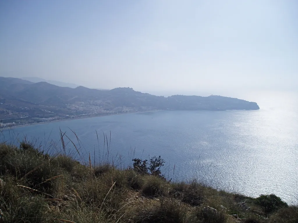
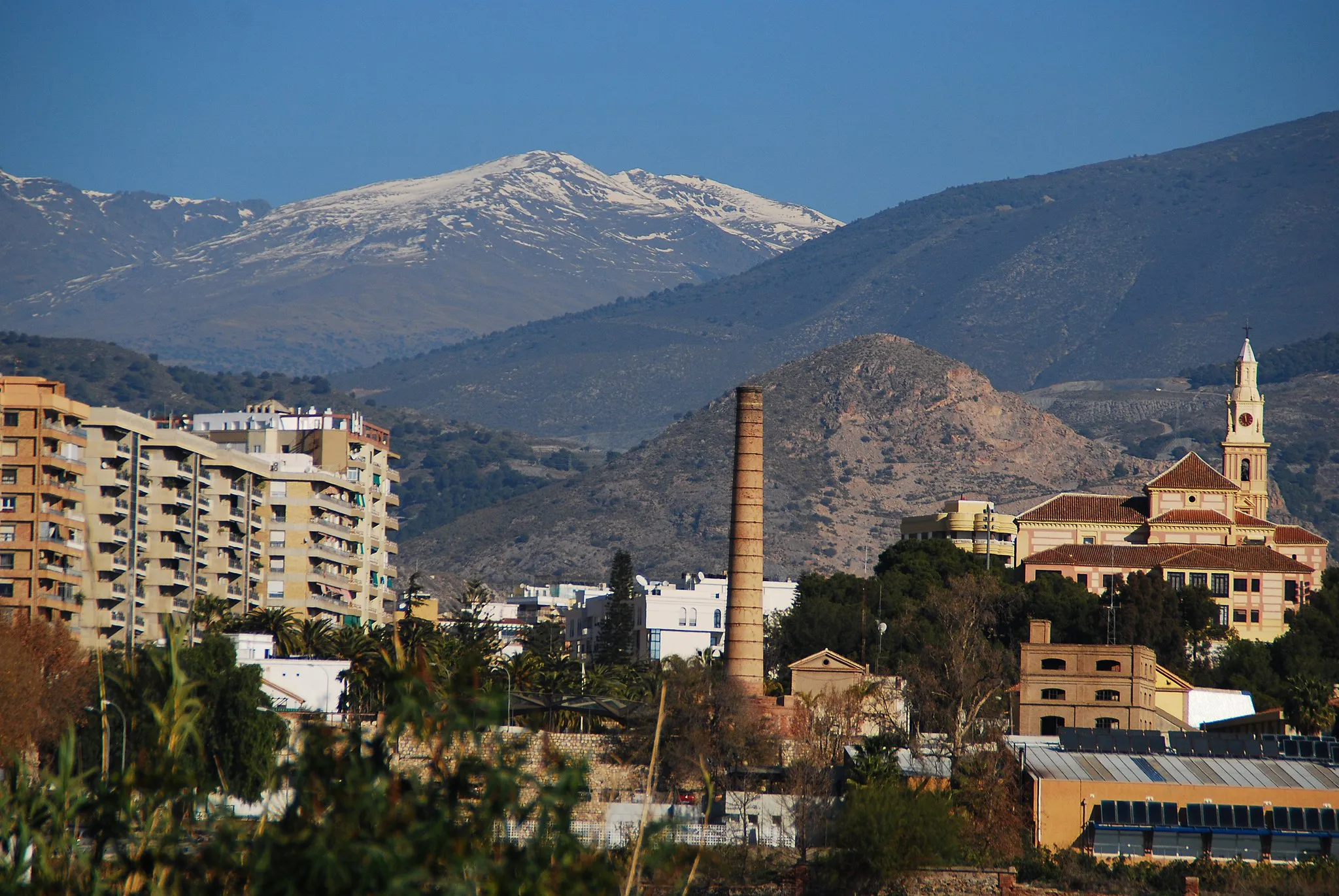
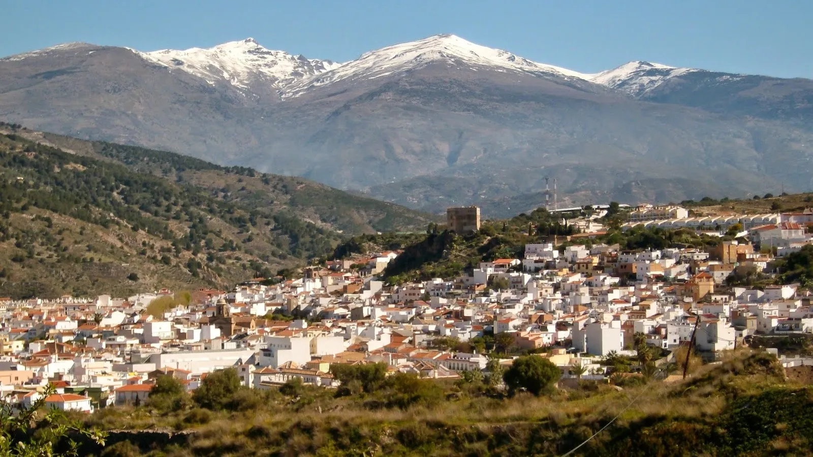
La Herradura, located in Andalucía, Spain, is an idyllic coastal locality offering fantastic cycling opportunities. As a road and gravel cyclist, you can enjoy riding along the picturesque shoreline and take in the breathtaking views of the Mediterranean Sea. The area also boasts spectacular climbs, including the famous Collado Espina and Puerto de la Ragua. La Herradura is a popular spot for cyclists seeking a combination of coastal beauty, challenging climbs, and a vibrant cycling community.
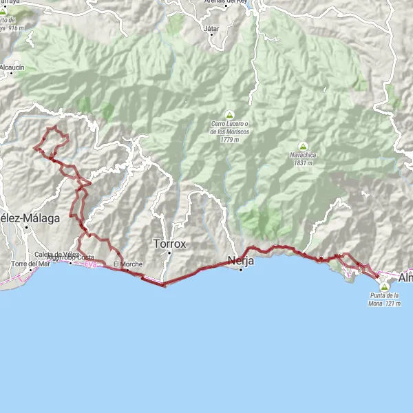
A scenic gravel route from Maro to La Herradura with highlights including Torre Vigía de Maro and Balcón de Europa
This gravel route takes you from the charming village of Maro to the beautiful coastal town of La Herradura. With a total ascent of 3375 meters over a distance of 114 kilometers, it is a challenging ride suitable for well-trained amateurs. The route offers stunning views from Torre Vigía de Maro and Balcón de Europa. Highlights include the picturesque village of Maro, the serene Lagos de la Herradura, and the iconic Faro de Torrox. Cyclists can also enjoy the vibrant atmosphere of La Herradura with its bustling beach promenade and delicious seafood restaurants.
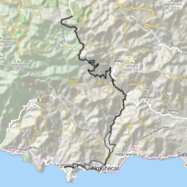
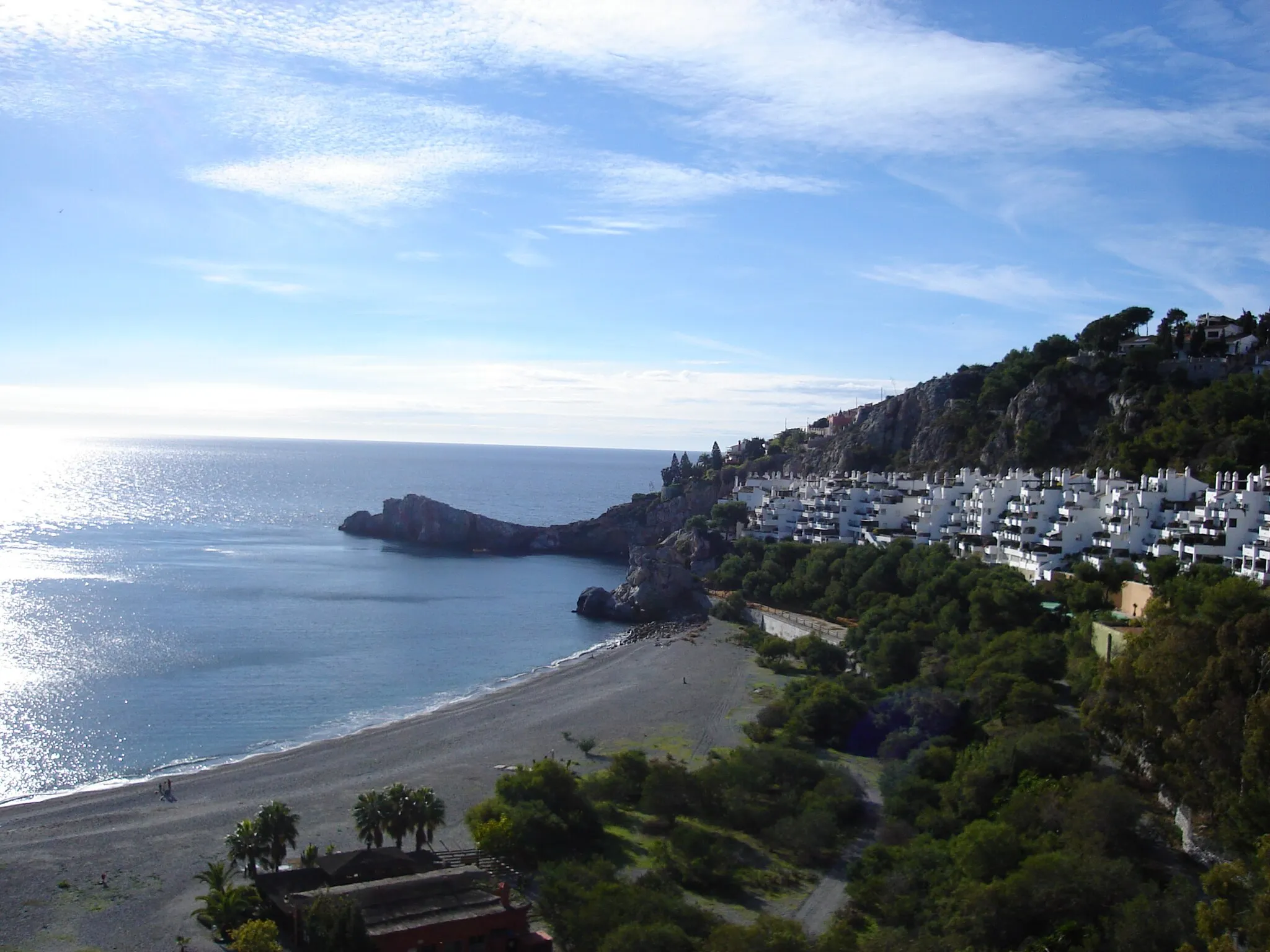
A scenic road route from Punta de la Mona to Almuñécar with highlights including Punta de la Mona and Almuñécar
This road route takes you from Punta de la Mona to the coastal town of Almuñécar. With a total ascent of 2364 meters over a distance of 80 kilometers, it is a moderately challenging ride suitable for intermediate cyclists. The route offers stunning views from Punta de la Mona and the Cerro de la Cruz. Highlights include the charming village of Otívar nestled in the Valle Tropical, and the historic town of Almuñécar with its Roman ruins and picturesque Old Town.
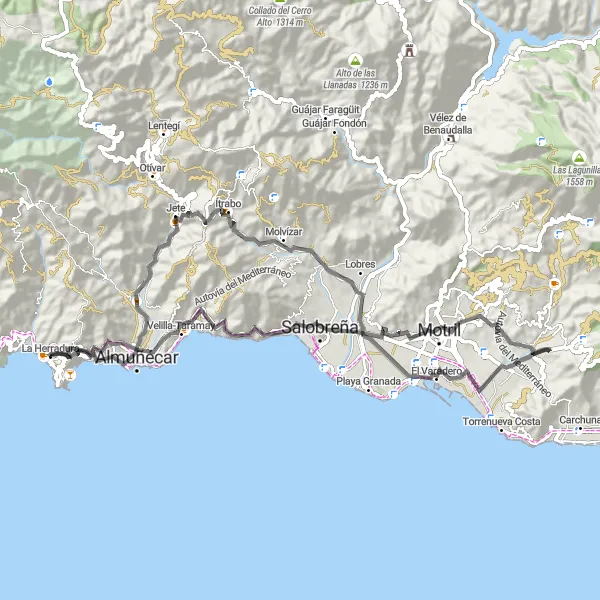
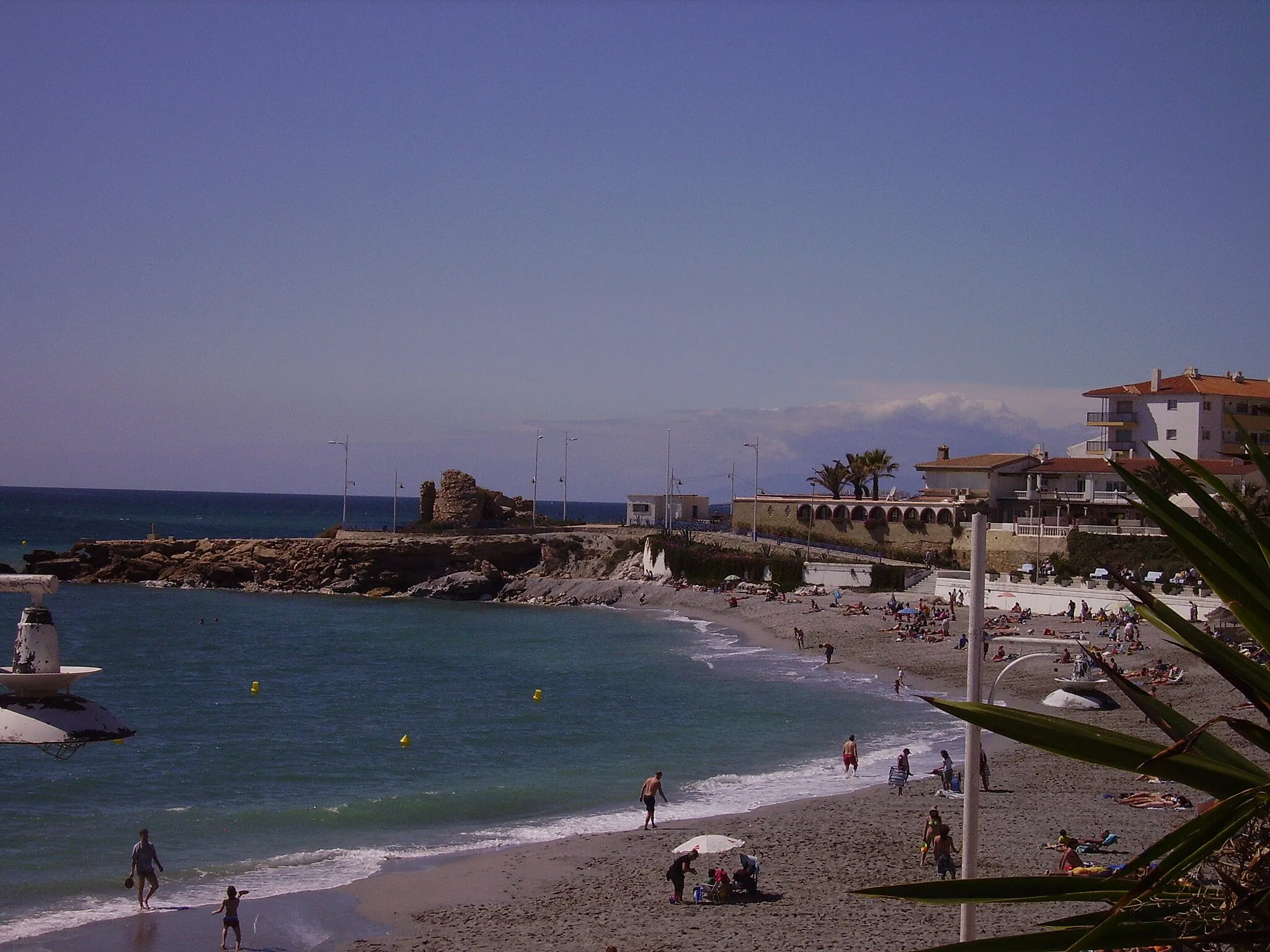
A scenic road route from Punta de la Mona to Almuñécar with highlights including Punta de la Mona and Almuñécar
This road route takes you from Punta de la Mona to the coastal town of Almuñécar. With a total ascent of 1434 meters over a distance of 79 kilometers, it is a relatively easy ride suitable for all levels of cyclists. The route offers stunning views from Punta de la Mona and Mirador Enrique Morente. Highlights include the vibrant beach towns of Velilla-Taramay and Varadero, as well as the charming village of Jete.
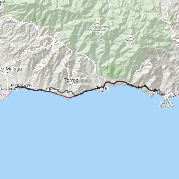
Ride along the coastline and discover ancient ruins and cultural gems
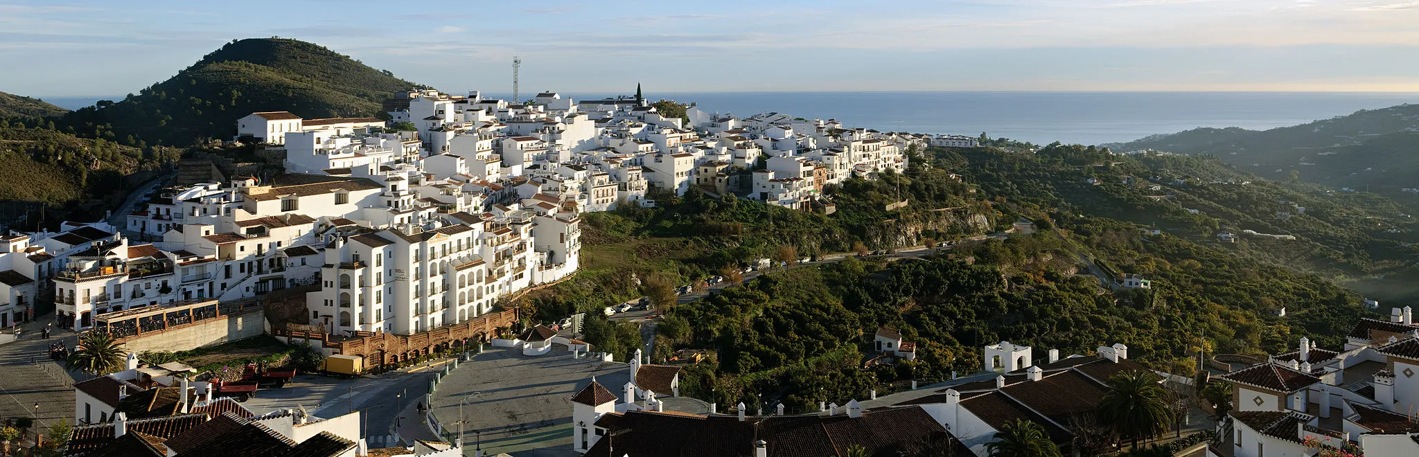
Embark on a rewarding road journey that covers 76 kilometers of stunning coastline and uncovers historical treasures along the way. As you ascend 1,379 meters, you'll encounter the ruins of Garitas de Vigilancia, serving as a reminder of the area's rich history. Admire the Torre Vigía de Maro, a watchtower guarding the coastline for centuries, before heading to Balcón del Mediterráneo, offering captivating views of the sparkling sea. Traverse through Lagos, where crystal-clear lakes punctuate the landscape, and Algarrobo-Costa, a charming coastal town known for its tranquility. The route then introduces you to cultural landmarks such as the Balcón de Europa in Nerja and the Castillo de la Herradura, steeped in history and mystique.
Gravel Adventure Through Nature
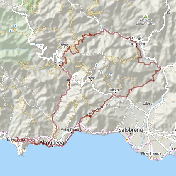
Immerse yourself in the beauty of nature and discover hidden gems
Embark on a captivating gravel adventure spanning 78 kilometers, allowing you to explore some of the natural wonders surrounding La Herradura. With an ascent of 2,750 meters, this route promises not only exciting challenges but also breathtaking scenery. Begin your adventure at Punta de la Mona, a stunning cape that offers a glimpse of the wonders to come. Pass through Jete, appreciating its charm and tranquility, before venturing onwards to Molvízar, known for its beautiful surroundings. Discover the picturesque Cerro de la Ferosa, a hidden gem boasting magnificent views. Conclude your journey at San Miguel Castle, a historical site with a rich past.

Scenic gravel route along the coast
This gravel route near La Herradura takes you on a scenic ride along the stunning coastline. With an ascent of 1705m and a distance of 48km, it offers a challenging yet rewarding cycling experience. The route is suitable for well-trained amateurs looking to explore the beautiful landscapes of Andalucía.
A scenic road route from Punta de la Mona to Velilla-Taramay with highlights including Punta de la Mona and Venta la Cebada
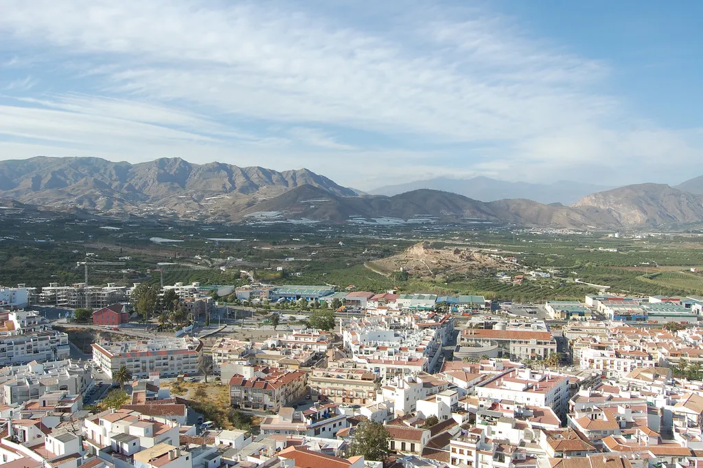
This road route takes you from Punta de la Mona to the beach town of Velilla-Taramay. With a total ascent of 3324 meters over a distance of 142 kilometers, it is a challenging ride suitable for well-trained amateurs. The route offers stunning views from Punta de la Mona and Mirador barranco de Tablate. Highlights include the picturesque village of Jete and the iconic Castillo "Venta la Cebada" perched high on a hilltop. Cyclists can also enjoy the beautiful coastal town of Salobreña with its white houses and Moorish castle.
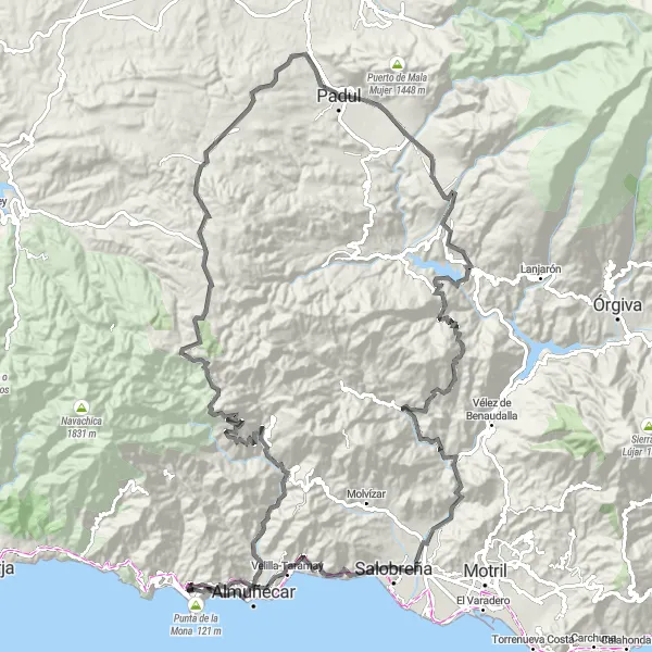
Scenic Road Escape
Experience the stunning beauty of the coastline and mountainous landscapes
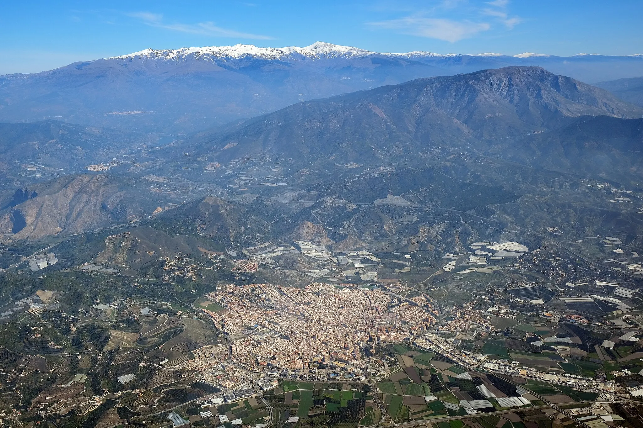
Embark on a memorable journey along this 164-km road route, taking in the awe-inspiring sights of La Herradura and its surroundings. As you ascend 3,633 meters, you'll be treated to magnificent views of Punta de la Mona and Jete, a charming village known for its white houses and narrow streets. The route then leads you to landmarks such as Cerro de la Cruz and Cerro de los Cañones, offering panoramic vistas of the sprawling countryside. Discover the historic town of Lanjarón, famous for its healing mineral springs, and delve into the enchanting beauty of the Alpujarra region. Conclude your ride in Velilla-Taramay, where you can bask in the serenity of the beach.
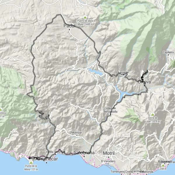
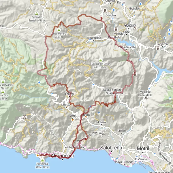
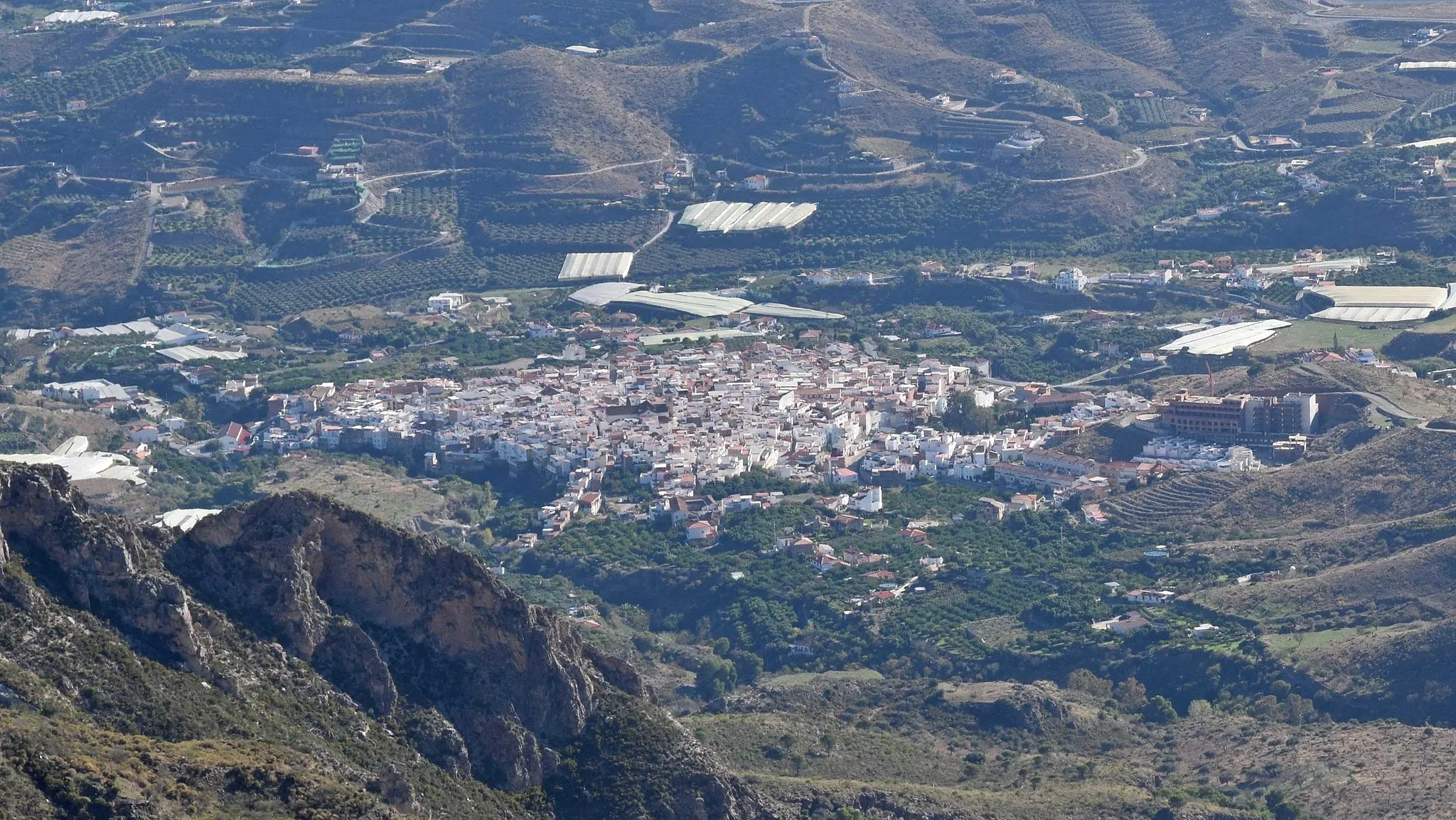
A scenic gravel route with highlights including Punta de la Mona and Vélez de Benaudalla
This gravel route starts at Punta de la Mona and takes you through picturesque villages like Otívar and Saleres. With a total ascent of 3900 meters over a distance of 123 kilometers, it is a challenging ride suitable for well-trained amateurs. The route also offers stunning views from Mirador de la Razuela and Mirador barranco de Tablate. Highlights include the historic Castillo de la Herradura and the charming town of Vélez de Benaudalla.
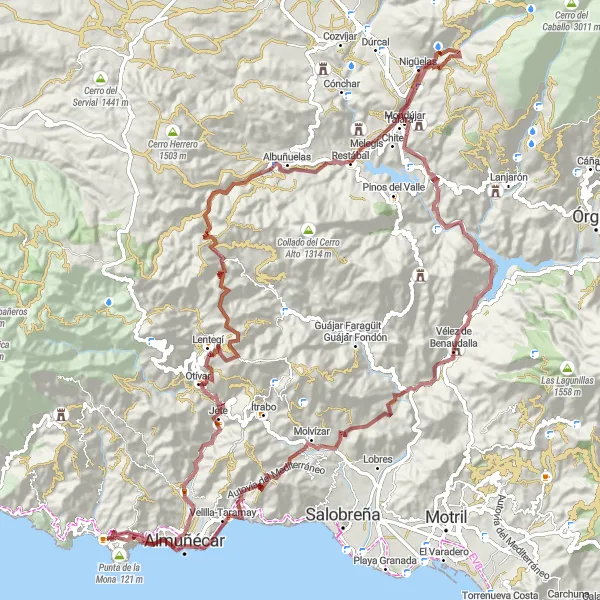
Challenging gravel adventure with dramatic climbs
Experience a challenging gravel adventure with the La Herradura - Lentegí loop. This epic 131km route boasts an outstanding ascent of 4413m, taking you through some of the most dramatic landscapes in Andalucía. Suitable for experienced cyclists, this route promises stunning views and exhilarating climbs.
Cycling routes nearby:

Nearby regions: