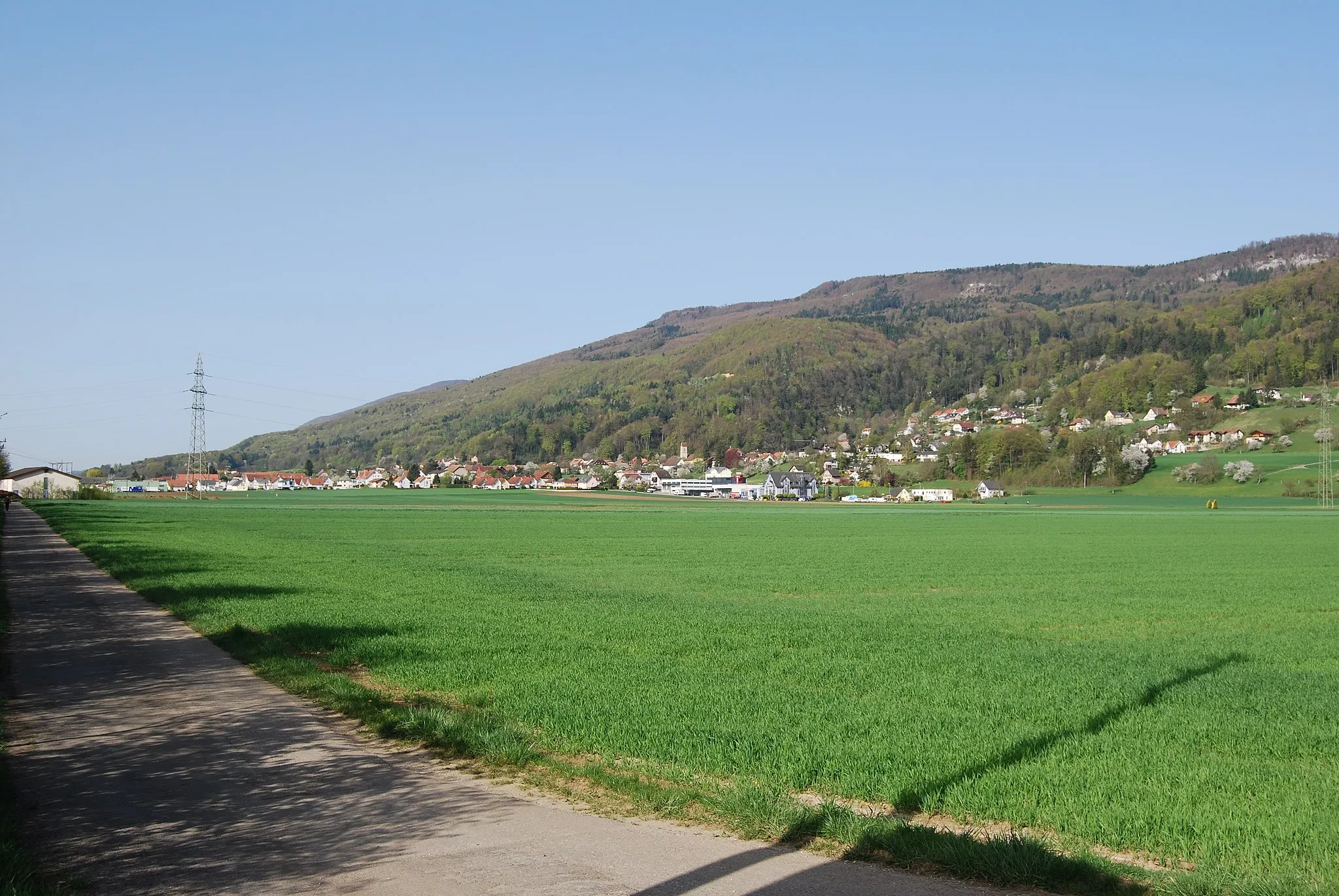
Cycling paradise in breathtaking Espace Mittelland, Switzerland
Cycling routes from Oberbuchsiten
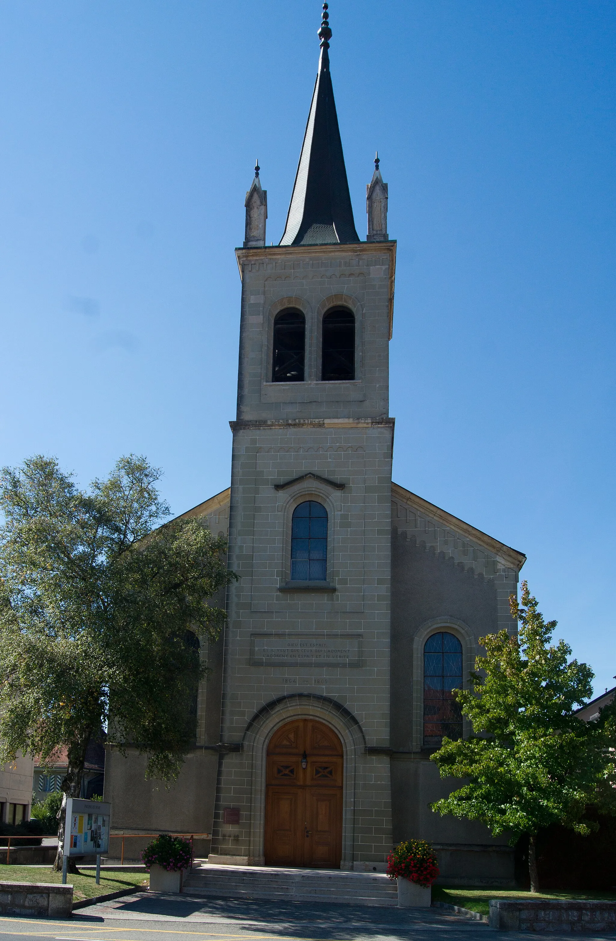
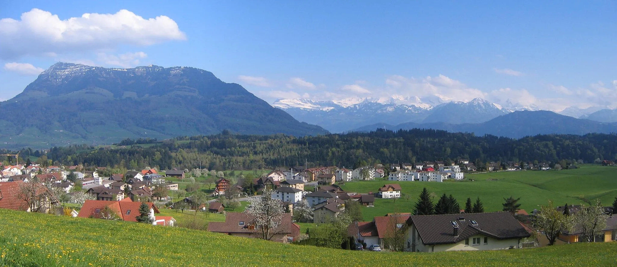
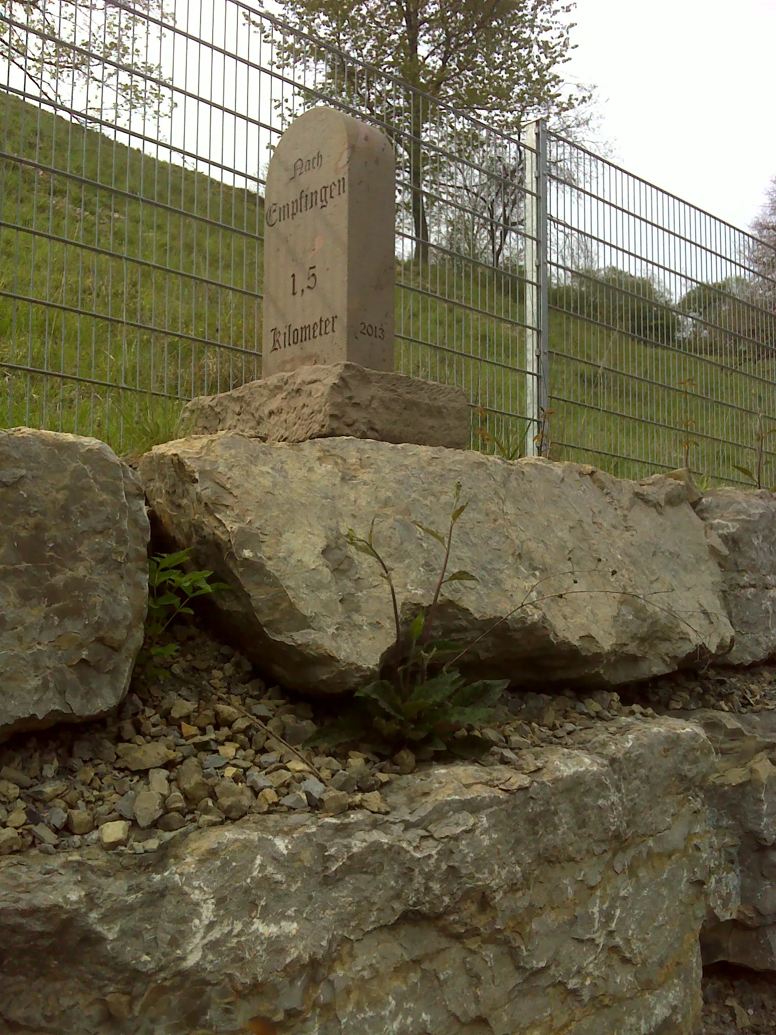
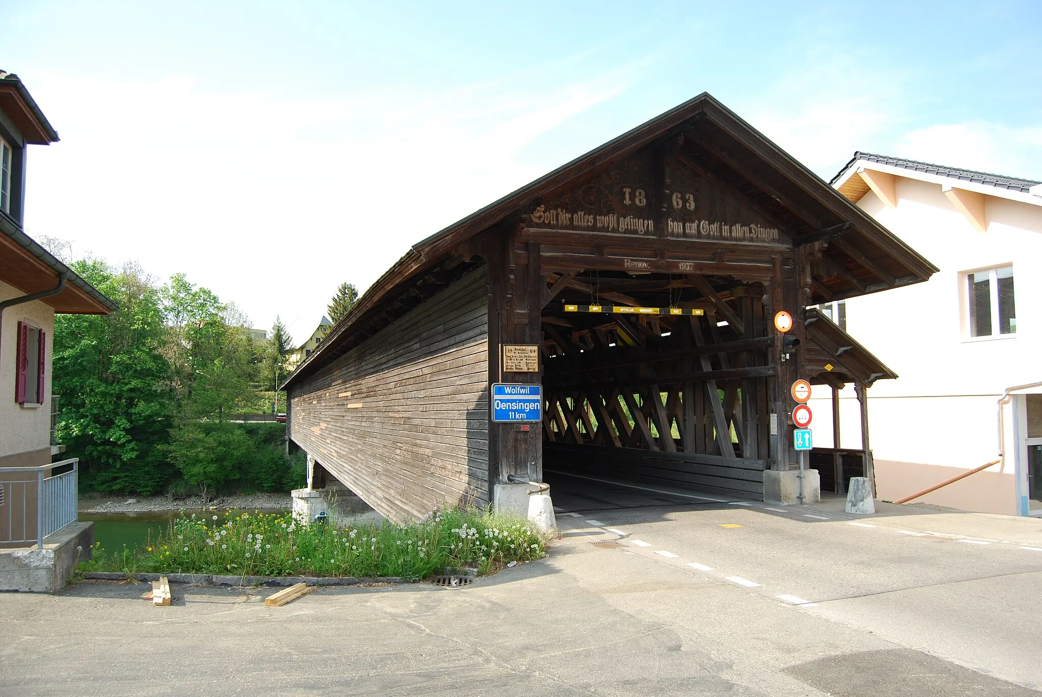
Oberbuchsiten in Switzerland's Espace Mittelland region offers cyclists a great variety of cycling routes and stunning scenery. The area is well-known for its well-maintained roads and extensive network of cycling paths, making it a haven for cycling enthusiasts. Cyclists can enjoy riding along the rolling countryside of Espace Mittelland, with its charming villages, green pastures, and beautiful lakes. One of the famous cycling spots near Oberbuchsiten is the fairy-tale like Emmental Valley, which offers breathtaking views and challenging climbs. Whether you're a road cyclist or prefer off-road adventures, Oberbuchsiten caters to all types of cyclists with its diverse cycling options and bike-friendly facilities.
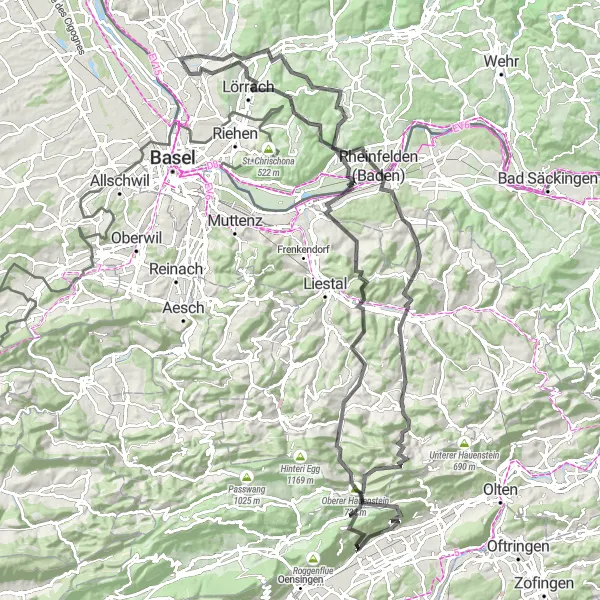
Embark on the ultimate climbing challenge from Rheinfelden to Oberbuchsiten
This road cycling route is a test of endurance, featuring a total ascent of 2,605 meters over a distance of 125 kilometers. Starting from Rheinfelden, the route takes you through thrilling highlights such as Eptingen, Sissach Flue, Rheinfelden, Bergfried Burg Rötteln, Rümmingen, Lörrach, Hünerberg, Eigenturm, Arisdorf, Waldenburg, Oberer Hauenstein, Ramelen, and Oberbuchsiten. Experience the thrill of conquering legendary climbs and take in breathtaking vistas along the way.
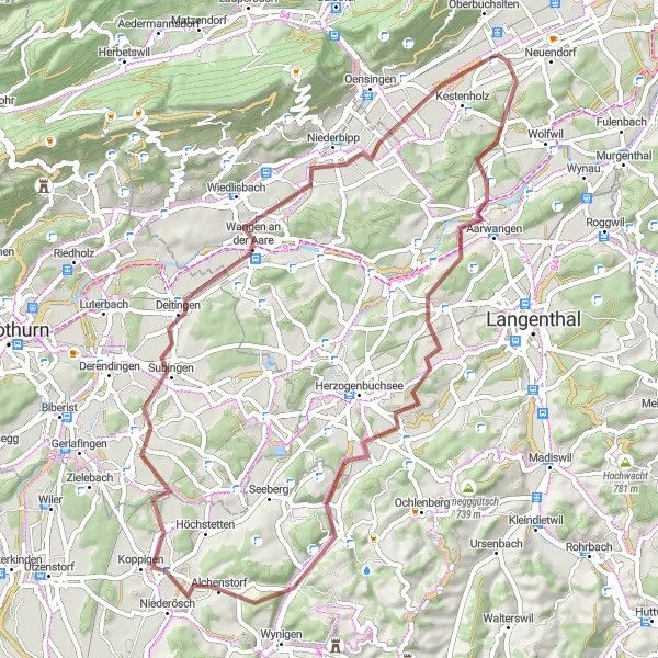
Explore enchanting landscapes on this mesmerizing gravel loop
This mesmerizing gravel loop near Oberbuchsiten covers a distance of 61 kilometers with an elevation gain of 546 meters. The route takes you through captivating landscapes and charming villages, providing a sense of tranquility and a connection with nature. Highlights on this route include Aarwangen, Bettenhausen, Humberg, Ieschberg, Alchenstorf, Kriegstetten, and Kestenholz. Suitable for gravel bikes, this loop offers a delightful cycling experience for those who appreciate the beauty of the Swiss countryside.
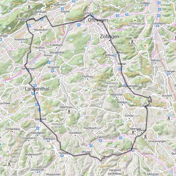
Experience the beauty of Mittelland on this road cycling adventure
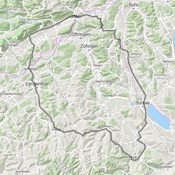
This road cycling loop starting in Oberbuchsiten offers a scenic journey through Mittelland. With a total distance of 84 kilometers and an elevation gain of 839 meters, this route takes you through picturesque towns and stunning landscapes. Highlights along the way include Ramelen, Oftringen, Ettiswil, Ufhusen, Bisig, Langenthal, and Niederbuchsiten. Suitable for road bikes, this route provides a challenging yet rewarding experience for cyclists looking to explore the region's natural beauty.
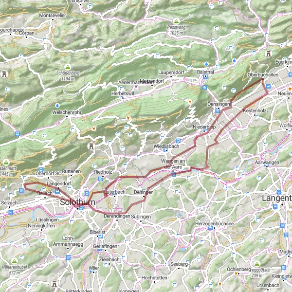
Embark on a gravel cycling journey through diverse landscapes
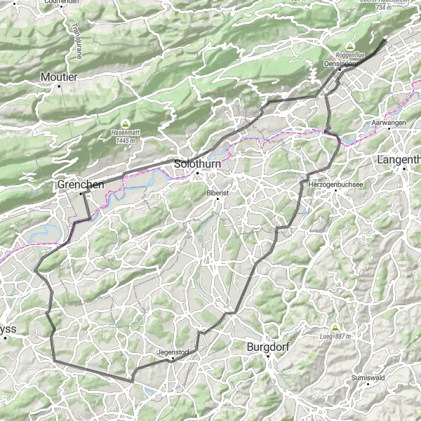
This challenging gravel route takes you through 64 kilometers of stunning scenery, with a total ascent of 532 meters. Starting in Oberbuchsiten, you'll encounter highlights such as Chöpfli, Oensingen, Flumenthal, Brästenberg, Solothurn, Bellach, Dittiberg, Gensberg, Walliswil bei Niederbipp, and Niederbuchsiten. The route is suitable for gravel bikes and offers a rewarding cycling experience for enthusiasts looking for a mix of adventure and natural beauty.
The Hills of Oberbuchsiten
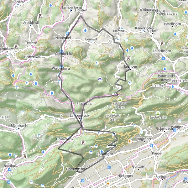
An exhilarating ride through the rolling hills near Oberbuchsiten
This route takes you through a picturesque landscape of rolling hills and charming villages. With a total ascent of 1,314 meters and a distance of 45 kilometers, it offers a challenging yet rewarding experience for cyclists. The route starts in Oberbuchsiten and takes you to breathtaking highlights such as Hard, Oberdorf BL, Eptingen, Belchenflue, Santelhöchi, and Oberbuchsiten.
Embark on an epic gravel journey through stunning mountain landscapes
This ultimate gravel adventure near Oberbuchsiten covers a distance of 62 kilometers with an elevation gain of 1494 meters. The route takes you through challenging terrains, picturesque villages, and awe-inspiring mountain panoramas. Highlights on this epic journey include Hard, Waldenburg, Liestal, Schleifenbergturm, Sissach, Schanz, Hägendorf, and Ramelen. Designed for experienced gravel riders seeking a thrilling and rewarding experience, this route offers a unique combination of natural beauty, tough climbs, and breathtaking views.
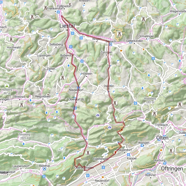
Discover challenging climbs and breathtaking views on this mountainous route
This mountainous road adventure starts in Oberbuchsiten and covers a distance of 72 kilometers with an elevation gain of 1228 meters. The route takes you through diverse landscapes, including challenging climbs and scenic vistas. Highlights along the way include Hard, Waldenburg, Buechholz, Gelterkinden, Oltingen, Leutschenberg, Känzeli, Aarburg, and Oberbuchsiten. Designed for experienced road cyclists, this route offers a thrilling and unforgettable experience for those seeking to test their cycling skills and enjoy panoramic views of the Espace Mittelland.
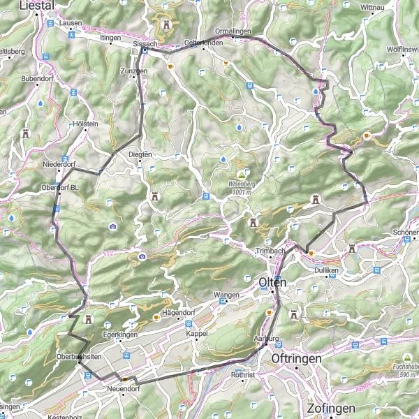
Conquer the challenging climbs of the Jura mountains on this road cycling route near Oberbuchsiten
This round-trip cycling route near Oberbuchsiten takes you through the beautiful Jura mountains, offering challenging climbs, stunning views, and plenty of highlights along the way. With a total ascent of 1241 meters and a distance of 114 kilometers, this route is perfect for very well-trained amateur cyclists looking for an epic adventure.
Embark on an off the beaten path adventure from Egerkingen to Härkingen
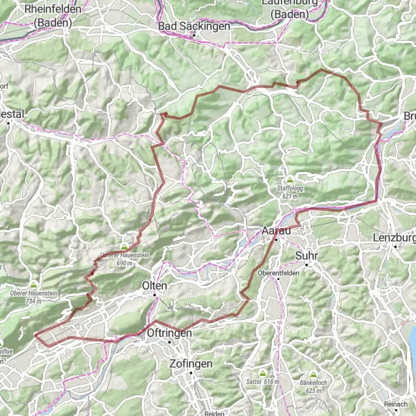
For those seeking a thrilling gravel adventure, this 109-kilometer route is sure to impress. With a total ascent of 2,182 meters, it takes you through lesser-known highlights such as Egerkingen, Unterer Hauenstein, Wenslingen, Tiersteinberg, Gipf-Oberfrick, Bözbergpass, Villnachern, Buchs, Oberholz, Oftringen, and Härkingen. Get ready to explore hidden gems and untouched nature as you traverse through diverse landscapes.
Discover the idyllic countryside charm from Kirchberg to Chöpfli
With a total ascent of 946 meters and a distance of 111 kilometers, this road cycling route allows you to immerse yourself in the idyllic countryside of Switzerland. Starting from Kirchberg, the route takes you through highlights such as Oberbuchsiten, Chline Fängleberg, Münchenbuchsee, Schlosshubel, Büren, Solothurn, Brästenberg, Rumisberg, and Chöpfli. Prepare to be captivated by the rustic beauty of the country lanes and charming villages along the way.
Cycling routes nearby:


Nearby regions: