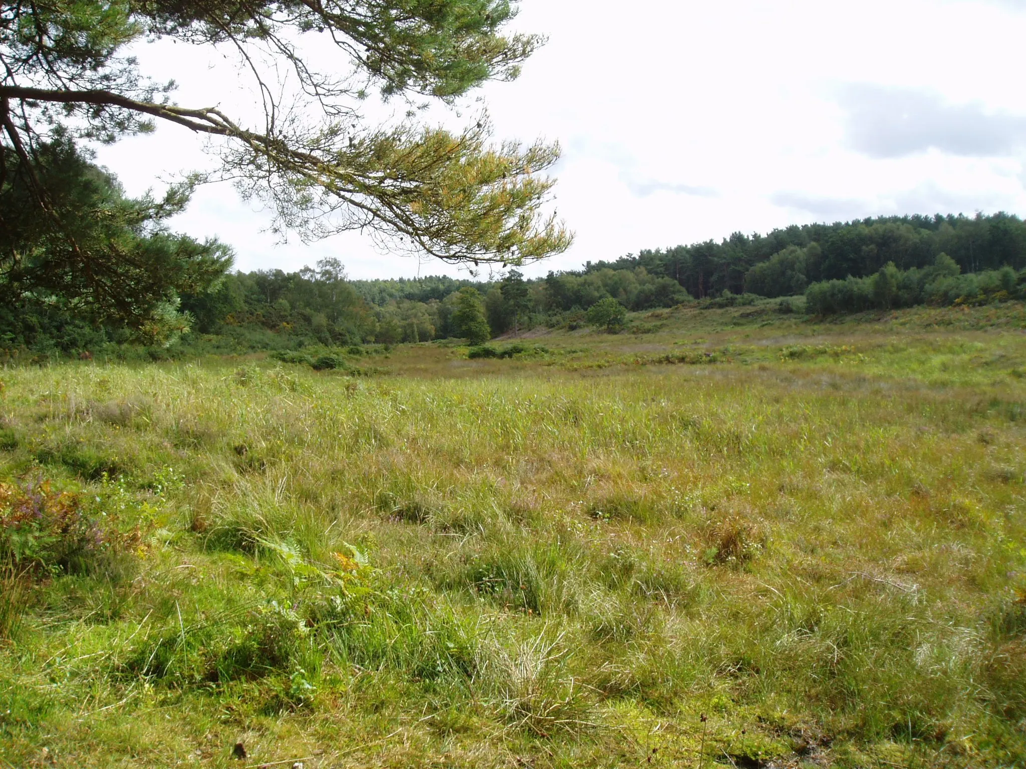
Tranquil cycling haven in the heart of East Anglia.
Cycling routes from Holt
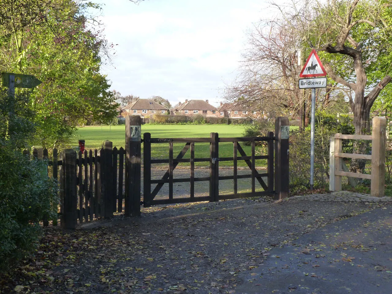
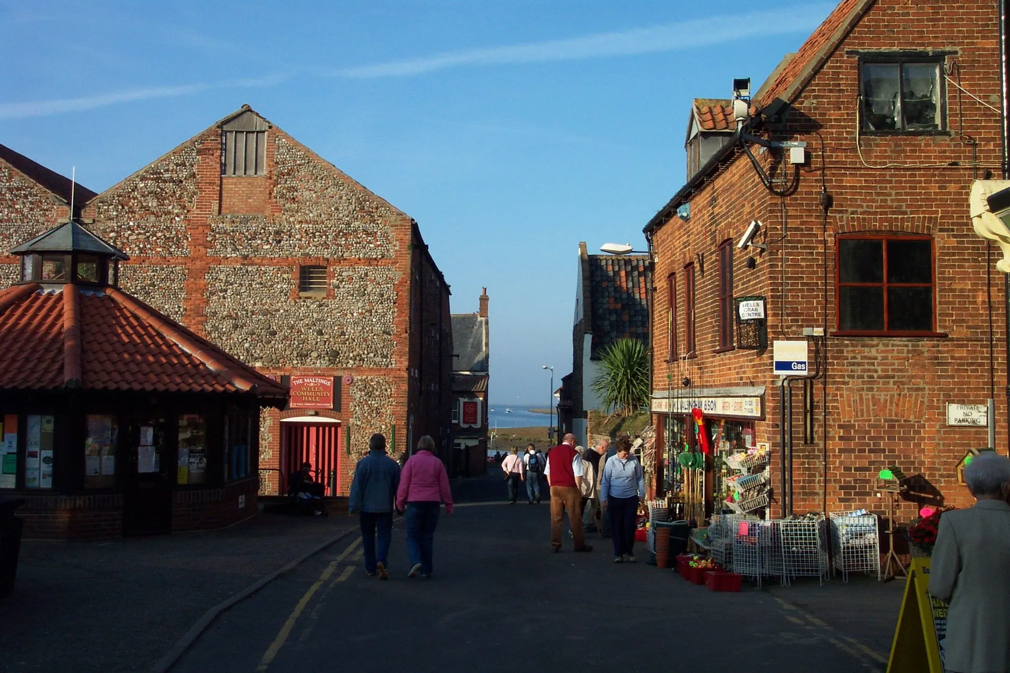
Holt in East Anglia, United Kingdom, offers road and gravel cyclists a charming and picturesque setting for their rides. With its tranquil countryside, scenic routes, and quiet country lanes, Holt provides cyclists with an idyllic cycling experience. The town itself is a thriving hub for cycling enthusiasts, boasting a number of bike rental and repair shops, as well as cycling-friendly accommodations. Notable cycling spots in the area include the Blickling Estate, featuring a network of off-road trails, and the coastal roads leading to the Norfolk Broads. Overall, Holt earns a ranking of 3 out of 5 for cyclists.
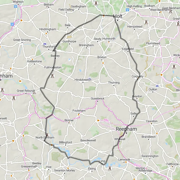
Explore the picturesque villages around Holt
This route takes you on a scenic journey through the beautiful countryside surrounding Holt in East Anglia. Starting from Holt, you will pass through charming villages such as Edgefield, Heydon, Sparham, North Elmham, and Thursford. The route offers a mix of quiet country lanes, gentle climbs, and stunning landscapes. With a total distance of 62 kilometers and an ascent of 306 meters, it is suitable for intermediate-level cyclists. Along the way, you will encounter historic landmarks, quaint pubs, and breathtaking views.
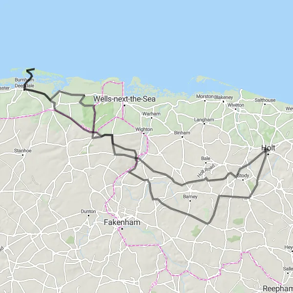
Experience the best of North Norfolk in one journey
Embark on a comprehensive cycling adventure that showcases the rich tapestry of North Norfolk. This 91-kilometer route starting near Holt takes you through picturesque villages such as Thornage, Thursford Collection, Burnham Deepdale, Holkham Hall, Fulmodeston, and Melton Constable. With an ascent of 547 meters, this intermediate to advanced-level route offers diverse landscapes, cultural landmarks, and coastal vistas. Immerse yourself in the beauty of the North Norfolk coastline, traverse peaceful countryside lanes, and explore historic sites along the way.

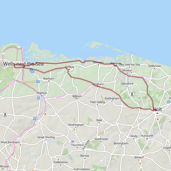
Embark on an exciting gravel journey through the idyllic Norfolk countryside
Discover the picturesque Norfolk countryside on this 35-kilometer gravel route with an ascent of 140 meters. The scenic landscapes and charming villages make it a perfect escape for cyclists looking to explore the beauty of rural East Anglia. Highlights along the route include Field Dalling, Morston, Glandford, and the National Trust Lookout, all offering unique attractions and memorable experiences.
Stately Homes and Scenic Routes
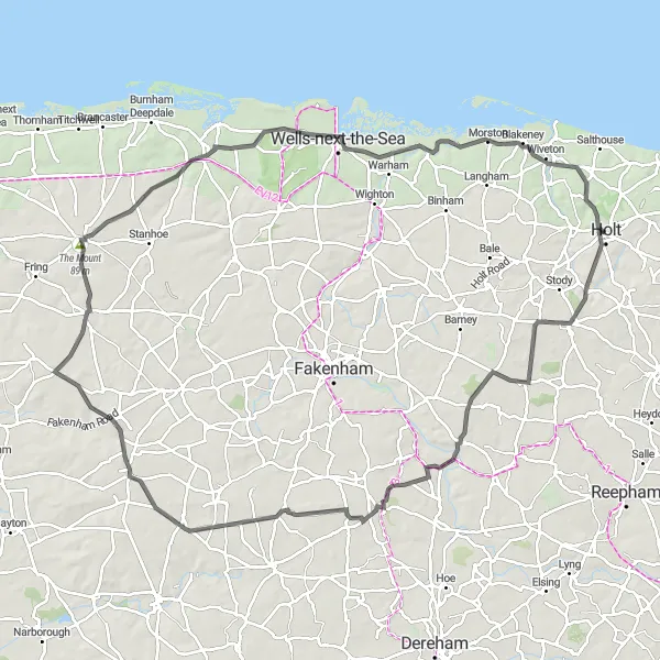
Immerse yourself in Norfolk's history and natural beauty
This 102-kilometer cycling route starting near Holt offers a perfect blend of Norfolk's rich history and picturesque landscapes. Journey through scenic villages such as Melton Constable, Brisley, Great Massingham, The Mount, Docking, Holkham, Stiffkey, and National Trust Lookout. With an ascent of 540 meters, this intermediate to advanced-level route provides a mix of gentle climbs, historic landmarks, and breathtaking vistas. Along the way, you'll discover stately homes, tranquil woodlands, and charming country pubs.
Explore the picturesque Holt countryside on this scenic road route
Enjoy a leisurely 29-kilometer road cycling route through the charming Holt countryside. With an ascent of 126 meters, this route offers a mix of quaint villages and beautiful landscapes. Explore Holt Country Park, Edgefield, Briston, and return to the starting point in Holt. Perfect for cyclists looking for a relaxing and scenic ride, this route showcases the beauty of the East Anglian countryside.
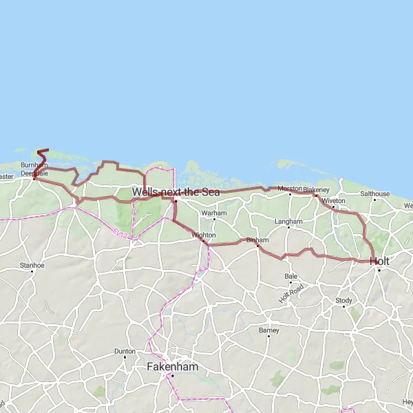
Discover the lesser-known treasures of North Norfolk
This 41-kilometer cycling route starting near Holt takes you off the beaten path to uncover the hidden gems of North Norfolk. As you pedal through the countryside, you will encounter charming villages such as Binham, National Trust Lookout, Morston, and Letheringsett. With a total ascent of 244 meters, this route is suitable for cyclists of all levels. Experience the tranquility of unspoiled landscapes, ancient ruins, and quaint pubs along the way.
Conquer the Norfolk roads on this epic cycling route spanning 108 kilometers
Prepare for a challenging 108-kilometer road cycling adventure with a total ascent of 701 meters. This route takes you through both picturesque countryside and historic towns, including Melton Constable, North Elmham, Great Dunham, Great Massingham, North Creake, Wells-next-the-Sea, and the National Trust Lookout. With a combination of gentle rolling hills, scenic landscapes, and notable landmarks, this route offers a diverse and exciting cycling experience.
Experience the best of coastal and rural Norfolk
Embark on a memorable cycling journey that combines the beauty of Norfolk's coastline with the rustic charm of its countryside. This 109-kilometer route starting near Holt will take you through villages such as Gazebo, Beeston Regis, Knapton, Smallburgh, Horning, Wroxham, Felthorpe, and Edgefield. With an ascent of 481 meters, this intermediate to advanced-level route offers a mix of flat stretches, rolling hills, and stunning coastal scenery. Along the way, you will encounter charming pubs, historic landmarks, and hidden gems.
The Coastal Gravel Loop
Experience the beautiful coastline of East Anglia on this challenging gravel route
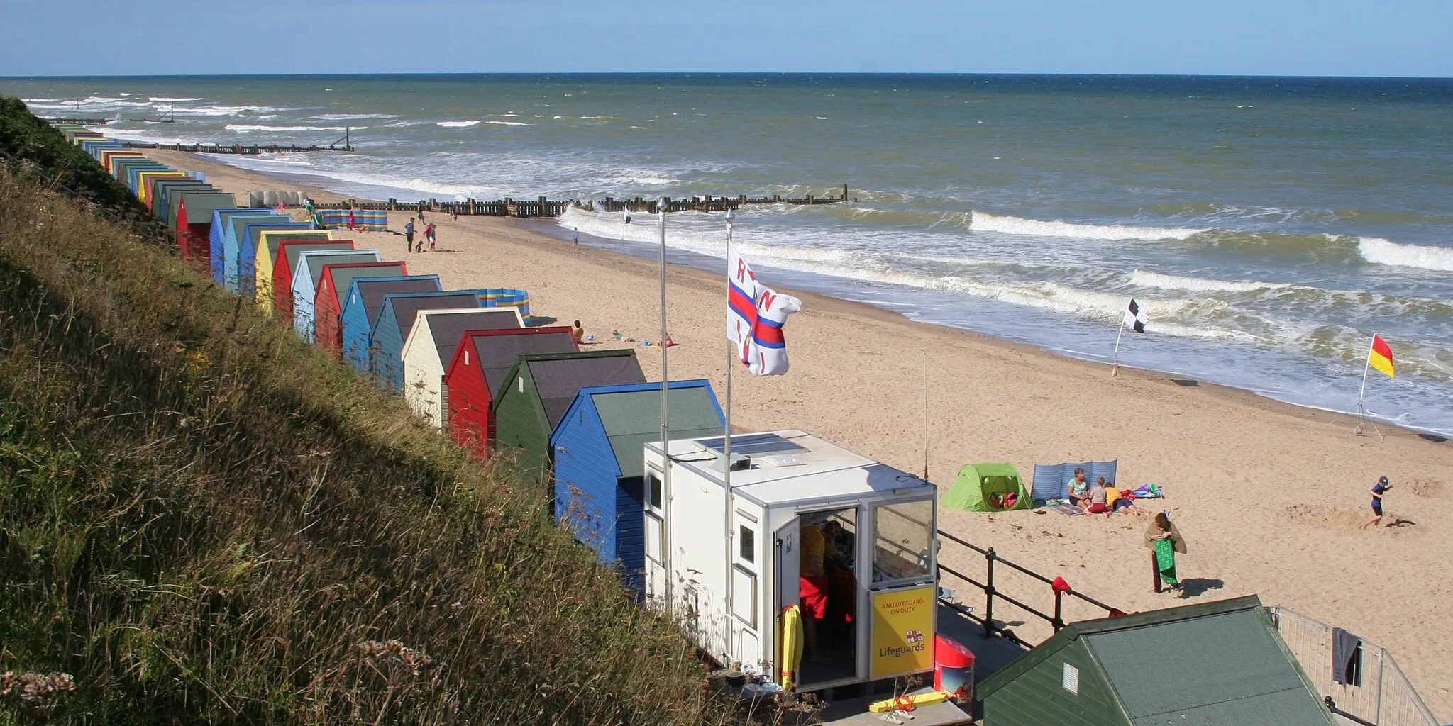
This round-trip cycling route takes you along the scenic Norfolk coast, providing breathtaking views of the sea and surrounding countryside. With a total distance of 43 kilometers and an ascent of 207 meters, this gravel route is suitable for adventurous cyclists who enjoy off-road cycling. The route passes through the charming villages of Cley next the Sea, Stiffkey, and Saxlingham, offering opportunities to stop and explore the local highlights.
The Coastal Gravel Adventure
Ride along Norfolk's coastal paths on this thrilling gravel adventure
Embark on a 78-kilometer gravel adventure showcasing the stunning beauty of Norfolk's coast. With an elevation gain of 363 meters, this challenging route takes you through coastal villages like Binham, Holkham, Gun Hill, Holkham Hall, Stiffkey, and the National Trust Lookout. Enjoy the mix of open landscapes, charming villages, and coastal views that make this gravel adventure an unforgettable experience.
Cycling routes nearby:


Nearby regions: