Exploring the Suffolk Countryside
A gravel cycling route starting from Southwold
Embark on a scenic journey through the picturesque villages of Suffolk
Map
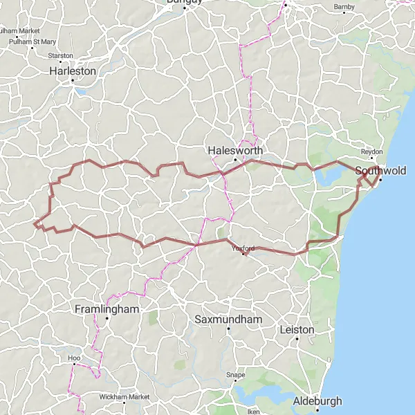
With a total distance of 79 kilometers and an ascent of 308 meters, this gravel route offers a fantastic opportunity to explore the Suffolk countryside. Well-suited for very well-trained amateurs, this route boasts an epicness score of 3. The highlights along this route include Southwold, a charming coastal town with a rich history, Yoxford, known for its beautiful architecture, Brundish, an idyllic village surrounded by verdant fields, and Stradbroke, a picturesque village with stunning countryside views. Blythburgh is another highlight, offering cyclists the chance to discover the fascinating Holy Trinity Church. The route is filled with interesting highlights, each showcasing the beauty of Suffolk.
gravel
79 km
308 m
Tough
Route profile
Highlights on the route
0 km
0 km
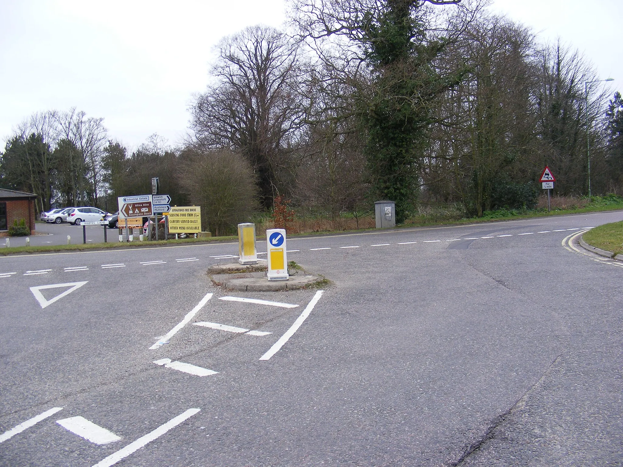
Start: Southwold City centerSouthwold: Coastal cycling paradise in Southwold, East Anglia, United Kingdom.
Southwold is a captivating locality in East Anglia, United Kingdom. As a road and gravel cyclist, Southwold provides a diverse cycling experience. The coastal scenery and gently undulating terrain make for delightful rides. Southwold is also home to the famous Southwold Pier, which offers a unique cycling experience along its promenade. The locality's cycling infrastructure is excellent, with designated cycling paths and well-paved roads. Notable nearby climbs include the scenic Dunwich Cliffs, providing a challenging ascent for experienced cyclists.0 km
0 km
SouthwoldTownSouthwold: Discover the rich history and coastal charm of this town.
18 km
18 km
YoxfordVillageYoxford: Admire the beautiful architecture and explore this stunning village.
33 km
33 km
BrundishVillageBrundish: Experience the tranquility of this idyllic village surrounded by lush fields.
44 km
44 km
StradbrokeVillageStradbroke: Enjoy breathtaking countryside views while cycling through this picturesque village.
54 km
54 km
CratfieldVillageCratfield: Take in the peaceful atmosphere of this charming rural village.
71 km
71 km
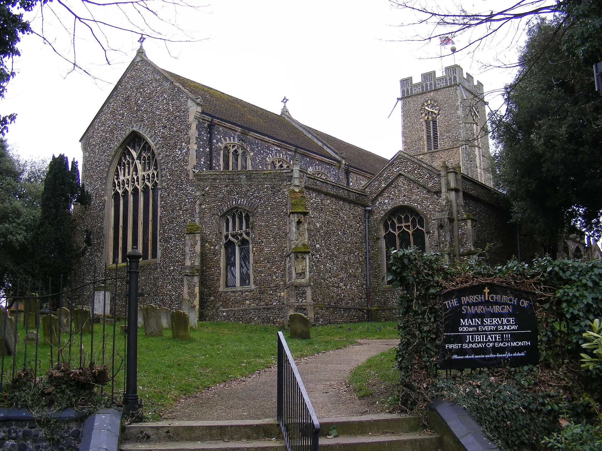
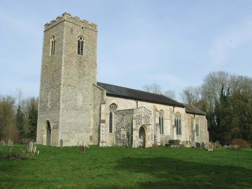
BlythburghVillageBlythburgh: Visit the historical Holy Trinity Church and immerse yourself in the fascinating history of the village.
79 km
79 km
Finish: Southwold City centerSouthwold: Coastal cycling paradise in Southwold, East Anglia, United Kingdom.
Cycling routes from Southwold:
The Suffolk Challenge Sotterley and Rushmere Gravel Ride Benacre and Kessingland Gravel Loop Dunwich Dash Dunwich and Aldeburgh Gravel Adventure Southwold Adventure Exploring the Suffolk Countryside Walberswick and Theberton Road Adventure Suffolk Scenic Road Trip Wrentham - Lowestoft - Ness Point - South Cove - Southwold The Coastal Circuit
Cycling routes nearby: