Vibrant cycling community and access to famous climbs in Greater Manchester.
Cycling routes from Fallowfield
Fallowfield is a locality in Greater Manchester, United Kingdom. It offers a mix of road and gravel cycling routes suitable for cyclists of different abilities. The area is well-connected with bike lanes and cycling paths, making it easy to explore. Fallowfield also has a vibrant cycling community, with regular group rides and events. Nearby, you can find the famous climbs of the Peak District, a popular destination for cyclists seeking challenging routes. Fallowfield is a great locality for both road and gravel cyclists, with scenic routes and access to famous climbs.
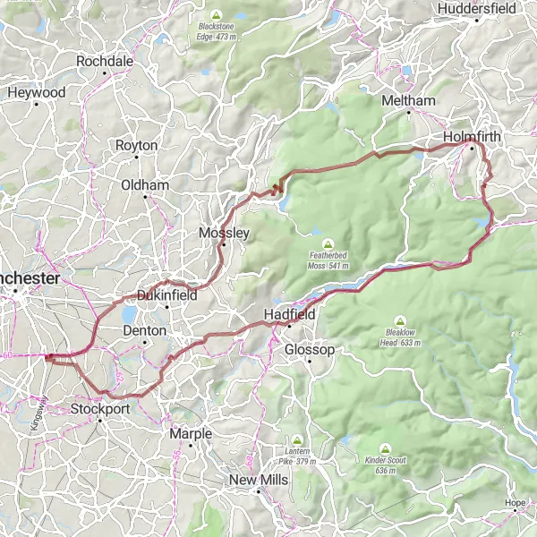
Embark on an epic gravel cycling route with highlights such as Stalybridge and Portwood.
This challenging gravel cycling route starts near Fallowfield and takes you through the stunning countryside of Stalybridge, Greenfield, Dean Head Hill, Holmfirth, Pikenaze Hill, and Portwood. With a distance of 86 km and an ascent of 1074 m, this route is suitable for experienced cyclists. The epicness rating of this route is 4, offering breathtaking views and challenging terrains. The highlights of this route include Stalybridge, a town surrounded by picturesque hills, and Portwood, a historic area known for its industrial heritage. Overall, this route provides a true adventure amidst stunning landscapes and iconic cycling spots.
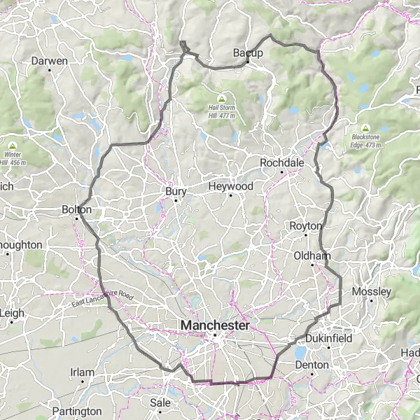
Challenge yourself on this epic climbing route from Chorlton-cum-Hardy to Walsden
Prepare for a challenging and rewarding cycling experience as you conquer breathtaking climbs and discover stunning landscapes. This 102-kilometer road route takes you through Chorlton-cum-Hardy, Walkden, Hawkshaw, Bacup, Walsden, Moy Hill, Levenshulme, and finally back to Fallowfield. With an elevation gain of 825 meters, this is a demanding route suitable for experienced cyclists seeking a true test of endurance.
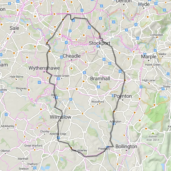
A road cycling route with highlights such as Staircase House and Wilmslow.
Starting near Fallowfield, this road cycling route takes you through various attractions including the renowned Staircase House and Wilmslow. With a distance of 48 km and an ascent of 306m, this route is suitable for well-trained amateurs. The epicness rating of this route is 2, offering a mix of cultural landmarks and scenic beauty. The highlights along the route include Staircase House, a fascinating historical site that showcases the town's rich heritage, and Wilmslow, a charming town known for its boutique shops and cafes. Withington is also worth exploring, with its picturesque countryside and beautiful landscapes. Overall, this route provides a diverse range of attractions and picturesque scenery.
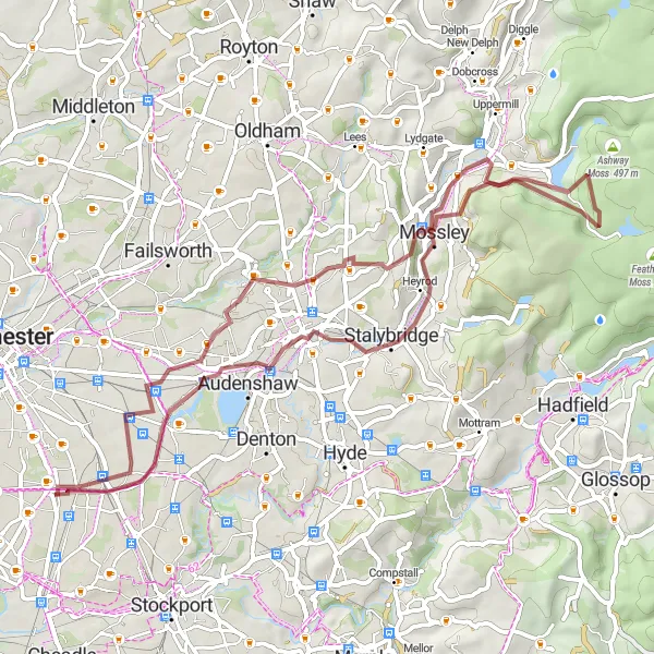
Discover a scenic gravel cycling route starting near Fallowfield.
Set off on a picturesque gravel cycling route near Fallowfield, offering scenic beauty and interesting highlights. The route includes attractions such as Stalybridge, Greenfield, Alphin Pike, Daisy Nook, and Levenshulme. With a distance of 54 km and an ascent of 663 m, this route is suitable for experienced cyclists. The epicness rating of this route is 3, providing beautiful countryside views and challenging terrains. The highlights of this route include Stalybridge, a historic town with picturesque landscapes, and Alphin Pike, a famous summit in the region. Daisy Nook offers a peaceful escape with beautiful parkland, while Levenshulme showcases vibrant arts and culture. Overall, this route offers a mix of natural beauty and cultural attractions.

Enjoy a scenic road loop passing through Timperley, Hollins Green, Kenyon, Boothstown, and Fallowfield
This road route traverses scenic landscapes and charming villages, offering a delightful cycling experience. You'll ride through Timperley's tree-lined streets, Hollins Green's picturesque farmland, Kenyon's tranquil countryside, and Boothstown's scenic canal. With a distance of 68 kilometers and an elevation gain of 203 meters, this route is suitable for cyclists of intermediate level.
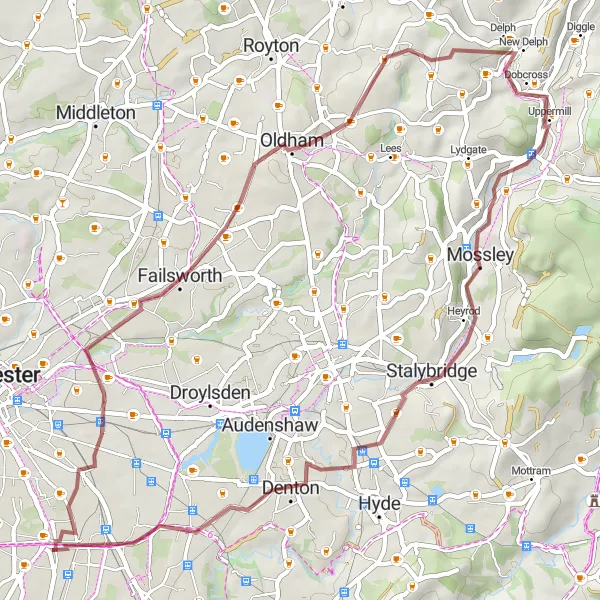
Embark on a gravel adventure through Failsworth and Uppermill
This gravel route offers an exciting adventure through the lovely areas of Failsworth and Uppermill. Expect picturesque landscapes, quaint villages, and some challenging climbs. With a distance of 50 kilometers and an elevation gain of 415 meters, this route is suitable for intermediate gravel riders looking for a scenic challenge.
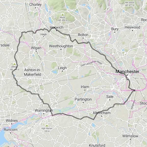
Discover the idyllic villages and scenic countryside of Cheshire on this epic road route
This road route takes you through the charming villages of Withington, Little Bollington, Lymm Dam, Wilhead, Billinge Hill, Shevington, Great Lever, Pendlebury, and finally back to Fallowfield. Along the way, you'll encounter picturesque landscapes, historic landmarks, and challenging climbs. With a distance of 106 kilometers and an elevation gain of 640 meters, this is a challenging route tailored for well-trained cyclists.

A scenic road cycling route featuring highlights such as Chorlton-cu-Hardy and Whitefield.
This road cycling route starts near Fallowfield and takes you through the picturesque villages of Chorlton-cum-Hardy, Boothstown, Chew Moor, White Brow, and Whitefield. With a total distance of 76 km and an ascent of 614 m, this route is suitable for well-trained amateurs. The epicness rating of this route is 3, offering beautiful countryside views along the way. The highlights include Chorlton-cum-Hardy, a charming village known for its vibrant art scene, and Whitefield, which has historical sites to explore. Overall, this route provides a combination of scenic beauty and cultural attractions.

A gravel cycling route with highlights such as Urmston and Eccles.
Discover the outskirts of Manchester on this gravel cycling route starting near Fallowfield. The route features highlights such as Urmston and Eccles, taking you through scenic landscapes and historical areas. With a distance of 79 km and an ascent of 230 m, this route is suitable for experienced amateurs. The epicness rating of this route is 3, offering a mix of natural beauty and urban attractions. Urmston showcases beautiful parks and green spaces, while Eccles has historical landmarks to explore. Overall, this route provides a balance between peaceful nature and vibrant city life.
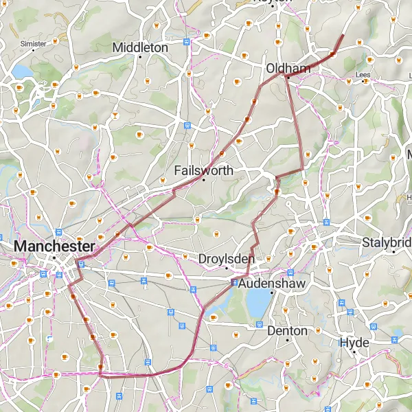
Explore the outskirts of Manchester on this scenic gravel route
This gravel route takes you through the charming areas of Failsworth, Oldham, Daisy Nook, and Levenshulme. Along the way, you'll encounter beautiful landscapes, quaint villages, and historic landmarks. The route offers a mix of moderate ascents and rolling terrain, making it suitable for experienced gravel riders. With a distance of 39 kilometers and an elevation gain of 238 meters, this can be a challenging yet rewarding ride.
Cycling routes nearby:
Nearby regions: