Gravel bike route to Signal de Saint-André
Cyklotrasa gravel začínajúca od Rive-de-Gier
Discover picturesque landscapes and charming villages on this challenging gravel bike route
Mapa
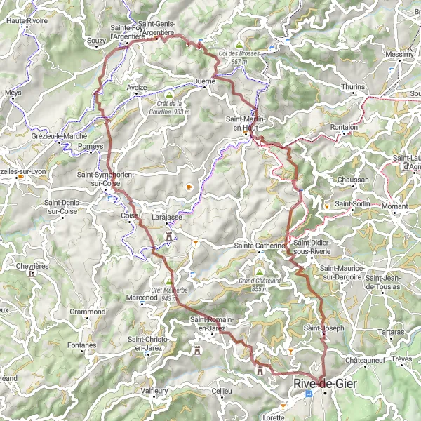
Explore the beauty of Genilac, Crêt Malherbe, Sainte-Foy-l'Argentière, Saint-Martin-en-Haut, and enjoy the breathtaking views from Signal de Saint-André. The route offers a mix of climbs and descents, making it perfect for adventurous cyclists looking for a scenic ride in the Rhône-Alpes region.
gravel
67 km
1878 m
Ťažký
Profil trasy
Zaujímavosti na trase
0 km
0 km
Štart: Rive-de-Gier City centerRive-de-Gier: Lokalita vhodná pre pohodlných cykloturistov.
Rive-de-Gier je menšie mesto v regióne Rhône-Alpes, ktoré poskytuje cyklistom obmedzené možnosti pre trénink a výlety. Cyklisticky priateľské trasy tu môžu byť ok, ale nie je to miesto, kde by ste našli legendárne cyklistické stúpania alebo extrémne tratě.3 km
3 km
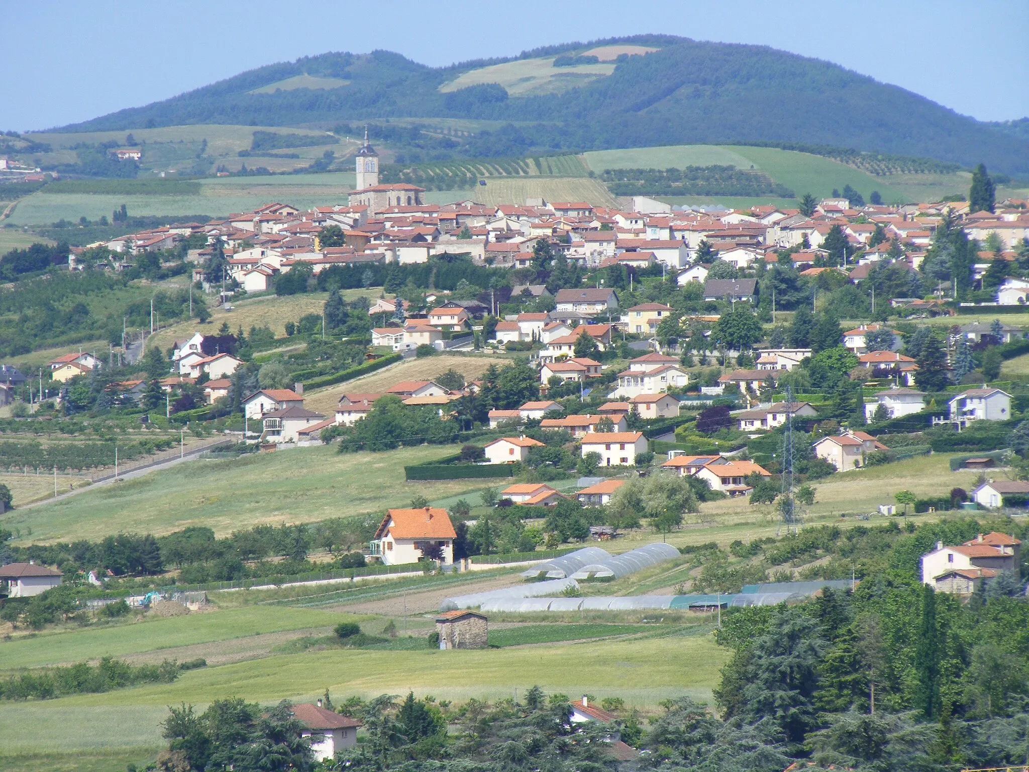
GenilacDedinaGenilac is known for its historical architecture and stunning views of the surrounding countryside.
13 km
13 km
Crêt Malherbe943 mVrcholCrêt Malherbe is a popular spot for hikers and cyclists, offering panoramic vistas of the region.
32 km
32 km
Sainte-Foy-l'ArgentièreDedinaSainte-Foy-l'Argentière is a charming village with traditional French architecture and a peaceful atmosphere.
45 km
45 km
Saint-Martin-en-HautDedinaSaint-Martin-en-Haut is a historic town with narrow streets and beautiful stone buildings.
51 km
51 km
Signal de Saint-André934 mVrcholSignal de Saint-André is a must-see viewpoint, offering sweeping views of the Rhône-Alpes countryside.
56 km
56 km
Table d'orientationVýhľadTable d'orientation is a scenic lookout point with informative panels highlighting the surrounding landmarks.
63 km
63 km
Saint-JosephDedinaSaint-Joseph is a quaint village with a rich history and friendly locals.
67 km
67 km
Cieľ: Rive-de-Gier City centerRive-de-Gier: Lokalita vhodná pre pohodlných cykloturistov.
Cyklotrasy od Rive-de-Gier:
Cyklistická trasa okolo Rive-de-Gier Pohľad na okolitú prírodu Výzva s výhľadmi Prírodná krása Rhône-Alpes Gravel bike route to Signal de Saint-André Scenic gravel loop through Col de la République Leisurely gravel tour to Le Marthoret Challenging gravel ride to Croix de Chaubouret Kruhová cyklotrasa z Rive-de-Gier Cyklistická trasa okolo Rive-de-Gier