![Cover image](https://images.tarmacs.app/cycling-routes/covers/austria/niederosterreich/kirchberg-am-wechsel-5.webp)
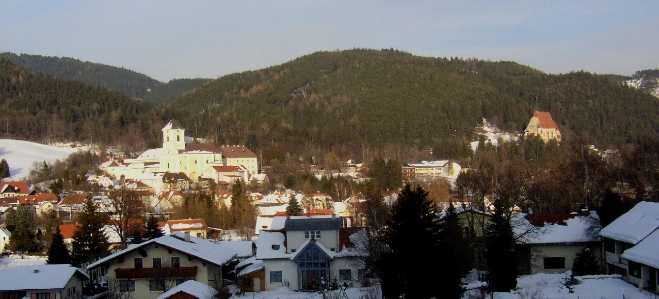
Zažijte cyklistické dobrodružství v Kirchberg am Wechsel.
Cyklistické trasy kolem Kirchberg am Wechsel
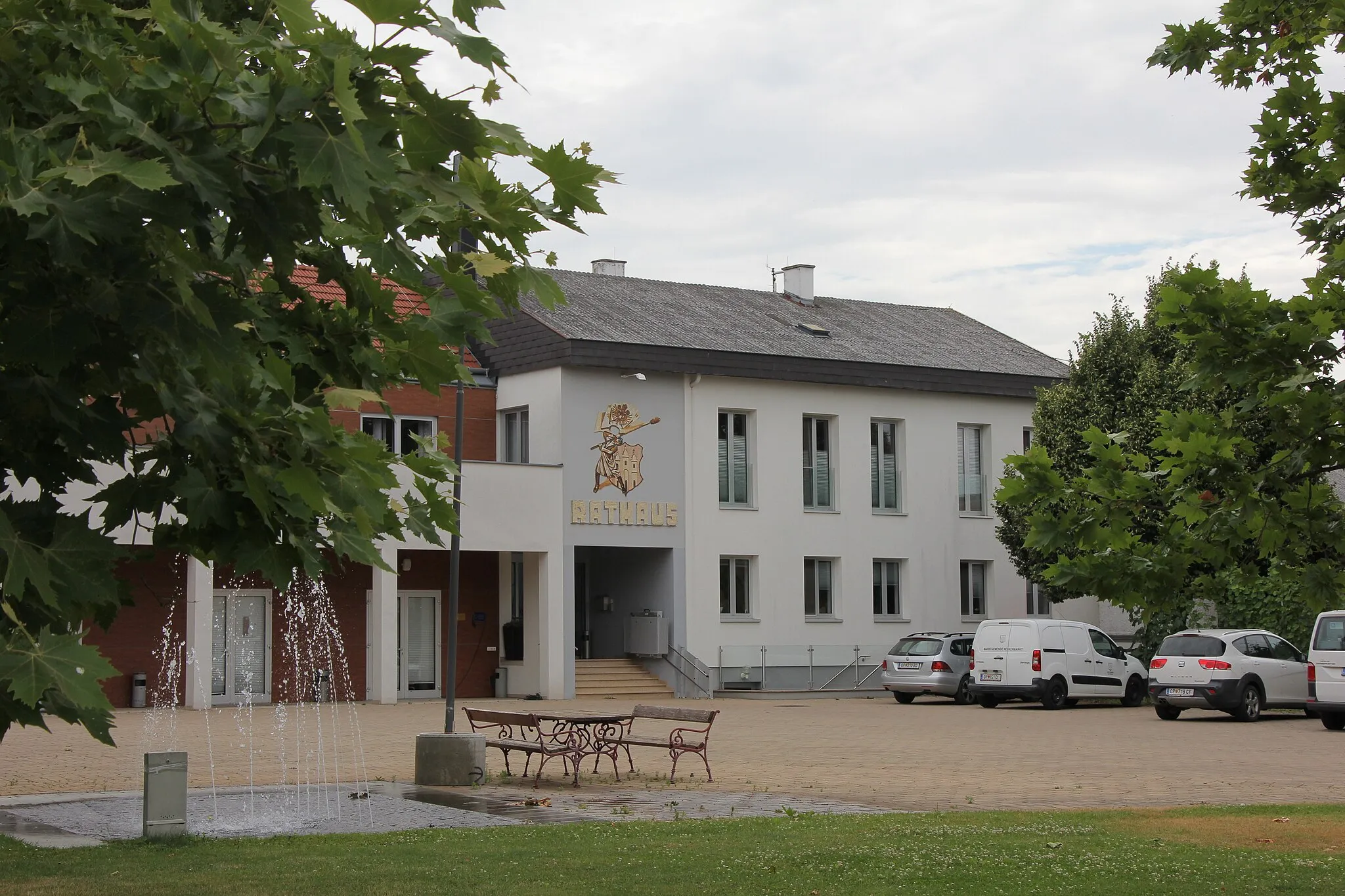
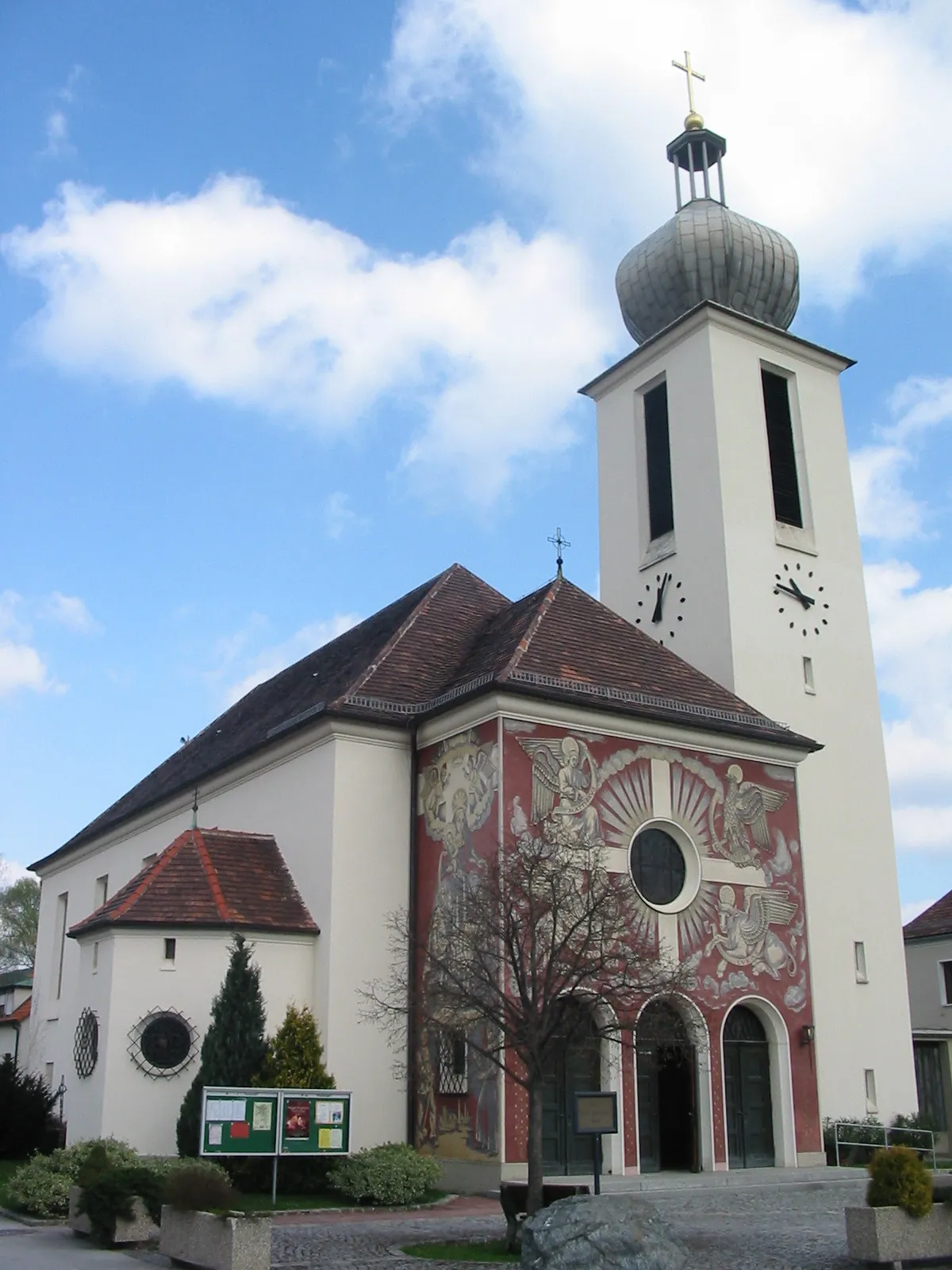
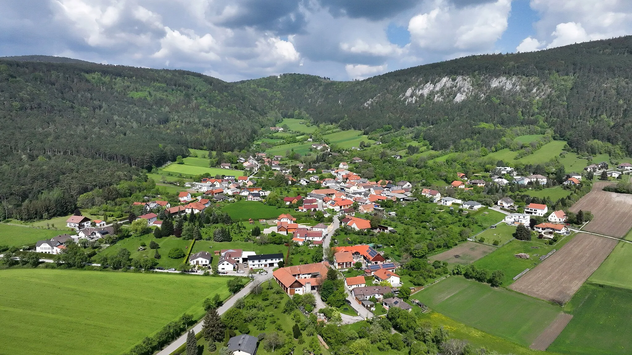
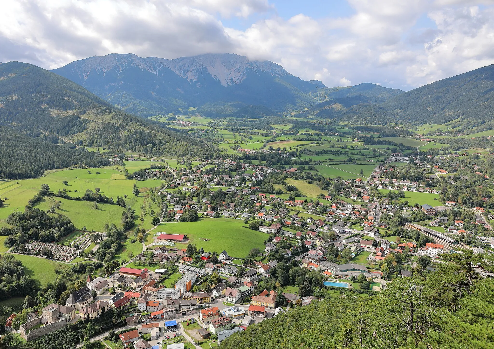
Kirchberg am Wechsel je malebná lokalita obklopená kopci a lesy. Pro cyklisty je zde dostupných několik náročných stoupání a sjezdů, které zaručují vzrušující jízdu.
![Miniaturní mapa "Okružní cyklotrasa Silo - Kapfenberg" inspirace pro cyklisty v oblasti Niederösterreich, Austria. Vytvořeno pomocí plánovače tras Tarmacs.app](https://images.tarmacs.app/cycling-routes/routemaps/600/austria/niederosterreich/kirchberg-am-wechsel/road/60251.webp)
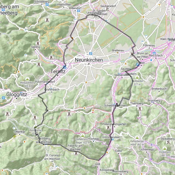
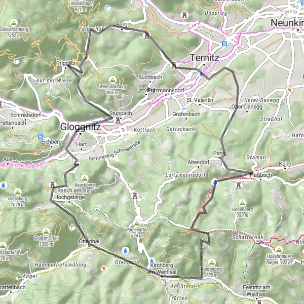
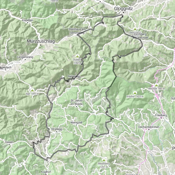
Vydejte se na 72km dlouhou silniční trasu s 988m převýšením
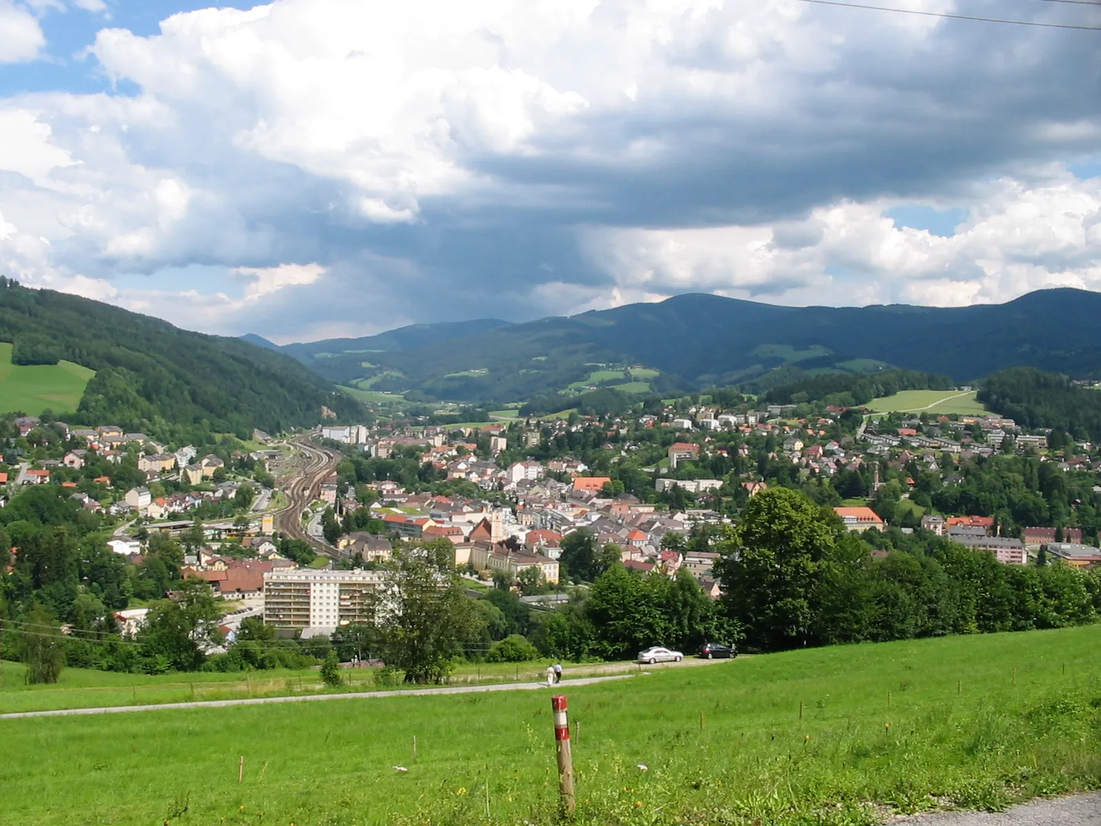
Tato trasa nabízí malebné výhledy a zajímavá místa od Ternitz po Feistritz am Wechsel. Projedete kolem malebných vesnic a historických památek, jako je hrad Ofenberg.
![Miniaturní mapa "Kruhovka okolo Kirchbergu" inspirace pro cyklisty v oblasti Niederösterreich, Austria. Vytvořeno pomocí plánovače tras Tarmacs.app](https://images.tarmacs.app/cycling-routes/routemaps/600/austria/niederosterreich/kirchberg-am-wechsel/road/60270.webp)
Exotická projížďka plná přírodních a historických skvostů
Trasa s množstvím stoupání a sjezdů vede od St. Corona am Wechsel po Aigenberg a Schäffern. Pokračuje okolo Bucheggu a Riedlingsdorfu a končí po vydatném výjezdu na Mönichwald. Cesta je doplněna výhledy na Hochwechsel, Hirschkogel a Kernstockwarte.
![Miniaturní mapa "Okružní cyklotrasa St. Corona am Wechsel - Hochwechsel" inspirace pro cyklisty v oblasti Niederösterreich, Austria. Vytvořeno pomocí plánovače tras Tarmacs.app](https://images.tarmacs.app/cycling-routes/routemaps/600/austria/niederosterreich/kirchberg-am-wechsel/gravel/60267.webp)
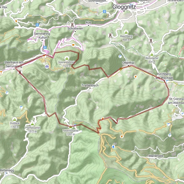
Na 120km dlouhé štěrkové trase s 3513m převýšením se těšte na dobrodružství
Tato trasa vás zavede do malebné krajiny a přírodních rezervací od St. Corona am Wechsel až po vrchol Hochwechsel. Projedete kolem úchvatných výhledů a malebných vesnic, jako je Sankt Johann in der Haide.
![Miniaturní mapa "Road Cycling Tour to Kapfenberg" inspirace pro cyklisty v oblasti Niederösterreich, Austria. Vytvořeno pomocí plánovače tras Tarmacs.app](https://images.tarmacs.app/cycling-routes/routemaps/600/austria/niederosterreich/kirchberg-am-wechsel/road/60250.webp)
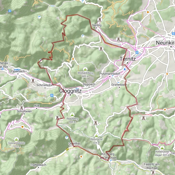
Enjoy a scenic road cycling tour to the historic town of Kapfenberg.
This road cycling tour takes you on a scenic journey through the rolling hills and charming villages of Lower Austria, ending in the historic town of Kapfenberg. The route offers a mix of flat stretches and challenging climbs, making it suitable for cyclists of all levels. Highlights include the picturesque Raachberg area and the stunning Burgstall region, known for its beautiful landscapes and tranquil atmosphere.
![Miniaturní mapa "Gravel Route through Wechselgebirge" inspirace pro cyklisty v oblasti Niederösterreich, Austria. Vytvořeno pomocí plánovače tras Tarmacs.app](https://images.tarmacs.app/cycling-routes/routemaps/600/austria/niederosterreich/kirchberg-am-wechsel/gravel/60304.webp)
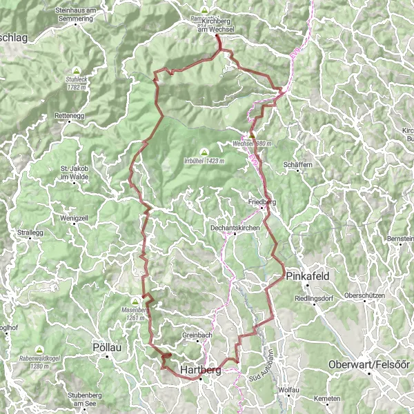
Explore the stunning Wechselgebirge on this challenging gravel route.
This gravel route offers breathtaking views of the Wechselgebirge, passing through picturesque villages and lush forests. The route includes a variety of terrain, from smooth tracks to rocky paths, making it a thrilling adventure for experienced cyclists. Don't miss highlights such as the Kernstockwarte lookout point and the charming town of Gfieder along the way.
![Miniaturní mapa "Road Route to Hartberg" inspirace pro cyklisty v oblasti Niederösterreich, Austria. Vytvořeno pomocí plánovače tras Tarmacs.app](https://images.tarmacs.app/cycling-routes/routemaps/600/austria/niederosterreich/kirchberg-am-wechsel/road/60271.webp)
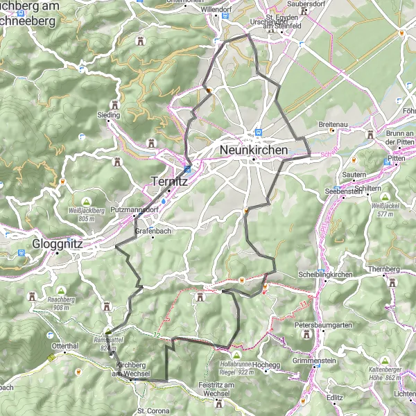
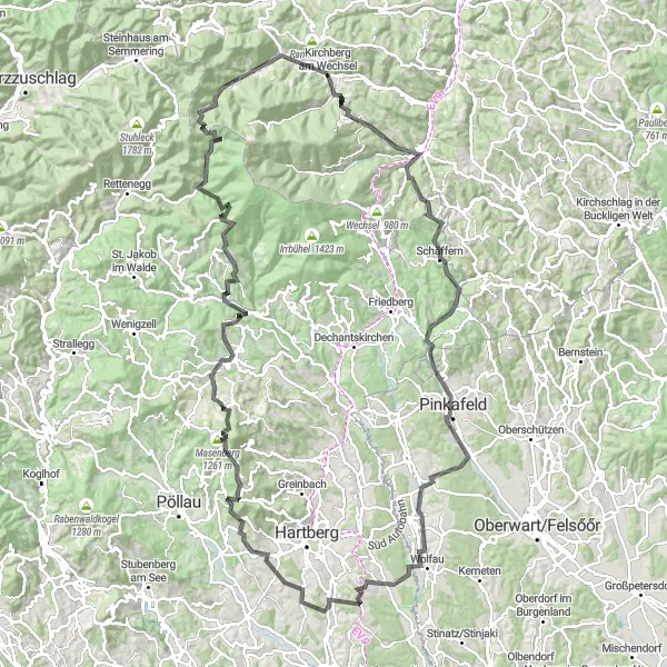
Experience the beauty of Lower Austria on this scenic road route to Hartberg.
This road route takes you through the picturesque countryside of Lower Austria, passing by charming villages and rolling hills. The route offers a mix of flat stretches and challenging climbs, making it suitable for cyclists of all levels. Highlights include the historic town of Silo and the beautiful Maisenbügel area, known for its stunning views and peaceful atmosphere.
![Miniaturní mapa "Gravel Trasa s výhledy" inspirace pro cyklisty v oblasti Niederösterreich, Austria. Vytvořeno pomocí plánovače tras Tarmacs.app](https://images.tarmacs.app/cycling-routes/routemaps/600/austria/niederosterreich/kirchberg-am-wechsel/gravel/60308.webp)
Trasa nabízí zajímavé skvosty přírody a architektury
Projíždí vás Schöberlriegel a Ochsenkopf a končí u Kernstockwarte po projížďce kolem Feistritzsattel a Trattenbach. Trasa poskytuje nádherné výhledy na krajinu a historická místa.
![Miniaturní mapa "Gravel Adventure to Alfredhütte" inspirace pro cyklisty v oblasti Niederösterreich, Austria. Vytvořeno pomocí plánovače tras Tarmacs.app](https://images.tarmacs.app/cycling-routes/routemaps/600/austria/niederosterreich/kirchberg-am-wechsel/gravel/60265.webp)
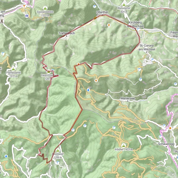
Embark on an exciting gravel adventure to the Alfredhütte mountain hut.
This gravel route takes you on a thrilling adventure through the rugged terrain of Lower Austria, passing by remote mountain huts and stunning alpine landscapes. The route includes challenging climbs and fast descents, making it ideal for experienced gravel cyclists. Highlights include the picturesque Alfredhütte mountain hut and the scenic Otterthal valley, known for its lush meadows and crystal-clear streams.
![Miniaturní mapa "Gravel Výlet Raach am Hochgebirge" inspirace pro cyklisty v oblasti Niederösterreich, Austria. Vytvořeno pomocí plánovače tras Tarmacs.app](https://images.tarmacs.app/cycling-routes/routemaps/600/austria/niederosterreich/kirchberg-am-wechsel/gravel/60318.webp)
Cyklovýlet okolo Kirchbergu dubovou krajinou
Tato trasa je doplněna malebnými výhledy z Raach am Hochgebirge a úchvatnými scenériemi kolem Alpkogelu a Spital am Semmering. Zastavit se můžete u Pinkenkogelu a poslední zastávka je Maria Schutz s historickými památkami.
Výlet na Hochwechsel
![Miniaturní mapa "Výlet na Hochwechsel" inspirace pro cyklisty v oblasti Niederösterreich, Austria. Vytvořeno pomocí plánovače tras Tarmacs.app](https://images.tarmacs.app/cycling-routes/routemaps/600/austria/niederosterreich/kirchberg-am-wechsel/road/60268.webp)
Zajímavá trasa plná náročných stoupání a malebných výhledů.
Projedete si 145 km s převýšením 4346 metrů, navštívíte vrchol Hochwechsel a malebné obce, jako je Miesenbach bei Birkfeld a Sankt Kathrein am Hauenstein.
Cyklotrasy v okolí:
![Obrázek Gloggnitz](https://images.tarmacs.app/cycling-routes/covers/austria/niederosterreich/gloggnitz-5.webp)
![Obrázek Aspang Markt](https://images.tarmacs.app/cycling-routes/covers/austria/niederosterreich/aspang-markt-5.webp)
![Obrázek Pottschach](https://images.tarmacs.app/cycling-routes/covers/austria/niederosterreich/pottschach-5.webp)
![Obrázek Wimpassing im Schwarzatale](https://images.tarmacs.app/cycling-routes/covers/austria/niederosterreich/wimpassing-im-schwarzatale-5.webp)
![Obrázek Ternitz](https://images.tarmacs.app/cycling-routes/covers/austria/niederosterreich/ternitz-5.webp)
![Obrázek Neunkirchen](https://images.tarmacs.app/cycling-routes/covers/austria/niederosterreich/neunkirchen-5.webp)
![Obrázek Breitenau](https://images.tarmacs.app/cycling-routes/covers/austria/niederosterreich/breitenau-5.webp)
![Obrázek Pitten](https://images.tarmacs.app/cycling-routes/covers/austria/niederosterreich/pitten-5.webp)
![Obrázek Puchberg am Schneeberg](https://images.tarmacs.app/cycling-routes/covers/austria/niederosterreich/puchberg-am-schneeberg-4.webp)
Okolní oblasti:
![Obrázek Burgenland](https://images.tarmacs.app/cycling-routes/covers/austria/burgenland/neckenmarkt-1.webp)
![Obrázek Vídeň](https://images.tarmacs.app/cycling-routes/covers/austria/wien/meidling-3.webp)
![Obrázek Kärnten](https://images.tarmacs.app/cycling-routes/covers/austria/karnten/friesach-4.webp)
![Obrázek Steiermark](https://images.tarmacs.app/cycling-routes/covers/austria/steiermark/muerzzuschlag-3.webp)
![Obrázek Oberösterreich](https://images.tarmacs.app/cycling-routes/covers/austria/oberosterreich/gmunden-5.webp)
![Obrázek Středočeský kraj](https://images.tarmacs.app/cycling-routes/covers/czech-republic/stredni-cechy/dolni-bousov-3.webp)
![Obrázek Jihozápad](https://images.tarmacs.app/cycling-routes/covers/czech-republic/jihozapad/chynov-2.webp)
![Obrázek Jihovýchod](https://images.tarmacs.app/cycling-routes/covers/czech-republic/jihovychod/blansko-5.webp)
![Obrázek Střední Morava](https://images.tarmacs.app/cycling-routes/covers/czech-republic/stredni-morava/nedakonice-1.webp)
![Obrázek Nyugat-Dunántúl](https://images.tarmacs.app/cycling-routes/covers/hungary/nyugat-dunantul/jak-1.webp)
![Obrázek Bratislavský kraj](https://images.tarmacs.app/cycling-routes/covers/slovakia/bratislavsky-kraj/rusovce-3.webp)
![Obrázek Západné Slovensko](https://images.tarmacs.app/cycling-routes/covers/slovakia/zapadne-slovensko/nitra-5.webp)