Expedice do hor kolem Puyloubier
Cyklistická trasa pro gravel začínající v Puyloubier
Náročná trasa s velkým převýšením a malebnými památkami
Mapa
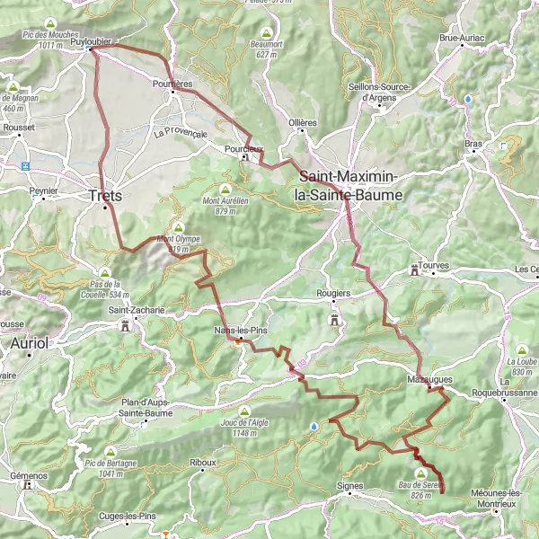
Tato 103 km dlouhá trasa vás provede horami okolo Puyloubier s nádhernými výhledy a mnoha zajímavými místy. Projedete Pourrières, Casteleret a Le Mourre d'Agnis. Dále budete mít možnost objevit Nans-les-Pins, Saint-Jean du Puy a nakonec se vrátíte zpět do Puyloubier.
gravel
103 km
2011 m
Divoký
Profil trasy
Zajímavosti na trase
0 km
0 km
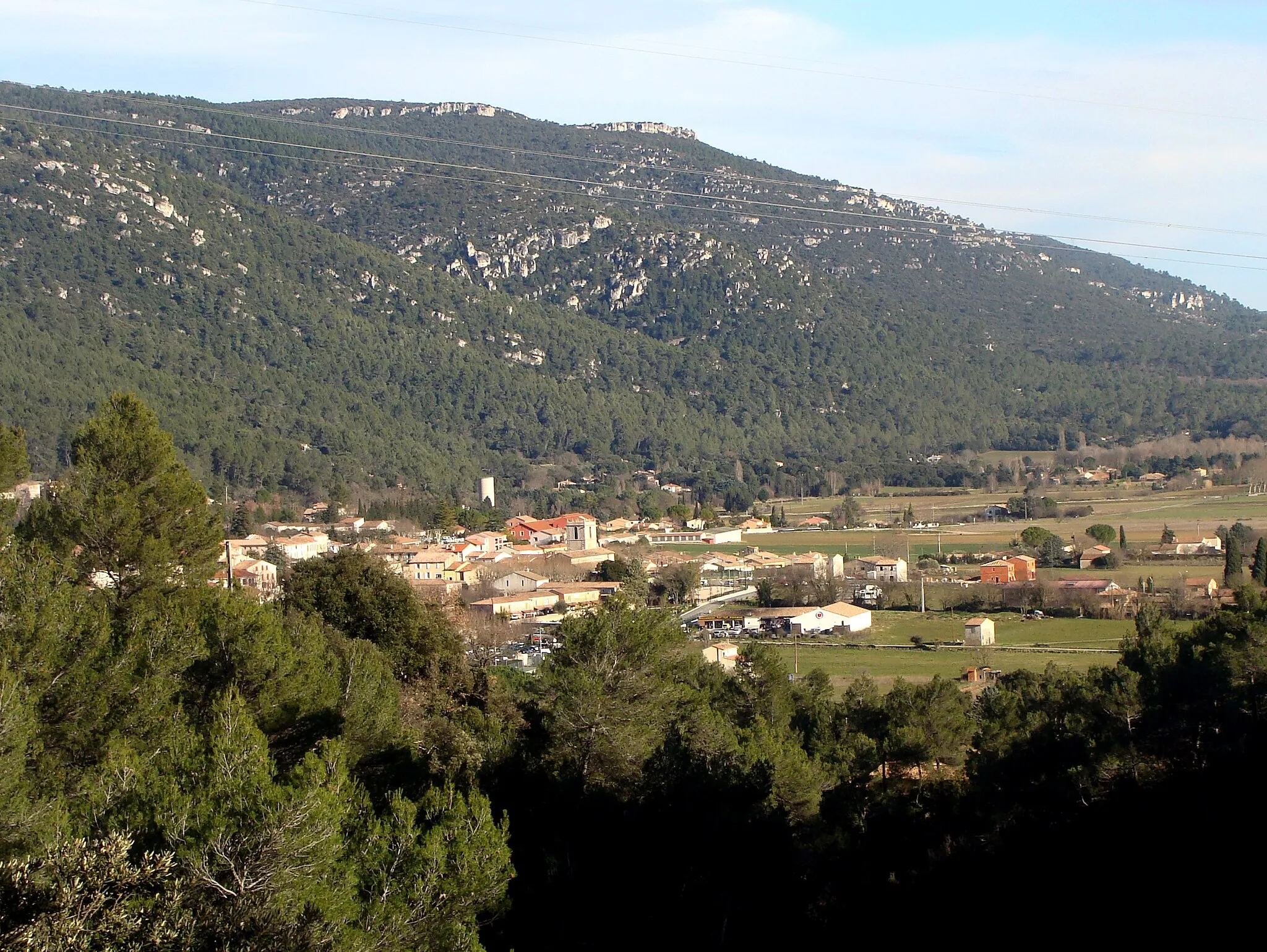
Start: Puyloubier Village centerPuyloubier: Cyklistický ráj mezi vinicemi
Puyloubier je malebné městečko obklopené kopci a vinicemi, což představuje ideální prostředí pro cyklistiku. V okolí se nachází několik horských průsmyků a cyklistických tras pro všechny úrovně dovedností.6 km
6 km
PourrièresVesniceVisit the picturesque Pourrières.
10 km
10 km
Collet de Mourgues299 mVrcholMarvel at the beauty of Collet de Mourgues.
21 km
21 km
Saint-Maximin-la-Sainte-BaumeMěstoDiscover the charm of Saint-Maximin-la-Sainte-Baume.
31 km
31 km
Casteleret486 mRuinyExplore the historic Casteleret.
46 km
46 km
Bau de Serein826 mVrcholMarvel at the views from Bau de Serein.
57 km
57 km
Le Mourre d'Agnis919 mVrcholDiscover the beauty of Le Mourre d'Agnis.
75 km
75 km
Nans-les-PinsVesniceExplore the charming village of Nans-les-Pins.
89 km
89 km
Saint-Jean du PuyVýhledAdmire the views from Saint-Jean du Puy.
103 km
103 km
PuyloubierVesniceStart and finish your journey in Puyloubier.
103 km
103 km
Cíl: Puyloubier Village centerPuyloubier: Cyklistický ráj mezi vinicemi
Cyklistické trasy z Puyloubier:
Okružní cyklotrasa z Puyloubier Road okruh kolem Puyloubier Cesta kolem vesnice Puyloubier Probíjejte se údolím kolem Puyloubier Road okruh kolem Puyloubier Gravelová cyklostezka do horského oparu Expedice do hor kolem Puyloubier Gravel okruh kolem Puyloubier Gravelová cyklotrasa kolem Puyloubier Road okruh kolem Puyloubier Trasa do kopce s výhledem na Puyloubier Gravelová cyklotrasa kolem Puyloubier Gravel cyklistická trasa kolem Puyloubier Zajímavá trasa kolem Puyloubier Náročná trasa s výhledem na Rians Road cyklostezka přes lesy a hory