
Okruh kolem Marignier
Cyklistická trasa pro road začínající v Marignier
Prozkoumejte malebnou francouzskou krajinu na kole
Mapa
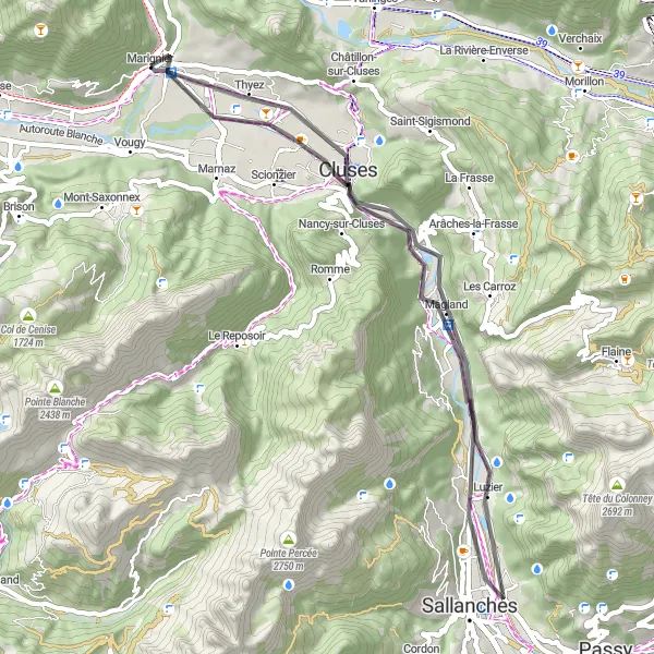
Tato cesta nabízí 48 km dlouhý výlet s 221 m převýšením. Projedete kolem měst Cluses a Sallanches s krásnými výhledy na okolní hory a řeku. Nezapomeňte si užít nádherné výhledy na Magland a pozor na okraj útesu!
road
48 km
221 m
Náročné
Profil trasy
Zajímavosti na trase
0 km
0 km
Start: Marignier Village centerMarignier: Scenic locality with a mix of flat and hilly terrain.
Marignier is a charming locality in the Rhône-Alpes region, offering a mix of flat terrain and rolling hills for cyclists to enjoy. Road cyclists can explore the surrounding countryside and take in the picturesque views of the Alps. Gravel cyclists will appreciate the quiet roads and scenic routes that pass through forests and pastures, creating a peaceful environment for a ride.7 km
7 km
ClusesMěstoUžijte si krásné výhledy na řeku a hory v Cluses.
24 km
24 km
SallanchesMěstoPodívejte se na půvabné město Sallanches s historickými památkami.
33 km
33 km
Attention bord de falaiseVýhledBuďte opatrní při projetí okraje útesu po celé 33 km trasy.
33 km
33 km
MaglandVesniceObdivujte nádherné výhledy na Magland během cesty.
48 km
48 km
Cíl: Marignier Village centerMarignier: Scenic locality with a mix of flat and hilly terrain.