Road Route: Colombier-Saugnieu - Fort de Saint-Priest - La Guillotière - La Jetée - Jonage - Pont-de-Chéruy
Cyklistická trasa pro road začínající v Pont-de-Cheruy
Scenic road cycling route through charming villages and historic sites
Mapa
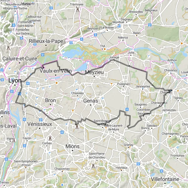
This 78 km road route will take you from Colombier-Saugnieu through Fort de Saint-Priest, La Guillotière, La Jetée, Jonage, and back to Pont-de-Chéruy. Enjoy the picturesque landscapes and explore the rich history of the region along the way.
road
78 km
265 m
Náročné
Profil trasy
Zajímavosti na trase
0 km
0 km
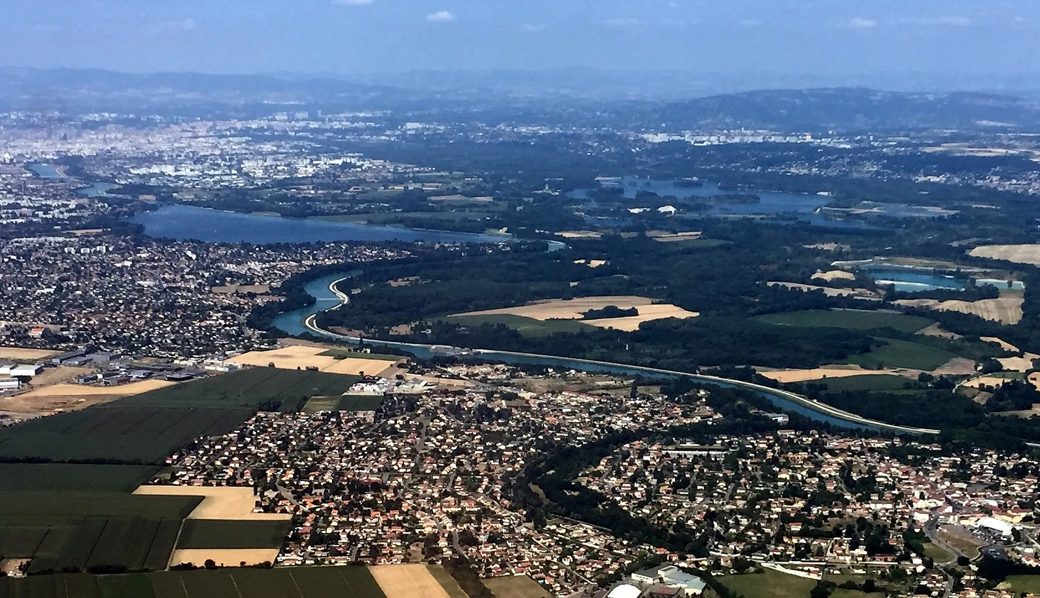
Start: Pont-de-Chéruy Village centerPont-de-Chéruy: Ideální lokalita pro gravel biking v Rhône-Alpes.
Pont-de-Chéruy je malebné město v regionu Rhône-Alpes s příjemnými cestami vhodnými pro gravel biking. Okolní krajinu zdobí vinice a menší kopce, což poskytuje zajímavé možnosti pro cyklistické výlety.7 km
7 km
Colombier-SaugnieuVesniceAdmire the beautiful scenery on the road to Colombier-Saugnieu.
27 km
27 km
Fort de Saint-PriestHradVisit the historic Fort de Saint-Priest and learn about its fascinating past.
43 km
43 km
La GuillotièrePod-předměstíExplore the charming village of La Guillotière and its unique architecture.
58 km
58 km
La JetéeVýhledStop by La Jetée and enjoy the peaceful atmosphere by the water.
65 km
65 km
JonageVesniceDiscover the hidden gems of Jonage and its surrounding areas.
78 km
78 km
Pont-de-ChéruyVesniceFinish your journey back in Pont-de-Chéruy and savor the memories of your cycling adventure.
78 km
78 km
Cíl: Pont-de-Chéruy Village centerPont-de-Chéruy: Ideální lokalita pro gravel biking v Rhône-Alpes.
Cyklistické trasy z Pont-de-Cheruy:
Trasa Charvieu - Grenay - Genas - Janneyrias Gravelový okruh kolem Pont-de-Chéruy Road Route: Loyettes - Proulieu - Parmilieu - Siccieu - Château Delphinal (ancien) Kolem Hières-sur-Amby Gravel turistika blízko Pont-de-Chéruy Gravelová cyklotrasa kolem Pont-de-Chéruy Gravel cyklistická trasa kolem Pont-de-Chéruy Road Route: Colombier-Saugnieu - Fort de Saint-Priest - La Guillotière - La Jetée - Jonage - Pont-de-Chéruy Historický okruh kolem Pont-de-Chéruy Okruh kolem Pont-de-Chéruy