Gravel Tour de Thurins
Cyklistická trasa pro gravel začínající v Thurins
Scenic gravel route with challenging climbs and stunning views
Mapa
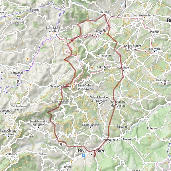
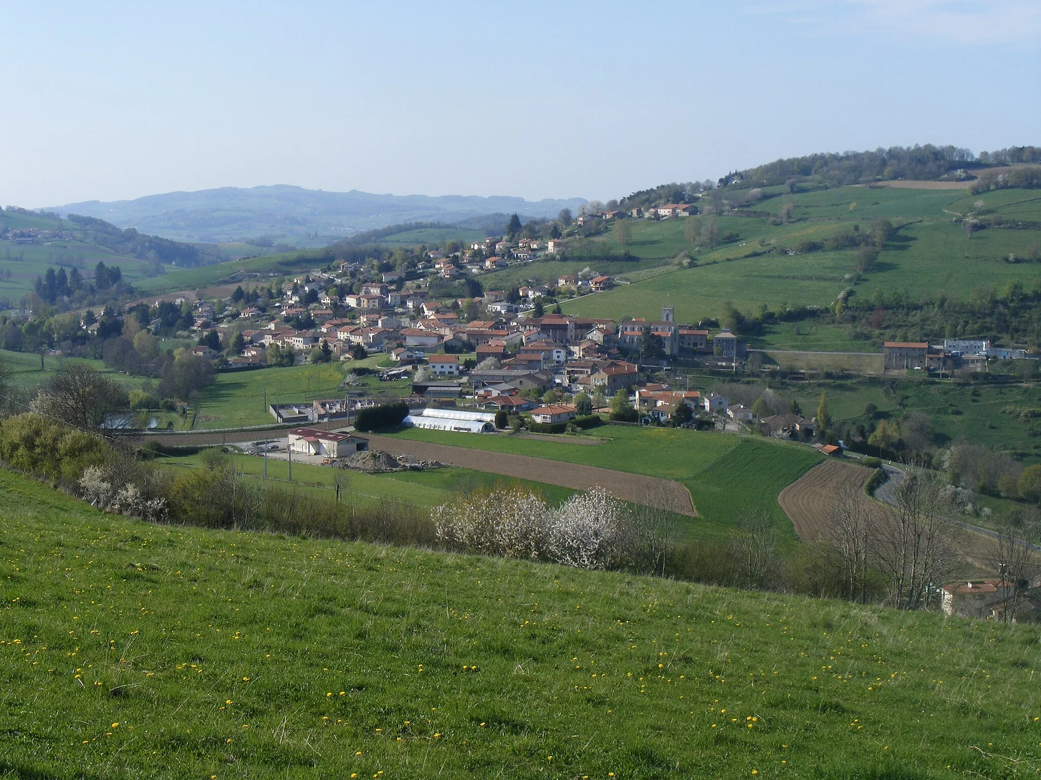
This gravel route near Thurins offers a challenging ride with over 1300 meters of ascent in just 56 kilometers. Highlights include the beautiful Crêt du Bouchat, the historic town of Mornant, and the impressive Châteauneuf. Don't miss the breathtaking views from Grand Châtelard and Signal de Saint-André. The route ends with a visit to the charming village of Sainte-Catherine and the serene Le Martin.
gravel
56 km
1363 m
Náročné
Profil trasy
Zajímavosti na trase
0 km
0 km
Start: Thurins Village centerThurins: Klidná obec ve francouzském regionu Rhône-Alpes
Thurins je klidná obec ve francouzském regionu Rhône-Alpes s příjemnými cyklistickými trasami a pohodovou atmosférou. Okolí nabízí různorodé terény pro cyklisty všech úrovní. Pro gravelové cyklisty je Thurins skvělým místem k objevování nových tras a užívání si klidné jízdy v přírodě. V okolí se nachází několik zajímavých lokalit pro cyklisty, i když žádné známé stoupání.4 km
4 km
Crêt du Bouchat586 mVrcholEnjoy panoramic views from the top of Crêt du Bouchat
9 km
9 km
MornantVesniceExplore the historic streets of Mornant and discover its hidden gems
19 km
19 km
ChâteauneufVesniceVisit the picturesque village of Châteauneuf and its stunning surroundings
36 km
36 km
Grand Châtelard855 mVrcholAdmire the majestic landscapes from the summit of Grand Châtelard
38 km
38 km
Sainte-CatherineVesniceDiscover the peaceful atmosphere of the village of Sainte-Catherine
45 km
45 km
Signal de Saint-André934 mVrcholTake in the views from the Signal de Saint-André lookout point
54 km
54 km
Le MartinVesniceExperience the tranquility of the countryside at Le Martin
56 km
56 km
Cíl: Thurins Village centerThurins: Klidná obec ve francouzském regionu Rhône-Alpes
Cyklistické trasy z Thurins:
Okružní cyklistická trasa kolem Thurins (silnice) Kolo okolo Thurins Gravelová cesta okolo Thurins Výlet okolo Les Roches-de-Condrieu Okružní cyklistická trasa kolem Thurins (silnice) Gravel Tour de Thurins Cyklotrasa od Thurins Okruh kolem Thurins - Gravel Silniční okruh kolem Thurins Okružní cyklistická trasa kolem Thurins (silnice) Okruh kolem Thurins - Road