Gravel route around Lac de Joux and Dent de Vaulion
Cyklistická trasa pro gravel začínající v Le Chenit
Explore the stunning natural beauty of Lac de Joux and Dent de Vaulion
Mapa

This 62 km gravel route offers breathtaking views of Lac de Joux and Dent de Vaulion. With 1342 meters of ascent, the ride will challenge you while surrounded by picturesque landscapes. Discover charming villages like L'Abbaye and Romainmôtier along the way. Don't miss the impressive Col du Mollendruz on your journey.
gravel
62 km
1342 m
Náročné
Profil trasy
Zajímavosti na trase
0 km
0 km
Start: Le Chenit Village centerLe Chenit: Království cyklistiky v Région lémanique.
Le Chenit se nachází v Région lémanique a nabízí malebné cyklistické trasy kolem jezer a přírodních rezervací. V okolí jsou také známé cyklistické stoupání.4 km
4 km
Lac de JouxJezeroLac de Joux is the largest lake in Switzerland at an altitude of 1000 meters.
9 km
9 km
L'AbbayeVesniceL'Abbaye is a quaint village with a rich history and beautiful architecture.
15 km
15 km
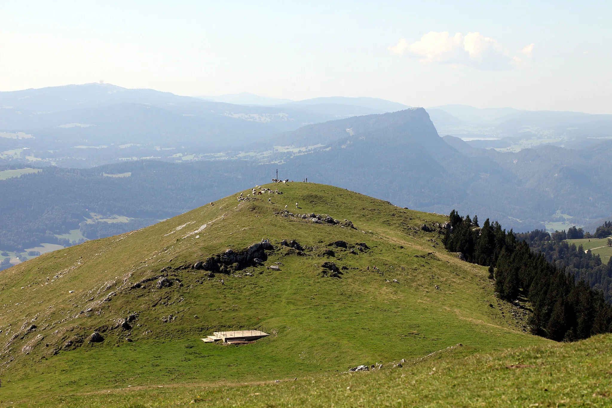
Dent de Vaulion1482 mVýhled z vrcholuDent de Vaulion offers panoramic views of the surrounding mountains and valleys.
19 km
19 km
VallorbeVesniceVallorbe is known for its impressive caves and geological wonders.
34 km
34 km
RomainmôtierVesniceRomainmôtier is home to a medieval abbey and charming streets to explore.
42 km
42 km
Mont-la-VilleVesniceMont-la-Ville is a peaceful village with traditional Swiss charm.
46 km
46 km
Col du Mollendruz1180 mPrůsmykCol du Mollendruz is a challenging climb with rewarding views at the top.
62 km
62 km
Cíl: Le Chenit Village centerLe Chenit: Království cyklistiky v Région lémanique.
Cyklistické trasy z Le Chenit:
Okruh kolem malebných vesnic Gravel route around Lac de Joux and Dent de Vaulion Trasa Roche fendue Trasa Les Crozets Scenic gravel ride from Le Chenit to Tête du lac Půvabné cesty Région lémanique Trasa Saint-Laurent-en-Grandvaux Trasa Crêt Gellin Trasa Labergement-Sainte-Marie Významné cesty ve švýcarských kopcích