Gravel Route through Ottenschlag im Mühlkreis
Pyöräilyreitti gravel alkaen Gallneukirchen
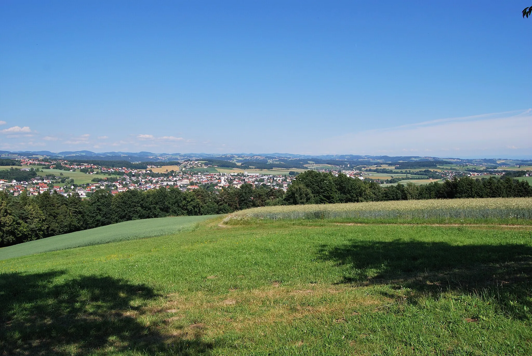
Off-road adventure with stunning views
Kartta
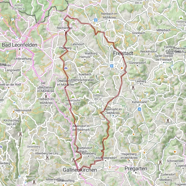
Embark on a gravel cycling adventure through Ottenschlag im Mühlkreis with a total ascent of 1409 meters. Highlights include the scenic Roadlberg and the charming village of Walchshof. This 71-kilometer route offers a mix of challenging terrain and beautiful landscapes, perfect for gravel enthusiasts.
gravel
71 km
1409 m
Raaka
Reitin profiili
Reitin kohokohdat
0 km
0 km
Aloitus: Gallneukirchen City centerGallneukirchen: Vehreitä maisemia
Gallneukirchen tarjoaa vehreitä maisemia ja hyviä pyöräilyreittejä niin maantielle kuin hiekallekin. Alueelta löytyy myös pikkukyliä ja maaseudun rauhaa fillarointiin.11 km
11 km
Roadlberg778 mHuippuRoadlberg offers a challenging climb with rewarding views at the top.
16 km
16 km
Ottenschlag im MühlkreisKyläOttenschlag im Mühlkreis is a quaint village with traditional architecture.
27 km
27 km
ReichenthalKyläReichenthal is a peaceful town surrounded by nature.
38 km
38 km
Gruberbühel701 mHuippuGruberbühel provides stunning views of the countryside.
47 km
47 km
WalchshofKyläWalchshof is a picturesque village nestled in the hills.
61 km
61 km
Kogl580 mHuippuKogl offers a peaceful setting with lush greenery and rolling hills.
71 km
71 km
GallneukirchenKaupunkiGallneukirchen serves as the starting point for this gravel route.
71 km
71 km
Maali: Gallneukirchen City centerGallneukirchen: Vehreitä maisemia
Pyöräilyreitit alkaen Gallneukirchen:
Alberndorf in der Riedmark - Ruhstetten Road Cycling Circuit Kulttuurin ja historian äärellä Gallneukirchen - Wartberg ob der Aist Road Route Haastava maastopyöräreitti Luonnon keskellä Altenberg bei Linz Gravel Exploration Neumarkt im Mühlkreis Loop Kulttuurin ja luonnon yhdistelmä Kulttuurin ja luonnon vuoropuhelu Gravel Route through Ottenschlag im Mühlkreis