Gravel Tour de Salzkammergut
Pyöräilyreitti gravel alkaen Kaltenbach
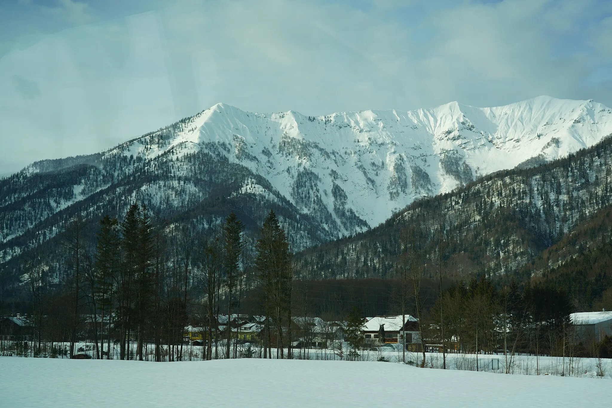
Exploring the natural beauty of Salzkammergut region on gravel roads
Kartta
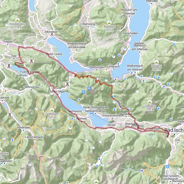
This challenging 79 km gravel route near Kaltenbach is a journey through picturesque villages, pristine lakes, and lush forests. The total ascent of 1753 meters will test your endurance and skills, but the stunning views make it all worth it. Highlights include picturesque towns like Strobl and Sankt Gilgen, as well as impressive natural landmarks such as Drachenwand and Kösselfall. The route is perfect for gravel enthusiasts looking for an adventure in the heart of Austria.
gravel
79 km
1753 m
Kova
Reitin profiili
Reitin kohokohdat
0 km
0 km
Aloitus: Kaltenbach Village centerKaltenbach: Rauhallinen pyöräilyalue Oberösterreichissa
Kaltenbach sijaitsee Oberösterreichin alueella Itävallassa. Alueella on pääosin tasaisia pyöräilyreittejä ja rauhallisia maisemia. Lähistöllä voi tutustua myös lähimaastoon ja jo jokiin joiden varrella on mukavia pyöräreittejä.11 km
11 km
StroblKyläExplore the charming town of Strobl on the shores of Wolfgangsee lake.
11 km
11 km
Bürgl745 mHuippuVisit the historic village of Bürgl with its traditional Austrian architecture.
23 km
23 km
Sankt GilgenKyläDiscover the beauty of Sankt Gilgen, the birthplace of Mozart's mother.
26 km
26 km
Wallhüttenkopf1116 mHuippuEnjoy the panoramic views from the top of Wallhüttenkopf peak.
46 km
46 km
Drachenwand1176 mHuippuMarvel at the imposing limestone cliffs of Drachenwand.
46 km
46 km
Sankt LorenzKyläPass by the idyllic village of Sankt Lorenz on the route.
60 km
60 km
Elferkogel1090 mHuippuAdmire the rugged terrain surrounding Elferkogel peak.
67 km
67 km
KösselfallVesiputousExperience the beauty of Kösselfall waterfall along the way.
77 km
77 km
Kalvarienberg606 mHuippunäköalapaikkaClimb to the top of Kalvarienberg for panoramic views of the region.
79 km
79 km
KaltenbachKyläStart and end your journey in the quaint village of Kaltenbach.
79 km
79 km
Maali: Kaltenbach Village centerKaltenbach: Rauhallinen pyöräilyalue Oberösterreichissa
Pyöräilyreitit alkaen Kaltenbach:
Maantieajo: Bad Goisernin ympäri Gravelreitti: Siriuskoglin kierros Maantieajo: Kalvarienbergista Siriuskogliin Salzkammergut Lake District Gravel Adventure Maantieajo: Lauffenista Siriuskogliin Gravelreitti: Siriuskoglin ympäri Kaltenbach - Oberosterreich toinen lyhyt gravel reitti Kaltenbach - Oberosterreich pitkä maantieretki Kaltenbach - Oberosterreich gravel reitti Kaltenbach - Oberosterreich maantieretki Gravel Tour de Salzkammergut