Innsbruck Countryside Loop
Pyöräilyreitti road alkaen Kolsass
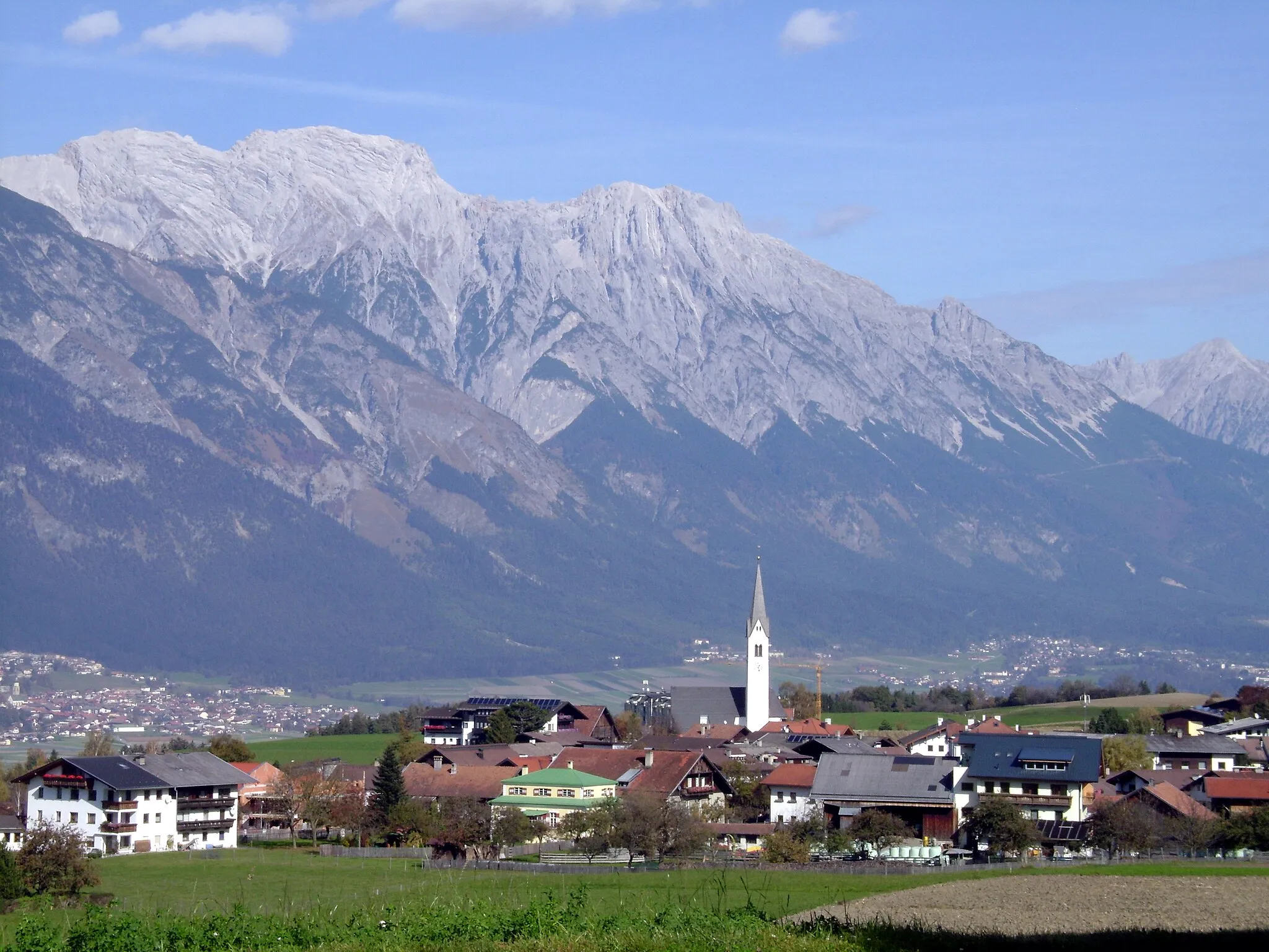
Scenic road cycling route through the Innsbruck countryside
Kartta
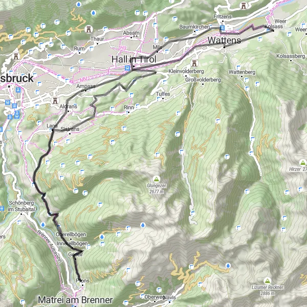
The Innsbruck Countryside Loop is a 73 km road cycling route that takes you through the picturesque countryside surrounding Innsbruck. With a total ascent of 1269m, the route passes highlights such as Mils and the Palmbühel viewpoint. Enjoy the peaceful atmosphere and stunning views on this leisurely cycling tour.
road
73 km
1269 m
Kova
Reitin profiili
Reitin kohokohdat
0 km
0 km
Aloitus: Kolsass Village centerKolsass: Tirolin pyöräilyparatiisi Zwölferkopfin juurella.
Kolsass sijaitsee Tirolin alueella ja tarjoaa upeat puitteet pyöräilyyn vuoristoisessa ympäristössä. Lähistöllä sijaitsee tunnettu vuoristo nousu Zwölferkopf, joka houkuttelee kuntoilijoita testaamaan kuntoaan haastavissa olosuhteissa.10 km
10 km
MilsKyläExplore the charming village of Mils and its traditional architecture.
24 km
24 km
SistransKyläCycle through the scenic countryside surrounding Sistrans.
40 km
40 km
PfonsKyläVisit the historic village of Pfons and its cultural landmarks.
56 km
56 km
AldransKyläEnjoy the scenic views from the Aldrans viewpoint.
57 km
57 km
Palmbühel730 mHuippuTake a break at the Palmbühel viewpoint and admire the surrounding landscapes.
66 km
66 km
VoldersKyläCycle through the quaint village of Volders with its historic charm.
70 km
70 km
Observation TowerNäköalapaikkaClimb to the top of the Observation Tower for panoramic views of the countryside.
73 km
73 km
Maali: Kolsass Village centerKolsass: Tirolin pyöräilyparatiisi Zwölferkopfin juurella.