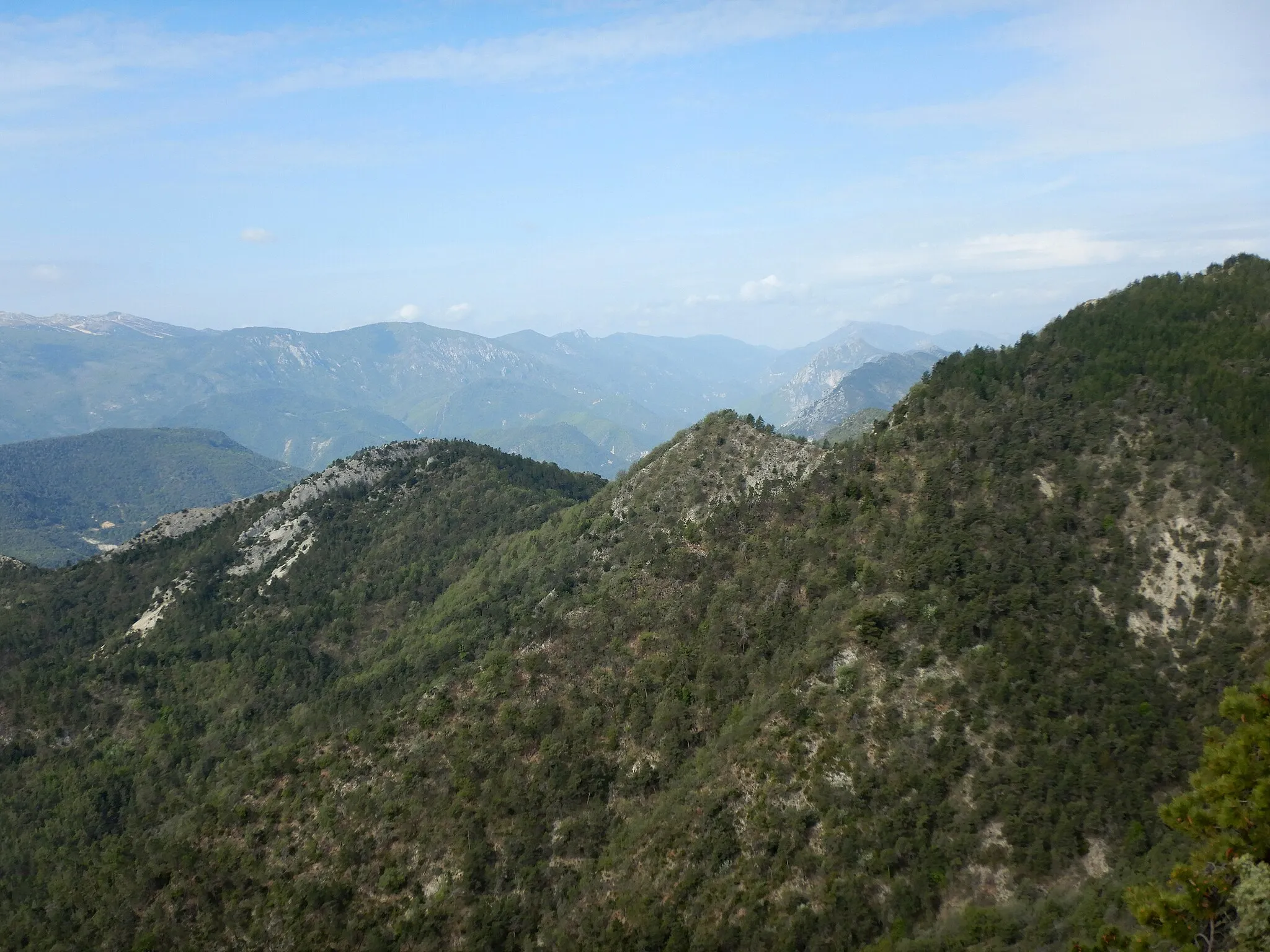
Table d'orientation - Cime des Collettes - Saint-Martin-du-Var
Pyöräilyreitti road alkaen Carros
Historiallinen maantie reitti vuoristomaisemissa ja idyllisillä kylistä
Kartta
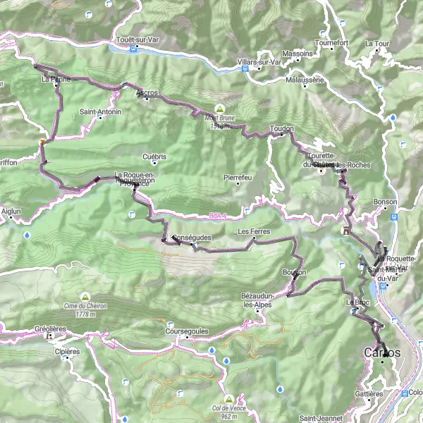
Tämä 103 km pitkä maantie reitti kulkee upeiden vuoristomaisemien ja viehättävien kylien läpi. Matkan varrella voit nähdä Mont Longin, La Pennen ja Toudonin. Lisäksi voit ihailla Cime des Colletten ja Tête de Longian maisemia.
road
103 km
2907 m
Kova
Reitin profiili
Reitin kohokohdat
0 km
0 km
Aloitus: Carros City centerCarros: Rentouttava lomaparatiisi
Carros on rauhallinen kaupunki lähellä Nizzan rantaviivaa, mutta pyöräilijöille se tarjoaa vähemmän houkuttelevia reittejä verrattuna muihin Rivieran kaupunkeihin.6 km
6 km
Table d'orientationNäköalapaikkaEnjoy the panoramic views from Table d'orientation along the way.
14 km
14 km
BouyonKyläDiscover the charming village of Bouyon with its historical buildings.
24 km
24 km
ConségudesKyläCycle through the picturesque village of Conségudes with its narrow streets and stone houses.
36 km
36 km
Mont Long1064 mHuippuExplore the stunning views of Mont Long and its natural surroundings.
49 km
49 km
La PenneKyläHead to La Penne for a cultural break and historical exploration.
59 km
59 km
Colletta1010 mHuippuVisit the charming village of Colletta and immerse yourself in its rural atmosphere.
68 km
68 km
Cime des Collettes1513 mHuippuAdmire the stunning scenery around Cime des Collettes on this road cycling adventure.
71 km
71 km
ToudonKyläExplore the picturesque village of Toudon with its ancient architecture and beautiful views.
85 km
85 km
Tête de Longia643 mHuippuDiscover the rugged landscape surrounding Tête de Longia and enjoy a peaceful moment in nature.
92 km
92 km
Saint-Martin-du-VarKyläCycle through the scenic village of Saint-Martin-du-Var and enjoy the picturesque surroundings.
101 km
101 km
Centre international d'art contemporainLinnaStop by the Centre international d'art contemporain for a cultural break and artistic inspiration.
103 km
103 km
Maali: Carros City centerCarros: Rentouttava lomaparatiisi
Pyöräilyreitit alkaen Carros:
Table d'orientation - Cime des Collettes - Saint-Martin-du-Var La Roquette-sur-Var - Col de Turini - Pueï de la Madone Touët-sur-Varin ympäripyöräilyreitti Puget-Théniers Circuit Reitti Cascade de Gairaut - Monte-Carlo - Le Trabuquet Le Broc - Pic Charvet - Belvédère du Saut des Français Dreiblanca - Monaco - Villefranche-sur-Mer Pyöräilyreitti Saint-Martin-du-Varin kautta Gréolièresin kierros Vence Circuit