Saint-Raphaël - Col du Testanier - Saint-Jean de l'Esterel Loop
Pyöräilyreitti road alkaen Mandelieu-la-Napoule
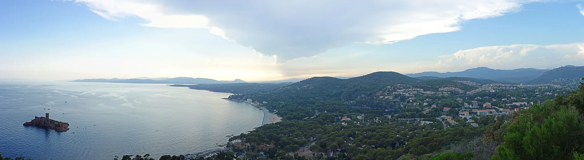
A scenic road route through the stunning landscapes of the Esterel Mountains
Kartta
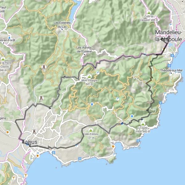
This road route takes you through charming villages and lush forests, with highlights including the peak of Pic de l'Ours, the panoramic views from Colle Marrone, and the historic Aqva Foroivliensis. The route offers a mix of challenging climbs and fast descents, providing a rewarding experience for road cyclists.
road
68 km
1150 m
Kova
Reitin profiili
Reitin kohokohdat
0 km
0 km
Aloitus: Mandelieu-la-Napoule City centerMandelieu-la-Napoule: Kauniit maisemat ja rentouttavat pyöräilyreitit.
Mandelieu-la-Napoule sijaitsee Provence-Alpes-Côte d’Azur -alueella Ranskassa. Alueella on hyvät mahdollisuudet niin maantie- kuin maastopyöräilyyn, ja Mandelieu-la-Napoule tarjoaa monia kauniita reittejä pyöräilijöille. Alueella on myös monia rentouttavia polkuja ja teitä, jotka sopivat hyvin pyöräilyretkiin. Mandelieu-la-Napoule on suosittu paikka pyöräilijöiden keskuudessa, ja alueella järjestetään usein pyöräilytapahtumia ja retkiä luontoon.11 km
11 km
Pic de l'Ours492 mHuippuPic de l'Ours is a rocky summit with stunning views of the Esterel Mountains and the coast.
23 km
23 km
Colle Marrone74 mHuippuColle Marrone is a scenic overlook with panoramic views of the surrounding mountains and valleys.
30 km
30 km
Saint-RaphaëlKaupunkiSaint-Raphaël is a vibrant coastal town with sandy beaches, a bustling port, and a rich maritime history.
42 km
42 km
Aqva ForoivliensisLinnan rauniotAqva Foroivliensis is a historic Roman site with well-preserved ruins and a museum showcasing ancient artifacts.
50 km
50 km
Col du Testanier312 mVuoristosolaCol du Testanier is a challenging climb with spectacular views of the Mediterranean Sea and the surrounding landscape.
57 km
57 km
Saint-Jean de l'EsterelKyläSaint-Jean de l'Esterel is a charming village surrounded by lush forests and rocky cliffs.
68 km
68 km
Maali: Mandelieu-la-Napoule City centerMandelieu-la-Napoule: Kauniit maisemat ja rentouttavat pyöräilyreitit.
Pyöräilyreitit alkaen Mandelieu-la-Napoule:
Gravel Mandelieu-la-Napoule - Colle du Mouton Gravel Mandelieu-la-Napoule - Le Grand Duc Gravel Mandelieu-la-Napoule - Saint-Jean de l'Esterel Mandelieu-la-Napoule - Callas - Tourrettes Route Le Tignet - Saint-Vallier-de-Thiey Loop Mandelieu-la-Napoule - Vence - Antibes Loop Saint-Raphaël - Col du Testanier - Saint-Jean de l'Esterel Loop Mandelieu-la-Napoule - Colle Douce - Baisse du Four Circuit Road Mandelieu-la-Napoule - Le Grand Duc Road Mandelieu-la-Napoule - Saint-Jean de l'Esterel Maantiepyöräilyreitti Mandelieu-la-Napoulen läheisyydessä 2 Maantiepyöräilyreitti Mandelieu-la-Napoulen läheisyydessä