Samoëns-Morzine-Samoëns Gravel Cycling Route
Pyöräilyreitti gravel alkaen Samoens
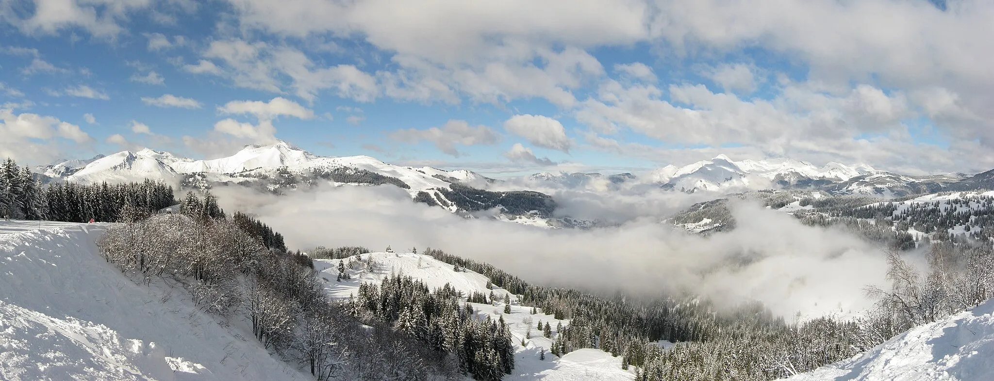
Adventurous gravel cycling route through the French Alps
Kartta
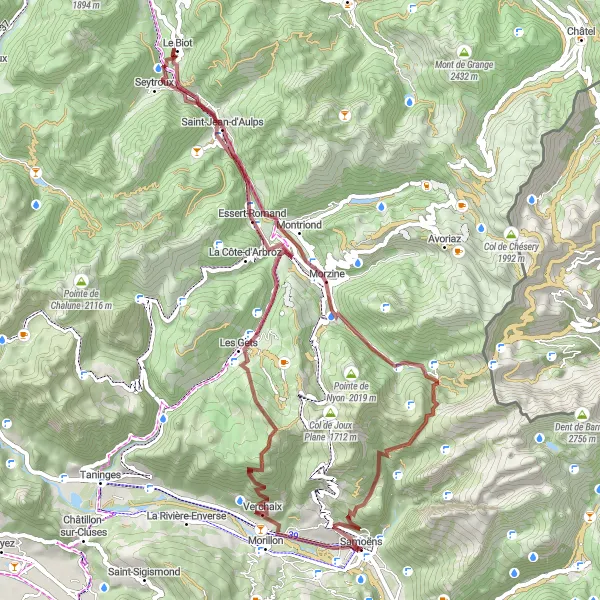
This gravel cycling route features a challenging ascent of 2418m over 67km, taking riders through rugged terrain and remote villages like Verchaix and Le Biot. Highlights include Col de la Golèse, a scenic mountain pass offering panoramic views of the surrounding peaks.
gravel
67 km
2418 m
Kova
Reitin profiili
Reitin kohokohdat
0 km
0 km
Aloitus: Samoëns Village centerSamoëns: Upeat maisemat ja monipuoliset pyöräilymahdollisuudet Rhône-Alpesin alueella.
Samoëns sijaitsee Rhône-Alpesin alueella Ranskassa ja tarjoaa upeat maisemat pyöräilijöille. Alueella on monia hiekkateitä ja maantiepyöräilyreittejä, jotka houkuttelevat pyöräilijöitä. Lähistöltä löytyy myös haastavia kiipeilykohteita ja maalaismainen ympäristö, jotka ovat suosittuja pyöräilijöiden keskuudessa.5 km
5 km
VerchaixKyläVerchaix is a picturesque village known for its traditional architecture and peaceful ambiance, ideal for a relaxing stop during the ride.
14 km
14 km
Pointe de la Turche1607 mHuippuPointe de la Turche is a scenic viewpoint overlooking the valley below, providing a perfect photo opportunity for cyclists.
24 km
24 km
Essert-RomandKyläEssert-Romand is a charming village with a rich history and delightful local cuisine, offering a taste of traditional alpine life.
33 km
33 km
Le BiotKyläLe Biot is a hidden gem in the French Alps, known for its authentic charm and stunning mountain views.
46 km
46 km
MorzineKyläMorzine is a popular destination for outdoor enthusiasts, with a wide range of activities and amenities for cyclists.
57 km
57 km
Col de la Golèse1660 mVuoristosolaCol de la Golèse is a challenging mountain pass with steep gradients and rewarding views at the summit.
67 km
67 km
Maali: Samoëns Village centerSamoëns: Upeat maisemat ja monipuoliset pyöräilymahdollisuudet Rhône-Alpesin alueella.
Pyöräilyreitit alkaen Samoens:
Samoëns - Morillon - Châtillon-sur-Cluses - Contamine-sur-Arve - Ancienne grenette - Rocher Blanc - Les Suets - Taninges - La Jaÿsinia - Samoëns Samoëns-Morzine-Samoëns Gravel Cycling Route Haastava maantieretki Samoënsista Samoëns - Morillon - Les Suets - Onnion - Habère-Poche - Col de Terramont - La Grande Pointe - Saint-Jean-d'Aulps - Morzine - Col de Joux Plane - La Jaÿsinia - Samoëns Samoëns-Les Suets-Samoëns Road Cycling Route Samoëns - Cascade de Saubaudy - Pointe Perfia - Flaine - Col de Pierre Carrée - Les Carroz - La Jaÿsinia - Gros Tilleul Samoëns - La Jaÿsinia - Mévoutier - Tête des Crêts - Morzine - Saint-Jean-d'Aulps - Col du Corbier - Vacheresse - Le Hucel - Meillerie - Château de la Porte du Scex - Troistorrents - Pas de Morgins - Châtel - Abondance - Pointe des Follys - Morzine 1000 - Le Ranfolly - Gros Tilleul Samoëns-Morzine-Samoëns Road Cycling Route Samoëns-Morzine-Samoëns Gravel Cycling Route Samoëns - Morillon - Saint-Jeoire - Bachais - Burdignin - Rocher Blanc - Onnion - Châtillon-sur-Cluses - La Jaÿsinia - Samoëns