Leisurely cycling in Désertines, Auvergne
Cycling routes from Desertines
Désertines, located in the Auvergne region of France, offers pleasant cycling routes through beautiful landscapes. The area features gentle hills and rural roads, making it a suitable destination for leisurely cycling trips. A popular nearby climb is the Puy Mary, attracting both road and gravel cyclists. Overall, Désertines earns a rank of 3 for its enjoyable cycling opportunities.
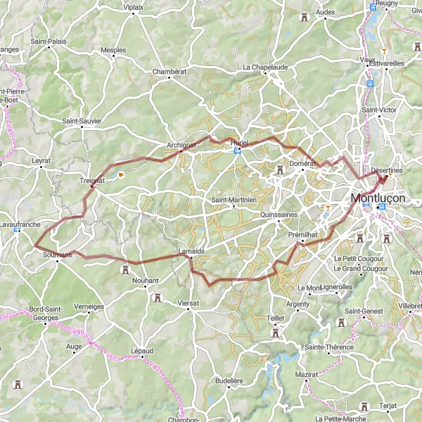
Lamaids Loop
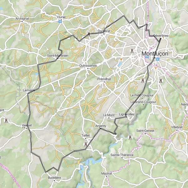
Discover the picturesque landscapes and charming villages on the Lamaids road cycling loop near Désertines.
Take in the breathtaking countryside and beautiful villages on this road cycling loop near Désertines. With a total distance of 58 km and an ascent of 641 meters, this route provides a moderately challenging ride suitable for experienced cyclists. The highlight of this loop is the town of Montluçon, which offers a diverse array of attractions ranging from historic landmarks to cultural events. Other notable stops along the way include Lamaids and Domérat, both known for their scenic beauty and traditional architecture.
Verneix to Chamblet
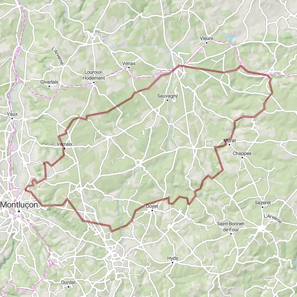
Discover the hidden gems of Verneix and experience the charm of Chamblet
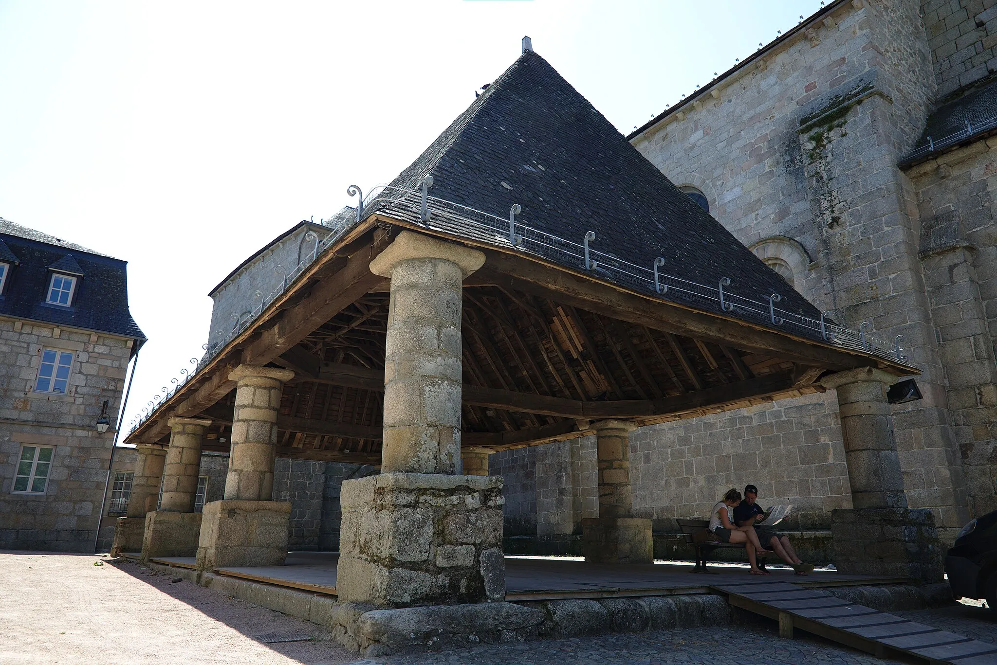
This gravel cycling route explores the hidden gems along the way, starting from Verneix and ending in Chamblet. With a total distance of 87 kilometers and an ascent of 967 meters, this route is suitable for well-trained amateur cyclists. The highlights along the route include Verneix, a picturesque village with its traditional architecture, Cosne-d'Allier, a quaint town known for its scenic beauty, Buxières-les-Mines, which offers a glimpse into the mining history, Château de Murat with its stunning architecture, Doyet with its tranquil landscapes, and Chamblet, a beautiful village surrounded by rolling hills.
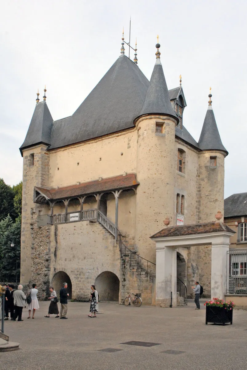
Deneuille-les-Mines to Montluçon
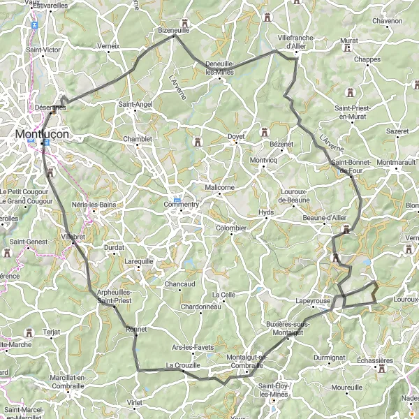
Experience the charm of Deneuille-les-Mines and notable landmarks in Montluçon
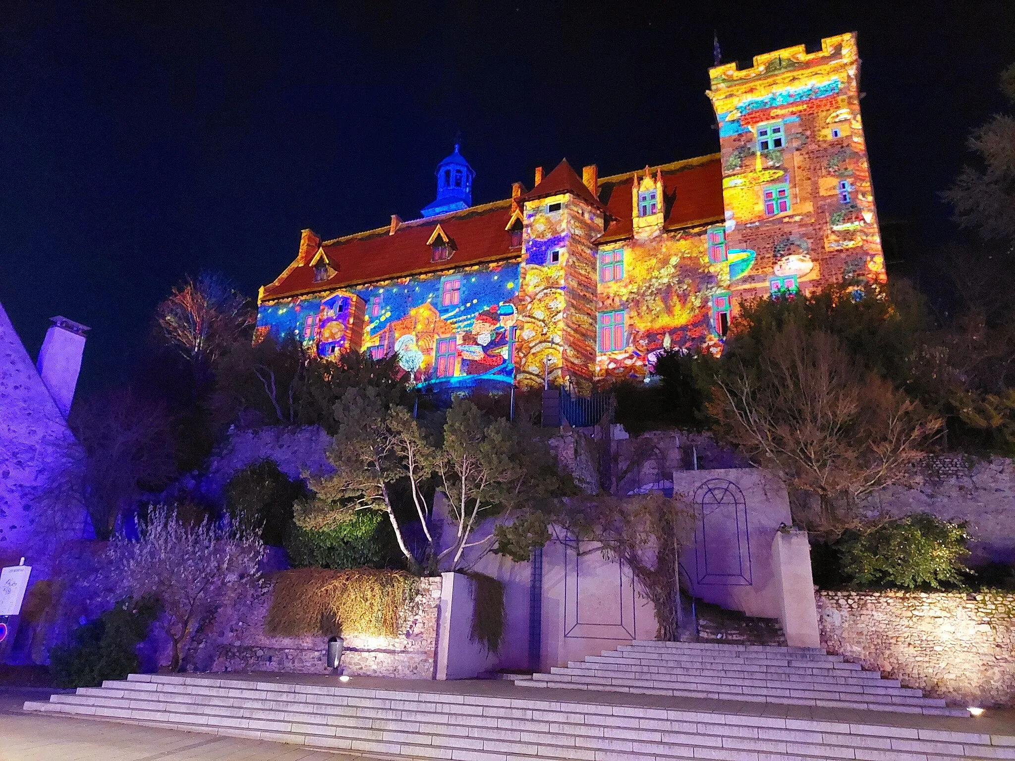
This road cycling route takes you through picturesque landscapes and allows you to explore the historic town of Montluçon. With a total distance of 98 kilometers and an ascent of 1171 meters, this route is suitable for well-trained amateur cyclists. The scenic highlights along the route include Deneuille-les-Mines, Saint-Bonnet-de-Four with its charming village atmosphere, Buxières-sous-Montaigut, Arpheuilles-Saint-Priest, and finally Montluçon, known for its medieval castle and beautiful old town.
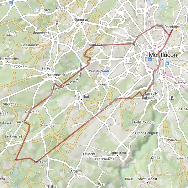
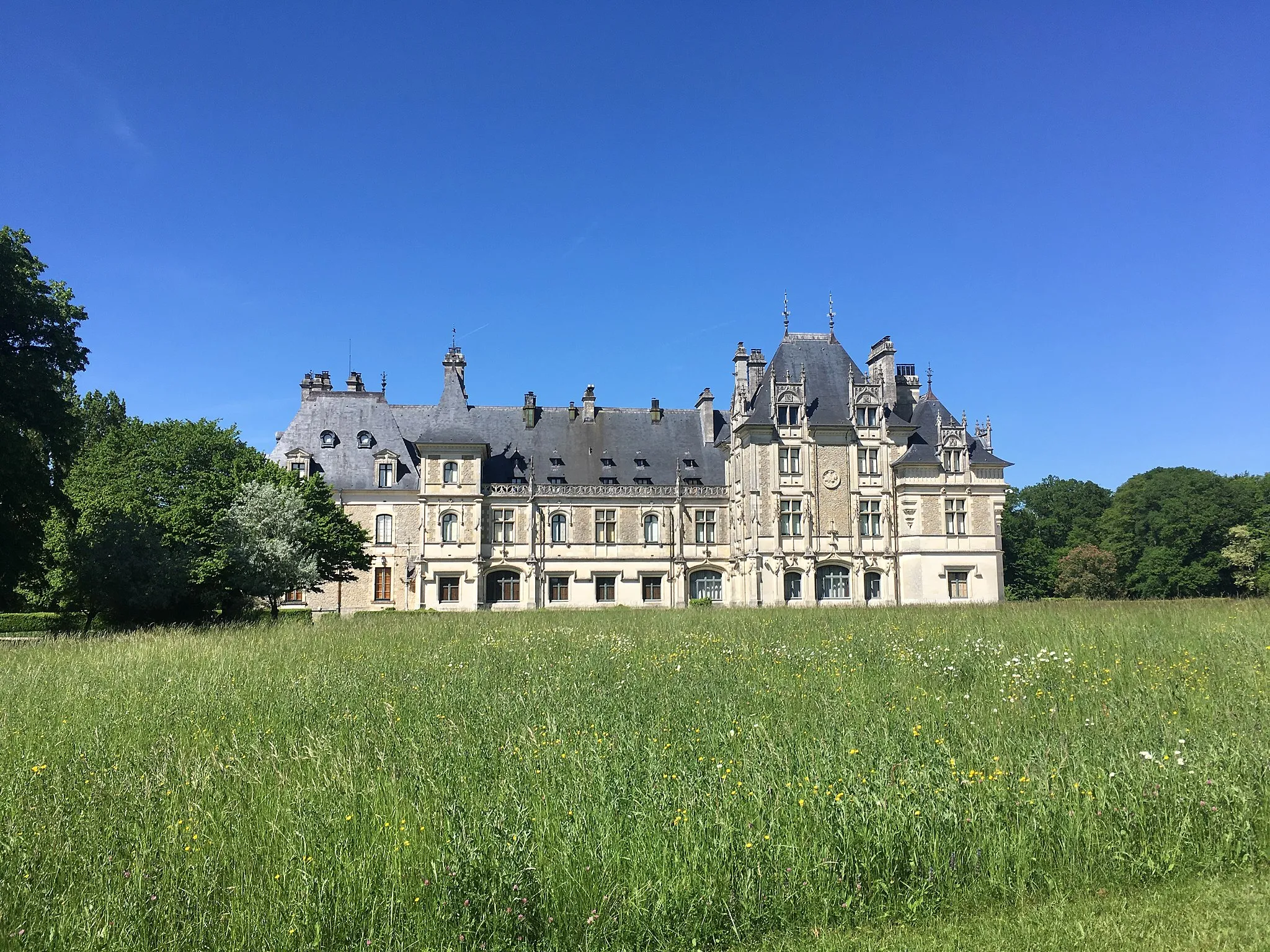
Indulge in natural beauty from Lavault-Sainte-Anne to Château de Bien-Assis
This gravel cycling route offers a picturesque journey through stunning natural landscapes. Starting from Lavault-Sainte-Anne and ending at Château de Bien-Assis, this route spans 35 kilometers with an ascent of 406 meters, making it suitable for well-trained amateur cyclists. Highlights along the route include Lavault-Sainte-Anne, where you can admire scenic views and beautiful forests, Quinssaines with its quaint charm and small village ambiance, and finally Château de Bien-Assis, a stunning castle surrounded by extensive gardens and picturesque scenery.
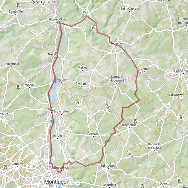
Embark on an adventure from Vaux to the majestic Château d'Hérisson
This gravel cycling route is perfect for exploring the beautiful countryside. Starting from Vaux and leading to the majestic Château d'Hérisson, this 63-kilometer route has an ascent of 435 meters and is suitable for well-trained amateur cyclists. The highlights along the route include Vaux, a charming village surrounded by green fields, Vallon-en-Sully with its historic ambiance and beautiful architecture, and the majestic Château d'Hérisson, known for its impressive medieval structure.
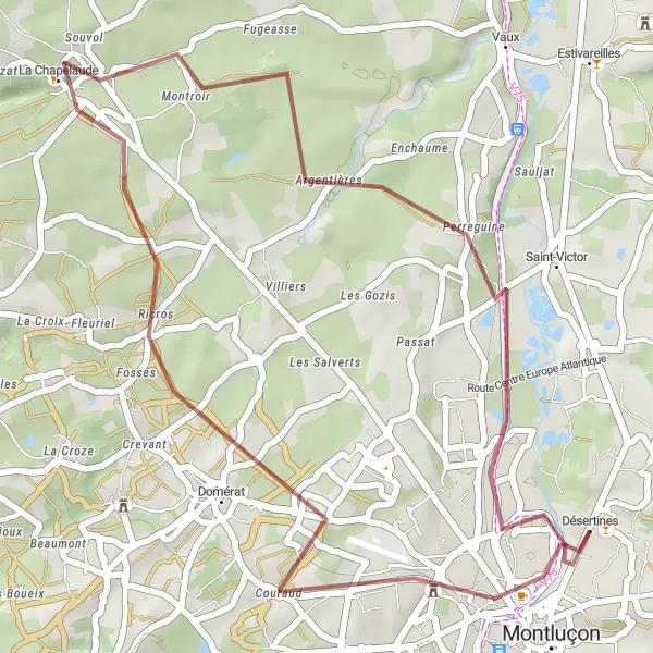
Immerse yourself in the natural beauty of Prémilhat and the tranquility of Désertines
This gravel cycling route takes you through scenic landscapes, offering a truly immersive natural beauty experience. Starting from Prémilhat and ending in Désertines, this 69-kilometer route has an ascent of 655 meters and is suitable for well-trained amateur cyclists. The highlights along the route include Prémilhat with its picturesque surroundings, the charming village of Lamaids, the tranquil village of Treignat, the historic town of Huriel, and finally Désertines, known for its peaceful atmosphere and rural charm.
Embark on a thrilling gravel adventure to Domérat and back from Désertines.
This gravel cycling route offers a thrilling adventure through the scenic countryside near Désertines. With a total distance of 35 km and an ascent of 231 meters, it provides a moderate challenge suitable for experienced cyclists. The highlight of this route is the town of Domérat, with its quaint streets and charming atmosphere. Starting and ending in Désertines, riders will pass through beautiful natural landscapes and enjoy the freedom that gravel biking has to offer.
Explore the stunning road cycling routes near Désertines, Auvergne
Discover the beautiful landscapes and charming villages of Auvergne as you embark on this road cycling adventure starting from Désertines. Along the way, you'll be treated to picturesque views, challenging climbs, and unique cultural highlights. This route is perfect for well-trained amateurs looking for a rewarding cycling experience.
Hérisson Castle Loop
Explore the picturesque Hérisson Castle and its surroundings on this road cycling route.
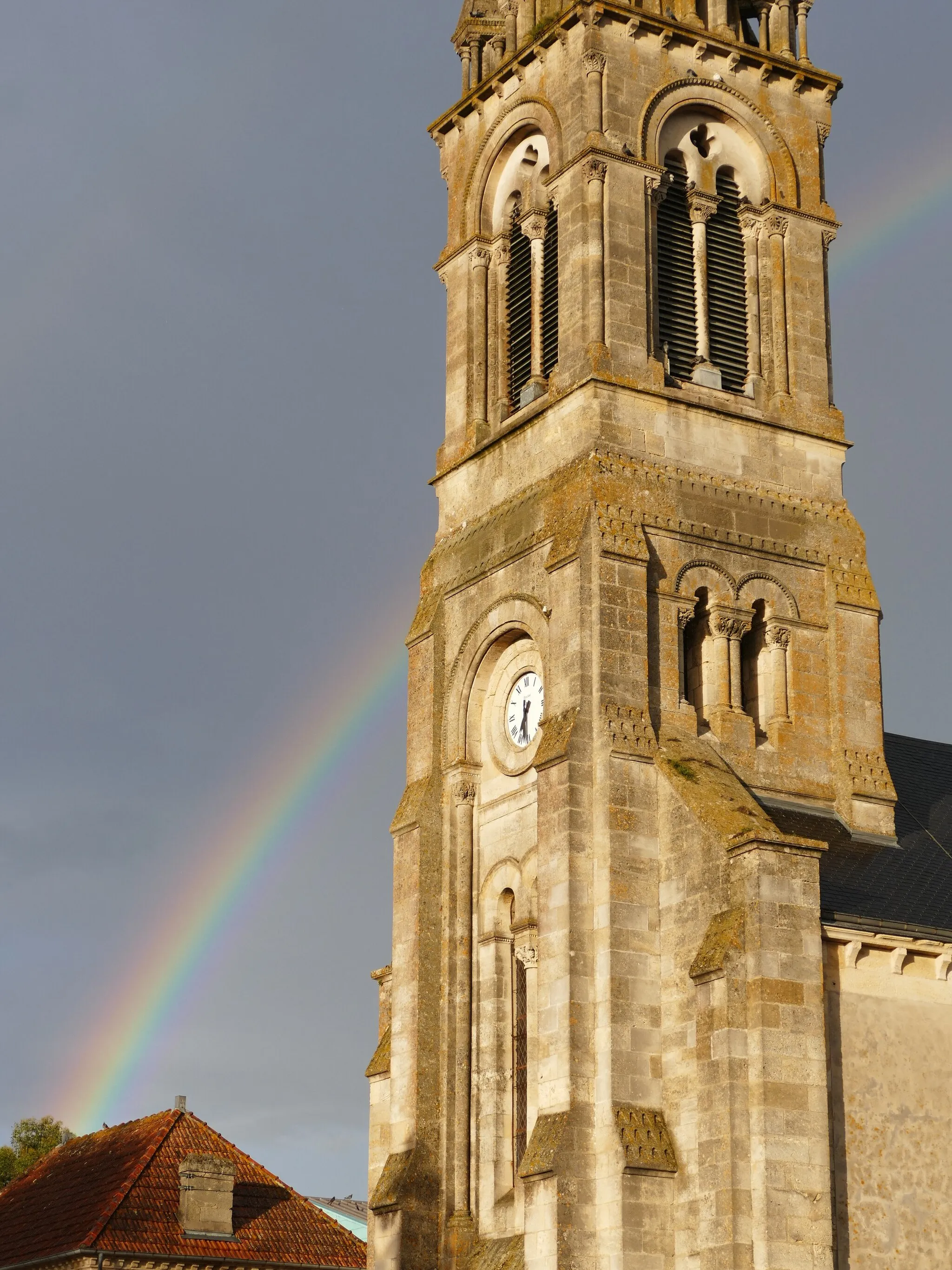
This scenic road cycling route takes you on a tour of the beautiful countryside near Désertines. With a total distance of 87 km and an ascent of 802 meters, it offers a moderately challenging ride suitable for experienced cyclists. The highlight of the route is the iconic Château d'Hérisson, a medieval castle with a rich history and stunning architecture. Other stops along the way include the charming villages of Theneuille, Cosne-d'Allier, Deneuille-les-Mines, and Chamblet.
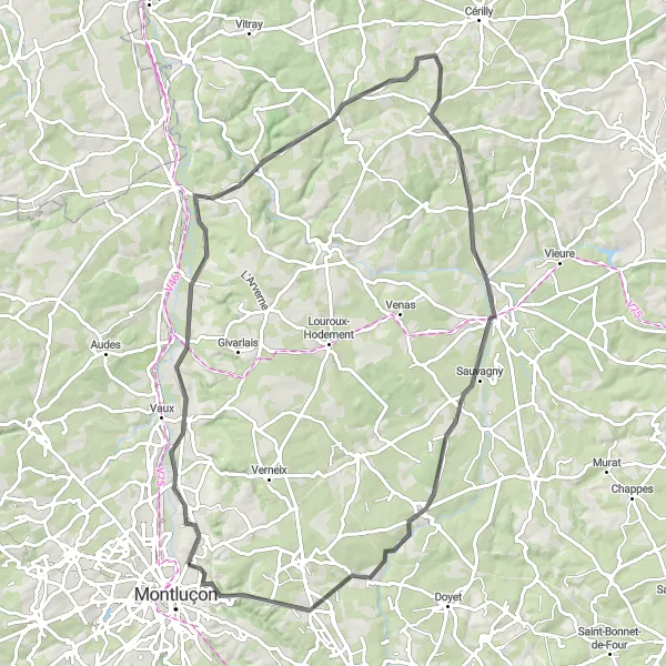
Embark on an epic cycling adventure through picturesque countryside and historic landmarks near Désertines.
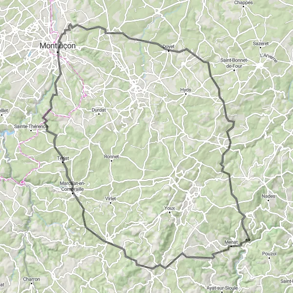
This road cycling route offers an epic adventure through the captivating landscapes and historic sites near Désertines. With a total distance of 115 km and an ascent of 1709 meters, it presents a challenging ride suitable for experienced cyclists. The highlight of the journey is the town of Montluçon, with its fascinating history and remarkable architecture. Other notable stops along the way include Bézenet, Beaune-d'Allier, Moureuille, Menat, Pionsat, Terjat, and a return to Désertines.
Cycling routes nearby:


Nearby regions: