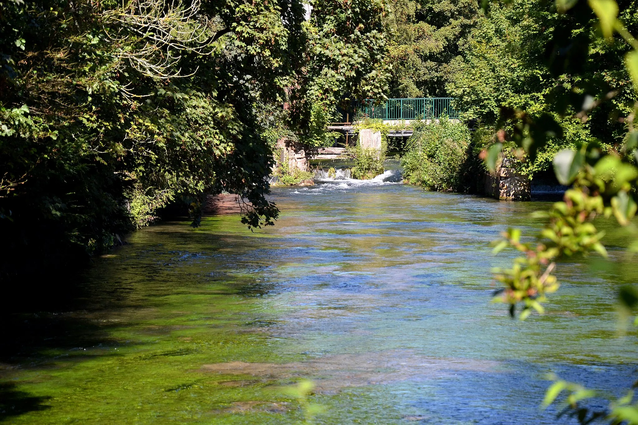
Peaceful cycling in the rural landscapes of Haute-Normandie.
Cycling routes from Malaunay
Malaunay, located in the Haute-Normandie region of France, offers a pleasant cycling experience for both road and gravel cyclists. The town is surrounded by countryside and rural landscapes, providing peaceful routes for cycling. While Malaunay itself does not have any famous cycling-related spots or well-known climbs nearby, it is well-connected to other cycling destinations in the region. Cyclists can explore the scenic Seine Valley or venture further to the famous cycling routes in Normandy. With its serene atmosphere and convenient location, Malaunay is a great base for exploring the cycling opportunities in the Haute-Normandie region.
Malaunay Explorer
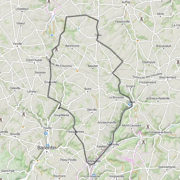
Discover the hidden gems of Malaunay and beyond on this road cycling adventure
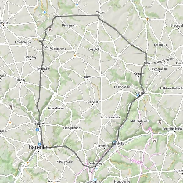
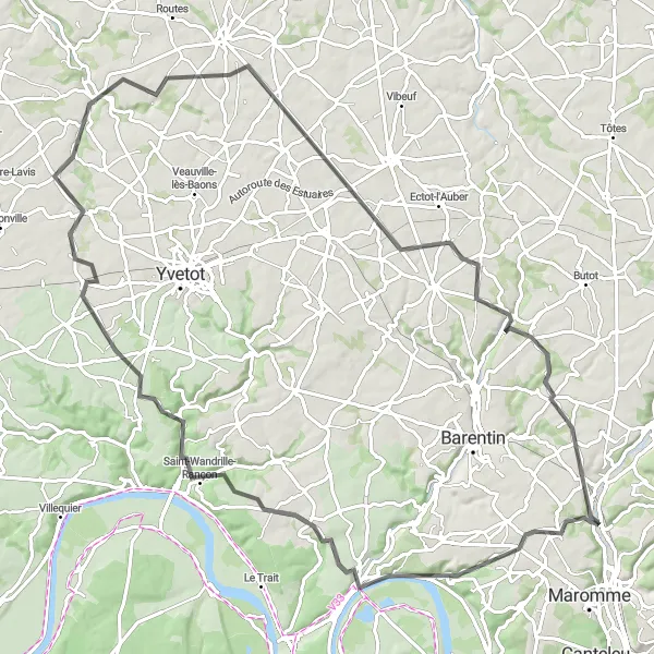
Embark on a thrilling road cycling adventure starting in Malaunay. This route explores hidden gems such as Émanville and Belleville-en-Caux, offering a mix of scenic beauty and cultural attractions. With a moderate difficulty level, it is suitable for intermediate cyclists. The route covers a distance of 56 kilometers with an ascent of 471 meters.

Cycling through charming villages and scenic landscapes
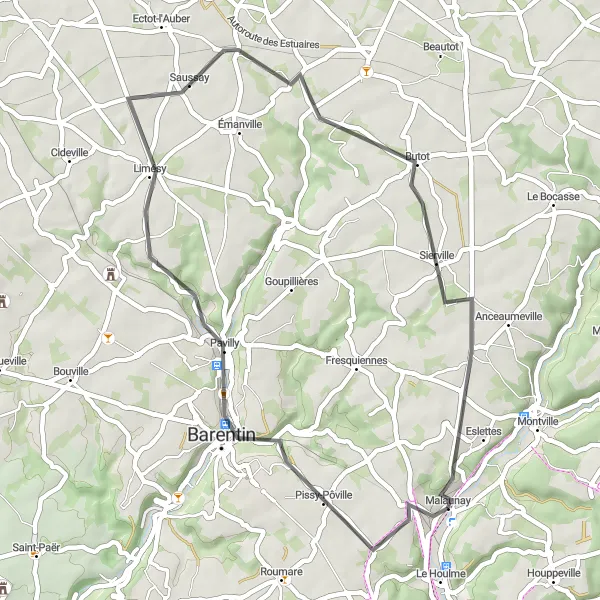
This round-trip cycling route takes you on a delightful adventure through some of the most picturesque villages in Haute-Normandie. Starting from Malaunay, the route passes through Saint-Ouen-du-Breuil and Quincampoix, offering stunning countryside scenery and charming village landscapes. With a total distance of 94 kilometers and an elevation gain of 809 meters, this route is suitable for well-trained amateurs. The difficulty level is moderate, providing an enjoyable challenge for experienced cyclists. Saint-Ouen-du-Breuil and Quincampoix are both worth a visit, with their traditional architecture, peaceful surroundings, and captivating views. Immerse yourself in the beauty of Haute-Normandie and enjoy a memorable cycling experience.
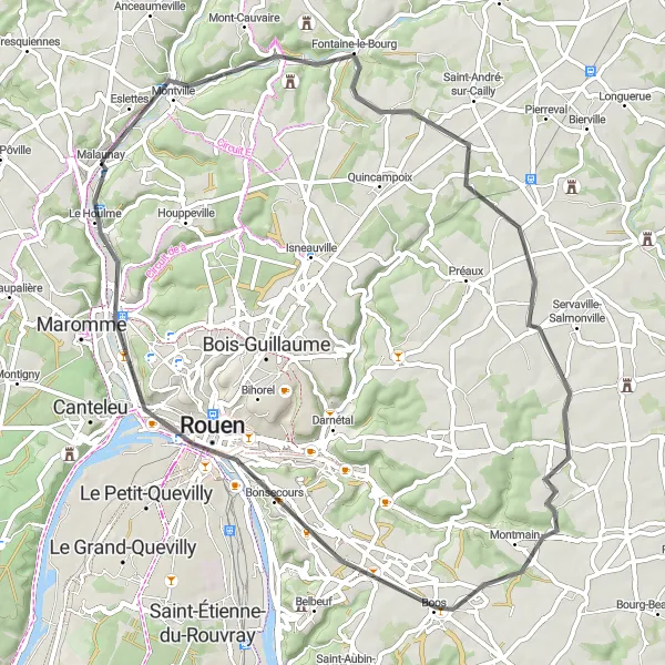
Explore the historic city of Rouen on this scenic route
Embark on a memorable cycling journey from Malaunay to Rouen, the historic capital of Normandy. With a total distance of 61 kilometers and an elevation gain of 401 meters, this route is suitable for well-trained amateurs. The difficulty level is moderate, offering a challenge without being too strenuous. The highlight of this route is the city of Rouen, known for its magnificent cathedral, historic architecture, and charming cobblestone streets. Take some time to explore the iconic sights of Rouen, such as the Gros-Horloge and the Place du Vieux-Marché. With its rich history and cultural heritage, Rouen is a must-visit destination for any cycling enthusiast. Starting and ending in Malaunay, this round-trip route provides a scenic and rewarding cycling experience.
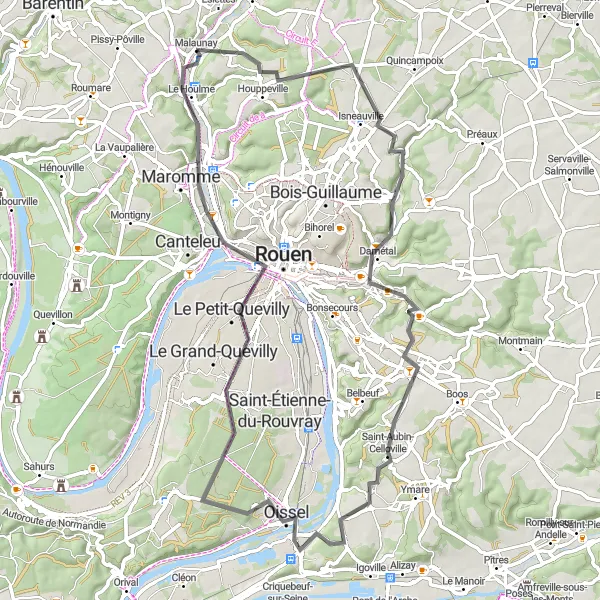
Discover scenic countryside and panoramic views on this picturesque route
Embark on a picturesque cycling journey from Malaunay to Saint-Martin-du-Vivier and Mont-Saint-Aignan. The route takes you through beautiful countryside landscapes, passing by charming villages and breathtaking viewpoints. With a total distance of 70 kilometers and an elevation gain of 510 meters, this route is suitable for well-trained amateurs. The difficulty level is moderate, providing an enjoyable challenge without being too strenuous. Along the way, you'll discover the peaceful village of Saint-Martin-du-Vivier, known for its traditional charm and countryside atmosphere. Further on, you'll reach Mont-Saint-Aignan, offering stunning panoramic views of the surrounding area. Take some time to appreciate the scenic beauty and capture some memorable photographs. The route also passes by Franqueville-Saint-Pierre and Le Petit-Quevilly, both worth a stop to explore their local attractions and charming surroundings. Overall, this round-trip cycling route provides a delightful journey through the captivating landscapes of Haute-Normandie.
Mont Géricault Adventure
Embark on an adventurous journey to Mont Géricault and beyond on this road cycling route
Embark on an exciting road cycling route to Mont Géricault and explore its surrounding areas. This adventurous route takes you through diverse landscapes and offers breathtaking views along the way. With a moderate difficulty level, it is suitable for intermediate cyclists. The route covers a distance of 51 kilometers with an ascent of 412 meters.
Embark on an epic journey from Duclair to Caudebec-en-Caux with stunning river views
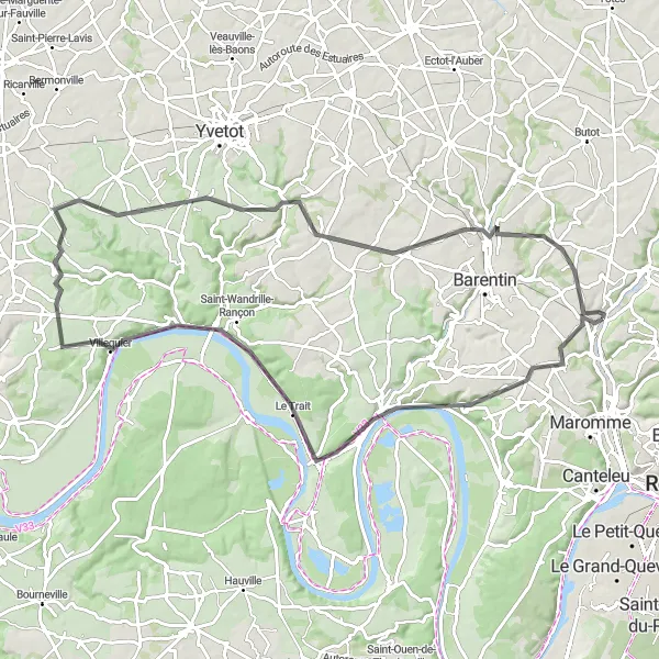
Experience the thrill of an epic road cycling route from Duclair to Caudebec-en-Caux. This challenging route offers breathtaking views of the Seine River and takes you through picturesque towns and villages. With a difficulty rating of 4, it is recommended for experienced cyclists. The route covers a distance of 85 kilometers with an ascent of 810 meters.
Admire the stunning views of Mont Géricault on this road cycling route starting near Malaunay
Enjoy a scenic and challenging road cycling route starting near Malaunay. This route takes you through picturesque villages and offers breathtaking views from Mont Géricault. With a moderate difficulty level, it is ideal for well-trained amateur cyclists. The route covers a distance of 42 kilometers with an ascent of 362 meters.
Malaunay to Mont Géricault Loop

Explore the picturesque beauty of Mont Géricault on this scenic cycling route
Embark on this delightful cycling route from Malaunay to Mont Géricault and experience the stunning natural beauty of the Haute-Normandie region. This loop will take you through charming villages, scenic countryside, and offer breathtaking views throughout the entirety of the ride. With a total ascent of 262 meters and a distance of 37 kilometers, this route is suitable for well-trained amateur cyclists. Get ready to witness some of the most picturesque landscapes and soak in the tranquility of the French countryside.
Authieux-Ratiéville Challenge
Take on the challenge of cycling from Malaunay to Authieux-Ratiéville through scenic countryside
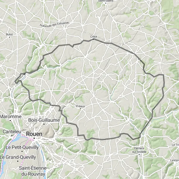
Embark on a challenging road cycling route from Malaunay to Authieux-Ratiéville. This route takes you through scenic countryside and offers breathtaking views along the way. With a difficulty rating of 4, it is recommended for experienced cyclists. The route covers a distance of 88 kilometers with an ascent of 770 meters.
Cycling through beautiful scenery and charming towns
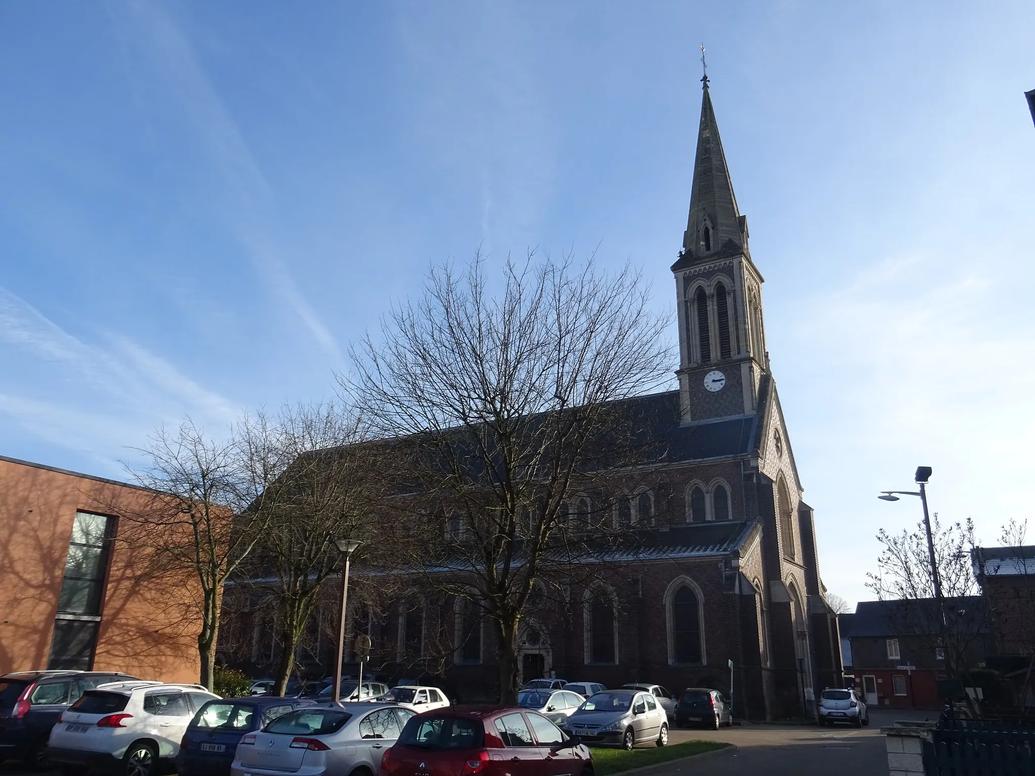
This route is a delightful journey through the picturesque countryside of Haute-Normandie. Starting from Malaunay, the route takes you to Saint-Jean-du-Cardonnay, where you can admire the stunning Saint-Jean-Baptiste church. Continuing on, you will reach Duclair, a scenic town nestled on the banks of the Seine River. Here, you can take some time to explore the historic buildings and enjoy the idyllic riverside views. With a total distance of 92 kilometers and an elevation gain of 880 meters, this route is suitable for well-trained amateurs. The difficulty level is moderate, offering a challenge without being too strenuous. The route is filled with highlights, including Valliquerville and Anvéville, which offer charming surroundings and interesting sites to visit. Overall, this round-trip cycling route provides a memorable experience through the captivating landscapes of Haute-Normandie.
Cycling routes nearby:


Nearby regions: