Peille Grand Tour
A gravel cycling route starting from Peille
Embark on an epic 162-kilometer journey around Peille, taking you through challenging gravel terrain and legendary climbs.
Map
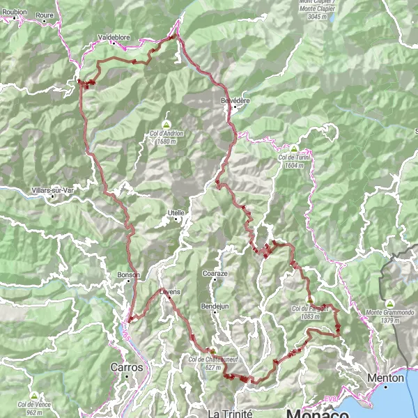
Prepare yourself for an epic adventure with this 162-kilometer route that circumnavigates the beautiful region of Peille. With a whopping 6,386 meters of ascent, this route is not for the faint of heart. It combines challenging gravel sections, legendary climbs, and breathtaking scenery, making it a true test of skill and endurance.
gravel
162 km
6386 m
Savage
Route profile
Highlights on the route
0 km
0 km
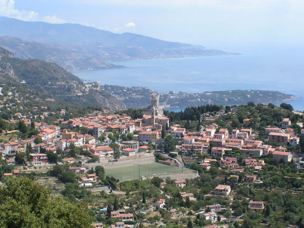
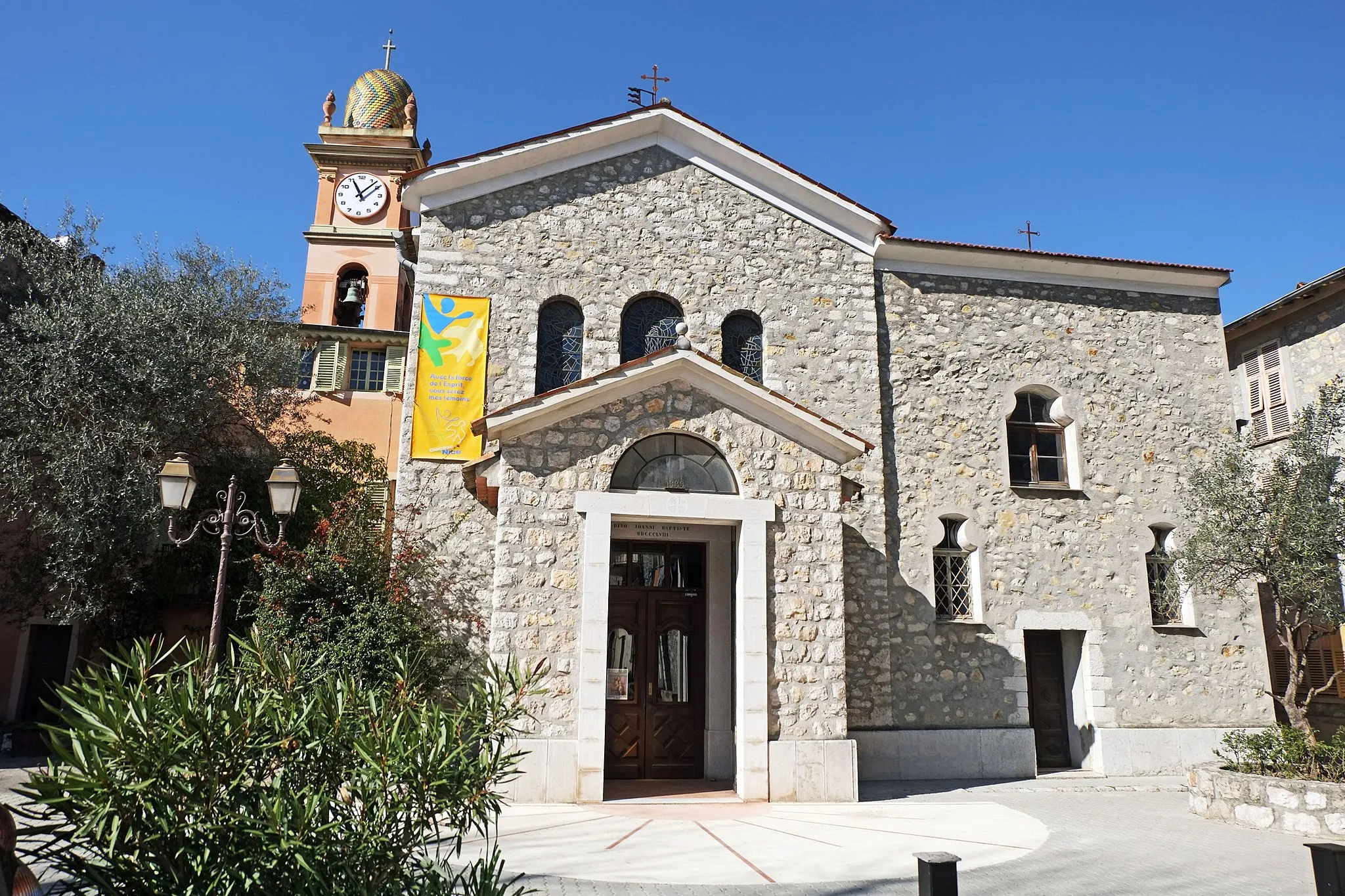
Start: Peille Village centerPeille: Exploring the scenic roads of Peille in Provence-Alpes-Côte d’Azur, France.
Peille, located in the Provence-Alpes-Côte d’Azur region of France, is a charming locality for road and gravel cyclists. The surrounding landscapes are stunning, with rolling hills and picturesque countryside. Cyclists can enjoy challenging climbs and thrilling descents while exploring the area. One must-visit spot for cyclists is the Col de l'Écre, a famous climb nearby that offers breathtaking views. With its beautiful scenery and cycling-friendly roads, Peille is a great destination for both local and visiting cyclists.5 km
5 km
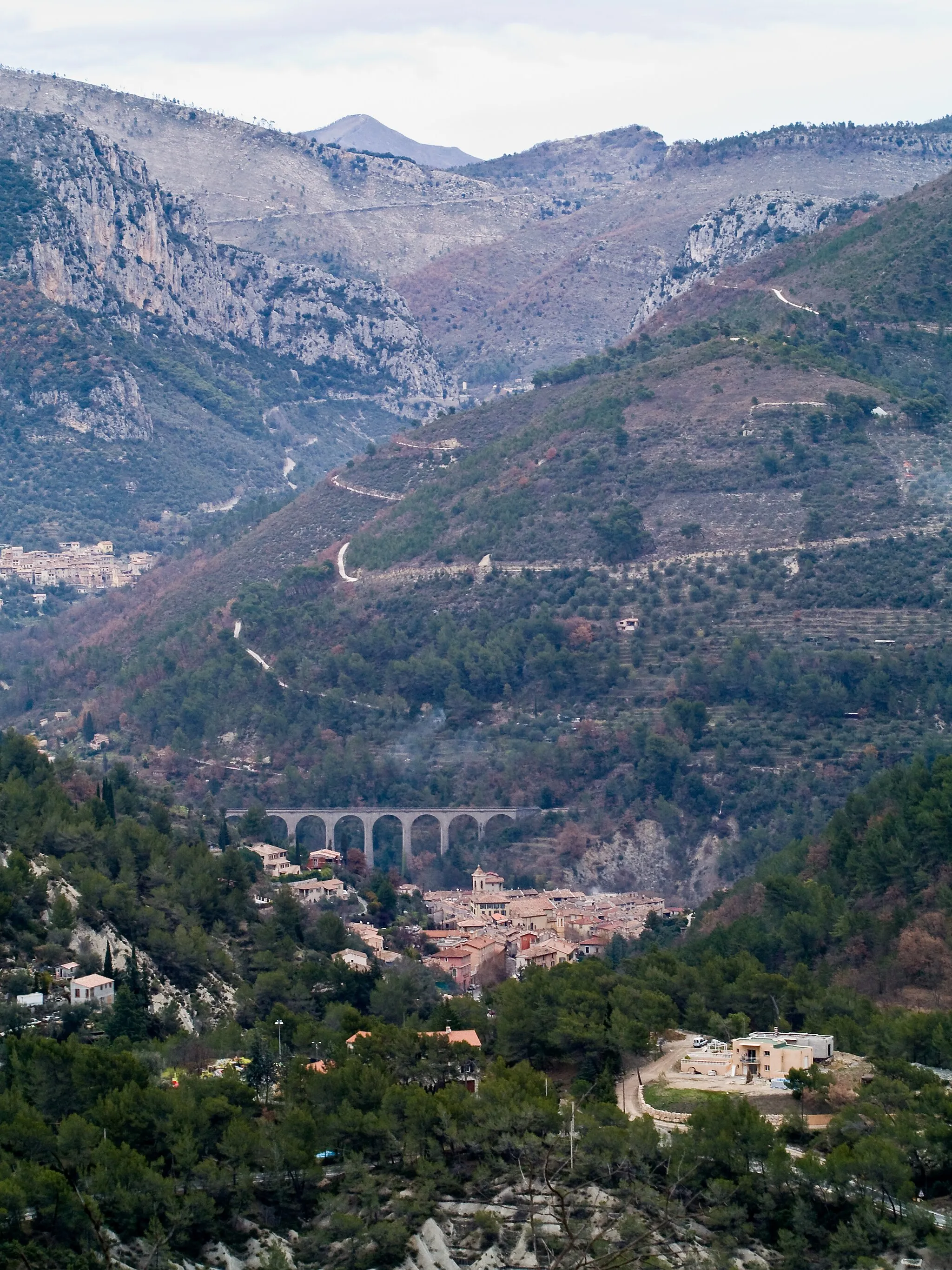
La Grave de PeilleHamletLa Grave de Peille, located at the 5-kilometer mark, is known for its picturesque landscapes and is a popular spot among cyclists.
11 km
11 km
Cicilia339 mPeakCicilia, at the 11-kilometer mark, is a charming village with winding streets and a rich history.
24 km
24 km
Col de Châteauneuf627 mMountain PassChallenge yourself with the famous Col de Châteauneuf, located at the 24-kilometer mark, and experience one of the most iconic climbs in the region.
34 km
34 km
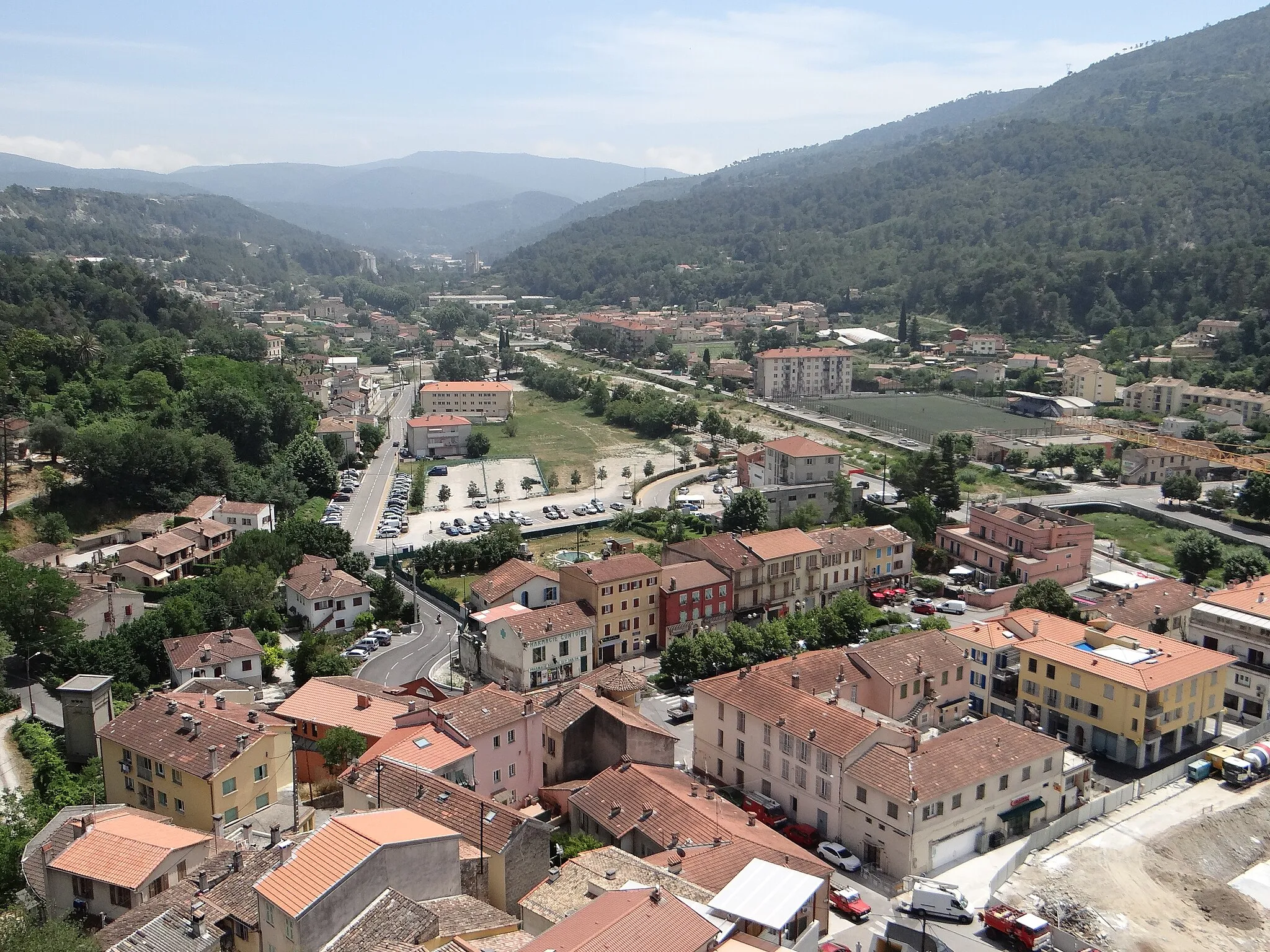
LevensVillageLevens, at the 34-kilometer mark, is a quaint village that offers stunning views over the surrounding countryside.
45 km
45 km
Plan-du-VarHamletPlan-du-Var, located at the 45-kilometer mark, is a charming hamlet with traditional Provençal architecture.
56 km
56 km
Pic Charvet774 mPeakPic Charvet, at the 56-kilometer mark, offers panoramic views of the Alpes-Maritimes region.
73 km
73 km
MarieVillageMarie, located at the 73-kilometer mark, is a picturesque village nestled in the mountains, offering a peaceful and scenic escape.
80 km
80 km
Col de la Clamia1234 mMountain PassCol de la Clamia, at the 80-kilometer mark, is a challenging climb that rewards you with breathtaking views at the top.
88 km
88 km
Le Suc1646 mPeakLe Suc, located at the 88-kilometer mark, offers stunning views over the surrounding valleys and mountains.
94 km
94 km
Saint-Martin-VésubieVillageSaint-Martin-Vésubie, at the 94-kilometer mark, is a charming village with beautiful old architecture and a tranquil atmosphere.
108 km
108 km
LantosqueVillageLantosque, located at the 108-kilometer mark, is a picturesque village surrounded by stunning natural beauty.
113 km
113 km
Castel Fortis673 mPeakCastel Fortis, at the 113-kilometer mark, is a medieval fortress with commanding views over the surrounding landscapes.
122 km
122 km
Col de la Porte1057 mMountain PassCol de la Porte, located at the 122-kilometer mark, is a challenging climb that offers breathtaking panoramic vistas at the summit.
130 km
130 km
LucéramVillageLucéram, at the 130-kilometer mark, is a charming village known for its medieval architecture and vibrant cultural heritage.
143 km
143 km
Col de Braus1002 mMountain PassCol de Braus, located at the 143-kilometer mark, is a legendary climb that has been featured in several professional cycling races.
156 km
156 km
Col des Banquettes736 mMountain PassCol des Banquettes, at the 156-kilometer mark, is a challenging climb that offers stunning views of the surrounding mountains and valleys.
162 km
162 km
Finish: Peille Village centerPeille: Exploring the scenic roads of Peille in Provence-Alpes-Côte d’Azur, France.
Cycling routes from Peille:
Peille to Cime de Rastel Gravel Cycling Route Peille Gravel Adventure Peille Hilltop Ride Peille to Cime de Rastel - Extended Road Cycling Route Peille Road Thrill Peille to Ventimiglia Road Cycling Route The Rugged Vistas of Peille Peille to Valdeblore Epic Road Cycling Route Peille Grand Tour Peille to Cime de Rastel Road Cycling Route
Cycling routes nearby: